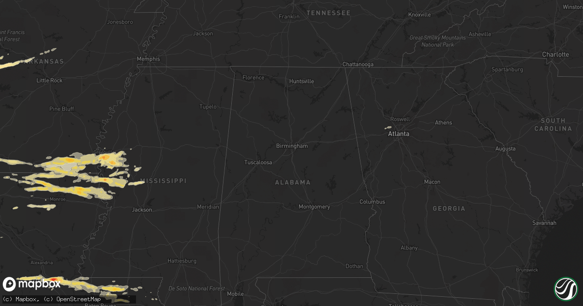
Hail Map in Arkansas on April 4, 2012
Get this storm
April 4 map
$229
one time, instant access
Download today. No call, no setup
Keep the $229
Bought the map and want the full workflow? Apply the entire $229 to a subscription within 7 days. None of it is wasted.
Every map, not just this one
This buys you this map. Subscription and you get every map we run, in the markets you choose from a few cities to whole states to nationwide. Plus real-time alerts the moment a storm fires.
Contact data
Name, contact info, occupancy, even credit band for addresses in the footprint. You go from where it hit to who to call.
Become the source they trust
Unlimited branding weather history reports on demand. You already have the documented answer ready for the property owner, and you are the one who showed up with it.
Property data and RoofTrace estimates
Pull up any address you have got, its value and the exact code rules for that jurisdiction, straight from One Click Code. Then RoofTrace estimates the squares, pitch, and roof value, priced the way you price.
Storm reports in Arkansas
Arkansas
| Date | Description |
|---|---|
| 04/04/20125:30 AM CDT | Reported by sod farm west of chicot junction |
| 04/04/20124:50 AM CDT | A local report indicates 1.00 inch wind near 5 SSW WEST CROSSETT |
| 04/04/20124:45 AM CDT | A local report indicates 1.75 inch wind near HAMBURG |
| 04/03/20128:55 PM CDT | A local report indicates 1.75 inch wind near 1 E OLA |
| 04/03/20128:53 PM CDT | Reports of windows and skylights broken out at two rivers high school in ola |
| 04/03/20128:45 PM CDT | A local report indicates 1.00 inch wind near DANVILLE |
| 04/03/20128:44 PM CDT | A local report indicates 2.00 inch wind near 2 E PLAINVIEW |
| 04/03/20128:44 PM CDT | A local report indicates 2.00 inch wind near 2 E PLAINVIEW |
| 04/03/20128:44 PM CDT | Golf ball size hail covering the ground in plainview |
| 04/03/20128:32 PM CDT | A local report indicates 1.50 inch wind near GILKEY |
All States Impacted by Hail Map on April 4, 2012
Cities Impacted by Hail Map on April 4, 2012
- Montegut, LA
- Rolla, MO
- Edgar Springs, MO
- Salem, MO
- Bay City, TX
- Sweeny, TX
- Pitkin, LA
- Benton, MS
- Vaughan, MS
- Yazoo City, MS
- Ganado, TX
- Lolita, TX
- Boling, TX
- Van Vleck, TX
- Clute, TX
- Blessing, TX
- Lake Jackson, TX
- Danbury, TX
- Galveston, TX
- West Columbia, TX
- Midfield, TX
- Angleton, TX
- Pledger, TX
- Markham, TX
- El Campo, TX
- Freeport, TX
- Brazoria, TX
- Louise, TX
- Wharton, TX
- Palacios, TX
- Eros, LA
- Austwell, TX
- Tivoli, TX
- Missouri City, TX
- Golden Meadow, LA
- Bunkie, LA
- Evergreen, LA
- Cottonport, LA
- Greenville, MS
- Hollandale, MS
- Eudora, AR
- Leland, MS
- Inverness, MS
- Lake Village, AR
- Indianola, MS
- Pioneer, LA
- Oak Grove, LA
- Mayersville, MS
- Lake Providence, LA
- Jones, LA
- Holly Bluff, MS
- Cary, MS
- Rolling Fork, MS
- Smyrna, GA
- Austell, GA
- Marietta, GA
- Havana, AR
- Franklin, VA
- Hamburg, AR
- Crossett, AR
- Strong, AR
- Anguilla, MS
- Louise, MS
- Manvel, TX
- Norris City, IL
- Carmi, IL
- Liverpool, TX
- Alvin, TX
- Hitchcock, TX
- Santa Fe, TX
- Pearland, TX
- Morgan City, LA
- Downsville, LA
- Farmerville, LA
- Reidsville, NC
- Castor, LA
- West Monroe, LA
- Lebanon, MO
- Niangua, MO
- Grovespring, MO
- Friendswood, TX
- Rosharon, TX
- Batchelor, LA
- Spearsville, LA
- El Dorado, AR
- Isola, MS
- Wilmot, AR
- Bastrop, LA
- Parkdale, AR
- Marion, LA
- Belzoni, MS
- Hermitage, AR
- Huttig, AR
- Portland, AR
- Montrose, AR
- Quitman, AR
- Mount Vernon, AR
- Greenbrier, AR
- Enola, AR
- Paris, AR
- Omaha, TX
- Naples, TX
- Cookville, TX
- Quitman, LA
- Chatham, LA
- Choudrant, LA
- Ruston, LA
- Ola, AR
- Danville, AR
- Rover, AR
- Plainview, AR
- Walker, LA
- Madison, FL
- Angola, LA
- Saint Francisville, LA
- Cut Off, LA
- Galliano, LA
- Tallulah, LA
- Monroe, LA
- Transylvania, LA
- Delhi, LA
- Vicksburg, MS
- Valley Park, MS
- Silver City, MS
- Bonita, LA
- Sterlington, LA
- Haynesville, LA
- Dubach, LA
- Homer, LA
- Lillie, LA
- Sondheimer, LA
- Bernice, LA
- Rayville, LA
- Oak Ridge, LA
- Lisbon, LA
- Collinston, LA
- Epps, LA
- Redwood, MS
- Mer Rouge, LA
- Summerfield, LA
- Arcadia, LA
- Carrsville, VA
- Sedley, VA
- Suffolk, VA
- Tchula, MS
- Holden, LA
- Greensburg, LA
- Port Lavaca, TX
- Falcon, MO
- Laquey, MO
- Glenmora, LA
- Oakdale, LA
- Forest Hill, LA
- Pine Grove, LA
- Clinton, LA
- Magazine, AR
- Blue Mountain, AR
- Cheneyville, LA
- Saint Landry, LA
- Simmesport, LA
- Plaucheville, LA
- Ethel, LA
- Morrow, LA
- Lettsworth, LA
- Jackson, LA
- Slaughter, LA
- Greenwell Springs, LA
- Tickfaw, LA
- Zachary, LA
- Denham Springs, LA
- Independence, LA
- Hammond, LA
- Pride, LA
- Albany, LA
- Schriever, LA
- Patterson, LA
- Berwick, LA
- Gibson, LA
- Donner, LA
- Amite, LA
- Ventress, LA
- Ville Platte, LA
- Woodville, MS
- Melville, LA
- New Roads, LA
- Roseland, LA
- Fluker, LA
- Richmond, TX
- Sugar Land, TX
- Fresno, TX
- Morrilton, AR
- Perry, AR
- Adona, AR
- Magnolia, AR
- Emerson, AR
- Mount Vernon, TX
- Sulphur Bluff, TX
- Talco, TX
- Goshen, KY
- Conway, MO
- Bush, LA
- Windsor, VA
- Stuttgart, AR
- Osceola, MO
- Matagorda, TX
- Shongaloo, LA
- Casa, AR
- Taylor, AR
- Waldo, AR
- Stamps, AR
- Buckner, AR
- Houma, LA
- Bienville, LA
- Jamestown, LA
- Richland, MO
- Waynesville, MO
- Kentwood, LA
- Franklinton, LA
- Lesterville, MO
- Franklin, LA
- Thibodaux, LA
- Powder Springs, GA
- Mount Pleasant, TX
- Theriot, LA
- Calhoun, LA
- Dickinson, TX
- Marthaville, LA
- Itta Bena, MS
- Moorhead, MS
- Hamlin, WV
- Jersey, AR
- Bourg, LA
- Lockport, LA
- Pendleton, NC
- Conway, NC
- Briggsville, AR
- Dardanelle, AR
- Bluffton, AR
- Covington, LA
- Georgetown, KY
- Rockport, TX
- New Boston, TX
- Minneola, KS
- Belleville, AR
- Plumerville, AR
- Dike, TX
- Newburg, MO
- Bogalusa, LA
- Seadrift, TX


