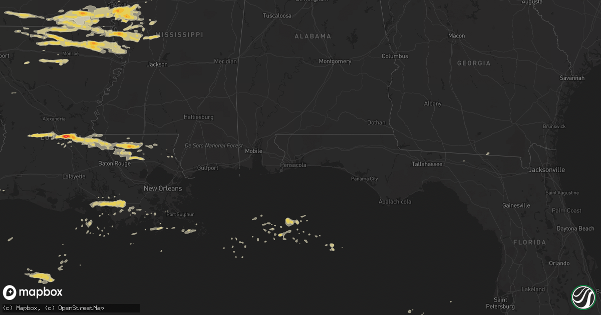
Hail Map on April 4, 2012
Get this storm
April 4 map
$229
one time, instant access
Download today. No call, no setup
Keep the $229
Bought the map and want the full workflow? Apply the entire $229 to a subscription within 7 days. None of it is wasted.
Every map, not just this one
This buys you this map. Subscription and you get every map we run, in the markets you choose from a few cities to whole states to nationwide. Plus real-time alerts the moment a storm fires.
Contact data
Name, contact info, occupancy, even credit band for addresses in the footprint. You go from where it hit to who to call.
Become the source they trust
Unlimited branding weather history reports on demand. You already have the documented answer ready for the property owner, and you are the one who showed up with it.
Property data and RoofTrace estimates
Pull up any address you have got, its value and the exact code rules for that jurisdiction, straight from One Click Code. Then RoofTrace estimates the squares, pitch, and roof value, priced the way you price.
States Impacted by Hail Map on April 4, 2012
Storm reports
Texas
| Date | Description |
|---|---|
| 04/04/20123:50 PM CDT | Reported by bayside express gas station |
| 04/04/20123:46 PM CDT | Dime to quarter size hail reported by trained spotter |
| 04/04/20123:28 PM CDT | Reported by mayor who is also the postmaster |
| 04/04/20123:18 PM CDT | Ktrk relayed report of golfball size hail |
| 04/04/20122:55 PM CDT | Law enforcement relayed reported of quarter size hail by the public |
| 04/04/201212:41 PM CDT | Public report of golfball size hail at alvin community college |
| 04/04/201212:39 PM CDT | Golfball size hail reported by the public at a local 711 store in west alvin |
| 04/04/201212:38 PM CDT | Baseball size hail reported on community drive near alvin community college |
| 04/04/201212:35 PM CDT | Quarter size hail reported by the public in alvin |
| 04/04/201212:33 PM CDT | Off duty nws employee reported 1 inch hail near fm518 and fm528 |
| 04/04/201212:33 PM CDT | Ktrk viewer photograph...mostly quarter size but getting larger |
| 04/04/201212:05 PM CDT | A local report indicates 1.00 inch wind near FRESNO |
Arkansas
| Date | Description |
|---|---|
| 04/04/20125:30 AM CDT | Reported by sod farm west of chicot junction |
| 04/04/20124:50 AM CDT | A local report indicates 1.00 inch wind near 5 SSW WEST CROSSETT |
| 04/04/20124:45 AM CDT | A local report indicates 1.75 inch wind near HAMBURG |
| 04/03/20128:55 PM CDT | A local report indicates 1.75 inch wind near 1 E OLA |
| 04/03/20128:53 PM CDT | Reports of windows and skylights broken out at two rivers high school in ola |
| 04/03/20128:45 PM CDT | A local report indicates 1.00 inch wind near DANVILLE |
| 04/03/20128:44 PM CDT | Golf ball size hail covering the ground in plainview |
| 04/03/20128:44 PM CDT | A local report indicates 2.00 inch wind near 2 E PLAINVIEW |
| 04/03/20128:44 PM CDT | A local report indicates 2.00 inch wind near 2 E PLAINVIEW |
| 04/03/20128:32 PM CDT | A local report indicates 1.50 inch wind near GILKEY |
South Carolina
| Date | Description |
|---|---|
| 04/04/20126:15 PM CDT | Several trees blow down in liberty hall subdivision. Time estimated based on radar. |
| 04/04/20125:58 PM CDT | Reported relayed by a member of the charleston media of a tree blown down in knightsville. Time estimated from radar. |
| 04/04/20125:56 PM CDT | Sc highway patrol reported a tree down at tupperway drive and boone hill road. Time estimated by radar |
| 04/04/20125:30 PM CDT | Sc highway patrol reported a tree down on pierce and mcdaniel town road. Time estimated by radar. |
| 04/04/20123:36 AM CDT | Lake blalock park ranger observed quarter sized hail. Time determined by radar. |
Mississippi
| Date | Description |
|---|---|
| 04/04/20126:56 AM CDT | Hail caused damage to corn fields |
| 04/04/20126:44 AM CDT | Some of the corn crop was damaged. |
| 04/04/20126:15 AM CDT | Mostly penny sized hail with some stones up to golf ball size. |
| 04/04/20126:03 AM CDT | A local report indicates 1.00 inch wind near 1 S ARCOLA |
| 04/04/20125:15 AM CDT | A local report indicates 1.25 inch wind near BENTON |
| 04/04/20123:06 AM CDT | Minor shingle damage and mailbox damage from the hail. |
| 04/04/20123:05 AM CDT | Large hail shattered the windshield of a vehicle |
| 04/04/20122:43 AM CDT | A local report indicates 1.75 inch wind near WAYSIDE |
| 04/04/20122:35 AM CDT | Quarter size hail reported by washington em |
Georgia
| Date | Description |
|---|---|
| 04/04/20126:55 PM CDT | The public reported quarter sized hail near powder springs. |
| 04/03/20127:00 PM CDT | The public reported quarter sized hail on pair road. |
Louisiana
| Date | Description |
|---|---|
| 04/04/20126:00 AM CDT | Reported by a farm to the west of epps |
| 04/04/20125:38 AM CDT | A local report indicates 1.00 inch wind near STERLINGTON |
| 04/04/20125:25 AM CDT | Reported by store on old monroe road |
| 04/04/20125:05 AM CDT | A local report indicates 1.00 inch wind near TICKFAW |
| 04/04/20124:52 AM CDT | Hail fell on the south side of farmerville on porter street the size of quarters to silver dollars. |
| 04/04/20124:15 AM CDT | Quarter to half dollar sized hail fell from amelia to gibson covering the ground in some locations. |
| 04/04/20124:11 AM CDT | Public reports via facebook quarter size hail near patterson |
| 04/04/20124:08 AM CDT | A local report indicates 1.75 inch wind near 5 S DARLINGTON |
| 04/04/20124:07 AM CDT | Public reports via facebook quarter size hail near morgan city. |
| 04/04/20124:00 AM CDT | Quarter to half dollar size hail fell from amelia to gibson covering the ground in several locations. |
| 04/04/20123:57 AM CDT | Public reports via facebook quarter size hail near amelia. Time estimated by radar |
| 04/04/20123:54 AM CDT | St mary sheriffs office reports quarter size hail near morgan city |
| 04/04/20123:11 AM CDT | Quarter to golf ball sized hail along hwy 585. |
| 04/04/20122:39 AM CDT | West feliciana sheriff on highway 61 just north of st. Francisville reported quarter sized hail. |
| 04/04/20122:30 AM CDT | A local report indicates 1.00 inch wind near 3 NW COLLINSTON |
| 04/04/20121:40 AM CDT | A local report indicates 1.00 inch wind near DUBACH |
| 04/04/20121:25 AM CDT | Klfy relays a public report of wind damage to the windows roof and porch of a house in bunkie. |
| 04/04/20121:24 AM CDT | Public reports via facebook golf ball size hail near cottonport. |
| 04/04/20121:18 AM CDT | Public reports via facebook golf ball size hail between bunkie and evergreen |
| 04/04/20121:15 AM CDT | Public reports quarter size hail near patterson |
| 04/04/20121:13 AM CDT | Bunkie fire department reports golf ball size hail near bunkie. |
| 04/04/20121:12 AM CDT | Public reports via facebook quarter size hail near bunkie. |
| 04/04/20121:06 AM CDT | Bunkie pd report baseball size hail near bunkie. Time estimated by radar |
| 04/04/20121:06 AM CDT | Up to baseball size hail fell in bunkie within a 2 mile wide area resulting in numerous business and vehicle windows broken. Winds estimated at 65 mph with gusts up to |
Virginia
| Date | Description |
|---|---|
| 04/04/20121:05 PM CDT | A local report indicates 1.00 inch wind near 1 NNW APPALACHIA |
Alabama
| Date | Description |
|---|---|
| 04/04/20126:14 PM CDT | Golfball hail and estimated wind gusts near empire. |
| 04/04/20126:14 PM CDT | A local report indicates 67 MPH wind near EMPIRE |
North Carolina
| Date | Description |
|---|---|
| 04/04/20125:30 PM CDT | 10 inch tree blown down |
| 04/04/20125:30 PM CDT | 10 inch tree blown down |
| 04/04/20123:44 PM CDT | Tree down near highway 258. |
Cities Impacted by Hail Map on April 4, 2012
- Montegut, LA
- Rolla, MO
- Edgar Springs, MO
- Salem, MO
- Bay City, TX
- Sweeny, TX
- Pitkin, LA
- Benton, MS
- Vaughan, MS
- Yazoo City, MS
- Ganado, TX
- Lolita, TX
- Boling, TX
- Van Vleck, TX
- Clute, TX
- Blessing, TX
- Lake Jackson, TX
- Danbury, TX
- Galveston, TX
- West Columbia, TX
- Midfield, TX
- Angleton, TX
- Pledger, TX
- Markham, TX
- El Campo, TX
- Freeport, TX
- Brazoria, TX
- Louise, TX
- Wharton, TX
- Palacios, TX
- Eros, LA
- Austwell, TX
- Tivoli, TX
- Missouri City, TX
- Golden Meadow, LA
- Bunkie, LA
- Evergreen, LA
- Cottonport, LA
- Greenville, MS
- Hollandale, MS
- Eudora, AR
- Leland, MS
- Inverness, MS
- Lake Village, AR
- Indianola, MS
- Pioneer, LA
- Oak Grove, LA
- Mayersville, MS
- Lake Providence, LA
- Jones, LA
- Holly Bluff, MS
- Cary, MS
- Rolling Fork, MS
- Smyrna, GA
- Austell, GA
- Marietta, GA
- Havana, AR
- Franklin, VA
- Hamburg, AR
- Crossett, AR
- Strong, AR
- Anguilla, MS
- Louise, MS
- Manvel, TX
- Norris City, IL
- Carmi, IL
- Liverpool, TX
- Alvin, TX
- Hitchcock, TX
- Santa Fe, TX
- Pearland, TX
- Morgan City, LA
- Downsville, LA
- Farmerville, LA
- Reidsville, NC
- Castor, LA
- West Monroe, LA
- Lebanon, MO
- Niangua, MO
- Grovespring, MO
- Friendswood, TX
- Rosharon, TX
- Batchelor, LA
- Spearsville, LA
- El Dorado, AR
- Isola, MS
- Wilmot, AR
- Bastrop, LA
- Parkdale, AR
- Marion, LA
- Belzoni, MS
- Hermitage, AR
- Huttig, AR
- Portland, AR
- Montrose, AR
- Quitman, AR
- Mount Vernon, AR
- Greenbrier, AR
- Enola, AR
- Paris, AR
- Omaha, TX
- Naples, TX
- Cookville, TX
- Quitman, LA
- Chatham, LA
- Choudrant, LA
- Ruston, LA
- Ola, AR
- Danville, AR
- Rover, AR
- Plainview, AR
- Walker, LA
- Madison, FL
- Angola, LA
- Saint Francisville, LA
- Cut Off, LA
- Galliano, LA
- Tallulah, LA
- Monroe, LA
- Transylvania, LA
- Delhi, LA
- Vicksburg, MS
- Valley Park, MS
- Silver City, MS
- Bonita, LA
- Sterlington, LA
- Haynesville, LA
- Dubach, LA
- Homer, LA
- Lillie, LA
- Sondheimer, LA
- Bernice, LA
- Rayville, LA
- Oak Ridge, LA
- Lisbon, LA
- Collinston, LA
- Epps, LA
- Redwood, MS
- Mer Rouge, LA
- Summerfield, LA
- Arcadia, LA
- Carrsville, VA
- Sedley, VA
- Suffolk, VA
- Tchula, MS
- Holden, LA
- Greensburg, LA
- Port Lavaca, TX
- Falcon, MO
- Laquey, MO
- Glenmora, LA
- Oakdale, LA
- Forest Hill, LA
- Pine Grove, LA
- Clinton, LA
- Magazine, AR
- Blue Mountain, AR
- Cheneyville, LA
- Saint Landry, LA
- Simmesport, LA
- Plaucheville, LA
- Ethel, LA
- Morrow, LA
- Lettsworth, LA
- Jackson, LA
- Slaughter, LA
- Greenwell Springs, LA
- Tickfaw, LA
- Zachary, LA
- Denham Springs, LA
- Independence, LA
- Hammond, LA
- Pride, LA
- Albany, LA
- Schriever, LA
- Patterson, LA
- Berwick, LA
- Gibson, LA
- Donner, LA
- Amite, LA
- Ventress, LA
- Ville Platte, LA
- Woodville, MS
- Melville, LA
- New Roads, LA
- Roseland, LA
- Fluker, LA
- Richmond, TX
- Sugar Land, TX
- Fresno, TX
- Morrilton, AR
- Perry, AR
- Adona, AR
- Magnolia, AR
- Emerson, AR
- Mount Vernon, TX
- Sulphur Bluff, TX
- Talco, TX
- Goshen, KY
- Conway, MO
- Bush, LA
- Windsor, VA
- Stuttgart, AR
- Osceola, MO
- Matagorda, TX
- Shongaloo, LA
- Casa, AR
- Taylor, AR
- Waldo, AR
- Stamps, AR
- Buckner, AR
- Houma, LA
- Bienville, LA
- Jamestown, LA
- Richland, MO
- Waynesville, MO
- Kentwood, LA
- Franklinton, LA
- Lesterville, MO
- Franklin, LA
- Thibodaux, LA
- Powder Springs, GA
- Mount Pleasant, TX
- Theriot, LA
- Calhoun, LA
- Dickinson, TX
- Marthaville, LA
- Itta Bena, MS
- Moorhead, MS
- Hamlin, WV
- Jersey, AR
- Bourg, LA
- Lockport, LA
- Pendleton, NC
- Conway, NC
- Briggsville, AR
- Dardanelle, AR
- Bluffton, AR
- Covington, LA
- Georgetown, KY
- Rockport, TX
- New Boston, TX
- Minneola, KS
- Belleville, AR
- Plumerville, AR
- Dike, TX
- Newburg, MO
- Bogalusa, LA
- Seadrift, TX