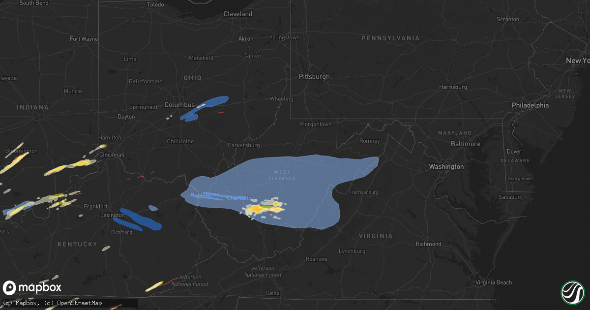
Hail Map in West Virginia on April 2, 2024
Get this storm
April 2 map
$229
one time, instant access
Download today. No call, no setup
Keep the $229
Bought the map and want the full workflow? Apply the entire $229 to a subscription within 7 days. None of it is wasted.
Every map, not just this one
This buys you this map. Subscription and you get every map we run, in the markets you choose from a few cities to whole states to nationwide. Plus real-time alerts the moment a storm fires.
Contact data
Name, contact info, occupancy, even credit band for addresses in the footprint. You go from where it hit to who to call.
Become the source they trust
Unlimited branding weather history reports on demand. You already have the documented answer ready for the property owner, and you are the one who showed up with it.
Property data and RoofTrace estimates
Pull up any address you have got, its value and the exact code rules for that jurisdiction, straight from One Click Code. Then RoofTrace estimates the squares, pitch, and roof value, priced the way you price.
Storm reports in West Virginia
West Virginia
| Date | Description |
|---|---|
| 04/02/20244:35 PM CDT | Corrects previous non-tstm wnd gst report from 9 wsw gassaway. Mesonet station digw2 dingy. |
| 04/02/20243:53 PM CDT | Report from mping: half dollar |
| 04/02/20243:44 PM CDT | Picture provided via email. Time estimated from radar. |
| 04/02/20243:37 PM CDT | Time estimated by radar. |
| 04/02/20243:32 PM CDT | *** 2 inj *** adds additional information to previous report. Several structures damaged along rt 60 between lookout and hico. |
| 04/02/20243:32 PM CDT | One structure damaged with person trapped inside. |
| 04/02/20243:30 PM CDT | An ef2 tornado began west of mallard rd then traveled eastward along mallard rd causing considerable and significant tree damage with hundreds of hardwood trees uproote |
| 04/02/20243:20 PM CDT | Quarter to golf-ball sized hail in adena village. |
| 04/02/202411:45 AM CDT | Corrects previous non-tstm wnd gst report from 1 nne snowshoe. Mesonet station gw1472 snowshoe. |
| 04/02/202411:30 AM CDT | Tree down across horseshoe rd. |
| 04/02/202411:28 AM CDT | Tree down blocking back mountain rd. |
| 04/02/202411:23 AM CDT | Multiple trees uprooted. |
| 04/02/202411:22 AM CDT | Trees down on mountain quest ln. |
| 04/02/202411:20 AM CDT | Trees in lines blocking both sides of selbyville rd. |
| 04/02/202411:19 AM CDT | Thunderstorm winds blew down one tree on madams creek road. |
| 04/02/202411:17 AM CDT | Corrects previous non-tstm wnd gst report from 4 sw marmet. Mesonet station beew2 bee mountain. |
| 04/02/202411:17 AM CDT | Tree down. |
| 04/02/202411:15 AM CDT | Several trees down blocking selbyville rd. |
| 04/02/202411:08 AM CDT | Roof blown off outbuilding. Two trees downed. |
| 04/02/202411:07 AM CDT | Numerous trees down in and around trout. |
| 04/02/202411:07 AM CDT | Numerous trees down in and around trout. |
| 04/02/202411:01 AM CDT | Corrects previous tstm wnd dmg report from rupert. Numerous trees down in and around rupert. |
| 04/02/202411:00 AM CDT | Part of a roof blown off and a window broken out. |
| 04/02/202411:00 AM CDT | Tree down along rock house rd. |
| 04/02/202411:00 AM CDT | Corrects previous tstm wnd dmg report from quinwood. Several trees and some power lines down in the quinwood area. Superficial damage to a couple buildings in area. Wid |
| 04/02/202411:00 AM CDT | Several trees and some power lines down in the quinwood area. Widespread power outages. |
| 04/02/202410:55 AM CDT | Multiple trees down from frametown to gassaway and sutton. |
| 04/02/202410:52 AM CDT | Multiple trees down. |
| 04/02/202410:50 AM CDT | Tree down blocking sherwood rd. |
| 04/02/202410:45 AM CDT | Several large limbs fell on a house. Time estimated by radar. |
| 04/02/202410:43 AM CDT | Storage shed was dislodged and blown across the street. |
| 04/02/202410:42 AM CDT | Multiple trees down along cafego rd. |
| 04/02/202410:40 AM CDT | Trees down between horse creek rd and pettry bottom. |
| 04/02/202410:40 AM CDT | Trees and lines down at horse creek rd and coal river rd. |
| 04/02/202410:37 AM CDT | Several large pine trees damaged along us 60. |
| 04/02/202410:35 AM CDT | Metal roof removed... Power lines on house. |
| 04/02/202410:35 AM CDT | Large pine tree blocking the road. |
| 04/02/202410:33 AM CDT | Several trees snapped on hillside along us 60. |
| 04/02/202410:32 AM CDT | Widespread trees down in bickmore community. |
| 04/02/202410:28 AM CDT | Several trees down around town. |
| 04/02/202410:25 AM CDT | Structures damaged and a tree down on a house. |
| 04/02/202410:25 AM CDT | Trees down in melville along rt 17. |
| 04/02/202410:24 AM CDT | Tree and lines down on calm school rd blocking the road. |
| 04/02/202410:22 AM CDT | Trees and lines down along remington dr. |
| 04/02/202410:20 AM CDT | Yeager airport. |
| 04/02/202410:18 AM CDT | Brick facade of commercial building partially destroyed. |
| 04/02/202410:18 AM CDT | Two vehicles destroyed by fallen trees in the south hills area. |
| 04/02/202410:15 AM CDT | Tree down on a car. |
| 04/02/202410:15 AM CDT | Powerlines down onto vehicle. |
| 04/02/202410:15 AM CDT | Multiple trees and large limbs down in kanawha city. |
| 04/02/202410:15 AM CDT | Trees down. |
| 04/02/202410:15 AM CDT | Tree down blocking the roadway. |
| 04/02/202410:15 AM CDT | Several trees snapped on hillside along campbells creek rd. |
| 04/02/202410:13 AM CDT | Several large limbs down. Time estimated by radar. |
| 04/02/202410:12 AM CDT | Trees down between chapmanville and logan. |
| 04/02/202410:12 AM CDT | Utility pole snapped and power lines down. |
| 04/02/202410:10 AM CDT | Several trees down in cross lanes. |
| 04/02/202410:10 AM CDT | Trees down on limestone hill rd. |
| 04/02/202410:10 AM CDT | Multiple trees and power lines down across northern end of county. |
| 04/02/202410:10 AM CDT | Multiple trees down in danville. |
| 04/02/202410:09 AM CDT | Corrects previous non-tstm wnd gst report from 6 e ravenswood. Mesonet station drfw2 drift run. |
| 04/02/202410:08 AM CDT | Large billboard collapsed. |
| 04/02/202410:08 AM CDT | Multiple trees down along six mile rd. |
| 04/02/202410:08 AM CDT | Adds information to previous tstm wnd dmg report from 1 ssw dunbar. Large billboard collapsed and tractor trailer blown over on i-64 bridge. |
| 04/02/202410:06 AM CDT | Multiple trees uprooted. |
| 04/02/202410:05 AM CDT | Multiple trees snapped off. Time estimated by radar. |
| 04/02/202410:05 AM CDT | Portions of a sheet metal roof ripped off a mobile home. |
| 04/02/202410:05 AM CDT | Two of the four wvsr-am radio towers collapsed. These are approximately 400 ft tall. |
| 04/02/202410:04 AM CDT | Narrow swath of significant tree damage near running right way off of us119. |
| 04/02/202410:03 AM CDT | Multiple sheet metal roofs damaged... A power pole snapped... And multiple trees down. |
| 04/02/202410:03 AM CDT | Several trees down on wv tech park campus. Weather station recorded 56 mph wind gust. |
| 04/02/202410:02 AM CDT | Multiple large trees down along the coal river. 41 mph reported on davis station. |
| 04/02/202410:00 AM CDT | Wooden fence blown down. Time estimated by radar. |
| 04/02/202410:00 AM CDT | Multiple trees down in red house and bancroft. |
| 04/02/202410:00 AM CDT | Multiple trees down between yawkey and sumerco. |
| 04/02/202410:00 AM CDT | Trees down from scott depot to nitro. |
| 04/02/20249:57 AM CDT | Tree down onto a house on meadowbrook circle. |
| 04/02/20249:55 AM CDT | Sheet metal roof blown nearly entirely off in hurricane. |
| 04/02/20249:55 AM CDT | Portion of a gas station canopy blown off in buffalo... Wv. Time estimated by radar. |
| 04/02/20249:52 AM CDT | Structures damage and trees down in hamlin and up rt 34 toward hurricane. |
| 04/02/20249:48 AM CDT | Large billboard blown over by i-64. |
| 04/02/20249:44 AM CDT | Structural damage to an exterior wall attached to the barboursville mall. Roof damage to a pet supply store in the mall area as well. |
| 04/02/20249:37 AM CDT | Tree down on a home. |
| 04/02/20249:37 AM CDT | Corrects previous tstm wnd dmg report and location from wayne. Em reports multiple trees down including a tree down on a home on state street and lakeside drive. Tree d |
| 04/02/20249:35 AM CDT | Trees and power lines down all over huntington. Tractor trailor flipped over on the 31st bridge. |
| 04/02/20249:30 AM CDT | A local report indicates 92 MPH wind near 2 S Ceredo |
| 04/02/202412:36 AM CDT | Tree down blocking road |
All States Impacted by Hail Map on April 2, 2024
Cities Impacted by Hail Map on April 2, 2024
- Watson, AR
- Brickeys, AR
- Hughes, AR
- Gunnison, MS
- Tunica, MS
- Lake Cormorant, MS
- Robinsonville, MS
- Bernice, LA
- Hernando, MS
- Nesbit, MS
- Snow Lake, AR
- Duncan, MS
- Olive Branch, MS
- Southaven, MS
- Walls, MS
- Memphis, TN
- Horn Lake, MS
- Byhalia, MS
- Cordova, TN
- Collierville, TN
- Germantown, TN
- Paris, KY
- Winchester, KY
- Mount Sterling, KY
- Lexington, KY
- Richmond, KY
- Irvine, KY
- Waco, KY
- Clay City, KY
- Jeffersonville, KY
- Stanton, KY
- Morehead, KY
- Salt Lick, KY
- Hillsboro, KY
- Owingsville, KY
- Means, KY
- Frenchburg, KY
- Ravenna, KY
- Slade, KY
- Wellington, KY
- Denniston, KY
- Campton, KY
- Ezel, KY
- Hazel Green, KY
- Kirbyville, TX
- Russell, KY
- Pedro, OH
- Ironton, OH
- Worthington, KY
- Flatwoods, KY
- Ashland, KY
- Kitts Hill, OH
- Willow Wood, OH
- South Point, OH
- Catlettsburg, KY
- Kenova, WV
- Prichard, WV
- Chesapeake, OH
- Ceredo, WV
- Huntington, WV
- Argillite, KY
- Rush, KY
- Grayson, KY
- Greenup, KY
- Fort Gay, WV
- Wayne, WV
- Louisa, KY
- Denton, KY
- East Lynn, WV
- Genoa, WV
- Lavalette, WV
- Branchland, WV
- Barboursville, WV
- Scottown, OH
- Proctorville, OH
- Ona, WV
- Glenwood, WV
- Apple Grove, WV
- Crown City, OH
- Gallipolis, OH
- West Hamlin, WV
- Waterloo, OH
- Salt Rock, WV
- Lesage, WV
- Milton, WV
- Ashton, WV
- Patriot, OH
- Newton, TX
- Harrisburg, IL
- Bethel Springs, TN
- Finger, TN
- Griffithsville, WV
- Midkiff, WV
- Culloden, WV
- Spurlockville, WV
- Hurricane, WV
- Ranger, WV
- Alkol, WV
- Myra, WV
- Hamlin, WV
- Eleanor, WV
- Yawkey, WV
- Scott Depot, WV
- Red House, WV
- Sod, WV
- Winfield, WV
- Saint Albans, WV
- Fraziers Bottom, WV
- Buffalo, WV
- Sardis, TN
- Burkeville, TX
- Evans, LA
- Deridder, LA
- Lexington, TN
- Merryville, LA
- Leesville, LA
- Enville, TN
- Reagan, TN
- Tornado, WV
- Sumerco, WV
- Julian, WV
- Ridgeview, WV
- Alum Creek, WV
- Nitro, WV
- Charleston, WV
- Ashford, WV
- Poca, WV
- Dunbar, WV
- Racine, WV
- Hernshaw, WV
- Bloomingrose, WV
- Comfort, WV
- Orgas, WV
- South Charleston, WV
- Cabin Creek, WV
- Winifrede, WV
- Nellis, WV
- Seth, WV
- Costa, WV
- Peytona, WV
- Eskdale, WV
- Tad, WV
- Elkview, WV
- Belle, WV
- Leon, WV
- Liberty, WV
- Darden, TN
- Parsons, TN
- Decaturville, TN
- Fort Polk, LA
- Scotts Hill, TN
- Bath Springs, TN
- Foster, WV
- Miami, WV
- Drybranch, WV
- East Bank, WV
- Glasgow, WV
- Blount, WV
- Cedar Grove, WV
- Hansford, WV
- Gallagher, WV
- London, WV
- Hugheston, WV
- Mammoth, WV
- Montgomery, WV
- Handley, WV
- Clendenin, WV
- Pratt, WV
- Kenna, WV
- Glen, WV
- Smithers, WV
- Swiss, WV
- Bickmore, WV
- Indore, WV
- Procious, WV
- Dixie, WV
- Powellton, WV
- Maysel, WV
- Pond Gap, WV
- Bomont, WV
- Wallback, WV
- Mount Carbon, WV
- Kimberly, WV
- Clay, WV
- Lizemores, WV
- Belva, WV
- Fayetteville, WV
- Kanawha Falls, WV
- Scarbro, WV
- Kincaid, WV
- Robson, WV
- Gauley Bridge, WV
- Linden, TN
- Pitkin, LA
- Mount Hope, WV
- Oak Hill, WV
- Ansted, WV
- Victor, WV
- Summersville, WV
- Drennen, WV
- Duck, WV
- Hico, WV
- Lansing, WV
- Glen Jean, WV
- Lookout, WV
- Thurmond, WV
- Edmond, WV
- Centerville, TN
- Monroe City, IN
- Lobelville, TN
- Wheatland, IN
- Washington, IN
- Nunnelly, TN
- Birch River, WV
- Dille, WV
- Frametown, WV
- Danese, WV
- Mount Lookout, WV
- Camden On Gauley, WV
- Calvin, WV
- Mount Nebo, WV
- Erbacon, WV
- Rainelle, WV
- Nallen, WV
- Quinwood, WV
- Tioga, WV
- Cowen, WV
- Craigsville, WV
- Pool, WV
- Nettie, WV
- Canvas, WV
- Leivasy, WV
- Fenwick, WV
- Webster Springs, WV
- Upperglade, WV
- Richwood, WV
- Charmco, WV
- Rupert, WV
- Meadow Bridge, WV
- Renick, WV
- Maxwelton, WV
- Crawley, WV
- Hillsboro, WV
- Smoot, WV
- Williamsburg, WV
- Alderson, WV
- Grassy Meadows, WV
- Asbury, WV
- Lewisburg, WV
- Montgomery, IN
- Odon, IN
- Loogootee, IN
- Duck River, TN
- Lyles, TN
- Crane, IN
- Frankford, WV
- White Sulphur Springs, WV
- Marlinton, WV
- Slatyfork, WV
- Cass, WV
- Valley Head, WV
- Buckeye, WV
- Primm Springs, TN
- Bloomfield, IN
- Springville, IN
- Owensburg, IN
- Bloomington, IN
- Troy, IN
- Lewisport, KY
- Tell City, IN
- Evanston, IN
- Grandview, IN
- Fairview, TN
- Bon Aqua, TN
- Covington, VA
- Dunmore, WV
- Hot Springs, VA
- Warm Springs, VA
- Millboro, VA
- Bacova, VA
- Green Bank, WV
- Monterey, VA
- Selma, VA
- Arbovale, WV
- Eagle Rock, VA
- Clifton Forge, VA
- Williamsville, VA
- McDowell, VA
- Iron Gate, VA
- Head Waters, VA
- Deerfield, VA
- Goshen, VA
- Doe Hill, VA
- Williamsport, TN
- Scottsville, KY
- Franklin, TN
- Santa Fe, TN
- Nashville, TN
- Branchville, IN
- Leopold, IN
- Bristow, IN
- Bedford, IN
- English, IN
- Saint Croix, IN
- Sulphur, IN
- Brentwood, TN
- Lucas, KY
- Glasgow, KY
- Rockbridge Baths, VA
- Lexington, VA
- West Augusta, VA
- Bergoo, WV
- Monterville, WV
- Bartow, WV
- Durbin, WV
- Huttonsville, WV
- Gallipolis Ferry, WV
- Henderson, WV
- Southside, WV
- Cottageville, WV
- Given, WV
- Ripley, WV
- Evans, WV
- Spencer, WV
- Le Roy, WV
- Advent, WV
- Sandyville, WV
- Reedy, WV
- Gandeeville, WV
- Gay, WV
- Palestine, WV
- Walton, WV
- Creston, WV
- Arnoldsburg, WV
- Grantsville, WV
- Big Bend, WV
- Mount Zion, WV
- Ravenswood, WV
- Elizabeth, WV
- Brohard, WV
- Macfarlan, WV
- Munday, WV
- Big Springs, WV
- Millstone, WV
- Alum Bridge, WV
- Chloe, WV
- Amma, WV
- Smithville, WV
- Looneyville, WV
- Orma, WV
- Troy, WV
- Shock, WV
- Linn, WV
- Left Hand, WV
- Coxs Mills, WV
- Normantown, WV
- Glenville, WV
- Newton, WV
- Nebo, WV
- Exchange, WV
- Copen, WV
- Sand Fork, WV
- Rosedale, WV
- Weston, WV
- Burnsville, WV
- Orlando, WV
- Jane Lew, WV
- Ivydale, WV
- Cedarville, WV
- Camden, WV
- Gassaway, WV
- Walkersville, WV
- Sutton, WV
- Napier, WV
- Buckhannon, WV
- Heaters, WV
- Flatwoods, WV
- Horner, WV
- Ireland, WV
- Ellamore, WV
- Adrian, WV
- Little Birch, WV
- Volga, WV
- French Creek, WV
- Philippi, WV
- Crawford, WV
- Rock Cave, WV
- Cleveland, WV
- Belington, WV
- Kanawha Head, WV
- Coalton, WV
- Selbyville, WV
- Hacker Valley, WV
- Diana, WV
- Montrose, WV
- Tallmansville, WV
- Mill Creek, WV
- Norton, WV
- Mabie, WV
- Hambleton, WV
- Elkins, WV
- Parsons, WV
- Pickens, WV
- Kerens, WV
- Helvetia, WV
- Thomas, WV
- Valley Bend, WV
- Beverly, WV
- Hendricks, WV
- Bowden, WV
- Cabins, WV
- Petersburg, WV
- Harman, WV
- Keyser, WV
- Seneca Rocks, WV
- Glady, WV
- Red Creek, WV
- Davis, WV
- Dryfork, WV
- Old Fields, WV
- Mount Storm, WV
- Whitmer, WV
- Maysville, WV
- Lahmansville, WV
- Milam, WV
- Delray, WV
- Riverton, WV
- Fisher, WV
- Rio, WV
- Moorefield, WV
- Sugar Grove, WV
- Upper Tract, WV
- Franklin, WV
- Brandywine, WV
- Circleville, WV
- Mathias, WV
- Blue Grass, VA
- Romney, WV
- Baker, WV
- Edinburg, VA
- Dayton, VA
- Wardensville, WV
- Yellow Spring, WV
- Basye, VA
- Fulks Run, VA
- Lost City, WV
- Criders, VA
- Star Tannery, VA
- Bergton, VA
- High View, WV
- Capon Bridge, WV
- Orkney Springs, VA
- Broadway, VA
- Hinton, VA
- Winchester, VA
- Craigsville, VA
- Bridgewater, VA
- Maurertown, VA
- Harrisonburg, VA
- Woodstock, VA
- Singers Glen, VA
- Mount Jackson, VA
- Quicksburg, VA
- Mount Solon, VA
- Swoope, VA
- Churchville, VA
- Linville, VA
- Timberville, VA
- New Market, VA
- Summer Shade, KY
- Eighty Eight, KY
- Antioch, TN
- Nashville, IN
- Cape Girardeau, MO
- Edmonton, KY
- Jackson, MO
- Lecompte, LA
- Forest Hill, LA
- Pleasant Shade, TN
- Carthage, TN
- Riddleton, TN
- Lebanon, TN
- Alto Pass, IL
- Wolf Lake, IL
- Jonesboro, IL
- Cobden, IL
- Carbondale, IL
- Goreville, IL
- Makanda, IL
- Whitleyville, TN
- Dixon Springs, TN
- Alexandria, LA
- Carterville, IL
- Herrin, IL
- Marion, IL
- Energy, IL
- Johnston City, IL
- Celina, TN
- Hilham, TN
- Allons, TN
- Buncombe, IL
- Dickson, TN
- Monroe, TN
- Natchez, MS
- Fayette, MS
- Anna, IL
- Lorman, MS
- Pineville, LA
- Eldorado, IL
- Equality, IL
- Deville, LA
- Effie, LA
- Jonesville, LA
- Monterey, LA
- Junction, IL
- Vidalia, LA
- Solsberry, IN
- Cannelburg, IN
- Ellettsville, IN
- Spencer, IN
- Jasper, IN
- Dubois, IN
- Roxie, MS
- Stanford, KY
- Hustonville, KY
- Decatur, MS
- Newton, MS
- Lawrence, MS
- Hazlehurst, MS
- Crystal Springs, MS
- Terry, MS
- Florence, MS
- Waynesburg, KY
- Arlington, TN
- Union Church, MS
- Wesson, MS
- Pattison, MS
- Hermanville, MS
- Lamar, IN
- Saint Meinrad, IN
- Dale, IN
- Santa Claus, IN
- Ferdinand, IN
- Crothersville, IN
- Leavenworth, IN
- Paris Crossing, IN
- Battletown, KY
- Depauw, IN
- Milltown, IN
- Corydon, IN
- Scottsburg, IN
- Brownstown, IN
- Bremen, KY
- Sacramento, KY
- Hawesville, KY
- Georgetown, MS
- Commiskey, IN
- Harrisville, MS
- Deputy, IN
- Marengo, IN
- Grantsburg, IN
- Austin, IN
- North Vernon, IN
- Greenville, IN
- Borden, IN
- Centertown, KY
- Crandall, IN
- Georgetown, IN
- Ramsey, IN
- New Salisbury, IN
- Palmyra, IN
- Central City, KY
- Artie, WV
- Sunbright, TN
- Robbins, TN
- Dupont, IN
- New Albany, IN
- Jeffersonville, IN
- Clarksville, IN
- Floyds Knobs, IN
- Lanesville, IN
- Prospect, KY
- Sellersburg, IN
- Charlestown, IN
- Goshen, KY
- Huntsville, TN
- Crestwood, KY
- Pioneer, TN
- Cross Plains, IN
- Madison, IN
- Versailles, IN
- Butlerville, IN
- La Grange, KY
- Cleves, OH
- Harrison, OH
- Cincinnati, OH
- Helenwood, TN
- Lawrenceburg, IN
- Aurora, IN
- Guilford, IN
- West Harrison, IN
- Oneida, TN
- Smithfield, KY
- New Castle, KY
- Eminence, KY
- Louisville, KY
- Masonic Home, KY
- Burlington, KY
- Pendleton, KY
- Sulphur, KY
- Elizabeth, IN
- Dillsboro, IN
- Canaan, IN
- Rising Sun, IN
- Shelbyville, KY
- Simpsonville, KY
- Bennington, IN
- Milan, IN
- Moores Hill, IN
- Pineville, KY
- Middlesboro, KY
- Hulen, KY
- Miracle, KY
- Greenbrier, TN
- Baxter, KY
- Wallins Creek, KY
- Dayhoit, KY
- Coldiron, KY
- Harlan, KY
- Loyall, KY
- Auburn, KY
- Brooksville, KY
- Augusta, KY
- Mount Sterling, OH
- Springfield, TN
- Cross Plains, TN
- Cottontown, TN
- White House, TN
- Adamsville, TN
- Dover, KY
- Germantown, KY
- Maysville, KY
- Ripley, OH
- Ages Brookside, KY
- Evarts, KY
- Orient, OH
- Portland, TN
- West Union, OH
- Mount Eden, KY
- Taylorsville, KY
- Baltimore, OH
- Lockbourne, OH
- Ashville, OH
- Groveport, OH
- Lithopolis, OH
- Canal Winchester, OH
- Carroll, OH
- Pickerington, OH
- Hebron, OH
- Millersport, OH
- Thornville, OH
- Buckeye Lake, OH
- Heath, OH
- Jacksontown, OH
- Glenford, OH
- Amanda, OH
- Lancaster, OH
- Mount Perry, OH
- Hopewell, OH
- Pleasant View, TN
- Zanesville, OH
- Adamsville, OH
- Nashport, OH
- Frazeysburg, OH
- Newark, OH
- Dresden, OH
- Roseville, OH
- Bethpage, TN
- Westmoreland, TN
- Marksville, LA
- Center Point, LA
- Marion, AL
- Lithonia, GA
- Conyers, GA
- Maplesville, AL
- Clanton, AL
- Andalusia, AL
- Ariton, AL
- Enterprise, AL
- Marianna, FL
- Baconton, GA
- Albany, GA
- Jacksonville, GA
- Camilla, GA
- Doerun, GA
- Sale City, GA
- Panama City, FL
- Moultrie, GA
- Sumner, GA
- Bainbridge, GA
- Norman Park, GA
- Ty Ty, GA
- Hartsfield, GA
- Omega, GA
- Bloomfield, KY
- Chaplin, KY
- Cordele, GA
- Byron, GA
- Warner Robins, GA
- Rockford, AL
- Sylacauga, AL
- Weogufka, AL
- Kellyton, AL
- Leighton, AL
- Athens, AL
- Herscher, IL
- Bonfield, IL
- Kankakee, IL
- Manteno, IL
- Lawrenceburg, KY
- Nicholasville, KY
- Versailles, KY
- Sharpsburg, KY
- Jackson, OH
- Richmond, IN
- New Concord, OH
- Chandlersville, OH


