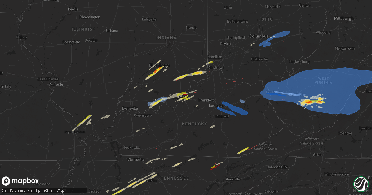
Hail Map on April 2, 2024
Get this storm
April 2 map
$229
one time, instant access
Download today. No call, no setup
Keep the $229
Bought the map and want the full workflow? Apply the entire $229 to a subscription within 7 days. None of it is wasted.
Every map, not just this one
This buys you this map. Subscription and you get every map we run, in the markets you choose from a few cities to whole states to nationwide. Plus real-time alerts the moment a storm fires.
Contact data
Name, contact info, occupancy, even credit band for addresses in the footprint. You go from where it hit to who to call.
Become the source they trust
Unlimited branding weather history reports on demand. You already have the documented answer ready for the property owner, and you are the one who showed up with it.
Property data and RoofTrace estimates
Pull up any address you have got, its value and the exact code rules for that jurisdiction, straight from One Click Code. Then RoofTrace estimates the squares, pitch, and roof value, priced the way you price.
States Impacted by Hail Map on April 2, 2024
Storm reports
Alabama
| Date | Description |
|---|---|
| 04/02/20246:16 PM CDT | Report from mping: 1-inch tree limbs broken; shingles blown off. |
| 04/02/20246:10 PM CDT | Video reportedly showing a funnel cloud along piney chapel road and elkmont road. |
| 04/02/20246:09 PM CDT | Corrects previous tstm wnd dmg report from 3 se ardmore. Report from mping: 1-inch tree limbs broken; shingles blown off. |
| 04/02/20246:04 PM CDT | Trees snapped and reported down on power lines. |
| 04/02/20246:01 PM CDT | An nws storm survey concluded an ef0 occurred between hall road and mooresville road east of athens... Al. |
| 04/02/20245:55 PM CDT | Trees reported down on a power line along elm street and elton road in athens. |
| 04/02/20244:59 PM CDT | Trees and power lines reported down along nora morgan street. |
| 04/02/20244:59 PM CDT | Corrects previous tstm wnd dmg report from 1 n leighton. Multiple trees reported down with one tree on a structure with possible entrapment off of puller loop road. |
| 04/02/20244:59 PM CDT | Multiple trees reported down with one tree on a structure with possible entrapment. |
| 04/02/20244:58 PM CDT | Storm survey by nws personnel concluded that an ef-1 tornado occurred just north of leighton... Alabama. |
| 04/02/20244:57 PM CDT | Corrects previous tstm wnd dmg report from 1 n leighton. Tree reported down on puller loop road. |
| 04/02/20244:57 PM CDT | Corrects previous tstm wnd dmg report from 1 n leighton. A tree was reported down at this location on county line road. |
| 04/02/20244:42 PM CDT | A tree was reported down at this location on n atlanta avenue. |
| 04/02/20241:20 PM CDT | A tree was reported down at the intersection of milk springs road and henderson point road. |
| 04/02/20243:41 AM CDT | Reports of downed trees along 109 near the fl and al state lines. Location estimated. |
| 04/02/20242:20 AM CDT | Report of a downed power line on whispering pines dr between maxwell st and pinedale dr. |
| 04/02/20242:00 AM CDT | Downed tree reported. |
| 04/02/202412:07 AM CDT | Tree down on power lines at highway 50 and church hill rd. |
| 04/02/202412:00 AM CDT | Trees down across friendship rd and tallassee hwy. |
| 04/01/202411:40 PM CDT | A brief ef0 tornado touched down near kellyton along county rd 62 causing a corridor of timber damage that was most notable near the intersection with al hwy 9. The tor |
| 04/01/202411:38 PM CDT | Trees down along elmore rd and marshell rd in wetumpka. |
| 04/01/202411:37 PM CDT | Trees and powerlines were reported down in kellyton. Possible tornado. |
| 04/01/202411:28 PM CDT | A brief ef1 tornado touched down northwest of rockford near kings bridge rd causing minor timber damage. The tornado continued northeast causing additional timber damag |
| 04/01/202411:25 PM CDT | Trees were reported down on us-231 around rockford. Possible tornado. |
| 04/01/202411:12 PM CDT | Several/numerous trees and powerlines reported down on the east side of the coosa river... Around cr 121... Daybreak curve... Lakeview road... And coosa run road. Possi |
| 04/01/202411:05 PM CDT | Two trees down on slaughter mill rd. |
| 04/01/202411:04 PM CDT | Trees reported down on cr 41. Tds on kbmx radar. |
| 04/01/202411:03 PM CDT | Multiple trees and power lines down on cr 424. Tds observed on kbmx radar. |
| 04/01/202410:54 PM CDT | Multiple structures damaged along cr 16 near pools crossroads. |
| 04/01/202410:49 PM CDT | The ef1 tornado formed near county road 359 where a couple trees were downed and minor roof damage occurred to the residence. Damage remained sporadic until it reached |
| 04/01/202410:45 PM CDT | Correction to damage type: trees down on cr 15. |
| 04/01/202410:45 PM CDT | Social media report of trees down on cr 15. Tds on kbmx radar. |
| 04/01/202410:37 PM CDT | Multiple trees uprooted and blocking cr 26 near plantersville. |
| 04/01/202410:35 PM CDT | Trees reported down near dallas county high school. Tds observed via kbmx radar. |
| 04/01/202410:28 PM CDT | The ef1 tornado began in a wooded area just west of the perry/dallas county line. It quickly reached its peak intensity as it crossed county road 272 where dozens of tr |
Kentucky
| Date | Description |
|---|---|
| 04/02/20246:55 PM CDT | Tree blown down and blocking skyline view road. Time estimated from radar. |
| 04/02/20246:34 PM CDT | Harlan county dispatch relayed a report of a downed tree on us 119 near mm 28. Time estimated from radar. |
| 04/02/20246:28 PM CDT | The nws survey team determined that the damage found was consistent with straight line winds... With maximum wind gusts estimated to be between 80 and 90 mph. The most |
| 04/02/20246:27 PM CDT | Ef1 tornado caused tree and structural damage... With maximum estimated wind speed of 105 mph. Path length of 3.5 miles. |
| 04/02/20246:18 PM CDT | Downed trees and power lines along the 800 block of ky-700. |
| 04/02/20246:17 PM CDT | Power lines blown down along us-27 north in the 800 block. |
| 04/02/20246:15 PM CDT | Ef0 tornado with a 3.2 mile path length and maximum estimated wind speed of 85 mph. Damage to trees... Barns... And outbuildings. |
| 04/02/20245:52 PM CDT | 1 large tree down. |
| 04/02/20245:48 PM CDT | A public report of half dollar sized hail was received near the bell county high school. Time estimated from radar. |
| 04/02/20245:31 PM CDT | Photo verified. Time estimated by radar. |
| 04/02/20245:25 PM CDT | A local report indicates 1.00 inch wind near 2 ENE Middletown |
| 04/02/20245:22 PM CDT | Several trees snapped and uprooted. Time estimated from radar. |
| 04/02/20245:15 PM CDT | House damaged with roof blown off. |
| 04/02/20245:15 PM CDT | Trees down and cars flipped at the intersection of ky153 and ky712. |
| 04/02/20244:50 PM CDT | Trees down. |
| 04/02/20244:38 PM CDT | Trees down in the area of whyte hill circle. |
| 04/02/20243:49 PM CDT | Two trees down on homes along scherm road on the west side of owensboro. |
| 04/02/20249:50 AM CDT | Numerous trees downed in the western portion of the county. County-wide power outages. |
| 04/02/20249:50 AM CDT | Martin county dispatch relayed a report of a tree through a roof near the 2000 block of tomahawk rd. Time estimated from radar. |
| 04/02/20249:46 AM CDT | Johnson county dispatch reported a tree down on u.s. 40 about 2 miles from the martin county line. Time estimated from radar. |
| 04/02/20249:40 AM CDT | Johnson county dispatch reported a tree blocking ky-172 near the 1930 block in staffordsville. Time estimated from radar. |
| 04/02/20249:34 AM CDT | A tree was blown down onto a pickup and farm outbuildings. Public report with photo relayed by broadcast media. |
| 04/02/20249:26 AM CDT | Boyd county emergency management drone footage shows a quarter-mile long path of uprooted and snapped trees associated with microburst winds of up to 100 mph along sout |
| 04/02/20249:25 AM CDT | Trees and power lines down on lowman dr and leighwood dr. |
| 04/02/20249:25 AM CDT | Trailer overturned and houses nearby destroyed. |
| 04/02/20249:24 AM CDT | An ef2 tornado with estimated maximum winds of up to 120 mph occurred along long branch road. The tornado caused considerable and significant tree damage with several l |
| 04/02/20249:23 AM CDT | Photos submitted by boyd county ema clearly indicate tornadic damage of at least ef1 intensity with two mobile homes displaced and/or rolled... Trees uprooted and snapp |
| 04/02/20249:21 AM CDT | An ef1 tornado with estimated maximum winds of up to 110 mph skipped eastward along a 1.35 mile path embedded in straight-line wind damage. The tornado likely began alo |
| 04/02/20249:21 AM CDT | Wind gust measured on a davis weather station mounted on the roof of the boyd county eoc. Several buildings in the industrial park also have garage doors blown in and h |
| 04/02/20249:20 AM CDT | Trees down on oakmont manor. |
| 04/02/20249:15 AM CDT | Swath of damage consistent with a microburst noted from greenup ky to the west side of ironton oh. The most significant damage occurred near hanging rock where several |
| 04/02/20249:15 AM CDT | Multiple trees down in multiple locations in eastern part of county. |
| 04/02/20249:15 AM CDT | Tree across the road on hwy 460. Info. Found via social media. |
| 04/02/20249:07 AM CDT | Path of damage begins at olive hill and continues eastward paralleling i-64 to grayson. |
| 04/02/20249:07 AM CDT | Updates previous report. Intermittent path of damage begins near olive hill and continues eastward paralleling i-64 to near grayson. Tree damage and some minor structur |
| 04/02/20249:00 AM CDT | On hwy 11. Multiple trees down... Limbs of up to 4 inches down. Winds at 50 mph estimated. |
| 04/02/20248:57 AM CDT | Roof blown off storage building. |
| 04/02/20248:57 AM CDT | Multiple downed trees at the north end of cave run lake near the dam. |
| 04/02/20248:36 AM CDT | Barn blown down. Roof partially blown off purcells auction service. |
| 04/02/20248:35 AM CDT | Nws storm survey found the end of tornado damage from a 13.44 mile long tornado in bourbon and clark counties in kentucky. A tree was uprooted with minor damage to a ne |
| 04/02/20248:35 AM CDT | Roof damage and trees down at the intersection of rt 4 and 421 on the northwest side of lexington. |
| 04/02/20248:33 AM CDT | Barn down with lots of damage. Animals injured. |
| 04/02/20248:33 AM CDT | Corrects previous tstm wnd dmg report from 5 wsw north middletown. Barn down with lots of damage. Animals injured. Intersection of winchester rd and thatchers mill rd. |
| 04/02/20248:30 AM CDT | The nws conducted a survey and found damage consistent with an ef1 tornado with max winds of 104 mph. The tornado lasted 3 minutes... Was 1.94 miles long and 150 yards |
| 04/02/20248:28 AM CDT | Nws storm survey found a tornado crossed into clark county... Ky from bourbon county... Ky. Tree trunks were snapped... Which was found to be consistent with 95 mph ef1 |
| 04/02/20248:25 AM CDT | Trees down and roofs blown off in an are from north middletown to clintonville reported by dispatch. |
| 04/02/20248:20 AM CDT | Nws storm survey found damage consistent with ef1 tornado damage 105 mph peak winds. The tornado lasted 15 minutes... Was 13.44 miles long and 100 yards wide. This fair |
| 04/02/20248:19 AM CDT | The tornado touched down on the northeast side of nicholasville off of us 27 just south of the sam’s club... But north of the providence school. The tornado touched d |
| 04/02/20248:18 AM CDT | The national weather service storm survey team confirmed straight-line wind damage on versailles rd |
| 04/02/20248:17 AM CDT | Trees down at the intersection of harrodsburg rd and matthews ln. |
| 04/02/20248:11 AM CDT | Damage to many trees and structures. Two barns demolished. Ef1. |
| 04/02/20248:07 AM CDT | Multiple trees and wires down. |
| 04/02/20248:06 AM CDT | The national weather service in louisville confirmed straight-line winds in salvisa. There was a bunch of cedar and maple tree damage off of old louisville road on the |
| 04/02/20247:56 AM CDT | Trees down here as the end point to the tornado in nelson county. Ef1 95 mph. |
| 04/02/20247:56 AM CDT | Nws survey found damage consistent with ef 1 90 mph peak winds. The tornado lasted 3 minutes... Was 2.10 miles long... And was 150 yards wide. The tornado touched down |
| 04/02/20247:50 AM CDT | Corrects previous tornado report from 2 n chaplin. The national weather service found a tornado consistent with ef1 95 mph peak winds. The length was 5.01 miles long wi |
| 04/02/20247:50 AM CDT | Corrects previous tornado report from 2 n chaplin. The strength was ef1 95 mph... Duration was 6 minutes... Length was 5.01 miles and width was 125 yards. The national |
| 04/02/20247:50 AM CDT | Trees down on ochs ln. |
| 04/02/20247:46 AM CDT | The national weather service louisville confirmed straight line winds in far southeastern spencer county... Near wakefield by the county line. Winds of 70 to 75 mph did |
| 04/02/20247:08 AM CDT | Tree reported down... Partially blocking road near 3060 payneville rd in western portion of meade county... Ky. |
| 04/01/20247:50 PM CDT | The national weather service conducted a storm damage assessment survey in nelson county from the storms mid morning... April 2. The tornado touched down between maude |
| 04/01/20247:25 PM CDT | Tree reported down on upper brush creek road near kentucky highway 906. |
| 04/01/20247:24 PM CDT | 70 foot pine tree fell on house. Time estimated from radar. |
| 04/01/20247:19 PM CDT | Rowan county dispatch reported a tree was down at the intersection of christy creek rd. And pattys lick rd. Time estimated from radar. |
| 04/01/20247:16 PM CDT | Large tree down. |
| 04/01/20247:12 PM CDT | Tree blown down on us-421 near the intersection with clay-leslie industrial park road. Time estimated from radar. |
| 04/01/20247:11 PM CDT | Tree blown down onto us-421 in vicinity of chat branch road. |
| 04/01/20247:11 PM CDT | Damage to roof of barn and outbuildings. |
Ohio
| Date | Description |
|---|---|
| 04/02/20246:55 PM CDT | Debris and trees down on the road near chapparal rd and oh-247. Time estimated from radar. |
| 04/02/20246:52 PM CDT | Time estimated from radar. |
| 04/02/20246:46 PM CDT | *** 1 inj *** ef1 tornado destroyed one structure and damaged several others... With numerous trees snapped and uprooted. Maximum estimated wind speeds of 100 mph. |
| 04/02/20246:38 PM CDT | A local report indicates a tornado near Ripley |
| 04/02/20245:07 PM CDT | 1 large tree down. Time estimated from radar. |
| 04/02/20245:07 PM CDT | Time estimated from radar. |
| 04/02/20244:50 PM CDT | A local report indicates 1.00 inch wind near 2 NNE Grandview |
| 04/02/20249:40 AM CDT | Out buildings destroyed and several trees down... Some onto structures. |
| 04/02/20249:37 AM CDT | Rear half of proctorville fd destroyed. Roof partially removed from fairland west elementary school. Damage consistent with microburst. Estimated wind speeds of 90 mph. |
| 04/02/20249:36 AM CDT | Part of the roof of elementary school blown off. |
| 04/02/20249:36 AM CDT | Significant damage reported across the town with roofs blown off... 1-2 ft diameter trees down... Rear half of fire dept destroyed. |
| 04/02/20249:35 AM CDT | Proctorville fire department building destroyed with severe damage to other structures. |
| 04/02/20249:34 AM CDT | Multiple power poles snapped midway up along north kenova rd. |
| 04/02/20249:30 AM CDT | Several trees down and structures damaged in aid township. |
| 04/02/20249:30 AM CDT | Widespread tree and power line damage. Multiple structures with damage. Truck overturned on proctorville bridge. |
| 04/02/20249:26 AM CDT | An ef1 tornado with maximum winds of up to 90 mph began near aid-oak ridge rd and traveled northeastward through mostly pastureland... Knocking down a few trees on the |
| 04/02/20249:23 AM CDT | Several trees snapped or uprooted along state route 141 near sugar creek christian academy. |
| 04/02/20249:20 AM CDT | Several campers flipped over and structures damaged. |
| 04/01/20248:20 PM CDT | Tornado confirmed on coon ridge road near wonderland road. Tornado speed... Width... Intensity... And path are still being evaluated. |
| 04/01/20248:18 PM CDT | Damage to trees reported near chandlersville. Additional details on damage and location forthcoming after initial evaluation by local fire department. |
| 04/01/20247:59 PM CDT | Tornado confirmed along cowden road. Tornado speed... Width... Intensity... And path is still being considered following yesterday's survey. We are evaluating whether t |
| 04/01/20247:58 PM CDT | Damage to trees and outbuilding associated with a possible tornado. A narrow swath of damage to be evaluated by a storm damage survey team. |
| 04/01/20247:57 PM CDT | An ef1 tornado touched down on april 2... 2024 along cowden road. The maximum wind speed was 100mph... Width was 75yrds... And length was 1.3 miles. |
| 04/01/20247:51 PM CDT | Tree reported down near the intersection of oakland road and roberts road. |
| 04/01/20247:51 PM CDT | Tree and power lines reported down near the intersection of oakland road and rock run road. |
| 04/01/20247:49 PM CDT | An ef0 tornado touched down on april 2...2024 in highland twp. Maximum winds were 85mph... Width was 50 yrds... And path length was 1.2 miles. |
| 04/01/20247:47 PM CDT | The tornado began along erwin hollow rd where several hardwood trees were snapped and uprooted. The tornado then moved northeast over a thick forest of mixed pine and h |
| 04/01/20247:45 PM CDT | Roof damage reported. Trees down |
| 04/01/20247:44 PM CDT | Part of a narrow swath of wind damage from a possible tornado... To be evaluated by storm damage survey team. |
| 04/01/20247:40 PM CDT | Report of down trees on house along route 93 north of pleasant grove. Time estimated based on radar. |
| 04/01/20247:32 PM CDT | A narrow swath of roof... Barn and tree damage associated with a possible tornado in vicinity of parr airport... To be evaluated by storm damage survey team. |
| 04/01/20247:30 PM CDT | Tornado confirmed near north zanesville. Tornado speed... Width... And path is still to be determined. |
| 04/01/20247:18 PM CDT | Tree damage reported associated with a possible tornado... To be evaluated by a storm damage survey team. |
| 04/01/20247:15 PM CDT | Several trees down. |
| 04/01/20247:12 PM CDT | Tree uprooted. Time estimated from radar. |
| 04/01/20247:08 PM CDT | Another damage report on fairview road |
| 04/01/20247:08 PM CDT | Trees uprooted on property on fairview road. No structural damage. Time estimated from radar. |
| 04/01/20247:08 PM CDT | An ef0 tornado damaged numerous trees... And caused minor structural damage to a barn and a few outbuildings. Maximum estimated wind speed of 75 mph. |
Missouri
| Date | Description |
|---|---|
| 04/02/20241:27 PM CDT | Time not estimated from radar yet facebook message report of 2 irrigation machines hit... 1 machine was a quarter of a mile long and the other was about a half mile lon |
Florida
| Date | Description |
|---|---|
| 04/02/20246:21 AM CDT | Report of a downed tree along spring creek and south of hwy 98. |
| 04/02/20246:00 AM CDT | Report of a downed tree along spring creek and south of hwy 98. |
| 04/02/20245:22 AM CDT | Reports of multiple trees down along hwy 71. |
| 04/02/20244:46 AM CDT | A local report indicates 60 MPH wind near 1 SSE Callaway |
| 04/02/20244:45 AM CDT | Downed trees were reported in along e hwy 98 in the parker area. |
| 04/02/20244:42 AM CDT | A local report indicates 67 MPH wind near 1 SE Springfield |
| 04/02/20244:39 AM CDT | Powerline down. |
South Carolina
| Date | Description |
|---|---|
| 04/02/20245:24 AM CDT | Darlington county em reports several trees fell on an apartment building near the myrtle street and manning avenue intersection. |
| 04/02/20244:46 AM CDT | Richland county em reported a tree fell on power lines at south ott rd and gill st. |
| 04/02/20244:42 AM CDT | Columbia fire reported tree fell on a residence at barhamville rd at slighs ave. |
| 04/02/20244:40 AM CDT | Sc highway patrol reports trees down on crystal springs dr near edmund hwy. Time estimated from radar. |
| 04/02/20244:40 AM CDT | Richland county em reported a tree fell along woodrow st at wheat st. |
| 04/02/20244:38 AM CDT | Richland co em reported tree fell in roadway at chester st and gadsden st. |
| 04/02/20244:38 AM CDT | Usc police reported a large tree fell on campus along barnwell rd between pendleton st and gibbes ct. |
| 04/02/20244:37 AM CDT | Columbia fire relayed report of tree falling on residence along joyner ave in west columbia. |
| 04/02/20244:36 AM CDT | Sc highway patrol reports trees down on methodist park rd near the intersection of augusta rd. Time estimated from radar. |
| 04/02/20244:35 AM CDT | Columbia fire relayed report of a tree falling through a home at the end of meadow wood dr. |
| 04/02/20244:35 AM CDT | Richland co em reported power lines in the roadway at ems hq at hampton st and laurens st. |
| 04/02/20244:26 AM CDT | Lexington pd reported a large tree blocking harmon st near taylor dr. |
| 04/02/20244:20 AM CDT | Richland county em reported several power lines down on winnsboro rd at braziel hill rd. |
| 04/02/20243:35 AM CDT | Public report and photo... Submitted via social media... Of large tree branches down on meeting st rd north of edgefield. Exact location and time estimated. |
| 04/02/20243:26 AM CDT | A tree was downed on hwy 28 s at wiggleton rd. Time estimated. |
| 04/02/20243:22 AM CDT | A tree was downed at hwy 28 s and ga ln. Time estimated. |
| 04/02/20243:21 AM CDT | Report and photo... Observed on social media... Showed a pine tree down on a vehicle in hawe creek campground... Site 30. Damage to the vehicle appeared minor. Time est |
Illinois
| Date | Description |
|---|---|
| 04/02/20242:20 PM CDT | Video of tornado near manteno. |
| 04/02/20241:59 PM CDT | Brief tornado with picture. |
| 04/02/202412:40 PM CDT | Hail up to quarter size falling at wsil-tv in carterville. |
Georgia
| Date | Description |
|---|---|
| 04/02/20246:32 AM CDT | Tree down on chaserville road. Time estimated from radar. |
| 04/02/20244:31 AM CDT | Tree down on edna moore road between hwy 341 and hwy 87. |
| 04/02/20243:50 AM CDT | Multiple reports of tree and structural damage in area between scenic route south to coney road. Tds seen from radar |
| 04/02/20243:45 AM CDT | Trees down on north doublegate drive. Time estimated from radar. |
| 04/02/20243:25 AM CDT | Trees down off of pettis road. Time estimated from radar. |
| 04/02/20242:45 AM CDT | Powerlines down along watson blvd near hwy 41. |
| 04/02/202412:08 AM CDT | 3 trees reported blown down in the city of elberton. Also a trampoline was picked up by wind and caused some issues. |
| 04/01/202411:40 PM CDT | Tree down near the intersection of hightower trail and adams way. |
| 04/01/202411:30 PM CDT | Tree down near the intersection of dally rd and jersey social circle rd. |
| 04/01/202411:30 PM CDT | Tree down near the intersection of westchester dr and westchester ln. |
| 04/01/202411:30 PM CDT | Tree down along kraddle creek rd. |
| 04/01/202411:30 PM CDT | Tree down near the intersection of jersey social circle rd and arnold dairy farm road. |
| 04/01/202411:30 PM CDT | Tree down near the intersection of hwy 11 and whitney rd. |
| 04/01/202411:30 PM CDT | Tree down near the intersection of lower jersey rd and harris rockmore rd. |
| 04/01/202411:25 PM CDT | Corrects previous tstm wnd dmg report from 2 nnw social circle. Tree down near the intersection of jersey social circle rd and arnold dairy farm road. |
| 04/01/202411:15 PM CDT | Tree down near the intersection of cornish mountain church rd and lower jersey rd. |
| 04/01/202411:15 PM CDT | Tree down near the intersection of willwood and marco dr. |
| 04/01/202411:12 PM CDT | Trees and powerlines down near the intersection of mcdaniel mill rd sw and turner rd sw. Possible tornado damage. |
| 04/01/202411:00 PM CDT | Several trees down along dial mill rd also near the intersection of hightower trail. Possible tornado damage. |
| 04/01/202410:55 PM CDT | Several trees down near piedmont rockdale hospital - near the intersection of sigman rd and milstead rd ne. Possible tornado damage. |
| 04/01/202410:50 PM CDT | *** 2 inj *** an ef-2 tornado with maximum winds of 115 mph traveled ene 9.5 miles across rockdale county... Including the city of conyers... Downing hundreds of trees. |
| 04/01/202410:49 PM CDT | *** 2 inj *** an ef-2 tornado with maximum winds of 115 mph traveled ene 9.5 miles across rockdale county... Including the city of conyers... Downing hundreds of trees. |
| 04/01/202410:49 PM CDT | Reports of trees down at several locations starting near 3000 block of hurst rd. |
Mississippi
| Date | Description |
|---|---|
| 04/02/20243:54 PM CDT | Penny to quarter hail... Lasted for 4 min with little to no rain. |
| 04/02/20243:54 PM CDT | A local report indicates 1.50 inch wind near 1 NNE Martinsville |
| 04/02/20243:40 PM CDT | A local report indicates 1.00 inch wind near Pleasant Hill |
| 04/02/20243:28 PM CDT | A local report indicates 1.00 inch wind near 1 NE Crystal Springs |
| 04/02/20243:27 PM CDT | A local report indicates 1.00 inch wind near 5 ENE McNair |
| 04/02/20243:09 PM CDT | Law enforcement reported quarter size hail near kingston rd in adams county. |
| 04/02/20243:09 PM CDT | Corrects previous hail report from 4 ne sibley. Local law enforcement reported hail up to quarter size near kingston rd in adams county. |
| 04/02/20243:06 PM CDT | Local law enforcement reported hail up to quarter size near kingston rd in adams county. |
| 04/02/20242:25 PM CDT | A local report indicates 1.25 inch wind near 1 NW Natchez |
| 04/02/20241:20 PM CDT | A few stones up to quarter size. |
| 04/02/20247:46 AM CDT | Hail up to the size of quarters south of the intersection of goodman rd and swinnea rd. |
Indiana
| Date | Description |
|---|---|
| 04/02/20245:47 PM CDT | Ef-2 tornado. This tornado started in far eastern posey county just northwest of st wendel. It then moved east southeast across the entire width of vanderburgh county b |
| 04/02/20245:09 PM CDT | Multiple tree limbs down- time estimated from radar. |
| 04/02/20245:03 PM CDT | 1 tree down. Time estimated from radar. |
| 04/02/20245:03 PM CDT | Barn destroyed- time estimated by radar. |
| 04/02/20244:54 PM CDT | Hail located in farmers retreat. |
| 04/02/20244:53 PM CDT | Ef0 tornado with a 3.5 mile path length damage trees... Barns and outbuildings. Maximum estimated winds of 80 mph. |
| 04/02/20244:52 PM CDT | An ef1 tornado destroyed a garage... A barn and numerous trees. Maximum estimated wind speed of 100 mph. |
| 04/02/20244:45 PM CDT | Barns damaged. Time estimated from radar. |
| 04/02/20244:35 PM CDT | Multiple structures damaged along a path from sr/62 at roundabout east to 8039 lakeside quarry drive. |
| 04/02/20244:32 PM CDT | Corrects previous hail report from 2 n new albany. 38.3211/-85.8172. |
| 04/02/20243:50 PM CDT | Many trees down. |
| 04/02/20243:50 PM CDT | Roof torn off fire station. |
| 04/02/20243:50 PM CDT | Corrects previous tstm wnd dmg report from carefree. Roof torn off fire station at the intersection of in66/i-64. |
| 04/02/20243:50 PM CDT | A local report indicates 60 MPH wind near Carefree |
| 04/02/20243:35 PM CDT | Three pine trees with snapped trunks. Wind speed estimated around 75 mph. |
| 04/02/20243:00 PM CDT | Large tree on road at west lost mans lane and north union valley road. Law enforcement on scene. |
| 04/02/20242:40 PM CDT | A local report indicates 60 MPH wind near 3 ESE Evansville |
| 04/02/202411:17 AM CDT | Mainly 0.88 inch hail or smaller. Time estimated from radar. |
| 04/02/20247:08 AM CDT | Shingles blown off. |
Tennessee
| Date | Description |
|---|---|
| 04/02/20246:30 PM CDT | About 1...300 customers without power mainly in the cross plains area and west of springfield. |
| 04/02/20246:30 PM CDT | Tree down at jernigan road and archer road near cross plains. Time estimated via radar. |
| 04/02/20246:30 PM CDT | Tree down at blackwood road and wilks road in springfield. Time estimated from radar. |
| 04/02/20244:30 PM CDT | Tornado spotted along hwy 27. |
| 04/02/20244:20 PM CDT | Heavy damage reported to schuberts funeral home. |
| 04/02/202411:43 AM CDT | Large trees uprooted on hill rd near granbery elementary school. ( |
| 04/02/202411:43 AM CDT | Large trees uprooted on hill rd near granbery elementary school. |
| 04/02/202410:06 AM CDT | A local report indicates 1.00 inch wind near 4 ENE Decaturville |
| 04/02/20248:55 AM CDT | Large tree snapped and minor shingle damage in brazil community. |
| 04/02/20248:05 AM CDT | Corrects previous hail report from 2 wsw bartlett. Tree down across road at sycamore view rd and main st. |
| 04/02/20248:05 AM CDT | Tree down across road at sycamore view rd and main st. |
Louisiana
| Date | Description |
|---|---|
| 04/02/20242:08 PM CDT | A local report indicates 1.00 inch wind near Monterey |
| 04/02/20242:05 PM CDT | A local report indicates 1.00 inch wind near 4 WSW Monterey |
West Virginia
| Date | Description |
|---|---|
| 04/02/20244:35 PM CDT | Corrects previous non-tstm wnd gst report from 9 wsw gassaway. Mesonet station digw2 dingy. |
| 04/02/20243:53 PM CDT | Report from mping: half dollar |
| 04/02/20243:44 PM CDT | Picture provided via email. Time estimated from radar. |
| 04/02/20243:37 PM CDT | Time estimated by radar. |
| 04/02/20243:32 PM CDT | *** 2 inj *** adds additional information to previous report. Several structures damaged along rt 60 between lookout and hico. |
| 04/02/20243:32 PM CDT | One structure damaged with person trapped inside. |
| 04/02/20243:30 PM CDT | An ef2 tornado began west of mallard rd then traveled eastward along mallard rd causing considerable and significant tree damage with hundreds of hardwood trees uproote |
| 04/02/20243:20 PM CDT | Quarter to golf-ball sized hail in adena village. |
| 04/02/202411:45 AM CDT | Corrects previous non-tstm wnd gst report from 1 nne snowshoe. Mesonet station gw1472 snowshoe. |
| 04/02/202411:30 AM CDT | Tree down across horseshoe rd. |
| 04/02/202411:28 AM CDT | Tree down blocking back mountain rd. |
| 04/02/202411:23 AM CDT | Multiple trees uprooted. |
| 04/02/202411:22 AM CDT | Trees down on mountain quest ln. |
| 04/02/202411:20 AM CDT | Trees in lines blocking both sides of selbyville rd. |
| 04/02/202411:19 AM CDT | Thunderstorm winds blew down one tree on madams creek road. |
| 04/02/202411:17 AM CDT | Tree down. |
| 04/02/202411:17 AM CDT | Corrects previous non-tstm wnd gst report from 4 sw marmet. Mesonet station beew2 bee mountain. |
| 04/02/202411:15 AM CDT | Several trees down blocking selbyville rd. |
| 04/02/202411:08 AM CDT | Roof blown off outbuilding. Two trees downed. |
| 04/02/202411:07 AM CDT | Numerous trees down in and around trout. |
| 04/02/202411:07 AM CDT | Numerous trees down in and around trout. |
| 04/02/202411:01 AM CDT | Corrects previous tstm wnd dmg report from rupert. Numerous trees down in and around rupert. |
| 04/02/202411:00 AM CDT | Several trees and some power lines down in the quinwood area. Widespread power outages. |
| 04/02/202411:00 AM CDT | Tree down along rock house rd. |
| 04/02/202411:00 AM CDT | Part of a roof blown off and a window broken out. |
| 04/02/202411:00 AM CDT | Corrects previous tstm wnd dmg report from quinwood. Several trees and some power lines down in the quinwood area. Superficial damage to a couple buildings in area. Wid |
| 04/02/202410:55 AM CDT | Multiple trees down from frametown to gassaway and sutton. |
| 04/02/202410:52 AM CDT | Multiple trees down. |
| 04/02/202410:50 AM CDT | Tree down blocking sherwood rd. |
| 04/02/202410:45 AM CDT | Several large limbs fell on a house. Time estimated by radar. |
| 04/02/202410:43 AM CDT | Storage shed was dislodged and blown across the street. |
| 04/02/202410:42 AM CDT | Multiple trees down along cafego rd. |
| 04/02/202410:40 AM CDT | Trees and lines down at horse creek rd and coal river rd. |
| 04/02/202410:40 AM CDT | Trees down between horse creek rd and pettry bottom. |
| 04/02/202410:37 AM CDT | Several large pine trees damaged along us 60. |
| 04/02/202410:35 AM CDT | Large pine tree blocking the road. |
| 04/02/202410:35 AM CDT | Metal roof removed... Power lines on house. |
| 04/02/202410:33 AM CDT | Several trees snapped on hillside along us 60. |
| 04/02/202410:32 AM CDT | Widespread trees down in bickmore community. |
| 04/02/202410:28 AM CDT | Several trees down around town. |
| 04/02/202410:25 AM CDT | Trees down in melville along rt 17. |
| 04/02/202410:25 AM CDT | Structures damaged and a tree down on a house. |
| 04/02/202410:24 AM CDT | Tree and lines down on calm school rd blocking the road. |
| 04/02/202410:22 AM CDT | Trees and lines down along remington dr. |
| 04/02/202410:20 AM CDT | Yeager airport. |
| 04/02/202410:18 AM CDT | Brick facade of commercial building partially destroyed. |
| 04/02/202410:18 AM CDT | Two vehicles destroyed by fallen trees in the south hills area. |
| 04/02/202410:15 AM CDT | Trees down. |
| 04/02/202410:15 AM CDT | Tree down on a car. |
| 04/02/202410:15 AM CDT | Several trees snapped on hillside along campbells creek rd. |
| 04/02/202410:15 AM CDT | Multiple trees and large limbs down in kanawha city. |
| 04/02/202410:15 AM CDT | Powerlines down onto vehicle. |
| 04/02/202410:15 AM CDT | Tree down blocking the roadway. |
| 04/02/202410:13 AM CDT | Several large limbs down. Time estimated by radar. |
| 04/02/202410:12 AM CDT | Trees down between chapmanville and logan. |
| 04/02/202410:12 AM CDT | Utility pole snapped and power lines down. |
| 04/02/202410:10 AM CDT | Trees down on limestone hill rd. |
| 04/02/202410:10 AM CDT | Multiple trees down in danville. |
| 04/02/202410:10 AM CDT | Several trees down in cross lanes. |
| 04/02/202410:10 AM CDT | Multiple trees and power lines down across northern end of county. |
| 04/02/202410:09 AM CDT | Corrects previous non-tstm wnd gst report from 6 e ravenswood. Mesonet station drfw2 drift run. |
| 04/02/202410:08 AM CDT | Multiple trees down along six mile rd. |
| 04/02/202410:08 AM CDT | Large billboard collapsed. |
| 04/02/202410:08 AM CDT | Adds information to previous tstm wnd dmg report from 1 ssw dunbar. Large billboard collapsed and tractor trailer blown over on i-64 bridge. |
| 04/02/202410:06 AM CDT | Multiple trees uprooted. |
| 04/02/202410:05 AM CDT | Multiple trees snapped off. Time estimated by radar. |
| 04/02/202410:05 AM CDT | Two of the four wvsr-am radio towers collapsed. These are approximately 400 ft tall. |
| 04/02/202410:05 AM CDT | Portions of a sheet metal roof ripped off a mobile home. |
| 04/02/202410:04 AM CDT | Narrow swath of significant tree damage near running right way off of us119. |
| 04/02/202410:03 AM CDT | Several trees down on wv tech park campus. Weather station recorded 56 mph wind gust. |
| 04/02/202410:03 AM CDT | Multiple sheet metal roofs damaged... A power pole snapped... And multiple trees down. |
| 04/02/202410:02 AM CDT | Multiple large trees down along the coal river. 41 mph reported on davis station. |
| 04/02/202410:00 AM CDT | Multiple trees down in red house and bancroft. |
| 04/02/202410:00 AM CDT | Wooden fence blown down. Time estimated by radar. |
| 04/02/202410:00 AM CDT | Trees down from scott depot to nitro. |
| 04/02/202410:00 AM CDT | Multiple trees down between yawkey and sumerco. |
| 04/02/20249:57 AM CDT | Tree down onto a house on meadowbrook circle. |
| 04/02/20249:55 AM CDT | Sheet metal roof blown nearly entirely off in hurricane. |
| 04/02/20249:55 AM CDT | Portion of a gas station canopy blown off in buffalo... Wv. Time estimated by radar. |
| 04/02/20249:52 AM CDT | Structures damage and trees down in hamlin and up rt 34 toward hurricane. |
| 04/02/20249:48 AM CDT | Large billboard blown over by i-64. |
| 04/02/20249:44 AM CDT | Structural damage to an exterior wall attached to the barboursville mall. Roof damage to a pet supply store in the mall area as well. |
| 04/02/20249:37 AM CDT | Tree down on a home. |
| 04/02/20249:37 AM CDT | Corrects previous tstm wnd dmg report and location from wayne. Em reports multiple trees down including a tree down on a home on state street and lakeside drive. Tree d |
| 04/02/20249:35 AM CDT | Trees and power lines down all over huntington. Tractor trailor flipped over on the 31st bridge. |
| 04/02/20249:30 AM CDT | A local report indicates 92 MPH wind near 2 S Ceredo |
| 04/02/202412:36 AM CDT | Tree down blocking road |
Virginia
| Date | Description |
|---|---|
| 04/02/202411:48 AM CDT | Trees reported down on cowpasture river road. |
| 04/02/202411:42 AM CDT | Tree blocking all lanes on bluegrass valley road. |
| 04/02/202411:36 AM CDT | Trees reported down on the 3000 block of mill gap road. |
| 04/02/202411:35 AM CDT | Tree blown down by thunderstorm winds along sam snead highway. |
| 04/02/202411:31 AM CDT | Tree blown down by thunderstorm winds along jackson river turnpike. |
Maryland
| Date | Description |
|---|---|
| 04/02/202412:36 AM CDT | Tree down near the intersection of swallow falls road and bert reams road |
Cities Impacted by Hail Map on April 2, 2024
- Watson, AR
- Brickeys, AR
- Hughes, AR
- Gunnison, MS
- Tunica, MS
- Lake Cormorant, MS
- Robinsonville, MS
- Bernice, LA
- Hernando, MS
- Nesbit, MS
- Snow Lake, AR
- Duncan, MS
- Olive Branch, MS
- Southaven, MS
- Walls, MS
- Memphis, TN
- Horn Lake, MS
- Byhalia, MS
- Cordova, TN
- Collierville, TN
- Germantown, TN
- Paris, KY
- Winchester, KY
- Mount Sterling, KY
- Lexington, KY
- Richmond, KY
- Irvine, KY
- Waco, KY
- Clay City, KY
- Jeffersonville, KY
- Stanton, KY
- Morehead, KY
- Salt Lick, KY
- Hillsboro, KY
- Owingsville, KY
- Means, KY
- Frenchburg, KY
- Ravenna, KY
- Slade, KY
- Wellington, KY
- Denniston, KY
- Campton, KY
- Ezel, KY
- Hazel Green, KY
- Kirbyville, TX
- Russell, KY
- Pedro, OH
- Ironton, OH
- Worthington, KY
- Flatwoods, KY
- Ashland, KY
- Kitts Hill, OH
- Willow Wood, OH
- South Point, OH
- Catlettsburg, KY
- Kenova, WV
- Prichard, WV
- Chesapeake, OH
- Ceredo, WV
- Huntington, WV
- Argillite, KY
- Rush, KY
- Grayson, KY
- Greenup, KY
- Fort Gay, WV
- Wayne, WV
- Louisa, KY
- Denton, KY
- East Lynn, WV
- Genoa, WV
- Lavalette, WV
- Branchland, WV
- Barboursville, WV
- Scottown, OH
- Proctorville, OH
- Ona, WV
- Glenwood, WV
- Apple Grove, WV
- Crown City, OH
- Gallipolis, OH
- West Hamlin, WV
- Waterloo, OH
- Salt Rock, WV
- Lesage, WV
- Milton, WV
- Ashton, WV
- Patriot, OH
- Newton, TX
- Harrisburg, IL
- Bethel Springs, TN
- Finger, TN
- Griffithsville, WV
- Midkiff, WV
- Culloden, WV
- Spurlockville, WV
- Hurricane, WV
- Ranger, WV
- Alkol, WV
- Myra, WV
- Hamlin, WV
- Eleanor, WV
- Yawkey, WV
- Scott Depot, WV
- Red House, WV
- Sod, WV
- Winfield, WV
- Saint Albans, WV
- Fraziers Bottom, WV
- Buffalo, WV
- Sardis, TN
- Burkeville, TX
- Evans, LA
- Deridder, LA
- Lexington, TN
- Merryville, LA
- Leesville, LA
- Enville, TN
- Reagan, TN
- Tornado, WV
- Sumerco, WV
- Julian, WV
- Ridgeview, WV
- Alum Creek, WV
- Nitro, WV
- Charleston, WV
- Ashford, WV
- Poca, WV
- Dunbar, WV
- Racine, WV
- Hernshaw, WV
- Bloomingrose, WV
- Comfort, WV
- Orgas, WV
- South Charleston, WV
- Cabin Creek, WV
- Winifrede, WV
- Nellis, WV
- Seth, WV
- Costa, WV
- Peytona, WV
- Eskdale, WV
- Tad, WV
- Elkview, WV
- Belle, WV
- Leon, WV
- Liberty, WV
- Darden, TN
- Parsons, TN
- Decaturville, TN
- Fort Polk, LA
- Scotts Hill, TN
- Bath Springs, TN
- Foster, WV
- Miami, WV
- Drybranch, WV
- East Bank, WV
- Glasgow, WV
- Blount, WV
- Cedar Grove, WV
- Hansford, WV
- Gallagher, WV
- London, WV
- Hugheston, WV
- Mammoth, WV
- Montgomery, WV
- Handley, WV
- Clendenin, WV
- Pratt, WV
- Kenna, WV
- Glen, WV
- Smithers, WV
- Swiss, WV
- Bickmore, WV
- Indore, WV
- Procious, WV
- Dixie, WV
- Powellton, WV
- Maysel, WV
- Pond Gap, WV
- Bomont, WV
- Wallback, WV
- Mount Carbon, WV
- Kimberly, WV
- Clay, WV
- Lizemores, WV
- Belva, WV
- Fayetteville, WV
- Kanawha Falls, WV
- Scarbro, WV
- Kincaid, WV
- Robson, WV
- Gauley Bridge, WV
- Linden, TN
- Pitkin, LA
- Mount Hope, WV
- Oak Hill, WV
- Ansted, WV
- Victor, WV
- Summersville, WV
- Drennen, WV
- Duck, WV
- Hico, WV
- Lansing, WV
- Glen Jean, WV
- Lookout, WV
- Thurmond, WV
- Edmond, WV
- Centerville, TN
- Monroe City, IN
- Lobelville, TN
- Wheatland, IN
- Washington, IN
- Nunnelly, TN
- Birch River, WV
- Dille, WV
- Frametown, WV
- Danese, WV
- Mount Lookout, WV
- Camden On Gauley, WV
- Calvin, WV
- Mount Nebo, WV
- Erbacon, WV
- Rainelle, WV
- Nallen, WV
- Quinwood, WV
- Tioga, WV
- Cowen, WV
- Craigsville, WV
- Pool, WV
- Nettie, WV
- Canvas, WV
- Leivasy, WV
- Fenwick, WV
- Webster Springs, WV
- Upperglade, WV
- Richwood, WV
- Charmco, WV
- Rupert, WV
- Meadow Bridge, WV
- Renick, WV
- Maxwelton, WV
- Crawley, WV
- Hillsboro, WV
- Smoot, WV
- Williamsburg, WV
- Alderson, WV
- Grassy Meadows, WV
- Asbury, WV
- Lewisburg, WV
- Montgomery, IN
- Odon, IN
- Loogootee, IN
- Duck River, TN
- Lyles, TN
- Crane, IN
- Frankford, WV
- White Sulphur Springs, WV
- Marlinton, WV
- Slatyfork, WV
- Cass, WV
- Valley Head, WV
- Buckeye, WV
- Primm Springs, TN
- Bloomfield, IN
- Springville, IN
- Owensburg, IN
- Bloomington, IN
- Troy, IN
- Lewisport, KY
- Tell City, IN
- Evanston, IN
- Grandview, IN
- Fairview, TN
- Bon Aqua, TN
- Covington, VA
- Dunmore, WV
- Hot Springs, VA
- Warm Springs, VA
- Millboro, VA
- Bacova, VA
- Green Bank, WV
- Monterey, VA
- Selma, VA
- Arbovale, WV
- Eagle Rock, VA
- Clifton Forge, VA
- Williamsville, VA
- McDowell, VA
- Iron Gate, VA
- Head Waters, VA
- Deerfield, VA
- Goshen, VA
- Doe Hill, VA
- Williamsport, TN
- Scottsville, KY
- Franklin, TN
- Santa Fe, TN
- Nashville, TN
- Branchville, IN
- Leopold, IN
- Bristow, IN
- Bedford, IN
- English, IN
- Saint Croix, IN
- Sulphur, IN
- Brentwood, TN
- Lucas, KY
- Glasgow, KY
- Rockbridge Baths, VA
- Lexington, VA
- West Augusta, VA
- Bergoo, WV
- Monterville, WV
- Bartow, WV
- Durbin, WV
- Huttonsville, WV
- Gallipolis Ferry, WV
- Henderson, WV
- Southside, WV
- Cottageville, WV
- Given, WV
- Ripley, WV
- Evans, WV
- Spencer, WV
- Le Roy, WV
- Advent, WV
- Sandyville, WV
- Reedy, WV
- Gandeeville, WV
- Gay, WV
- Palestine, WV
- Walton, WV
- Creston, WV
- Arnoldsburg, WV
- Grantsville, WV
- Big Bend, WV
- Mount Zion, WV
- Ravenswood, WV
- Elizabeth, WV
- Brohard, WV
- Macfarlan, WV
- Munday, WV
- Big Springs, WV
- Millstone, WV
- Alum Bridge, WV
- Chloe, WV
- Amma, WV
- Smithville, WV
- Looneyville, WV
- Orma, WV
- Troy, WV
- Shock, WV
- Linn, WV
- Left Hand, WV
- Coxs Mills, WV
- Normantown, WV
- Glenville, WV
- Newton, WV
- Nebo, WV
- Exchange, WV
- Copen, WV
- Sand Fork, WV
- Rosedale, WV
- Weston, WV
- Burnsville, WV
- Orlando, WV
- Jane Lew, WV
- Ivydale, WV
- Cedarville, WV
- Camden, WV
- Gassaway, WV
- Walkersville, WV
- Sutton, WV
- Napier, WV
- Buckhannon, WV
- Heaters, WV
- Flatwoods, WV
- Horner, WV
- Ireland, WV
- Ellamore, WV
- Adrian, WV
- Little Birch, WV
- Volga, WV
- French Creek, WV
- Philippi, WV
- Crawford, WV
- Rock Cave, WV
- Cleveland, WV
- Belington, WV
- Kanawha Head, WV
- Coalton, WV
- Selbyville, WV
- Hacker Valley, WV
- Diana, WV
- Montrose, WV
- Tallmansville, WV
- Mill Creek, WV
- Norton, WV
- Mabie, WV
- Hambleton, WV
- Elkins, WV
- Parsons, WV
- Pickens, WV
- Kerens, WV
- Helvetia, WV
- Thomas, WV
- Valley Bend, WV
- Beverly, WV
- Hendricks, WV
- Bowden, WV
- Cabins, WV
- Petersburg, WV
- Harman, WV
- Keyser, WV
- Seneca Rocks, WV
- Glady, WV
- Red Creek, WV
- Davis, WV
- Dryfork, WV
- Old Fields, WV
- Mount Storm, WV
- Whitmer, WV
- Maysville, WV
- Lahmansville, WV
- Milam, WV
- Delray, WV
- Riverton, WV
- Fisher, WV
- Rio, WV
- Moorefield, WV
- Sugar Grove, WV
- Upper Tract, WV
- Franklin, WV
- Brandywine, WV
- Circleville, WV
- Mathias, WV
- Blue Grass, VA
- Romney, WV
- Baker, WV
- Edinburg, VA
- Dayton, VA
- Wardensville, WV
- Yellow Spring, WV
- Basye, VA
- Fulks Run, VA
- Lost City, WV
- Criders, VA
- Star Tannery, VA
- Bergton, VA
- High View, WV
- Capon Bridge, WV
- Orkney Springs, VA
- Broadway, VA
- Hinton, VA
- Winchester, VA
- Craigsville, VA
- Bridgewater, VA
- Maurertown, VA
- Harrisonburg, VA
- Woodstock, VA
- Singers Glen, VA
- Mount Jackson, VA
- Quicksburg, VA
- Mount Solon, VA
- Swoope, VA
- Churchville, VA
- Linville, VA
- Timberville, VA
- New Market, VA
- Summer Shade, KY
- Eighty Eight, KY
- Antioch, TN
- Nashville, IN
- Cape Girardeau, MO
- Edmonton, KY
- Jackson, MO
- Lecompte, LA
- Forest Hill, LA
- Pleasant Shade, TN
- Carthage, TN
- Riddleton, TN
- Lebanon, TN
- Alto Pass, IL
- Wolf Lake, IL
- Jonesboro, IL
- Cobden, IL
- Carbondale, IL
- Goreville, IL
- Makanda, IL
- Whitleyville, TN
- Dixon Springs, TN
- Alexandria, LA
- Carterville, IL
- Herrin, IL
- Marion, IL
- Energy, IL
- Johnston City, IL
- Celina, TN
- Hilham, TN
- Allons, TN
- Buncombe, IL
- Dickson, TN
- Monroe, TN
- Natchez, MS
- Fayette, MS
- Anna, IL
- Lorman, MS
- Pineville, LA
- Eldorado, IL
- Equality, IL
- Deville, LA
- Effie, LA
- Jonesville, LA
- Monterey, LA
- Junction, IL
- Vidalia, LA
- Solsberry, IN
- Cannelburg, IN
- Ellettsville, IN
- Spencer, IN
- Jasper, IN
- Dubois, IN
- Roxie, MS
- Stanford, KY
- Hustonville, KY
- Decatur, MS
- Newton, MS
- Lawrence, MS
- Hazlehurst, MS
- Crystal Springs, MS
- Terry, MS
- Florence, MS
- Waynesburg, KY
- Arlington, TN
- Union Church, MS
- Wesson, MS
- Pattison, MS
- Hermanville, MS
- Lamar, IN
- Saint Meinrad, IN
- Dale, IN
- Santa Claus, IN
- Ferdinand, IN
- Crothersville, IN
- Leavenworth, IN
- Paris Crossing, IN
- Battletown, KY
- Depauw, IN
- Milltown, IN
- Corydon, IN
- Scottsburg, IN
- Brownstown, IN
- Bremen, KY
- Sacramento, KY
- Hawesville, KY
- Georgetown, MS
- Commiskey, IN
- Harrisville, MS
- Deputy, IN
- Marengo, IN
- Grantsburg, IN
- Austin, IN
- North Vernon, IN
- Greenville, IN
- Borden, IN
- Centertown, KY
- Crandall, IN
- Georgetown, IN
- Ramsey, IN
- New Salisbury, IN
- Palmyra, IN
- Central City, KY
- Artie, WV
- Sunbright, TN
- Robbins, TN
- Dupont, IN
- New Albany, IN
- Jeffersonville, IN
- Clarksville, IN
- Floyds Knobs, IN
- Lanesville, IN
- Prospect, KY
- Sellersburg, IN
- Charlestown, IN
- Goshen, KY
- Huntsville, TN
- Crestwood, KY
- Pioneer, TN
- Cross Plains, IN
- Madison, IN
- Versailles, IN
- Butlerville, IN
- La Grange, KY
- Cleves, OH
- Harrison, OH
- Cincinnati, OH
- Helenwood, TN
- Lawrenceburg, IN
- Aurora, IN
- Guilford, IN
- West Harrison, IN
- Oneida, TN
- Smithfield, KY
- New Castle, KY
- Eminence, KY
- Louisville, KY
- Masonic Home, KY
- Burlington, KY
- Pendleton, KY
- Sulphur, KY
- Elizabeth, IN
- Dillsboro, IN
- Canaan, IN
- Rising Sun, IN
- Shelbyville, KY
- Simpsonville, KY
- Bennington, IN
- Milan, IN
- Moores Hill, IN
- Pineville, KY
- Middlesboro, KY
- Hulen, KY
- Miracle, KY
- Greenbrier, TN
- Baxter, KY
- Wallins Creek, KY
- Dayhoit, KY
- Coldiron, KY
- Harlan, KY
- Loyall, KY
- Auburn, KY
- Brooksville, KY
- Augusta, KY
- Mount Sterling, OH
- Springfield, TN
- Cross Plains, TN
- Cottontown, TN
- White House, TN
- Adamsville, TN
- Dover, KY
- Germantown, KY
- Maysville, KY
- Ripley, OH
- Ages Brookside, KY
- Evarts, KY
- Orient, OH
- Portland, TN
- West Union, OH
- Mount Eden, KY
- Taylorsville, KY
- Baltimore, OH
- Lockbourne, OH
- Ashville, OH
- Groveport, OH
- Lithopolis, OH
- Canal Winchester, OH
- Carroll, OH
- Pickerington, OH
- Hebron, OH
- Millersport, OH
- Thornville, OH
- Buckeye Lake, OH
- Heath, OH
- Jacksontown, OH
- Glenford, OH
- Amanda, OH
- Lancaster, OH
- Mount Perry, OH
- Hopewell, OH
- Pleasant View, TN
- Zanesville, OH
- Adamsville, OH
- Nashport, OH
- Frazeysburg, OH
- Newark, OH
- Dresden, OH
- Roseville, OH
- Bethpage, TN
- Westmoreland, TN
- Marksville, LA
- Center Point, LA
- Marion, AL
- Lithonia, GA
- Conyers, GA
- Maplesville, AL
- Clanton, AL
- Andalusia, AL
- Ariton, AL
- Enterprise, AL
- Marianna, FL
- Baconton, GA
- Albany, GA
- Jacksonville, GA
- Camilla, GA
- Doerun, GA
- Sale City, GA
- Panama City, FL
- Moultrie, GA
- Sumner, GA
- Bainbridge, GA
- Norman Park, GA
- Ty Ty, GA
- Hartsfield, GA
- Omega, GA
- Bloomfield, KY
- Chaplin, KY
- Cordele, GA
- Byron, GA
- Warner Robins, GA
- Rockford, AL
- Sylacauga, AL
- Weogufka, AL
- Kellyton, AL
- Leighton, AL
- Athens, AL
- Herscher, IL
- Bonfield, IL
- Kankakee, IL
- Manteno, IL
- Lawrenceburg, KY
- Nicholasville, KY
- Versailles, KY
- Sharpsburg, KY
- Jackson, OH
- Richmond, IN
- New Concord, OH
- Chandlersville, OH