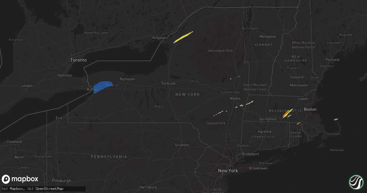
Hail Map in New York on March 29, 2020
Get this storm
March 29 map
$229
one time, instant access
Download today. No call, no setup
Keep the $229
Bought the map and want the full workflow? Apply the entire $229 to a subscription within 7 days. None of it is wasted.
Every map, not just this one
This buys you this map. Subscription and you get every map we run, in the markets you choose from a few cities to whole states to nationwide. Plus real-time alerts the moment a storm fires.
Contact data
Name, contact info, occupancy, even credit band for addresses in the footprint. You go from where it hit to who to call.
Become the source they trust
Unlimited branding weather history reports on demand. You already have the documented answer ready for the property owner, and you are the one who showed up with it.
Property data and RoofTrace estimates
Pull up any address you have got, its value and the exact code rules for that jurisdiction, straight from One Click Code. Then RoofTrace estimates the squares, pitch, and roof value, priced the way you price.
Storm reports in New York
New York
| Date | Description |
|---|---|
| 03/29/20204:30 PM CDT | A local report indicates 1.00 inch wind near 2 S GOUVERNEUR |
| 03/29/20204:22 PM CDT | Time based on radar |
| 03/29/20201:24 PM CDT | Multiple large trees down. |
| 03/29/20201:12 PM CDT | Large tree down |
| 03/29/20201:08 PM CDT | Tree down on house on ransom rd. |
| 03/29/20201:07 PM CDT | Tree and power lines down on stony road between pleasant view and genesee in lancaster. |
| 03/29/20201:05 PM CDT | Siding and signs down at walden and transit. Time is based on radar. |
| 03/29/20201:04 PM CDT | A local report indicates 68 MPH wind near BUFFALO AIRPORT |
| 03/29/202012:22 AM CDT | At 521 PM EDT, a severe thunderstorm was located near West Fowler, moving northeast at 55 mph. HAZARD...60 mph wind gusts and quarter size hail. SOURCE...Radar indicated. IMPACT...Minor hail damage to vehicles is possible. Expect wind damage to trees and powerlines. Locations impacted include... Potsdam, Gouverneur, Canton, De Kalb, Fowler, Colton, Degrasse, Hermon, Richville, Pierrepont, Russell, Fine, Rossie, Pitcairn, Stark, Edwards, West Parishville, Talcville, South Edwards and North Gouverneur. |
| 03/29/202012:11 AM CDT | At 511 PM EDT, a severe thunderstorm was located 8 miles south of Redwood, or 8 miles north of Fort Drum, moving northeast at 50 mph. HAZARD...Quarter size hail. SOURCE...Radar indicated. IMPACT...Minor damage to vehicles is possible. Locations impacted include... Redwood, Philadelphia, Theresa, Antwerp, Plessis, Oxbow and Muskellunge Lake. This includes Interstate 81 near exit 49. |
| 03/28/202010:10 PM CDT | At 310 PM EDT, a severe thunderstorm was located over Warsaw, or 11 miles northwest of Letchworth State Park, moving northeast at 65 mph. HAZARD...60 mph wind gusts and quarter size hail. SOURCE...Radar indicated. IMPACT...Minor damage to vehicles is possible. Expect wind damage to roofs, siding, and trees. Locations impacted include... Geneseo, Letchworth State Park, Perry, Warsaw, Avon, Mount Morris, Attica, Pavilion, Conesus and Bristol. This includes Interstate 390 between exits 6 and 10. |
| 03/28/20209:56 PM CDT | At 255 PM EDT, a severe thunderstorm was located over East Branch Dam, moving northeast at 50 mph. HAZARD...60 mph wind gusts and quarter size hail. SOURCE...Radar indicated. IMPACT...Hail damage to vehicles is expected. Expect wind damage to trees, roofs, and siding. This severe thunderstorm will be near... Elk River around 300 PM EDT. Betula and Sizerville around 310 PM EDT. Keating Summit and Roulette around 320 PM EDT. Coudersport around 330 PM EDT.Other locations impacted by this severe thunderstorm include Austin,Oswayo, Sweden Valley, Ski Denton Ski Area and Ulysses. |
| 03/28/20209:41 PM CDT | At 241 PM EDT, severe thunderstorms were located along a line extending from near Albion to near Batavia, moving east at 50 mph. HAZARD...60 mph wind gusts and nickel size hail. SOURCE...Radar indicated. IMPACT...Expect damage to roofs, siding, and trees. Locations impacted include... Rochester, Greece, Irondequoit, Chili, Brockport, East Rochester, Hilton, Webster, Fairport and Brighton. This includes the following highways... Interstate 390 between exits 11 and 12. Interstate 90 between exits 47 and 45. |
| 03/28/20209:03 PM CDT | At 202 PM EDT, severe thunderstorms were located along a line extending from near Sanborn to West Seneca, moving northeast at 55 mph. HAZARD...60 mph wind gusts and nickel size hail. SOURCE...Radar indicated. IMPACT...Expect damage to roofs, siding, and trees. Locations impacted include... Akron, Alden, Batavia, Gasport, Medina, Albion, Darien Lakes State Park, Newfane, Marilla, Pembroke, Bennington and Akron. This includes Interstate 90 between exits 48A and 48. |
| 03/28/20208:24 PM CDT | At 122 PM EDT, severe thunderstorms were located along a line extending from 26 miles southwest of Niagara Falls to near Lake Erie State Park, moving northeast at 50 mph. HAZARD...60 mph wind gusts and nickel size hail. SOURCE...Radar indicated. IMPACT...Expect damage to roofs, siding, and trees. Locations impacted include... Buffalo, Cheektowaga, Niagara Falls, West Seneca, North Tonawanda, Lackawanna, Kenmore, Dunkirk, Silver Creek, Angola, and Perrysburg. This includes Interstate 90 between exits 60 and 49. |
| 03/28/20208:18 PM CDT | At 117 PM EDT, a severe thunderstorm was located near Erie, moving northeast at 50 mph. HAZARD...60 mph wind gusts and quarter size hail. SOURCE...Radar indicated. IMPACT...Minor damage to vehicles is possible. Expect damage to trees and power lines. Locations impacted include... Erie, North East, Northwest Harborcreek, Harborcreek, Lawrence Park, Wesleyville, McKean, Northwest Harborcr and Avonia. |
All States Impacted by Hail Map on March 29, 2020
Cities Impacted by Hail Map on March 29, 2020
- Gansevoort, NY
- Prattsville, NY
- Jewett, NY
- Windham, NY
- Rochdale, MA
- Leicester, MA
- Cherry Valley, MA
- Worcester, MA
- Fort Drum, NY
- Gouverneur, NY
- Evans Mills, NY
- Hermon, NY
- Theresa, NY
- La Fargeville, NY
- Antwerp, NY
- Philadelphia, NY
- West Kill, NY
- Fleischmanns, NY
- North Truro, MA
- Provincetown, MA
- Mirando City, TX
- Laredo, TX
- Oilton, TX
- Valatie, NY
- Kinderhook, NY
- Stuyvesant, NY
- Oxford, MA
- Millbury, MA
- Auburn, MA
- Shrewsbury, MA
- Charlton, MA
- West Boylston, MA
- Spencer, MA
- Boylston, MA
- Porter Corners, NY
- Lancaster, NY
- Cheshire, MA
- Lanesborough, MA
- Pittsfield, MA
- Old Chatham, NY
- East Chatham, NY
- Brainard, NY
- Purling, NY
- Acra, NY
- Round Top, NY
- Cairo, NY
- Hensonville, NY
- Realitos, TX
- Bruni, TX
- Sturbridge, MA
- Holden, MA
- East Brookfield, MA
- Paxton, MA
- North Smithfield, RI
- Cumberland, RI
- Manville, RI
- Woonsocket, RI
- Orchard Park, NY
- Akron, NY
- Alden, NY
- Elba, NY
- Lockport, NY
- Clarence Center, NY
- East Amherst, NY
- Bowmansville, NY
- Darien Center, NY
- Corfu, NY
- Buffalo, NY
- Oakfield, NY
- Batavia, NY
- Basom, NY
- East Pembroke, NY
- Depew, NY
- Clarence, NY
- Elma, NY


