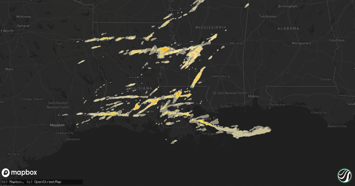
Hail Map in Louisiana on March 29, 2011
Get this storm
March 29 map
$229
one time, instant access
Download today. No call, no setup
Keep the $229
Bought the map and want the full workflow? Apply the entire $229 to a subscription within 7 days. None of it is wasted.
Every map, not just this one
This buys you this map. Subscription and you get every map we run, in the markets you choose from a few cities to whole states to nationwide. Plus real-time alerts the moment a storm fires.
Contact data
Name, contact info, occupancy, even credit band for addresses in the footprint. You go from where it hit to who to call.
Become the source they trust
Unlimited branding weather history reports on demand. You already have the documented answer ready for the property owner, and you are the one who showed up with it.
Property data and RoofTrace estimates
Pull up any address you have got, its value and the exact code rules for that jurisdiction, straight from One Click Code. Then RoofTrace estimates the squares, pitch, and roof value, priced the way you price.
Storm reports in Louisiana
Louisiana
| Date | Description |
|---|---|
| 03/29/20116:35 PM CDT | Trained spotter reported quarter sized hail just east of the airport in kenner. |
| 03/29/20116:30 PM CDT | A local report indicates 1.00 inch wind near 4 S MER ROUGE |
| 03/29/20116:30 PM CDT | Broadcast media reported 1 inch hail. |
| 03/29/20116:21 PM CDT | A local report indicates 1.00 inch wind near 3 SSW BASKIN |
| 03/29/20116:16 PM CDT | A local report indicates 1.75 inch wind near 6 S COLLINSTON |
| 03/29/20116:15 PM CDT | Public reported to emergency management of quarter size hail in luling |
| 03/29/20116:11 PM CDT | Lakeshore/swartz area |
| 03/29/20115:40 PM CDT | Photo received from baton rouge television station of golfball size hail at bluff creek. |
| 03/29/20115:30 PM CDT | Photo received from baton rouge tv station of slighltly larger than baseball size hail along highway 63 southeast of clinton. |
| 03/29/20115:19 PM CDT | A local report indicates 1.75 inch wind near AMITE |
| 03/29/20115:15 PM CDT | A local report indicates 1.75 inch wind near AMITE |
| 03/29/20115:10 PM CDT | Funnel cloud seen. Numerous power poles snapped near garyville and reserve. Also large air condition units on top of sams blown down the street. Possible tornado. |
| 03/29/20115:00 PM CDT | Trained spotter reported quarter sized hail along the interstate 10/55 interchange in the laplace area. |
| 03/29/20115:00 PM CDT | Broadcast media reported golf ball sized hail from a viewer in the laplace area. |
| 03/29/20114:25 PM CDT | Broadcast media passed on a viewer report of at least quarter size hail with some larger stones mixed in. |
| 03/29/20114:10 PM CDT | A local report indicates 1.25 inch wind near BAYOU SORREL |
| 03/29/20115:56 AM CDT | Reported in fordoche by public. Report relayed by baton rouge television station. |
| 03/29/20115:48 AM CDT | Egg size hail reported by public along the atchafalaya river south of krotz springs |
| 03/29/20115:35 AM CDT | A local report indicates 1.00 inch wind near ARNAUDVILLE |
| 03/29/20115:30 AM CDT | Cocorahs observer reported 1.50 inch size hail. Hail lasted for 7 minutes. Hail covered the ground and piled up along the fences. |
| 03/29/20115:30 AM CDT | Cocorahs observer reported hail size 1.25 inches. Hail lasted for 2 minutes. |
| 03/29/20115:11 AM CDT | A local report indicates 1.50 inch wind near 5 S LAKE CHARLES |
| 03/29/20115:10 AM CDT | Public reported quarter to half dollar size hail between mamou and vidrine |
| 03/29/20115:07 AM CDT | Harbor tug energy hercules report from trunkline lng. |
| 03/29/20115:07 AM CDT | Harbor tug energy hercules report from trunkline lng. |
| 03/29/20115:00 AM CDT | Large pine tree fell onto a house causing considerable damage. |
| 03/29/20115:00 AM CDT | Estimated quarter size hail near nelson road. |
| 03/29/20114:59 AM CDT | Public reported a boathouse was damaged on airhart road. An outbuilding was destroyed with debris blown into the roadway and a power pole was snapped. Several large tre |
| 03/29/201112:54 AM CDT | A local report indicates 1.00 inch wind near 4 SSW LEBLANC |
| 03/29/201112:52 AM CDT | On flowers landing rd |
| 03/28/201110:45 PM CDT | A local report indicates 1.00 inch wind near 6 SSE LAKE CHARLES |
| 03/28/201110:44 PM CDT | Nickel to quarter size hail observed outside nws office |
| 03/28/201110:37 PM CDT | Reports of pine trees across 1914 martin tramel road and roof blow off home. |
| 03/28/201110:30 PM CDT | Porch and part of roof torn off home. Possible tornado. |
| 03/28/201110:29 PM CDT | Trained spotter reported quarter sized hail in the city of amite. |
| 03/28/201110:27 PM CDT | Quarter to golfball size hail |
| 03/28/201110:23 PM CDT | Nws storm survey found ef-0 tornado. Path length was 1/2 mile and width of 25 yards. Damage includes roof of one home blown off to the northwest and several trees blown |
| 03/28/20119:53 PM CDT | Trees blown down along with hail of unknown size. |
| 03/28/20118:10 PM CDT | Public reported golf ball sized hail and broken windows in the delacroix area. |
| 03/28/20118:06 PM CDT | St. Bernard parish emergency repsonse employee reported power poles snapped...power lines down...several campers turned over and that the old delacroix center was aroun |
| 03/28/20118:02 PM CDT | Survey team classified the damage consistent with ef1 with estimated winds around 105 mph. Vacant 3 story delacroix govt complext lost top 2 floors...and collapse of no |
| 03/28/20118:02 PM CDT | Survey team found damage consistent with estimated winds around 105 mph. Vacant 3 story delacroix govt complext lost top 2 floors...and collapse of north and east facin |
| 03/28/20117:52 PM CDT | Hail to the size of nickels and quarters. |
| 03/28/20117:45 PM CDT | Public reported quarter sized hail in chalmette. |
| 03/28/20117:32 PM CDT | At a government building at 8056 highway 23. |
| 03/28/20117:32 PM CDT | Parish government office measured a wind gust of 100 mph at the end of avenue g and main street near plaquimines pride. |
| 03/28/20117:30 PM CDT | Nws new orleans conducted a storm survey in jefferson and plaquemines. The greatest concentration of damage was in gretna on manhattan blvd where nearly 1.8 miles of ha |
| 03/28/20117:30 PM CDT | Golf ball hail reported along highway 406 and 23. |
| 03/28/20117:30 PM CDT | Several public reported possible tornado at manhattan place shopping center. Awning blown down and damaged several cars in the parking lot. |
| 03/28/20117:27 PM CDT | Belle chasse asos reported a wind gust of 58 mph. |
| 03/28/20117:20 PM CDT | Tree on house along hero dr in harvey. |
| 03/28/20117:20 PM CDT | Co-op observer in terrytown reported quarter sized hail covering the yard. |
| 03/28/20117:20 PM CDT | Co-op observer measured a wind gust of 60 mph in terrytown. |
| 03/28/20117:15 PM CDT | Trained spotter reported half dollar sized hail in marrero. |
| 03/28/20117:15 PM CDT | A few trees and powerlines down |
| 03/28/20117:15 PM CDT | Jefferson parish emergency manager reported quarter sized hail at the intersection of manhattan and the westbank expressway. |
| 03/28/20117:05 PM CDT | Nws storm survey discovered intense microburst affecting area near highway 742 east of opelousas. Estimated wind speeds of 90-100 mph. 1 large metal barn destroyed and |
| 03/28/20117:03 PM CDT | A local report indicates 1.00 inch wind near LEONVILLE |
| 03/28/20117:02 PM CDT | A truck and roof was damaged |
| 03/28/20117:00 PM CDT | A local report indicates 1.25 inch wind near 1 S OPELOUSAS |
| 03/28/20117:00 PM CDT | Report of hail ranging from 1 inch to 1 1/2 inches. |
| 03/28/20117:00 PM CDT | Report of hail ranging from 1 inch to 1 1/4 inch in size. |
| 03/28/20117:00 PM CDT | Reported along highway 65 by law enforcement to emergency manager |
All States Impacted by Hail Map on March 29, 2011
Cities Impacted by Hail Map on March 29, 2011
- Clinton, AR
- Shirley, AR
- Hammond, LA
- Ponchatoula, LA
- Nettleton, MS
- Maurepas, LA
- Harrisville, MS
- Jasper, TX
- Tanner, AL
- Athens, AL
- Franklin, LA
- Newellton, LA
- Boutte, LA
- Paradis, LA
- Cherokee, AL
- Tuscumbia, AL
- Florence, AL
- Cabot, AR
- North Little Rock, AR
- Jacksonville, AR
- Sherwood, AR
- Dequincy, LA
- Ragley, LA
- Port Gibson, MS
- Choudrant, LA
- Ruston, LA
- Grambling, LA
- Simsboro, LA
- Eagle Pass, TX
- Marshall, TX
- Shreveport, LA
- Greenwood, LA
- Waskom, TX
- Rayne, LA
- Crowley, LA
- Doyline, LA
- Port Allen, LA
- Keithville, LA
- Stonewall, LA
- Gibsland, LA
- Oberlin, LA
- Timpson, TX
- Garrison, TX
- Rocksprings, TX
- Duson, LA
- Denham Springs, LA
- Magnolia, MS
- Mccomb, MS
- Amite, LA
- Independence, LA
- Fordoche, LA
- Krotz Springs, LA
- Lottie, LA
- Westwego, LA
- Eudora, AR
- Oak Grove, LA
- Jones, LA
- Forest, MS
- Walnut Grove, MS
- Lena, MS
- Morton, MS
- Ardmore, AL
- Elkmont, AL
- Ardmore, TN
- Toney, AL
- Opelousas, LA
- Port Barre, LA
- Little Rock, AR
- Hensley, AR
- Glynn, LA
- Zachary, LA
- Slaughter, LA
- Jarreau, LA
- Leesville, LA
- Courtland, AL
- Town Creek, AL
- Taft, TN
- Rogersville, AL
- Hillsboro, AL
- Clinton, LA
- Plaquemine, LA
- Del Rio, TX
- Brackettville, TX
- Maumelle, AR
- Greensburg, LA
- Pine Grove, LA
- Greenwell Springs, LA
- Miami, FL
- Okeechobee, FL
- Belle Glade, FL
- Canal Point, FL
- Pahokee, FL
- Monroe, LA
- Monticello, MS
- Jayess, MS
- Tylertown, MS
- Terry, MS
- Geismar, LA
- Donaldsonville, LA
- Saint Martinville, LA
- White Castle, LA
- Gonzales, LA
- Darrow, LA
- Crystal Springs, MS
- Holden, LA
- Roseland, LA
- Loranger, LA
- Hazlehurst, MS
- Union Church, MS
- Brookhaven, MS
- Wesson, MS
- La Place, LA
- Reserve, LA
- Garyville, LA
- Lake Village, AR
- Gueydan, LA
- Kaplan, LA
- Morse, LA
- Raymond, MS
- Dodson, LA
- Sikes, LA
- Foxworth, MS
- Oak Vale, MS
- Livingston, LA
- Madison, AL
- Millport, AL
- Steens, MS
- Loxahatchee, FL
- Vicksburg, MS
- Barksdale Afb, LA
- Haughton, LA
- Bossier City, LA
- Braithwaite, LA
- Belle Chasse, LA
- Gretna, LA
- Harvey, LA
- New Orleans, LA
- Longview, TX
- Hallsville, TX
- Mendenhall, MS
- Mize, MS
- Magee, MS
- Raleigh, MS
- Arcadia, LA
- Glenmora, LA
- Forest Hill, LA
- Grosse Tete, LA
- Newport, AR
- Oil Trough, AR
- Rosie, AR
- Magness, AR
- Newark, AR
- Bee Branch, AR
- Gilbert, LA
- Utica, MS
- Branch, LA
- Egan, LA
- Eunice, LA
- Iota, LA
- Carencro, LA
- Maringouin, LA
- Arnaudville, LA
- Breaux Bridge, LA
- Florence, MS
- Georgetown, MS
- Orange, TX
- Starks, LA
- Kentwood, LA
- Amory, MS
- Fulton, MS
- Smithville, MS
- Sherwood, TN
- Clinton, MS
- Bolton, MS
- Benton, LA
- Destrehan, LA
- Luling, LA
- Saint Rose, LA
- Ama, LA
- Carthage, MS
- Bruce, MS
- Randolph, MS
- Sulphur, LA
- Winnsboro, LA
- Lacassine, LA
- Bell City, LA
- Trenton, TN
- Richland, MS
- Pearl, MS
- Brandon, MS
- Saint Bernard, LA
- Marrero, LA
- Vidalia, GA
- Lyons, GA
- Tuckerman, AR
- Greenville, MS
- Mer Rouge, LA
- Hollandale, MS
- Chatham, MS
- Saint Joseph, LA
- Delhi, LA
- Tallulah, LA
- Lettsworth, LA
- Batchelor, LA
- Okolona, MS
- Shannon, MS
- Baskin, LA
- Metter, GA
- Byram, MS
- Jackson, MS
- Iowa, LA
- Lake Arthur, LA
- Prentiss, MS
- Osyka, MS
- Kokomo, MS
- Silver Creek, MS
- Saint James, LA
- Sour Lake, TX
- Hull, TX
- Devers, TX
- Melville, LA
- Estill Springs, TN
- Decherd, TN
- Belvidere, TN
- Flintville, TN
- Mulberry, TN
- Kelso, TN
- Winchester, TN
- Elton, LA
- Newton, TX
- Mangham, LA
- Prairieville, LA
- Paron, AR
- Itta Bena, MS
- Sidon, MS
- Greenwood, MS
- Columbia, LA
- Grayson, LA
- Morgan City, LA
- Pierre Part, LA
- Napoleonville, LA
- Drasco, AR
- Tremont, MS
- Goldonna, LA
- Saline, LA
- Pineville, LA
- Hessmer, LA
- Marksville, LA
- Collinston, LA
- Hackberry, LA
- Pitkin, LA
- Jena, LA
- Kinder, LA
- Lake Charles, LA
- McCall Creek, MS
- Braxton, MS
- Hillsboro, TN
- Harvest, AL
- Hazel Green, AL
- Fayetteville, TN
- Leighton, AL
- Water Valley, MS
- Banner, MS
- Oxford, MS
- Paris, MS
- Aberdeen, MS
- Mount Hermon, LA
- Mamou, LA
- Ville Platte, LA
- Mittie, LA
- Oakdale, LA
- Holcomb, MS
- Carrollton, MS
- Covington, LA
- Abita Springs, LA
- Dry Creek, LA
- Longville, LA
- Trout, LA
- Isola, MS
- Anahuac, TX
- Call, TX
- Kirbyville, TX
- Merryville, LA
- Buna, TX
- Beaumont, TX
- Cameron, LA
- Vinton, LA
- Vidor, TX
- Hot Springs Village, AR
- Hot Springs National Park, AR
- Warren, TX
- Kountze, TX
- Leland, MS
- El Indio, TX
- Natchez, MS
- Baton Rouge, LA
- Mabelvale, AR
- Coffeeville, MS
- Dubberly, LA
- Carrizo Springs, TX
- Chalmette, LA
- Violet, LA
- Meraux, LA
- Kenner, LA
- Lafitte, LA
- Metairie, LA
- Barataria, LA
- Des Allemands, LA
- Pride, LA
- Columbus, MS
- Theriot, LA
- Huntsville, AL
- Ochopee, FL
- Ethelsville, AL
- Lafayette, LA
- Bogue Chitto, MS
- Minden, LA
- Winnie, TX
- Sicily Island, LA
- Clayton, LA
- Lorman, MS
- Keatchie, LA
- De Berry, TX
- Cascilla, MS
- Grenada, MS
- Benton, AR
- Port Sulphur, LA
- Ventress, LA
- Princeton, LA
- Sibley, LA
- Scobey, MS
- Tillatoba, MS
- Red Bay, AL
- Sugartown, LA
- Grant, LA
- Morganza, LA
- Washington, LA
- Rougon, LA
- Youngsville, LA
- Oscar, LA
- Scott, LA
- Jackson, LA
- Ethel, LA
- Walker, LA
- Sunset, LA
- Erwinville, LA
- Livonia, LA
- New Roads, LA
- Lakeland, LA
- Church Point, LA
- Maurice, LA
- Bon Wier, TX
- Deridder, LA
- Jennings, LA
- Philadelphia, MS
- Porter, TX
- Palmetto, LA
- Saint Francisville, LA
- Plaucheville, LA
- Huntland, TN
- Elora, TN
- Jonesboro, AR
- Estillfork, AL
- Winnfield, LA
- Pleasant Plains, AR
- Batesville, AR
- Westlake, LA
- Quitman, AR
- Saint Amant, LA
- Gramercy, LA
- Convent, LA
- Paulina, LA
- Sorrento, LA
- Belle Rose, LA
- Brusly, LA
- Wiergate, TX
- Floral, AR
- Tumbling Shoals, AR
- Ida, AR
- Concord, AR
- Welsh, LA
- Jonesville, LA
- Edgard, LA
- Albany, LA
- Springfield, LA
- Lutcher, LA
- Plattenville, LA
- Addis, LA
- Norco, LA
- Carville, LA
- Jeanerette, LA
- Bauxite, AR
- Alexander, AR
- Roland, AR
- Scott, AR
- New Market, AL
- Lonsdale, AR
- West Monroe, LA
- Bridge City, TX
- Evangeline, LA
- Nederland, TX
- Reeves, LA
- Clewiston, FL
- Thibodaux, LA
- Guin, AL
- Hamilton, AL
- Deville, LA
- Rayville, LA
- Oak Ridge, LA
- Hermanville, MS
- Waterproof, LA
- Ferriday, LA
- Bunkie, LA
- Morrow, LA
- Hamshire, TX
- Kingwood, TX
- Huffman, TX
- Dayton, TX
- Burkeville, TX
- McKenzie, TN
- Flowood, MS
- Edwards, MS
- Swifton, AR
- Pinola, MS
- England, AR
- Louin, MS
- Newton, MS
- Lawrence, MS
- Twin City, GA
- Angola, LA
- Whitwell, TN
- Indianola, MS
- Decatur, AL
- Somerville, AL
- Pelahatchie, MS
- Bastrop, LA
- Avon Park, FL
- Waldron, AR
- Nacogdoches, TX
- Mansfield, LA
- Broussard, LA
- Schlater, MS
- Malvern, AR
- Lecompte, LA
- Woodworth, LA
- Singer, LA
- Jonesboro, LA
- Olla, LA
- Cottonport, LA
- Russellville, AR
- Booneville, AR
- Enterprise, LA
- Homestead, FL
- Tickfaw, LA
- Mandeville, LA
- Bradford, TN
- Milan, TN
- Cohutta, GA
- Fluker, LA
- Pelham, TN
- Beaverton, AL
- Hahnville, LA
- Fort Necessity, LA
- Wisner, LA
- Chatham, LA


