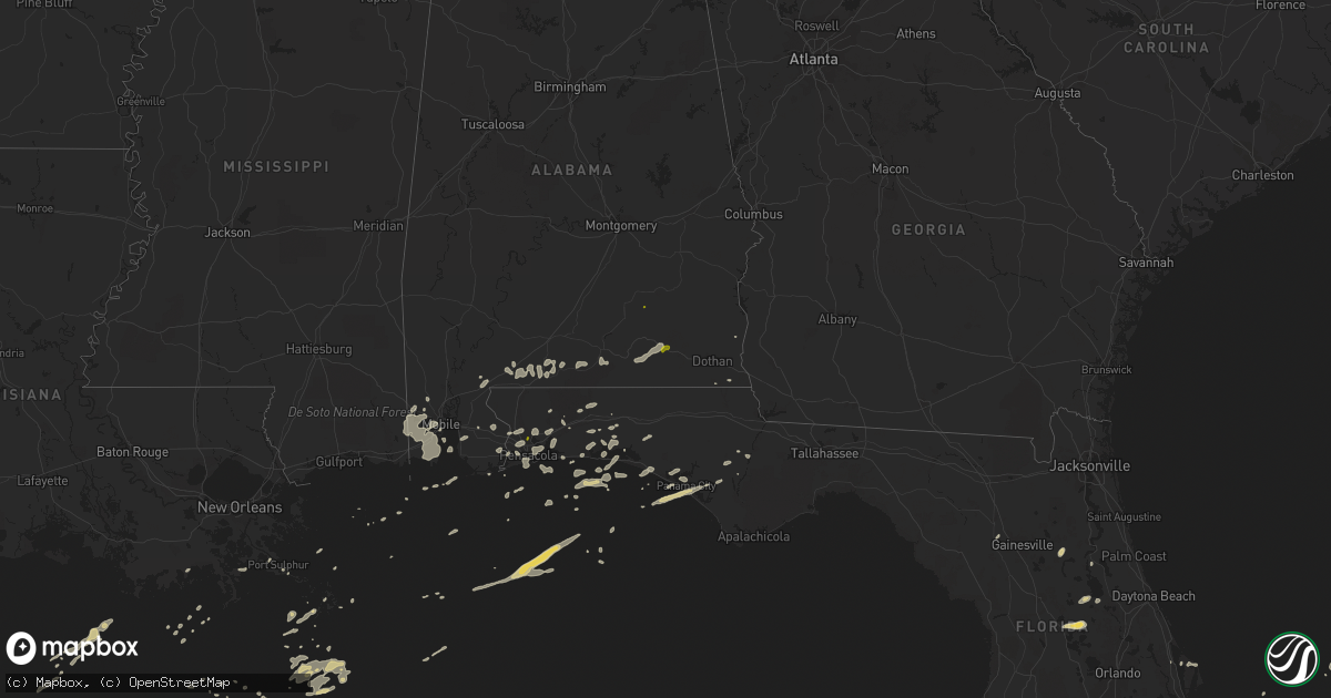
Hail Map on March 24, 2016
Get this storm
March 24 map
$229
one time, instant access
Download today. No call, no setup
Keep the $229
Bought the map and want the full workflow? Apply the entire $229 to a subscription within 7 days. None of it is wasted.
Every map, not just this one
This buys you this map. Subscription and you get every map we run, in the markets you choose from a few cities to whole states to nationwide. Plus real-time alerts the moment a storm fires.
Contact data
Name, contact info, occupancy, even credit band for addresses in the footprint. You go from where it hit to who to call.
Become the source they trust
Unlimited branding weather history reports on demand. You already have the documented answer ready for the property owner, and you are the one who showed up with it.
Property data and RoofTrace estimates
Pull up any address you have got, its value and the exact code rules for that jurisdiction, straight from One Click Code. Then RoofTrace estimates the squares, pitch, and roof value, priced the way you price.
States Impacted by Hail Map on March 24, 2016
Storm reports
Florida
| Date | Description |
|---|---|
| 03/24/20166:30 PM CDT | Emergency manager reported trees down across the county. One tree is down at birschbach way near deerlake w. Another tree was reported down on power lines at thomasvill |
| 03/24/20165:52 PM CDT | 1 large tree and several smaller trees downed just north of the intersection of lyons rd and hammock blvd. Time estimated via radar. |
| 03/24/20165:00 PM CDT | Roof damage to a structure in greenwood during the march 24th storms. |
| 03/24/20164:40 PM CDT | Several residents in southern palm bay near grant road and babcock street sent in photos and videos of hail up to the size of quarters. |
| 03/24/20164:06 PM CDT | A storm spotter estimated 60 mph winds in freeport. |
| 03/24/20164:06 PM CDT | Trees were blown down on kylea laird road during the march 24th storms. |
| 03/24/20163:39 PM CDT | Power pole down on forest rd north of rocky bayou. Report via social media. |
| 03/24/20163:31 PM CDT | Okeechobee county fire rescue station 4 at the intersection of us-441 and ne 168th street reported golf ball sized hail. Time estimated using radar. |
| 03/24/20163:25 PM CDT | Two trees were blown down near phillips road and highway 83 during the march 24th storms |
| 03/24/20162:45 PM CDT | Report of quarter sized hail on the campus of university of west florida via social media. |
| 03/24/20165:37 AM CDT | Reported on highway 22 near callaway. Forwarded by a wjhg-tv meteorologist. |
| 03/24/20165:35 AM CDT | A tree and power line were blown down into the roadway during an early morning storm on march 25th |
| 03/23/201611:30 PM CDT | 14 mobile homes damaged with some sheet metal peeled off roofs and porches. |
| 03/23/20169:49 PM CDT | Broadcast media sent pictures of metal roof of a barn torn off in baldwin. |
| 03/23/20169:49 PM CDT | Wjxt news reports that five barns on a farm were destroyed by an apparent downburst as thunderstorms moved through the baldwin area late on thursday evening. A tin roof |
| 03/23/20169:45 PM CDT | Central dispatch reported a large branch fell through a roof and into the living room of a residence in gainesville. No injuries reported. Other large branches were rep |
| 03/23/20169:32 PM CDT | Central dispatch reported trees down in the city of alachua. |
| 03/23/20169:25 PM CDT | Central dispatch reported branches and trees down near micanopy. |
| 03/23/20168:00 PM CDT | Tree fell over a power line on jody morgan grade near the beaches during the march 24th storms |
| 03/23/20167:55 PM CDT | Tree down on highway 221 about 6 miles north of perry during march 24th storms |
| 03/23/20167:46 PM CDT | A tree blew down close to the outside eastbound lane of i-10 during the march 24th storms. |
| 03/23/20167:15 PM CDT | A tree blew down in the road near the intersection of sr-30 and sr-59 during the march 24th storms. |
| 03/23/20167:08 PM CDT | Report of downed tree on cemetery road near woodville highway during march 24th storms |
| 03/23/20167:04 PM CDT | One tree downed on i-10. |
Texas
| Date | Description |
|---|---|
| 03/24/201610:20 AM CDT | Up to golfball sized hail in plano at park blvd and preston rd |
| 03/24/20167:06 AM CDT | Public reported downed trees and tree limbs in orange. Time estimated from radar. |
Mississippi
| Date | Description |
|---|---|
| 03/24/201610:00 AM CDT | Several large trees blown down and roof damage to two structures. A shed had the roof blown off and a home had a corner of the roof removed. |
| 03/24/20169:35 AM CDT | Several large trees blown down and roof damage to a building. Event time estimated by radar. |
Alabama
| Date | Description |
|---|---|
| 03/24/20163:55 PM CDT | A tree was blown down on highway 231 south just passed ozark. Report from march 24th storms. |
| 03/24/20163:55 PM CDT | Trees blown down on highway 123 going towards ariton during the march 24th storms. |
| 03/24/20163:35 PM CDT | The covington electric co-op reported a billboard blown onto powerlines on rucker blvd. In enterprise. |
| 03/24/20163:34 PM CDT | A local report indicates 1.00 inch wind near ENTERPRISE |
| 03/24/20163:26 PM CDT | Damage was reported to a few fences with a few fence sections blown over. In addition... Large limbs were broken off two trees. A flag pole was also tilted by the wind to (ta |
| 03/24/20163:25 PM CDT | Trees down on county highway 513 in coffee county. |
| 03/24/20163:23 PM CDT | Quarter sized hail reported at scotts farm supply store. |
| 03/24/20163:15 PM CDT | Damage to multiple structures in the community of brantley. |
| 03/24/20163:10 PM CDT | Reports of trees down in and around dozier with thunderstorm passage. |
| 03/24/20163:09 PM CDT | Trees down on highway 189 north in coffee county. |
| 03/24/20163:04 PM CDT | Public reports trees down in brantley. Time estimated from radar. |
| 03/24/20163:01 PM CDT | Trees and power lines reported down. Time estimated via radar. |
| 03/24/20162:55 PM CDT | Power lines reported down along leon tower rd. Relayed via social media. |
| 03/24/20162:55 PM CDT | Trees reported down along pigeon creek rd. Time estimated via radar. |
| 03/24/20162:54 PM CDT | Trees reported down on power lines along substation rd near onycha. Time estimated via radar. |
| 03/24/20162:51 PM CDT | Large tree across mashville rd east of greenville. |
| 03/24/20162:46 PM CDT | Trees reported down on power lines on lindsey bridge rd. Time estimated via radar. |
| 03/24/20162:40 PM CDT | Trees down along with awnings ripped off three homes and a gas station in the river falls/gant area. |
| 03/24/20162:33 PM CDT | Public reports tree down in river falls and minor damage to gas stattion awning. Time estimated from radar. |
| 03/24/20162:30 PM CDT | Hardwood trees uprooted. |
| 03/24/20162:30 PM CDT | Large tree uprooted and blown onto mobile home. |
| 03/24/20162:30 PM CDT | County em reports trees down on two houses... City workshop sustained damage... And at least one barn destroyed by strong winds. |
| 03/24/20162:26 PM CDT | Public reports trees down. Time estimated from radar |
| 03/24/20162:22 PM CDT | 3-4 houses sustained roof damage. Lots of trees down across the area east of i-65 in the garland area. |
| 03/24/20162:01 PM CDT | Broadcast media relayed report of tree and trampoline damage along highway 29 in escambia county. |
| 03/24/20162:01 PM CDT | Damage to a mobile home and outbuilding on zion hill rd near castleberry. Several large trees down. Report via social media. |
| 03/24/20161:57 PM CDT | Broadcast media relayed reports of trees down near appleton. Radar used for timing of damage. |
| 03/24/20161:50 PM CDT | Trees down on county road 41 in escambia county |
| 03/24/20161:00 PM CDT | Wind damage to the roof of apartments on university of south alabama campus. Reported by public via social media. |
| 03/24/201612:49 PM CDT | Large tree reported down near the intersection of airport blvd and green park dr. Relayed via social media. Time estimated via radar. |
Indiana
| Date | Description |
|---|---|
| 03/24/20162:10 PM CDT | Damage to a roof and other small structure on lath trail. |
| 03/24/20162:10 PM CDT | Tree down on power lines. Power is out. Bleachers blown over. |
| 03/24/20162:07 PM CDT | Siding and structural damage to a garage/shed. |
| 03/24/20162:07 PM CDT | Storefronts along western avenue in south bend have their windows blown out. Power is out... Tree limbs/power lines down. |
| 03/24/20162:07 PM CDT | Fallen tree limbs and trees on the 900 block of napier in south bend. |
| 03/24/20162:05 PM CDT | Multiple power poles leaning and in jeopardy of falling along mayflower road between sr 23 and cloyd street. Roof blown off a building on west dunham. |
| 03/24/20162:05 PM CDT | Located in laurel court off west avenue. Large tree limbs/branches down. Size of branches was denoted as 2 inches or greater. |
| 03/24/20161:30 PM CDT | Tornado touched down in an open field east of the intersection of state route 39 and county road 1150 south. The tornado moved northeast causing extensive damage to a g |
| 03/24/20161:26 PM CDT | Tornado touched down in an open field southwest of the intersection of county road 1600 south and 900 west moving east where it caused significant damage to a 120ft by |
| 03/24/201612:30 PM CDT | Tornado touched down in an open field east of the intersection of state route 39 and county road 1150 south. The tornado moved northeast causing extensive damage to a g |
Georgia
| Date | Description |
|---|---|
| 03/24/20166:30 PM CDT | There were 6 reports of trees down in the eastern part of mitchell county during the march 24th storms. |
| 03/24/20165:00 PM CDT | Power lines down along highway 37 south of fort gaines. Also... Several trees were reported down throughout clay county. |
| 03/24/20164:45 PM CDT | Power lines down along highway 37 south of fort gaines. Also... Several trees were reported down throughout clay county. Corrected time of event |
| 03/23/20168:55 PM CDT | Clinch county emergency management reports that the tin roof on a local restaurant in fargo was peeled off. No significant structural damage to the building occurred. T |
Louisiana
| Date | Description |
|---|---|
| 03/24/20167:47 AM CDT | Damage reported to two homes on taylor street |
| 03/24/20167:45 AM CDT | An ef1 tornado lifted the roof off a house and it landed on three neighboring houses and vehicles to the east. Although people were home at the time...no injuries were |
| 03/24/20167:28 AM CDT | Public posted photo of tree that fell into a house. Time estimated from radar. |
| 03/24/20167:28 AM CDT | Nws storm survey found sporadic straight line wind damage just east of ragley along lonnie cole road. A large tree branch fell on a mobile home at 144 lonnie cole rd ca |
| 03/24/20167:28 AM CDT | Nws storm survey found sporadic straight line wind damage in gillis in a neighborhood just east of hwy 171 off of topsy rd. A few 3-4 inch diameter tree brances were sn |
Michigan
| Date | Description |
|---|---|
| 03/24/20162:18 PM CDT | Em reported wind damage in the region south of us 12... Northwest of m 62... And east of section street in edwardsburg. Large tree... Approximately 2-3 ft in diameter uproote |
| 03/24/20162:14 PM CDT | Tornado touched down at the north end of sundance road just south of us-12. The tornado heavily damaged a barn and partially removed the roof of a church. Trees were al |
Cities Impacted by Hail Map on March 24, 2016
- Niceville, FL
- Okeechobee, FL
- Inlet Beach, FL
- Panama City Beach, FL
- Panama City, FL
- Interlachen, FL
- Hawthorne, FL
- Eglin Afb, FL
- Pensacola, FL
- Brewton, AL
- Cantonment, FL
- Umatilla, FL
- Leesburg, FL
- Miramar Beach, FL
- Titusville, FL
- Pomona Park, FL
- Perdido, AL
- Milton, FL
- Elberta, AL
- Robertsdale, AL
- Lady Lake, FL
- Weirsdale, FL
- Grand Island, FL
- Altoona, FL
- Astor, FL
- Mobile, AL
- Flomaton, AL
- Eight Mile, AL
- Blountstown, FL
- Castleberry, AL
- Wilmer, AL
- Navarre, FL
- Destin, FL
- Bagdad, FL
- Cottonwood, AL
- Chunchula, AL
- Baker, FL
- Clarksville, FL
- Crestview, FL
- Laurel Hill, FL
- Lynn Haven, FL
- Fort Walton Beach, FL
- Mary Esther, FL
- Hurlburt Field, FL
- Lillian, AL
- Fairhope, AL
- Daphne, AL
- Andalusia, AL
- Port Sulphur, LA
- Defuniak Springs, FL
- Vero Beach, FL
- Holt, FL
- Fort McCoy, FL
- Montegut, LA
- Chauvin, LA
- Loxley, AL
- Elba, AL
- Samson, AL
- Enterprise, AL
- Kinston, AL
- New Brockton, AL
- Newberry, FL
- Alachua, FL
- Bayou La Batre, AL
- Semmes, AL
- Coden, AL
- Grand Bay, AL
- Moss Point, MS
- Lucedale, MS
- Irvington, AL
- Theodore, AL
- Freeport, FL
- Atmore, AL
- Golden Meadow, LA
- Gulf Breeze, FL
- Columbia, AL
- Troy, AL
- Fellsmere, FL
- Palm Bay, FL