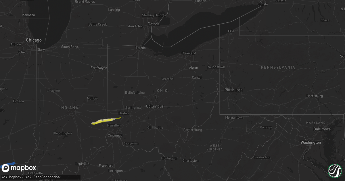
Hail Map in Ohio on March 19, 2020
Get this storm
March 19 map
$229
one time, instant access
Download today. No call, no setup
Keep the $229
Bought the map and want the full workflow? Apply the entire $229 to a subscription within 7 days. None of it is wasted.
Every map, not just this one
This buys you this map. Subscription and you get every map we run, in the markets you choose from a few cities to whole states to nationwide. Plus real-time alerts the moment a storm fires.
Contact data
Name, contact info, occupancy, even credit band for addresses in the footprint. You go from where it hit to who to call.
Become the source they trust
Unlimited branding weather history reports on demand. You already have the documented answer ready for the property owner, and you are the one who showed up with it.
Property data and RoofTrace estimates
Pull up any address you have got, its value and the exact code rules for that jurisdiction, straight from One Click Code. Then RoofTrace estimates the squares, pitch, and roof value, priced the way you price.
Storm reports in Ohio
Ohio
| Date | Description |
|---|---|
| 03/19/20202:55 AM CDT | Several trees downed near manning road and bear creek road. Time of damage estimated from radar data. |
| 03/18/202011:12 PM CDT | Several trees downed along wales road. Car dealership sign also damaged. Semi-trailer partially blown over near mile marker 19 of i71. |
All States Impacted by Hail Map on March 19, 2020
Cities Impacted by Hail Map on March 19, 2020
- Gretna, NE
- Cleveland, AR
- Clinton, AR
- Scotland, AR
- Funk, NE
- Axtell, NE
- Kearney, NE
- Waldron, AR
- Omaha, NE
- Emerson, IA
- Red Oak, IA
- New Virginia, IA
- Osceola, IA
- Electra, TX
- Harrold, TX
- Asherton, TX
- Catarina, TX
- Rulo, NE
- Hiawatha, KS
- Craig, MO
- Falls City, NE
- Indianola, IA
- Ravenwood, MO
- Clyde, MO
- Stanberry, MO
- Del Rio, TX
- Pleasantville, IA
- Knoxville, IA
- Morrill, KS
- White Cloud, KS
- Dallas, TX
- Granbury, TX
- Holdrege, NE
- Maitland, MO
- Mound City, MO
- Graham, MO
- Essex, IA
- Stanton, IA
- Villisca, IA
- Clarinda, IA
- Nodaway, IA
- Laredo, TX
- Crystal City, TX
- Pearsall, TX
- Quemado, TX
- Eagle Pass, TX
- Batesville, TX
- La Pryor, TX
- Burleson, TX
- Crowley, TX
- Rocksprings, TX
- Staplehurst, NE
- Bee, NE
- Seward, NE
- Utica, NE
- Ulysses, NE
- Dwight, NE
- Sutton, NE
- Grafton, NE
- Cumberland, IA
- Elliott, IA
- Corning, IA
- Hastings, IA
- Glenwood, IA
- Malvern, IA
- Imogene, IA
- Tabor, IA
- Randolph, IA
- Konawa, OK
- Tolar, TX
- Edgemont, AR
- Mountain View, AR
- Iowa Park, TX
- Grandfield, OK
- Devol, OK
- Fairfax, MO
- Shenandoah, IA
- Barnard, MO
- Maryville, MO
- Centralia, KS
- Vermillion, KS
- Conception Junction, MO
- Skidmore, MO
- Lipan, TX
- Ponder, TX
- Justin, TX
- Krum, TX
- Gatesville, TX
- Atkins, AR
- Jerusalem, AR
- Russellville, AR
- Hector, AR
- Moore, TX
- Aubrey, TX
- Naval Air Station Jrb, TX
- Fort Worth, TX
- Joshua, TX
- Marlow, OK
- Fletcher, OK
- McCool Junction, NE
- Fairmont, NE
- Coin, IA
- Yorktown, IA
- West College Corner, IN
- Liberty, IN
- College Corner, OH
- Oxford, OH
- Alma, NE
- Camden, OH
- Brookville, IN
- Bath, IN
- Somerville, OH
- Hamilton, OH
- Bradley, OK
- Geneva, NE
- Cotulla, TX
- Big Wells, TX
- Dannebrog, NE
- Cairo, NE
- Broken Bow, OK
- Goldthwaite, TX
- Paris, TX
- Powderly, TX
- Carrizo Springs, TX
- Booneville, AR
- Rushville, IN
- Weatherford, TX
- Coppell, TX
- Irving, TX
- Grapevine, TX
- Addison, TX
- Carrollton, TX
- Flower Mound, TX
- Ackworth, IA
- Saint Charles, IA
- Milo, IA
- Shirley, AR
- Lindsay, OK
- Alex, OK
- Rush Springs, OK
- Tilden, TX
- Jourdanton, TX
- Charlotte, TX
- Fowlerton, TX
- Ashland, NE
- Delaware, AR
- Southlake, TX
- Colleyville, TX
- Lewisville, TX
- Plano, TX
- Bigfoot, TX
- Farragut, IA
- Mullin, TX
- Afton, IA
- Aledo, TX
- Indianola, NE
- Comstock, TX
- Waxahachie, TX
- Ohiowa, NE
- Strang, NE
- Honey Grove, TX
- Grand Prairie, TX
- Duncanville, TX
- Hamilton, TX
- Hampton, NE
- Aurora, NE
- Pacific Junction, IA
- Massena, IA
- Henderson, IA
- Prescott, IA
- Lenox, IA
- Valley Mills, TX
- Connersville, IN
- Laurel, IN
- Metamora, IN
- Cranfills Gap, TX
- Clifton, TX
- Creston, IA
- Edgar, NE
- Exeter, NE
- York, NE
- Pleasant Grove, AR
- Loveland, OK
- Allen, OK
- Calvin, OK
- George West, TX
- Three Rivers, TX
- Grandview, TX
- Cedar Hill, TX
- Arlington, TX
- Desoto, TX
- Dardanelle, AR
- Lampasas, TX
- Denton, TX
- Bonham, TX
- Lometa, TX
- Purmela, TX
- Fairview, KS
- Sabetha, KS
- Parnell, MO
- Gentry, MO
- Powhattan, KS
- Alvarado, TX
- Sumner, TX
- Walters, OK
- Venus, TX
- Mansfield, TX
- Godley, TX
- Middletown, OH
- Milroy, IN
- Greensburg, IN
- Telephone, TX
- Tarkio, MO
- Elmo, MO
- Burlington Junction, MO
- Corning, KS
- Geronimo, OK
- Purcell, OK
- Blanchard, OK
- Ninnekah, OK
- Cleburne, TX
- Covington, TX
- Rio Vista, TX
- Blum, TX
- Danville, AR
- Copperas Cove, TX
- Dilley, TX
- Martinsville, MO
- Denver, MO
- Hopkins, MO
- Clearmont, MO
- Wayne, OK
- Maysville, OK
- Clatonia, NE
- Whitney, TX
- Truro, IA
- Frost, TX
- Lawton, OK
- North Richland Hills, TX
- Keller, TX
- Santo, TX
- Bluff Dale, TX
- Dover, AR
- Pauls Valley, OK
- Northboro, IA
- Thurman, IA
- Melcher Dallas, IA
- Lacona, IA
- Miamisburg, OH
- Germantown, OH
- La Vista, NE
- Ozark, AR
- Roland, OK
- Van Buren, AR
- Alma, AR
- Muldrow, OK
- Fort Smith, AR
- Mulberry, AR
- Bokoshe, OK
- Keota, OK
- Mccurtain, OK
- Spiro, OK
- Gassville, AR
- Summit, AR
- Cotter, AR
- Kingston, AR
- Parthenon, AR
- Pettigrew, AR
- Gamaliel, AR
- Harrison, AR
- Flippin, AR
- Hasty, AR
- Jasper, AR
- Western Grove, AR
- Caulfield, MO
- Everton, AR
- Bakersfield, MO
- Mountain Home, AR
- Yellville, AR
- Ponca, AR
- Mena, AR
- London, AR
- Belleville, AR
- Havana, AR
- Pottsville, AR
- Mount Pleasant, AR
- Sidney, AR
- Sage, AR
- Guion, AR
- Melbourne, AR
- Horseshoe Bend, AR
- Evening Shade, AR
- Benton, IL
- Mulkeytown, IL
- Barnhill, IL
- Whittington, IL
- Bonnie, IL
- Sesser, IL
- Fairfield, IL
- Waltonville, IL
- Scheller, IL
- Wayne City, IL
- Ina, IL
- Du Quoin, IL
- Mill Shoals, IL
- Belle Rive, IL
- Dahlgren, IL
- Tamaroa, IL
- Weleetka, OK
- Okemah, OK
- Tecumseh, OK
- Maud, OK
- Wewoka, OK
- Henryetta, OK
- Earlsboro, OK
- Macomb, OK
- Seminole, OK
- Okmulgee, OK
- Wetumka, OK
- Stilwell, OK
- Canehill, AR
- Evansville, AR
- Lincoln, AR
- Bunch, OK
- Checotah, OK
- Council Hill, OK
- Drumright, OK
- Stuart, OK


