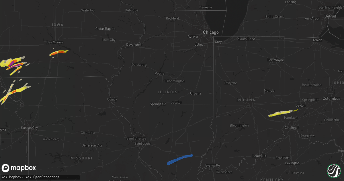
Hail Map in Illinois on March 19, 2020
Get this storm
March 19 map
$229
one time, instant access
Download today. No call, no setup
Keep the $229
Bought the map and want the full workflow? Apply the entire $229 to a subscription within 7 days. None of it is wasted.
Every map, not just this one
This buys you this map. Subscription and you get every map we run, in the markets you choose from a few cities to whole states to nationwide. Plus real-time alerts the moment a storm fires.
Contact data
Name, contact info, occupancy, even credit band for addresses in the footprint. You go from where it hit to who to call.
Become the source they trust
Unlimited branding weather history reports on demand. You already have the documented answer ready for the property owner, and you are the one who showed up with it.
Property data and RoofTrace estimates
Pull up any address you have got, its value and the exact code rules for that jurisdiction, straight from One Click Code. Then RoofTrace estimates the squares, pitch, and roof value, priced the way you price.
Storm reports in Illinois
Illinois
| Date | Description |
|---|---|
| 03/19/20204:25 PM CDT | 2 homes with roof decking removed... 2 barns damaged... And numerous trees and power lines down. |
| 03/19/20204:25 PM CDT | Tree and pole pole blown down in dalhgren. Time estimated. |
| 03/19/20204:23 PM CDT | The tornado began in extreme eastern jefferson county and moved across the northwest side of dahlgren in hamilton county. Several homes sustained roofing or soffit dama |
| 03/19/20204:09 PM CDT | Large idot sign blown down. |
| 03/19/20203:53 PM CDT | Report from mping: 1-inch tree limbs broken; shingles blown off. |
| 03/19/20203:44 PM CDT | At least a dozen homes damaged... Including four with major structural damage... Including numerous blown out windows and roof damage. One home had part of its roof dec |
| 03/19/20203:43 PM CDT | Narrow damage path in sunfield il. 12-15 houses damaged... 4 with major structural damage... 10 with roof damage... Garage destroyed. Numerous power poles and trees dow |
| 03/19/20203:43 PM CDT | Multiple power lines and trees down. Structural damage to a garage. Possible tornado. Time estimated. |
| 03/18/202011:06 PM CDT | At 406 PM CDT, a severe thunderstorm was located near Rend Lake Area, moving northeast at 55 mph. HAZARD...60 mph wind gusts and quarter size hail. SOURCE...Radar indicated. IMPACT...Hail damage to vehicles is expected. Expect wind damage to roofs, siding, and trees. Locations impacted include... Mount Vernon, Fairfield, Mcleansboro, Wayne City, Bluford, Dahlgren, Jeffersonville, Belle Rive, Ewing, Sims, Keenes and Belle Prairie City.This includes Interstate 64 in Illinois between Mile Markers 82 and109. |
| 03/18/202010:27 PM CDT | At 327 PM CDT, a severe thunderstorm was located near Pinckneyville, moving northeast at 55 mph. HAZARD...60 mph wind gusts and quarter size hail. SOURCE...Radar indicated. IMPACT...Hail damage to vehicles is expected. Expect wind damage to roofs, siding, and trees. Locations impacted include... Mount Vernon, Benton, Du Quoin, Pinckneyville, Christopher, Rend Lake Area, Sesser, Elkville, Valier, West City, Ava, Tamaroa, Ina, North City, Buckner, Waltonville, Dowell, Bonnie, Ewing and Vergennes.This includes the following highways... Interstate 57 in Illinois between Mile Markers 69 and 94. Interstate 64 in Illinois between Mile Markers 76 and 84. |
All States Impacted by Hail Map on March 19, 2020
Cities Impacted by Hail Map on March 19, 2020
- Gretna, NE
- Cleveland, AR
- Clinton, AR
- Scotland, AR
- Funk, NE
- Axtell, NE
- Kearney, NE
- Waldron, AR
- Omaha, NE
- Emerson, IA
- Red Oak, IA
- New Virginia, IA
- Osceola, IA
- Electra, TX
- Harrold, TX
- Asherton, TX
- Catarina, TX
- Rulo, NE
- Hiawatha, KS
- Craig, MO
- Falls City, NE
- Indianola, IA
- Ravenwood, MO
- Clyde, MO
- Stanberry, MO
- Del Rio, TX
- Pleasantville, IA
- Knoxville, IA
- Morrill, KS
- White Cloud, KS
- Dallas, TX
- Granbury, TX
- Holdrege, NE
- Maitland, MO
- Mound City, MO
- Graham, MO
- Essex, IA
- Stanton, IA
- Villisca, IA
- Clarinda, IA
- Nodaway, IA
- Laredo, TX
- Crystal City, TX
- Pearsall, TX
- Quemado, TX
- Eagle Pass, TX
- Batesville, TX
- La Pryor, TX
- Burleson, TX
- Crowley, TX
- Rocksprings, TX
- Staplehurst, NE
- Bee, NE
- Seward, NE
- Utica, NE
- Ulysses, NE
- Dwight, NE
- Sutton, NE
- Grafton, NE
- Cumberland, IA
- Elliott, IA
- Corning, IA
- Hastings, IA
- Glenwood, IA
- Malvern, IA
- Imogene, IA
- Tabor, IA
- Randolph, IA
- Konawa, OK
- Tolar, TX
- Edgemont, AR
- Mountain View, AR
- Iowa Park, TX
- Grandfield, OK
- Devol, OK
- Fairfax, MO
- Shenandoah, IA
- Barnard, MO
- Maryville, MO
- Centralia, KS
- Vermillion, KS
- Conception Junction, MO
- Skidmore, MO
- Lipan, TX
- Ponder, TX
- Justin, TX
- Krum, TX
- Gatesville, TX
- Atkins, AR
- Jerusalem, AR
- Russellville, AR
- Hector, AR
- Moore, TX
- Aubrey, TX
- Naval Air Station Jrb, TX
- Fort Worth, TX
- Joshua, TX
- Marlow, OK
- Fletcher, OK
- McCool Junction, NE
- Fairmont, NE
- Coin, IA
- Yorktown, IA
- West College Corner, IN
- Liberty, IN
- College Corner, OH
- Oxford, OH
- Alma, NE
- Camden, OH
- Brookville, IN
- Bath, IN
- Somerville, OH
- Hamilton, OH
- Bradley, OK
- Geneva, NE
- Cotulla, TX
- Big Wells, TX
- Dannebrog, NE
- Cairo, NE
- Broken Bow, OK
- Goldthwaite, TX
- Paris, TX
- Powderly, TX
- Carrizo Springs, TX
- Booneville, AR
- Rushville, IN
- Weatherford, TX
- Coppell, TX
- Irving, TX
- Grapevine, TX
- Addison, TX
- Carrollton, TX
- Flower Mound, TX
- Ackworth, IA
- Saint Charles, IA
- Milo, IA
- Shirley, AR
- Lindsay, OK
- Alex, OK
- Rush Springs, OK
- Tilden, TX
- Jourdanton, TX
- Charlotte, TX
- Fowlerton, TX
- Ashland, NE
- Delaware, AR
- Southlake, TX
- Colleyville, TX
- Lewisville, TX
- Plano, TX
- Bigfoot, TX
- Farragut, IA
- Mullin, TX
- Afton, IA
- Aledo, TX
- Indianola, NE
- Comstock, TX
- Waxahachie, TX
- Ohiowa, NE
- Strang, NE
- Honey Grove, TX
- Grand Prairie, TX
- Duncanville, TX
- Hamilton, TX
- Hampton, NE
- Aurora, NE
- Pacific Junction, IA
- Massena, IA
- Henderson, IA
- Prescott, IA
- Lenox, IA
- Valley Mills, TX
- Connersville, IN
- Laurel, IN
- Metamora, IN
- Cranfills Gap, TX
- Clifton, TX
- Creston, IA
- Edgar, NE
- Exeter, NE
- York, NE
- Pleasant Grove, AR
- Loveland, OK
- Allen, OK
- Calvin, OK
- George West, TX
- Three Rivers, TX
- Grandview, TX
- Cedar Hill, TX
- Arlington, TX
- Desoto, TX
- Dardanelle, AR
- Lampasas, TX
- Denton, TX
- Bonham, TX
- Lometa, TX
- Purmela, TX
- Fairview, KS
- Sabetha, KS
- Parnell, MO
- Gentry, MO
- Powhattan, KS
- Alvarado, TX
- Sumner, TX
- Walters, OK
- Venus, TX
- Mansfield, TX
- Godley, TX
- Middletown, OH
- Milroy, IN
- Greensburg, IN
- Telephone, TX
- Tarkio, MO
- Elmo, MO
- Burlington Junction, MO
- Corning, KS
- Geronimo, OK
- Purcell, OK
- Blanchard, OK
- Ninnekah, OK
- Cleburne, TX
- Covington, TX
- Rio Vista, TX
- Blum, TX
- Danville, AR
- Copperas Cove, TX
- Dilley, TX
- Martinsville, MO
- Denver, MO
- Hopkins, MO
- Clearmont, MO
- Wayne, OK
- Maysville, OK
- Clatonia, NE
- Whitney, TX
- Truro, IA
- Frost, TX
- Lawton, OK
- North Richland Hills, TX
- Keller, TX
- Santo, TX
- Bluff Dale, TX
- Dover, AR
- Pauls Valley, OK
- Northboro, IA
- Thurman, IA
- Melcher Dallas, IA
- Lacona, IA
- Miamisburg, OH
- Germantown, OH
- La Vista, NE
- Ozark, AR
- Roland, OK
- Van Buren, AR
- Alma, AR
- Muldrow, OK
- Fort Smith, AR
- Mulberry, AR
- Bokoshe, OK
- Keota, OK
- Mccurtain, OK
- Spiro, OK
- Gassville, AR
- Summit, AR
- Cotter, AR
- Kingston, AR
- Parthenon, AR
- Pettigrew, AR
- Gamaliel, AR
- Harrison, AR
- Flippin, AR
- Hasty, AR
- Jasper, AR
- Western Grove, AR
- Caulfield, MO
- Everton, AR
- Bakersfield, MO
- Mountain Home, AR
- Yellville, AR
- Ponca, AR
- Mena, AR
- London, AR
- Belleville, AR
- Havana, AR
- Pottsville, AR
- Mount Pleasant, AR
- Sidney, AR
- Sage, AR
- Guion, AR
- Melbourne, AR
- Horseshoe Bend, AR
- Evening Shade, AR
- Benton, IL
- Mulkeytown, IL
- Barnhill, IL
- Whittington, IL
- Bonnie, IL
- Sesser, IL
- Fairfield, IL
- Waltonville, IL
- Scheller, IL
- Wayne City, IL
- Ina, IL
- Du Quoin, IL
- Mill Shoals, IL
- Belle Rive, IL
- Dahlgren, IL
- Tamaroa, IL
- Weleetka, OK
- Okemah, OK
- Tecumseh, OK
- Maud, OK
- Wewoka, OK
- Henryetta, OK
- Earlsboro, OK
- Macomb, OK
- Seminole, OK
- Okmulgee, OK
- Wetumka, OK
- Stilwell, OK
- Canehill, AR
- Evansville, AR
- Lincoln, AR
- Bunch, OK
- Checotah, OK
- Council Hill, OK
- Drumright, OK
- Stuart, OK


