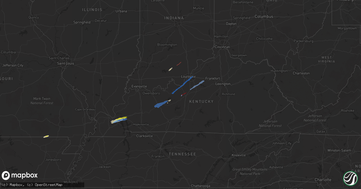
Hail Map in Kentucky on March 18, 2022
Get this storm
March 18 map
$229
one time, instant access
Download today. No call, no setup
Keep the $229
Bought the map and want the full workflow? Apply the entire $229 to a subscription within 7 days. None of it is wasted.
Every map, not just this one
This buys you this map. Subscription and you get every map we run, in the markets you choose from a few cities to whole states to nationwide. Plus real-time alerts the moment a storm fires.
Contact data
Name, contact info, occupancy, even credit band for addresses in the footprint. You go from where it hit to who to call.
Become the source they trust
Unlimited branding weather history reports on demand. You already have the documented answer ready for the property owner, and you are the one who showed up with it.
Property data and RoofTrace estimates
Pull up any address you have got, its value and the exact code rules for that jurisdiction, straight from One Click Code. Then RoofTrace estimates the squares, pitch, and roof value, priced the way you price.
Storm reports in Kentucky
Kentucky
| Date | Description |
|---|---|
| 03/18/20225:55 PM CDT | A local report indicates 1.00 inch wind near GRAND RIVERS |
| 03/18/20225:48 PM CDT | A local report indicates 1.25 inch wind near GILBERTSVILLE |
| 03/18/20225:41 PM CDT | A local report indicates 70 MPH wind near 1 SSE GILBERTSVILLE |
| 03/18/20225:33 PM CDT | A local report indicates 60 MPH wind near 1 NW SYMSONIA |
| 03/18/20229:41 AM CDT | Via nws chat reports of storm damage to homes on spear lane around st. John. |
| 03/18/20226:56 AM CDT | At 1156 PM EDT, a severe thunderstorm was located near Shelbyville, moving northeast at 40 mph. HAZARD...60 mph wind gusts. SOURCE...Radar indicated. IMPACT...Expect damage to roofs, siding, and trees. This severe thunderstorm will be near... Shelbyville around 1205 AM EDT. |
| 03/18/20226:51 AM CDT | At 1151 PM EDT, a severe thunderstorm was located near Coldstream, moving northeast at 40 mph. HAZARD...65 mph wind gusts. SOURCE...Radar indicated. IMPACT...Expect damage to roofs, siding, and trees. This severe thunderstorm will be near... La Grange around 1200 AM EDT.Other locations in the path of this severe thunderstorm include NewCastle. |
| 03/18/20226:27 AM CDT | At 1127 PM EDT, a severe thunderstorm was located 10 miles east of Shepherdsville, moving northeast at 40 mph. HAZARD...60 mph wind gusts. SOURCE...Radar indicated. IMPACT...Expect damage to roofs, siding, and trees. This severe thunderstorm will be near... Taylorsville around 1145 PM EDT. |
| 03/18/20226:04 AM CDT | At 1104 PM EDT, a severe thunderstorm was located 10 miles south of Shepherdsville, moving northeast at 35 mph. HAZARD...60 mph wind gusts. SOURCE...Radar indicated. IMPACT...Expect damage to roofs, siding, and trees. This severe thunderstorm will remain over mainly rural areas of northwestern Nelson and eastern Bullitt Counties, including the following locations... Ridgetop, Solitude, Bardstown Junction, Hobbs, Scuffletown, Deatsville, Cedar Grove, Belmont, Lebanon Junction and Lotus. |
| 03/18/20225:42 AM CDT | At 1042 PM EDT, a severe thunderstorm was located near Elizabethtown, moving northeast at 35 mph. HAZARD...60 mph wind gusts and quarter size hail. SOURCE...Radar indicated. IMPACT...Hail damage to vehicles is expected. Expect wind damage to roofs, siding, and trees. This severe thunderstorm will be near... Elizabethtown around 1050 PM EDT. |
| 03/18/20225:18 AM CDT | At 1018 PM EDT/918 PM CDT/, a severe thunderstorm was located 9 miles east of Hardinsburg, moving northeast at 30 mph. HAZARD...60 mph wind gusts. SOURCE...Radar indicated. IMPACT...Expect damage to roofs, siding, and trees. This severe thunderstorm will remain over mainly rural areas of southeastern Meade and east central Breckinridge Counties, including the following locations... Maples Corner, Guston, Garfield, Graysville, Big Spring, Buck Grove, Hillgrove, Ekron, Garrett and Bewleyville. |
| 03/18/20225:04 AM CDT | At 1004 PM EDT/904 PM CDT/, a severe thunderstorm was located 7 miles northwest of Leitchfield, moving east at 35 mph. HAZARD...60 mph wind gusts. SOURCE...Radar indicated. IMPACT...Expect damage to roofs, siding, and trees. This severe thunderstorm will remain over mainly rural areas of northeastern Grayson, southwestern Hardin and southeastern Breckinridge Counties, including the following locations... Dyer, Constantine, Limp, Saint Paul, Hudson, Vertrees, Cobblers Knob, West Clifty, Solway and Tar Hill. |
| 03/18/20223:27 AM CDT | At 826 PM CDT, a severe thunderstorm was located 8 miles east of Hartford, moving east at 40 mph. HAZARD...60 mph wind gusts. SOURCE...Radar indicated. IMPACT...Expect damage to roofs, siding, and trees. This severe thunderstorm will remain over mainly rural areas of western Grayson, southwestern Breckinridge and east central Ohio Counties, including the following locations... Horse Branch, Steff, Shreve, Tousey, Windy Hill, Caneyville, Do Stop, Pine Knob, Dogwalk and Jingo. |
| 03/18/202212:32 AM CDT | At 531 PM CDT, a severe thunderstorm was located near Reidland, moving east at 40 mph. HAZARD...60 mph wind gusts and quarter size hail. SOURCE...Radar indicated. IMPACT...Hail damage to vehicles is expected. Expect wind damage to roofs, siding, and trees. This severe thunderstorm will be near... Benton around 540 PM CDT. Calvert City around 545 PM CDT.This includes the following highways... Interstate 24 in Kentucky between Mile Markers 15 and 29. Interstate 69 in Kentucky between Mile Markers 39 and 51. |
| 03/17/202211:14 PM CDT | At 413 PM CDT, a severe thunderstorm was located near Big Oak Tree State Park, moving northeast at 45 mph. HAZARD...60 mph wind gusts and quarter size hail. SOURCE...Emergency management and law enforcement. IMPACT...Hail damage to vehicles is expected. Expect wind damage to roofs, siding, and trees. This severe thunderstorm will be near... Towosahgy State Historic Site around 420 PM CDT.Other locations in the path of this severe thunderstorm includeBardwell. |
| 03/17/202211:03 PM CDT | Unanchored 30x60 pole barn blown off foundation into road. Tree down. |
| 03/17/202210:36 PM CDT | Klou asos measured wind gust of 58 mph. |
| 03/17/202210:32 PM CDT | Large tree down on power lines via social media around brown park off browns lane and kresge way. |
| 03/17/202210:24 PM CDT | Ksdf asos measured 68 mph wind gust... |
| 03/17/20229:58 PM CDT | Power poles and wires down along wooldridge ferry road between ky 434 and ky 313. Time estimated via radar. |
| 03/17/20229:50 PM CDT | Large number of power poles broken along south wilson road between w.a. Jenkins road and hutcherson lane. Power company provided pictures via social media. |
| 03/17/20229:43 PM CDT | Via nws chat... Trained spotter reported power lines down in thornhill estates and damage reports from firefighters of damage in the neighborhood. |
| 03/17/20229:40 PM CDT | Significant roof damage to a home on spears lane just off st. John rd. |
| 03/17/20229:38 PM CDT | A tornado touched down near the intersection of spears lane and st. John road and continued for 10 minutes... Lifting near leasor lane at 10:48 edt. The tornado was 100 |
All States Impacted by Hail Map on March 18, 2022
Cities Impacted by Hail Map on March 18, 2022
- Panama City, FL
- Marbury, AL
- Titus, AL
- Deatsville, AL
- Lake Wales, FL
- Newville, AL
- Doniphan, MO
- Maynard, AR
- Warm Springs, AR
- Frostproof, FL
- Saint Augustine, FL
- Midland City, AL
- Ozark, AL
- Calvert City, KY
- Benton, KY
- Symsonia, KY
- Gilbertsville, KY
- Grand Rivers, KY
- Kuttawa, KY
- Campbellton, FL
- Graceville, FL
- Cottonwood, AL
- Valley Springs, AR
- Yellville, AR
- Opp, AL
- Elba, AL
- Kinston, AL
- Paoli, IN
- Hardinsburg, IN
- Defuniak Springs, FL
- Quincy, FL
- Eddyville, KY
- Boaz, KY
- Paducah, KY
- Hickory, KY
- Verbena, AL
- Prattville, AL
- Clanton, AL
- Dothan, AL
- Grove Hill, AL
- Sardis, AL
- Sylacauga, AL
- Caneyville, KY
- Leitchfield, KY
- Falls Of Rough, KY
- Bay Minette, AL
- Perdido, AL
- Atmore, AL
- Andalusia, AL
- Tuskegee, AL
- Christmas, FL
- Thomasville, GA
- Tallahassee, FL
- Youngstown, FL
- Rockford, AL
- Whatley, AL
- Titusville, FL
- Mims, FL
- Kenansville, FL
- Minter, AL
- Venus, FL
- Saraland, AL
- Hosford, FL
- Cragford, AL
- Wadley, AL
- Moore Haven, FL
- Labelle, FL
- Orlando, FL
- Pelham, GA
- Camilla, GA
- Coden, AL
- Camden, AL
- Slocomb, AL
- Clarksville, FL
- Altha, FL
- Sebring, FL
- Shelby, AL
- McHenry, KY
- Cromwell, KY
- Olaton, KY
- Beaver Dam, KY
- Centertown, KY
- Rosine, KY
- Horse Branch, KY
- Hartford, KY
- Brandenburg, KY
- Muldraugh, KY
- Elizabeth, IN
- Ekron, KY
- Vine Grove, KY
- Irvington, KY
- Fairdale, KY
- Louisville, KY
- West Point, KY
- Garfield, KY
- Guston, KY
- Elizabethtown, KY
- Cecilia, KY
- Shelbyville, KY
- Shepherdsville, KY
- Lebanon Junction, KY
- Coxs Creek, KY
- Taylorsville, KY
- Waddy, KY
- Selma, AL
- Marion, AL
- Maplesville, AL
- Faunsdale, AL
- Billingsley, AL
- Plantersville, AL
- Stanton, AL
- Newbern, AL
- Uniontown, AL
- Marion Junction, AL
- Irvington, AL
- Grand Bay, AL
- Luverne, AL
- Brantley, AL
- Greenville, AL
- McKenzie, AL
- Dozier, AL
- Georgiana, AL
- Rutledge, AL
- Red Level, AL
- Glenwood, AL
- Fairhope, AL
- McDavid, FL
- Jay, FL
- Robertsdale, AL
- Wing, AL
- Milton, FL
- Flomaton, AL
- Molino, FL
- Loxley, AL
- Century, FL
- Brewton, AL
- Florala, AL
- Holt, FL
- Bagdad, FL
- Crestview, FL
- Baker, FL
- Cantonment, FL
- Repton, AL
- Chipley, FL
- Vernon, FL
- Caryville, FL
- Panama City Beach, FL
- Lynn Haven, FL
- Norman Park, GA
- Bainbridge, GA
- Ochlocknee, GA
- Moultrie, GA
- Coolidge, GA
- Iron City, GA
- Newton, GA
- Meigs, GA
- Damascus, GA
- Donalsonville, GA
- Albany, GA
- Blakely, GA
- Jakin, GA
- Brinson, GA
- Hartsfield, GA
- Whigham, GA
- Cairo, GA
- Colquitt, GA
- Sale City, GA
- Doerun, GA
- Climax, GA
- Baconton, GA
- Sylvester, GA
- Funston, GA
- Leary, GA
- Sumner, GA
- Cowarts, AL
- Webb, AL
- Columbia, AL
- Ashford, AL
- Princeton, KY
- Jacksonville, FL
- Salem, IN
- Campbellsburg, IN
- Ponce De Leon, FL
- Rineyville, KY


