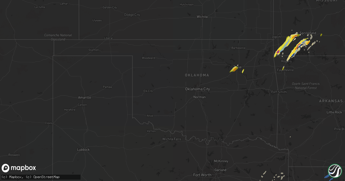
Hail Map in Oklahoma on March 17, 2021
Get this storm
March 17 map
$229
one time, instant access
Download today. No call, no setup
Keep the $229
Bought the map and want the full workflow? Apply the entire $229 to a subscription within 7 days. None of it is wasted.
Every map, not just this one
This buys you this map. Subscription and you get every map we run, in the markets you choose from a few cities to whole states to nationwide. Plus real-time alerts the moment a storm fires.
Contact data
Name, contact info, occupancy, even credit band for addresses in the footprint. You go from where it hit to who to call.
Become the source they trust
Unlimited branding weather history reports on demand. You already have the documented answer ready for the property owner, and you are the one who showed up with it.
Property data and RoofTrace estimates
Pull up any address you have got, its value and the exact code rules for that jurisdiction, straight from One Click Code. Then RoofTrace estimates the squares, pitch, and roof value, priced the way you price.
Storm reports in Oklahoma
Oklahoma
| Date | Description |
|---|---|
| 03/17/20212:42 PM CDT | Report from mping: quarter |
| 03/17/20211:53 PM CDT | Off duty meteorologist 1 mile west of nsu ba. |
| 03/17/20217:59 AM CDT | At 1259 AM CDT, a severe thunderstorm was located 6 miles north of Loyal, moving northeast at 35 mph. HAZARD...60 mph wind gusts and quarter size hail. SOURCE...Radar indicated. IMPACT...Hail damage to vehicles is expected. Expect wind damage to roofs, siding, and trees. Locations impacted include... Enid, Hennessey, Waukomis, Drummond, Loyal, Vance Air Force Base, Bison and Lacey. |
| 03/17/20217:54 AM CDT | At 1253 AM CDT, a severe thunderstorm was located 4 miles northeast of Hydro, moving northeast at 25 mph. HAZARD...60 mph wind gusts and quarter size hail. SOURCE...Radar indicated. IMPACT...Hail damage to vehicles is expected. Expect wind damage to roofs, siding, and trees. Locations impacted include... Geary, Hydro and Greenfield. |
| 03/17/20217:42 AM CDT | At 1242 AM CDT, a severe thunderstorm was located near Hinton, moving northeast at 25 mph. HAZARD...60 mph wind gusts and quarter size hail. SOURCE...Radar indicated. IMPACT...Hail damage to vehicles is expected. Expect wind damage to roofs, siding, and trees. Locations impacted include... Hinton, Bridgeport and Cedar Lake. |
| 03/17/20217:34 AM CDT | At 1234 AM CDT, severe thunderstorms were located along a line extending from near Cestos to 9 miles northwest of Putnam to 11 miles east of Leedey, moving east at 35 mph. HAZARD...70 mph wind gusts and quarter size hail. SOURCE...Radar indicated. IMPACT...Hail damage to vehicles is expected. Expect considerable tree damage. Wind damage is also likely to mobile homes, roofs, and outbuildings. Locations impacted include... Taloga, Seiling, Canton, Longdale, Camargo, Oakwood, Putnam, Canton Lake, Orion, Chester, Eagle City, Cestos, Hucmac and Southard. |
| 03/17/20217:32 AM CDT | At 1232 AM CDT, severe thunderstorms were located along a line extending from 7 miles south of Delhi to 4 miles south of Willow to 7 miles northwest of Duke, moving northeast at 45 mph. HAZARD...70 mph wind gusts and quarter size hail. SOURCE...Radar indicated. IMPACT...Hail damage to vehicles is expected. Expect considerable tree damage. Wind damage is also likely to mobile homes, roofs, and outbuildings. Locations impacted include... Elk City, Hobart, Mangum, Cordell, Granite, Burns Flat, Sentinel, Dill City, Canute, Lone Wolf, Carter, Rocky, Foss, Willow, Retrop, Brinkman, Hester and Altus-Lugert Lake. |
| 03/17/20217:20 AM CDT | At 1220 AM CDT, a severe thunderstorm was located 4 miles north of Colony, moving northeast at 20 mph. HAZARD...60 mph wind gusts and quarter size hail. SOURCE...Radar indicated. IMPACT...Hail damage to vehicles is expected. Expect wind damage to roofs, siding, and trees. Locations impacted include... Hydro, Colony and Bridgeport. |
| 03/17/20217:18 AM CDT | At 1218 AM CDT, a severe thunderstorm was located near Watonga, moving northeast at 20 mph. HAZARD...60 mph wind gusts and quarter size hail. SOURCE...Radar indicated. IMPACT...Hail damage to vehicles is expected. Expect wind damage to roofs, siding, and trees. Locations impacted include... Watonga, Hitchcock, Greenfield, Loyal and Omega. |
| 03/17/20217:09 AM CDT | At 1209 AM CDT, a severe thunderstorm was located 6 miles northwest of Leedey, moving northeast at 30 mph. HAZARD...60 mph wind gusts and quarter size hail. SOURCE...Radar indicated. IMPACT...Hail damage to vehicles is expected. Expect wind damage to roofs, siding, and trees. Locations impacted include... Taloga, Leedey, Camargo, Angora and Cestos. |
| 03/17/20212:36 AM CDT | At 736 AM CDT, severe thunderstorms were located along a line extending from near Wilton to 6 miles east of Naples, moving northeast at 55 mph. HAZARD...70 mph wind gusts and quarter size hail. SOURCE...Radar indicated. IMPACT...Hail damage to vehicles is expected. Expect considerable tree damage. Wind damage is also likely to mobile homes, roofs, and outbuildings. Locations impacted include... Texarkana, Wake Village, Ashdown, Nashville, New Boston, Mineral Springs, Foreman, Nash, Hooks, De Kalb, Naples, Redwater, Maud, Red Lick, Fouke, Lockesburg, Wilton, Blevins, Tollette and Fulton. |
| 03/17/20211:11 AM CDT | At 611 AM CDT, a severe thunderstorm was located over Albany, moving northeast at 50 mph. HAZARD...60 mph wind gusts and quarter size hail. SOURCE...Radar indicated. IMPACT...Hail damage to vehicles is expected. Expect wind damage to roofs, siding, and trees. Locations impacted include... Bokchito, Bennington, Utica, Albany and Wade. |
| 03/17/202112:40 AM CDT | At 540 AM CDT, a severe thunderstorm was located near Kemp, moving northeast at 50 mph. HAZARD...60 mph wind gusts and quarter size hail. SOURCE...Radar indicated. IMPACT...Hail damage to vehicles is expected. Expect wind damage to roofs, siding, and trees. Locations impacted include... Bokchito, Achille, Bennington, Kemp, Hendrix, Blue, Utica, Albany and Wade. |
| 03/17/202112:33 AM CDT | At 533 AM CDT, severe thunderstorms were located along a line extending from 8 miles east of Hepler to Treece, moving east at 40 mph. HAZARD...60 mph wind gusts and penny size hail. SOURCE...Radar indicated. IMPACT...Expect damage to roofs, siding, and trees. Locations impacted include... Joplin... Pittsburg... Carthage... Neosho... Webb City... Prairie State Park... Carl Junction... Lamar... Baxter Springs... Frontenac... Columbus... Galena... Girard... Oronogo... Granby... Carterville... Duquesne... Arma... Sarcoxie... Duenweg...This includes the following highways... Interstate 44 between mile markers 0 and 29. Interstate 49 between mile markers 25 and 76. |
| 03/16/202111:01 PM CDT | At 401 AM CDT, a severe thunderstorm was located 5 miles southwest of Meridian, moving northeast at 35 mph. HAZARD...60 mph wind gusts and quarter size hail. SOURCE...Radar indicated. IMPACT...Hail damage to vehicles is expected. Expect wind damage to roofs, siding, and trees. Locations impacted include... Perkins, Tryon, Ripley and Meridian. |
| 03/16/202110:28 PM CDT | At 328 AM CDT, a severe thunderstorm was located 4 miles northwest of Pearsonia, moving northeast at 55 mph. HAZARD...60 mph wind gusts and quarter size hail. SOURCE...Radar indicated. IMPACT...Hail damage to vehicles is expected. Expect wind damage to roofs, siding, and trees. Locations in or near the path include... Foraker... Pearsonia... Wah Sha She State Park... |
| 03/16/20219:55 PM CDT | At 255 AM CDT, severe thunderstorms were located along a line extending from near Hunter to 6 miles southeast of Garber to 4 miles east of Douglas, moving northeast at 40 mph. HAZARD...60 mph wind gusts and quarter size hail. SOURCE...Radar indicated. IMPACT...Hail damage to vehicles is expected. Expect wind damage to roofs, siding, and trees. Locations impacted include... Ponca City, Perry, Tonkawa, Garber, Morrison, Covington, Billings, Red Rock, Breckenridge, Marland, Hunter, Douglas, Lucien, Sooner Lake, Ceres and Hayward. |
| 03/16/20219:37 PM CDT | At 237 AM CDT, a severe thunderstorm was located 4 miles southeast of Hartford, moving northeast at 35 mph. HAZARD...60 mph wind gusts and quarter size hail. SOURCE...Radar indicated. IMPACT...Hail damage to vehicles is expected. Expect wind damage to roofs, siding, and trees. Locations in or near the path include... Charleston... Greenwood... Hartford... Huntington... Branch... Midland... Bloomer... Washburn... Burnville... Fort Chaffee... Patterson... Arkola... Crossroads... Witcherville... Dayton... Milltown... Vesta... Ursula... |
| 03/16/20219:13 PM CDT | At 213 AM CDT, severe thunderstorms were located along a line extending from 3 miles west of Waukomis to near Dover to 9 miles south of Loyal, moving northeast at 35 mph. HAZARD...60 mph wind gusts and nickel size hail. SOURCE...Radar indicated. IMPACT...Expect damage to roofs, siding, and trees. Locations impacted include... Enid, Hennessey, Waukomis, Garber, Covington, Dover, Drummond, Marshall, Breckenridge, Fairmont, Loyal, Douglas, Vance Air Force Base, Lovell, Bison, Omega, Hayward and Lacey. |
| 03/16/20219:11 PM CDT | At 211 AM CDT, severe thunderstorms were located along a line extending from 6 miles southwest of Ponca City to 3 miles northeast of Red Rock to 4 miles northeast of Perry, moving northeast at 30 mph. HAZARD...60 mph wind gusts and quarter size hail. SOURCE...Radar indicated. IMPACT...Hail damage to vehicles is expected. Expect wind damage to roofs, siding, and trees. Locations impacted include... Ponca City, Perry, Kaw City, Red Rock, Marland, southwestern Kaw Lake, Sooner Lake and Ceres. |
| 03/16/20219:04 PM CDT | At 203 AM CDT, severe thunderstorms were located along a line extending from 5 miles northwest of Marland to 3 miles north of Perry, moving northeast at 35 mph. HAZARD...60 mph wind gusts and quarter size hail. SOURCE...Radar indicated. IMPACT...Hail damage to vehicles is expected. Expect wind damage to roofs, siding, and trees. These severe thunderstorms will remain over mainly rural areas of west central Osage and northwestern Pawnee Counties. |
| 03/16/20218:57 PM CDT | At 157 AM CDT, a severe thunderstorm was located near Fay, moving northeast at 30 mph. HAZARD...70 mph wind gusts and penny size hail. SOURCE...Radar indicated. IMPACT...Expect considerable tree damage. Damage is likely to mobile homes, roofs, and outbuildings. Locations impacted include... Watonga, Thomas, Eagle City, Fay and Southard. |
| 03/16/20218:42 PM CDT | At 142 AM CDT, a severe thunderstorm was located near Vance Air Force Base, moving northeast at 30 mph. HAZARD...60 mph wind gusts and quarter size hail. SOURCE...Radar indicated. IMPACT...Hail damage to vehicles is expected. Expect wind damage to roofs, siding, and trees. Locations impacted include... Enid, Waukomis, Garber, Breckenridge, Hunter, Fairmont, Vance Air Force Base and North Enid. |
| 03/16/20218:39 PM CDT | At 139 AM CDT, a severe thunderstorm was located 4 miles north of Watonga, moving northeast at 30 mph. HAZARD...70 mph wind gusts and quarter size hail. SOURCE...Radar indicated. IMPACT...Hail damage to vehicles is expected. Expect considerable tree damage. Wind damage is also likely to mobile homes, roofs, and outbuildings. Locations impacted include... Watonga, Okeene, Hitchcock and Loyal. |
| 03/16/20218:30 PM CDT | At 130 AM CDT, a severe thunderstorm was located 4 miles northeast of Greenfield, moving northeast at 25 mph. HAZARD...60 mph wind gusts and quarter size hail. SOURCE...Radar indicated. IMPACT...Hail damage to vehicles is expected. Expect wind damage to roofs, siding, and trees. Locations impacted include... Greenfield, Loyal and Omega. |
| 03/16/20218:27 PM CDT | At 127 AM CDT, severe thunderstorms were located along a line extending from 5 miles south of Billings to near Lucien to 4 miles northwest of Orlando, moving east at 20 mph. HAZARD...70 mph wind gusts and quarter size hail. SOURCE...Radar indicated. IMPACT...Hail damage to vehicles is expected. Expect considerable tree damage. Wind damage is also likely to mobile homes, roofs, and outbuildings. Locations impacted include... Perry, Red Rock, Marland, Lake Mcmurtry, Lucien, Sooner Lake, Ceres and Hayward. |
| 03/16/20218:26 PM CDT | At 125 AM CDT, a severe thunderstorm was located near Canton, moving northeast at 30 mph. HAZARD...70 mph wind gusts and quarter size hail. SOURCE...Radar indicated. IMPACT...Hail damage to vehicles is expected. Expect considerable tree damage. Wind damage is also likely to mobile homes, roofs, and outbuildings. Locations impacted include... Fairview, Okeene, Canton, Ringwood, Longdale, Ames, Canton Lake, Isabella, Homestead, Southard and Lacey. |
| 03/16/20218:14 PM CDT | At 114 AM CDT, severe thunderstorms were located along a line extending from near Retrop to 3 miles southeast of Granite, moving northeast at 30 mph. HAZARD...70 mph wind gusts and quarter size hail. SOURCE...Radar indicated. IMPACT...Hail damage to vehicles is expected. Expect considerable tree damage. Wind damage is also likely to mobile homes, roofs, and outbuildings. Locations impacted include... Hobart, Cordell, Granite, Sentinel, Dill City, Lone Wolf, Gotebo, Bessie, Rocky, Retrop and Altus-Lugert Lake. |
All States Impacted by Hail Map on March 17, 2021
Cities Impacted by Hail Map on March 17, 2021
- Vernon, AL
- Sulligent, AL
- Beaverton, AL
- Mount Vernon, MO
- Stotts City, MO
- Batesville, MS
- Hickory Flat, MS
- Potts Camp, MS
- Dayton, TX
- Plains, GA
- Americus, GA
- Preston, GA
- Cape Fair, MO
- Galena, MO
- Waynesboro, MS
- Aurora, MO
- Ash Grove, MO
- Reform, AL
- Gordo, AL
- Aliceville, AL
- Carrollton, AL
- Tebbetts, MO
- Bonnots Mill, MO
- Guin, AL
- Pierce City, MO
- Noel, MO
- Jonesboro, AR
- Detroit, AL
- Broaddus, TX
- Jasper, TX
- Zavalla, TX
- Pontotoc, MS
- Blue Springs, MS
- Belden, MS
- Tupelo, MS
- Hattiesburg, MS
- Grapeland, TX
- Elkhart, TX
- Sardis, MS
- Como, MS
- Campbell, AL
- Thomasville, AL
- Linden, AL
- Magnolia, AL
- Dixons Mills, AL
- Sweet Water, AL
- Garfield, AR
- Cassville, MO
- Seligman, MO
- Syracuse, MO
- Florence, MO
- Pineville, MO
- Ellaville, GA
- Andersonville, GA
- Wentworth, MO
- Stark City, MO
- Sarcoxie, MO
- Cameron, LA
- Bogue Chitto, MS
- Crane, MO
- Marionville, MO
- Eagle Rock, MO
- Washburn, MO
- Buna, TX
- Houston, MS
- Nettleton, MS
- Okolona, MS
- Hull, TX
- Liberty, TX
- Gilbertown, AL
- Toxey, AL
- Butler, AL
- Silas, AL
- Gladewater, TX
- Selma, AL
- Abbeville, LA
- Erath, LA
- Franklin, LA
- Patterson, LA
- Shannon, MS
- Houlka, MS
- Logansport, LA
- Troup, TX
- Wells, TX
- Columbia, MS
- Verona, MO
- Thomaston, AL
- Catherine, AL
- Uniontown, AL
- Safford, AL
- Marion Junction, AL
- Anderson, MO
- Goodman, MO
- Middleton, TN
- Walnut, MS
- Shubuta, MS
- Houston, TX
- Neosho, MO
- Saltillo, MS
- Springfield, MO
- Rogersville, MO
- Ozark, MO
- Sparta, MO
- Highlandville, MO
- Spokane, MO
- Rogers, AR
- Billings, MO
- Ponce De Leon, MO
- Shell Knob, MO
- Clever, MO
- Nixa, MO
- Purdy, MO
- Batson, TX
- Saratoga, TX
- Creole, LA
- Laurel, MS
- Bryan, TX
- Iola, TX
- North Zulch, TX
- Prentiss, MS
- Jefferson, TX
- Jacksonville, TX
- Bon Wier, TX
- Morgan City, LA
- Gibson, LA
- Schriever, LA
- Grand Chenier, LA
- Lake Arthur, LA
- Hollister, MO
- Port Barre, LA
- Krotz Springs, LA
- Duck Hill, MS
- Eupora, MS
- Calhoun City, MS
- Gore Springs, MS
- Stewart, MS
- Hernando, MS
- Van Buren, MO
- Fremont, MO
- Benoit, MS
- Dermott, AR
- Greenville, MS
- Eureka Springs, AR
- Fayette, AL
- Elrod, AL
- Northport, AL
- Woodville, MS
- Jefferson City, MO
- Centertown, MO
- Russellville, MO
- Hartsburg, MO
- New Bloomfield, MO
- Ashland, MO
- Lohman, MO
- Bella Vista, AR
- Fosters, AL
- Freistatt, MO
- Fairview, MO
- Sulphur Springs, AR
- Granby, MO
- Everton, MO
- Stella, MO
- Lanagan, MO
- Rocky Comfort, MO
- Monett, MO
- South West City, MO
- Miller, MO
- Gilmer, TX
- Longview, TX
- Jones, AL
- Prattville, AL
- Billingsley, AL
- Plantersville, AL
- Autaugaville, AL
- Sunshine, LA
- Plaquemine, LA
- Saint Gabriel, LA
- Baton Rouge, LA
- Addis, LA
- Forsyth, MO
- Chadwick, MO
- Garrison, MO
- Harleton, TX
- Marshall, TX
- Tulsa, OK
- Loose Creek, MO
- Fulton, MO
- Crowley, LA
- Egan, LA
- Crenshaw, MS
- Louin, MS
- Hickory, MS
- Kaplan, LA
- New Iberia, LA
- Jeanerette, LA
- Loreauville, LA
- Saint Martinville, LA
- Arlington, AL
- Pine Hill, AL
- Alberta, AL
- Crosby, MS
- Lauderdale, MS
- Geismar, LA
- Prairieville, LA
- Belle Rose, LA
- Pierre Part, LA
- New Albany, MS
- Dumas, MS
- Guntown, MS
- Luling, LA
- Hahnville, LA
- Thibodaux, LA
- Amory, MS
- Fulton, MS
- California, MO
- Sand Springs, OK
- Springdale, AR
- Fayetteville, AR
- Big Sandy, TX
- Jamestown, MO
- Latham, MO
- Baldwyn, MS
- Ripley, MS
- Booneville, MS
- Lake Village, AR
- Kirbyville, TX
- Coffeeville, AL
- Quitman, MS
- Winona, TX
- Lumberton, MS
- Stanton, TN
- Lambert, MS
- Courtland, MS
- Oxford, MS
- Marks, MS
- Nacogdoches, TX
- Coldwater, MS
- Alto, TX
- Kilgore, TX
- Chunky, MS
- Sour Lake, TX
- Middletown, MO
- Silsbee, TX
- Vidor, TX
- Saint Amant, LA
- Maurepas, LA
- Sapulpa, OK
- Ecru, MS
- McCrory, AR
- Brookwood, AL
- Moundville, AL
- Diana, TX
- Oak Vale, MS
- Monticello, MS
- Silver Creek, MS
- Pope, MS
- Oakland, MS
- Broken Arrow, OK
- Oldfield, MO
- Ava, MO
- Meridian, MS
- Echola, AL
- Mantee, MS
- Vardaman, MS
- Kennedy, AL
- Merryville, LA
- Cushing, TX
- Douglass, TX
- Kountze, TX
- Mathiston, MS
- Maben, MS
- Berwick, LA
- Baldwin, LA
- Richmond, TX
- Georgiana, AL
- Evergreen, AL
- McKenzie, AL
- Morse, LA
- Estherwood, LA
- Plantersville, MS
- Jackson, AL
- Grove Hill, AL
- Brinkley, AR
- Ralph, AL
- Knoxville, AL
- Perkinston, MS
- Poplarville, MS
- Branson, MO
- Walnut Shade, MO
- Blue Mountain, MS
- Myrtle, MS
- Pennington, AL
- Foxworth, MS
- Kokomo, MS
- East Bernard, TX
- Buhl, AL
- Mansfield, LA
- Grand Cane, LA
- Rusk, TX
- Gonzales, LA
- Harrisburg, AR
- Fisher, AR
- Liberty, MS
- Reeds Spring, MO
- Richland, GA
- Pearl River, LA
- Corning, AR
- Emelle, AL
- Nashville, AR
- Mineral Springs, AR
- Hamilton, AL
- Uriah, AL
- Versailles, MO
- Clarksburg, MO
- Barnett, MO
- Arp, TX
- Tyler, TX
- Forest, MS
- Raleigh, MS
- Gueydan, LA
- Lake Charles, LA
- Bell City, LA
- Abbeville, MS
- Cottondale, AL
- Tuscaloosa, AL
- Duncanville, AL
- Hallsville, TX
- Russellville, AL
- Tuscumbia, AL
- Quinton, AL
- Gallion, AL
- Faunsdale, AL
- Marbury, AL
- Verbena, AL
- Holcomb, MS
- Needham, AL
- Call, TX
- Karnack, TX
- Republic, MO
- Lockwood, MO
- Fortuna, MO
- Rienzi, MS
- Prairie Home, MO
- Oakman, AL
- Tipton, MO
- Overton, TX
- Hackberry, LA
- Livingston, AL
- Boligee, AL
- Buckatunna, MS
- Palestine, TX
- White Castle, LA
- Donaldsonville, LA
- Darrow, LA
- Slidell, LA
- Orange, TX
- Whitehouse, TX
- Labadieville, LA
- Napoleonville, LA
- Church Point, LA
- Branch, LA
- Rayne, LA
- Demopolis, AL
- Kellyville, OK
- Orrville, AL
- Sardis, AL
- Ward, AL
- Bellamy, AL
- Cuba, AL
- York, AL
- Clanton, AL
- Melvin, AL
- Weogufka, AL
- Sylacauga, AL
- Marion, AL
- Eutaw, AL
- Akron, AL
- Adger, AL
- Millry, AL
- Mulga, AL
- Adamsville, AL
- Oneonta, AL
- Locust Fork, AL
- Kimberly, AL
- Pinson, AL
- Brookside, AL
- Boaz, AL
- Trafford, AL
- Remlap, AL
- Warrior, AL
- Fultondale, AL
- Birmingham, AL
- Cleveland, AL
- Morris, AL
- Altoona, AL
- Docena, AL
- Gardendale, AL
- Mount Olive, AL
- Graysville, AL
- Camden, AL
- Frankville, AL
- Minter, AL
- Horton, AL
- Blountsville, AL
- Lower Peach Tree, AL
- Dickinson, AL
- Bremen, AL
- Cullman, AL
- Hanceville, AL
- Baileyton, AL
- Scooba, MS
- Porterville, MS
- Epes, AL
- Gainesville, AL
- Phil Campbell, AL
- Bear Creek, AL
- Town Creek, AL
- Spruce Pine, AL
- Hackleburg, AL
- Mount Hope, AL
- Haleyville, AL
- Tyler, AL
- Deatsville, AL
- Hope Hull, AL
- Montgomery, AL
- Letohatchee, AL
- Hayneville, AL
- Millbrook, AL
- Lowndesboro, AL
- Citronelle, AL
- Wagarville, AL
- Deer Park, AL
- Gainestown, AL
- McIntosh, AL
- Ashville, AL
- Leeds, AL
- Rainbow City, AL
- Lincoln, AL
- Ragland, AL
- Pell City, AL
- Gadsden, AL
- Vandiver, AL
- Ohatchee, AL
- Harpersville, AL
- Wilsonville, AL
- Alpine, AL
- Oxford, AL
- Vincent, AL
- Talladega, AL
- Munford, AL
- Eastaboga, AL
- Greenville, AL
- Forest Home, AL
- Highland Home, AL
- Grady, AL
- Ramer, AL
- Fitzpatrick, AL
- Fort Deposit, AL
- Lapine, AL
- Mathews, AL
- Fyffe, AL
- Dawson, AL
- Crossville, AL
- Fort Payne, AL
- Geraldine, AL
- Collinsville, AL
- Rainsville, AL
- Newton, AL
- Dothan, AL
- Shorterville, AL
- Headland, AL
- Dubach, LA
- Choudrant, LA
- Farmerville, LA
- Bernice, LA
- Downsville, LA
- Walker, LA
- Tickfaw, LA
- Delcambre, LA
- Pride, LA
- Hammond, LA
- Holden, LA
- French Settlement, LA
- Pine Grove, LA
- Denham Springs, LA
- Amite, LA
- Zachary, LA
- Springfield, LA
- Livingston, LA
- Albany, LA
- Independence, LA
- Brusly, LA
- Grosse Tete, LA
- Greenwell Springs, LA
- Carville, LA
- Baker, LA
- Port Allen, LA
- Freeburg, MO
- Westphalia, MO
- Gravette, AR
- Seymour, MO
- Tatum, TX
- Henderson, TX
- Oglethorpe, GA
- Blakely, GA
- Leesburg, GA
- Dawson, GA
- Brownsville, TN
- Whiteville, TN
- Mason, TN
- Arlington, TN
- Somerville, TN
- Farmington, AR
- Clarksdale, MS
- Alligator, MS
- Lyon, MS
- Sledge, MS
- Brookhaven, MS
- Wesson, MS
- Sontag, MS
- Monterey, LA
- Gloster, MS
- Hazlehurst, MS
- Natchez, MS
- Meadville, MS
- McCall Creek, MS
- Bude, MS
- Union Church, MS
- Roxie, MS
- Golden, MS
- Red Bay, AL
- Cleveland, MS
- Shaw, MS
- Edwards, MS
- Pearl, MS
- Utica, MS
- Richland, MS
- Bolton, MS
- Vicksburg, MS
- Flowood, MS
- Clinton, MS
- Raymond, MS
- Jackson, MS
- Port Gibson, MS
- Carthage, MS
- Louisville, MS
- McCool, MS
- Ethel, MS
- Kosciusko, MS
- Weir, MS
- Purvis, MS
- Jayess, MS
- Ruth, MS
- Sumrall, MS
- Angie, LA
- Sandy Hook, MS
- Seminary, MS
- Carson, MS
- Bassfield, MS
- Collins, MS
- Pheba, MS
- Starkville, MS
- West Point, MS
- Cedarbluff, MS
- Mississippi State, MS
- Ackerman, MS
- Sturgis, MS
- Philadelphia, MS
- Union, MS
- Brooklyn, MS
- New Augusta, MS
- Woodland, MS
- Greenwood Springs, MS
- Prairie, MS
- Aberdeen, MS
- Hamilton, MS
- Walthall, MS
- Crawford, MS
- Artesia, MS
- Columbus, MS
- Steens, MS
- De Kalb, MS
- Daleville, MS
- Macon, MS
- Shuqualak, MS
- Cherokee, AL
- Sheffield, AL
- Vina, AL
- Dennis, MS
- Muscle Shoals, AL
- Belmont, MS
- Tremont, MS
- Picayune, MS
- McLain, MS
- McHenry, MS
- Wiggins, MS
- Carriere, MS
- Lucedale, MS
- New Orleans, LA
- Long Beach, MS
- Waveland, MS
- Pearlington, MS
- Pass Christian, MS
- Bay Saint Louis, MS
- Diberville, MS
- Biloxi, MS
- Gulfport, MS
- Pinola, MS
- Inlet Beach, FL
- Vernon, FL
- Panama City Beach, FL
- Chipley, FL
- Panama City, FL


