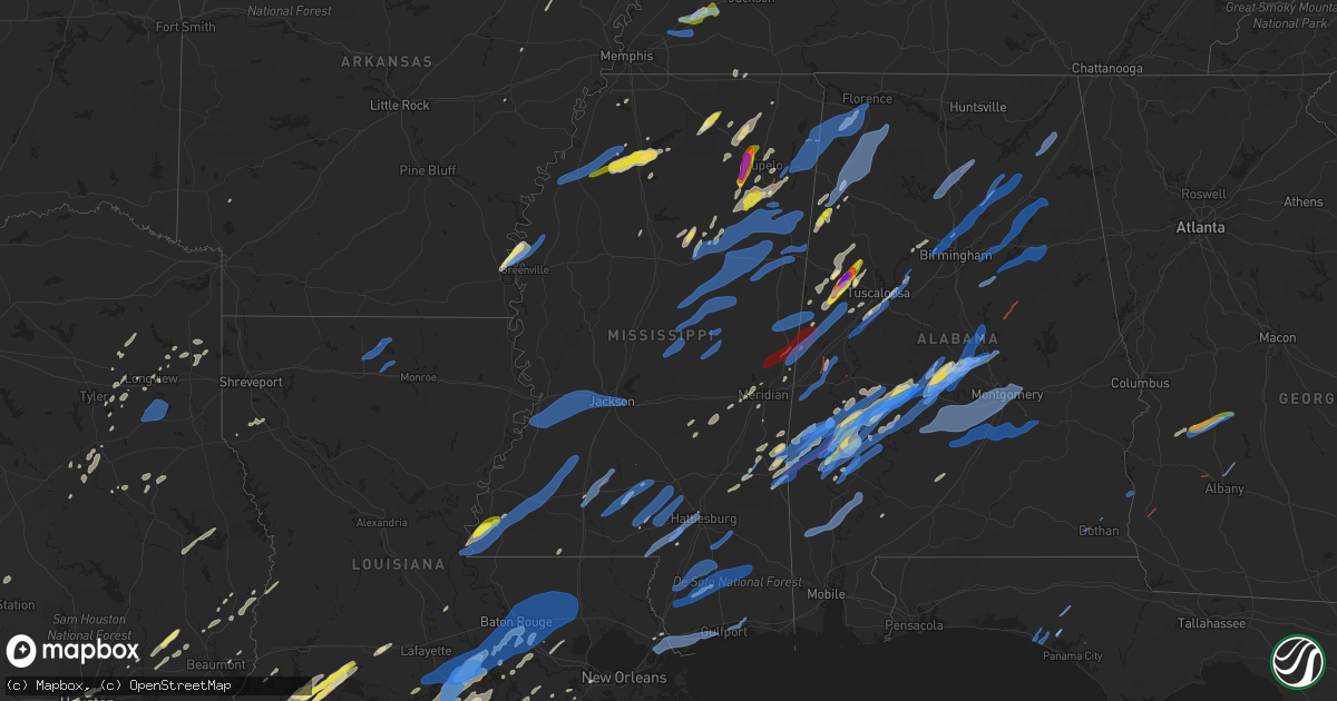
Hail Map in Mississippi on March 17, 2021
Get this storm
March 17 map
$229
one time, instant access
Download today. No call, no setup
Keep the $229
Bought the map and want the full workflow? Apply the entire $229 to a subscription within 7 days. None of it is wasted.
Every map, not just this one
This buys you this map. Subscription and you get every map we run, in the markets you choose from a few cities to whole states to nationwide. Plus real-time alerts the moment a storm fires.
Contact data
Name, contact info, occupancy, even credit band for addresses in the footprint. You go from where it hit to who to call.
Become the source they trust
Unlimited branding weather history reports on demand. You already have the documented answer ready for the property owner, and you are the one who showed up with it.
Property data and RoofTrace estimates
Pull up any address you have got, its value and the exact code rules for that jurisdiction, straight from One Click Code. Then RoofTrace estimates the squares, pitch, and roof value, priced the way you price.
Storm reports in Mississippi
Mississippi
| Date | Description |
|---|---|
| 03/17/20216:57 PM CDT | Tree downed on a power line along ms highway 15. |
| 03/17/20216:52 PM CDT | Trees downed blocking both lanes of ms highway 12 near the oktibbeha/choctaw county line. |
| 03/17/20216:45 PM CDT | Tree downed on ms highway 15. |
| 03/17/20216:45 PM CDT | A large tin shed was destroyed. Report relayed via social media. |
| 03/17/20216:38 PM CDT | Trees down on anderson rd. |
| 03/17/20216:37 PM CDT | Trees down on ollie williams rd. |
| 03/17/20216:36 PM CDT | Tree blown down onto a house. |
| 03/17/20216:32 PM CDT | Six trees downed and damage to the roof of a home along ms highway 14 near the winston/attala county line. |
| 03/17/20216:31 PM CDT | Several pine trees snapped at shadow ridge golf course. |
| 03/17/20216:24 PM CDT | Tree downed on ms highway 589 at luther lee rd. |
| 03/17/20216:24 PM CDT | Scattered downed trees across covington county. |
| 03/17/20216:23 PM CDT | Trees downed across leake county. |
| 03/17/20216:23 PM CDT | Scattered trees downed around attala county. |
| 03/17/20216:18 PM CDT | Scattered downed trees and limbs along purvis to columbia rd. |
| 03/17/20216:18 PM CDT | Several trees and limbs downed on roads across leake county. |
| 03/17/20216:16 PM CDT | This brief ef0 tornado touched down near carroll and caney church road. A few trees were down and a couple sheds were destroyed. Damage was blown across a field in a no |
| 03/17/20216:12 PM CDT | Swath of thunderstorm wind damage continued into western lamar county. Many uprooted and snapped trees. |
| 03/17/20216:08 PM CDT | A swath of wind damage occurred across southern marion county generally from the sandy hook community... Then on the e side of the river and s of hwy 13. Some of the mo |
| 03/17/20216:05 PM CDT | Trees down on hall rd. |
| 03/17/20216:05 PM CDT | Trees and powerlines down on mt. Zion rd. Near hwy 84. |
| 03/17/20216:03 PM CDT | Corrects previous tstm wnd dmg report from progress. A few trees down on progress rd. |
| 03/17/20216:03 PM CDT | Possible tornado...report received via sm of considerable damage to a few homes along highway 43 about 15 miles south of columbia. |
| 03/17/20216:01 PM CDT | Trees and power lines down on buddy price rd. |
| 03/17/20216:01 PM CDT | One home damaged and trees down on military rd. |
| 03/17/20215:58 PM CDT | Tree downed on a house on harper rd. |
| 03/17/20215:51 PM CDT | Powerlines down at the corner of hwy 13 and riverbend road. |
| 03/17/20215:50 PM CDT | Measured at the jan asos. |
| 03/17/20215:47 PM CDT | A few trees down and multiple large limbs were broken. A large section of tin was torn off a large carport type structure. |
| 03/17/20215:44 PM CDT | Scattered trees and tree limbs downed across madison county. |
| 03/17/20215:43 PM CDT | Estimated 1 1/2 inch sized hail reported in endville. |
| 03/17/20215:35 PM CDT | Quarter to half dollar sized hail near belden. |
| 03/17/20215:25 PM CDT | Near old highway 9 |
| 03/17/20215:25 PM CDT | Golf ball size hail in belden. |
| 03/17/20215:23 PM CDT | Estimated 1 1/2 inch sized hail reported in endville community. Corrected time and location. |
| 03/17/20215:20 PM CDT | Quarter size hail in chesterville community. |
| 03/17/20215:18 PM CDT | Small to medium sized limbs downed along ms highway 3. |
| 03/17/20215:17 PM CDT | Trees downed. |
| 03/17/20215:16 PM CDT | Trees downed. |
| 03/17/20215:10 PM CDT | Quarter size hail in black zion |
| 03/17/20215:08 PM CDT | Trees downed in utica and along the natchez trace parkway. |
| 03/17/20214:54 PM CDT | Utility pole and lines downed on clay st near i-20. |
| 03/17/20214:39 PM CDT | Tree limbs downed along us 84. |
| 03/17/20214:06 PM CDT | A one mile long... 100 yard wide... Ef0 tornado with max winds of 85 mph touched down just west of highway 61 north in wilkinson county... Ms. The tornado was recorded |
| 03/17/20213:52 PM CDT | Public reported tree debris on road 61 via social media in wilkinson county. Possible tornado. |
| 03/17/20213:47 PM CDT | Three structures damaged. Report via ema. |
| 03/17/20211:29 PM CDT | Tin blow off 2 sheds... A large metal carport flipped and several large limbs down. |
| 03/17/20211:16 PM CDT | Tornado damaged trees from nola rd to autrey to sandifer to cotten. A roof was off a structure on cotten. Tds was also noted during this time. |
| 03/17/202112:07 PM CDT | Report of homes damaged near strengthford cooley road. No details at this time. |
| 03/17/20217:30 AM CDT | Tree down on roof... Causing minor roof damage. |
| 03/17/20217:21 AM CDT | At 1221 PM CDT, a severe thunderstorm was located over Lamar County Airport, or near Sulligent, moving northeast at 50 mph. HAZARD...60 mph wind gusts and half dollar size hail. SOURCE...Radar indicated. IMPACT...Hail damage to vehicles is expected. Expect wind damage to roofs, siding, and trees. Locations impacted include... Hamilton, Winfield, Haleyville, Vernon, Sulligent, Guin, Hackleburg, Brilliant, Detroit, Beaverton, Gu- Win, Weston, Blooming Grove, Lamar County Airport, Brinn, Lake Buttahatchee, Crews, Bedford, Bear Creek and Twin. |
| 03/17/20214:54 AM CDT | At 954 PM CDT, a severe thunderstorm was located near Long Beach, moving northeast at 45 mph. HAZARD...60 mph wind gusts. SOURCE...Radar indicated. IMPACT...Expect damage to roofs, siding, and trees. Locations impacted include... Gulfport, Biloxi, Ocean Springs, Long Beach, St. Martin, Escatawpa, D'iberville, Latimer, Lyman, Gulf Hills, Vancleave, Hickory Hills and Gulfport Airport. |
| 03/17/20213:54 AM CDT | At 853 PM CDT, a severe thunderstorm was located 8 miles east of Wiggins, moving northeast at 55 mph. HAZARD...70 mph wind gusts and penny size hail. SOURCE...Radar indicated. IMPACT...Expect considerable tree damage. Damage is likely to mobile homes, roofs, and outbuildings. Locations impacted include... Wiggins, Lucedale, Leakesville, Perkinston and McLain. |
| 03/17/20213:22 AM CDT | At 821 PM CDT, a severe thunderstorm was located 11 miles southeast of Poplarville, moving northeast at 50 mph. HAZARD...60 mph wind gusts and quarter size hail. SOURCE...Radar indicated. IMPACT...Hail damage to vehicles is expected. Expect wind damage to roofs, siding, and trees. Locations impacted include... Wiggins, Perkinston, McHenry and Beaumont. |
| 03/17/20213:20 AM CDT | At 820 PM CDT, severe thunderstorms were located along a line extending from 7 miles southeast of Poplarville to 6 miles northwest of Kiln, moving northeast at 45 mph. HAZARD...60 mph wind gusts and penny size hail. SOURCE...Radar indicated. IMPACT...Expect damage to roofs, siding, and trees. Locations impacted include... Saucier and Kiln. |
| 03/17/20212:47 AM CDT | At 746 PM CDT, severe thunderstorms were located along a line extending from near Amory to 7 miles northwest of Bedford to near Steens, moving northeast at 45 mph. HAZARD...60 mph wind gusts. SOURCE...Radar indicated. IMPACT...Expect damage to roofs, siding, and trees. Locations impacted include... Hamilton, Winfield, Fayette, Haleyville, Vernon, Sulligent, Guin, Hackleburg, Brilliant, Glen Allen, Detroit, Beaverton, Gu- Win, Weston, Bluff, Blooming Grove, Lamar County Airport, Brinn, Lake Buttahatchee and Crews. |
| 03/17/20212:44 AM CDT | At 744 PM CDT, a severe thunderstorm was located over Plantersville, or near Verona, moving northeast at 55 mph. HAZARD...60 mph wind gusts. SOURCE...Radar indicated. IMPACT...Expect damage to roofs, siding, and trees. Locations impacted include... Tupelo, Fulton, Baldwyn, Red Bay, Verona, Tombigbee State Park, Saltillo, Guntown, Belmont, Shannon, Plantersville, Mantachie, Smithville, Tremont, Fairview, Pratts Friendship, New Salem, Wheeler, Sandy Springs and Blair. |
| 03/17/20212:43 AM CDT | At 743 PM CDT, a severe thunderstorm was located over Blackwater, or near Meridian Station, moving northeast at 55 mph. HAZARD...60 mph wind gusts. SOURCE...Radar indicated. IMPACT...Expect damage to roofs, siding, and trees. This severe thunderstorm will be near... Porterville around 755 PM CDT. Electric Mills around 800 PM CDT.Other locations impacted by this severe thunderstorm include Scooba. |
| 03/17/20212:17 AM CDT | At 717 PM CDT, a severe thunderstorm was located over Trebloc, or 7 miles southeast of Houston, moving northeast at 35 mph. HAZARD...60 mph wind gusts. SOURCE...Radar indicated. IMPACT...Expect damage to roofs, siding, and trees. Locations impacted include... Amory, Aberdeen, Fulton, Houston, Verona, Okolona, Shannon, Smithville, Tremont, Prairie, New Salem, New Wren, Trebloc, Houlka, Evergreen, Nettleton, New Houlka, Hatley, Gattman and Abney. |
| 03/17/20212:12 AM CDT | At 711 AM CDT, a severe thunderstorm was located near Curtis Station, or 7 miles west of Batesville, moving east at 50 mph. HAZARD...60 mph wind gusts and quarter size hail. SOURCE...Radar indicated. IMPACT...Hail damage to vehicles is expected. Expect wind damage to roofs, siding, and trees. Locations impacted include... Oxford, Batesville, Water Valley, George Payne State Park, Holly Springs National Forest, John W Kyle State Park, Marks, Sardis, Lambert, Como, Crenshaw, Crowder, Sledge, Pope, Pleasant Grove, Harmontown, Springdale, Curtis Station, Burgess and Laws Hill. |
| 03/17/20211:28 AM CDT | At 628 PM CDT, severe thunderstorms were located along a line extending from near Taylorsville to Sanford, moving northeast at 60 mph. HAZARD...60 mph wind gusts. SOURCE...Radar indicated. IMPACT...Expect damage to roofs, siding, and trees. Severe thunderstorms will be near... Ellisville around 640 PM CDT. Laurel and Bay Springs around 645 PM CDT. Turnerville and Tuckers Crossing around 650 PM CDT. Moss around 655 PM CDT. Sandersville and Garlandville around 700 PM CDT. Heidelberg and Rose Hill around 705 PM CDT. Stafford Springs around 710 PM CDT.Other locations impacted by these severe thunderstorms includeMontrose, Louin and Soso. |
| 03/17/20211:19 AM CDT | At 619 PM CDT, severe thunderstorms were located along a line extending from 3 miles south of Magee to 3 miles south of Sumrall to 7 miles northwest of Poplarville, moving northeast at 60 mph. HAZARD...60 mph wind gusts. SOURCE...Radar indicated. IMPACT...Expect damage to roofs, siding, and trees. Locations impacted include... Richton, Clara, Beaumont, New Augusta and McLain. |
| 03/17/20211:13 AM CDT | At 612 PM CDT, severe thunderstorms were located along a line extending from Melba to 6 miles south of Baxterville, moving east at 55 mph. HAZARD...60 mph wind gusts. SOURCE...Radar indicated. IMPACT...Expect damage to roofs, siding, and trees. Severe thunderstorms will be near... Sumrall around 620 PM CDT. Lumberton around 625 PM CDT. Rawls Springs around 630 PM CDT. Rock Hill around 635 PM CDT. Brooklyn, Maxie and Mclaurin around 640 PM CDT.Other locations impacted by these severe thunderstorms includeCorinth. |
| 03/17/20211:12 AM CDT | At 612 PM CDT, severe thunderstorms were located along a line extending from near Clem to near Melba, moving northeast at 70 mph. HAZARD...60 mph wind gusts. SOURCE...Radar indicated. IMPACT...Expect damage to roofs, siding, and trees. Severe thunderstorms will be near... Magee, Collins and Sanatorium around 620 PM CDT. Martinville around 625 PM CDT. White Oak around 630 PM CDT. Raleigh and Taylorsville around 635 PM CDT. Burns, Pineville and Center Ridge around 640 PM CDT.Other locations impacted by these severe thunderstorms includeSylvarena, Seminary and Mize. |
| 03/17/20211:05 AM CDT | At 604 PM CDT, severe thunderstorms were located along a line extending from near Thomastown to near Ludlow to near Brandon, moving northeast at 60 mph. HAZARD...60 mph wind gusts. SOURCE...Radar indicated. IMPACT...Expect damage to roofs, siding, and trees. Severe thunderstorms will be near... Ludlow around 610 PM CDT. Tuscola around 620 PM CDT. Morton, Branch, Madden and Forkville around 630 PM CDT. Dowdville around 635 PM CDT. Harperville and Hillsboro around 640 PM CDT. Philadelphia and Steele around 645 PM CDT. Prospect around 655 PM CDT. Neshoba and Dixon around 700 PM CDT.Other locations impacted by these severe thunderstorms include Lena,Tucker, Walnut Grove, Lake, Sebastopol and Standing Pine. |
| 03/17/202112:55 AM CDT | At 555 PM CDT, severe thunderstorms were located along a line extending from near Franklin to Cameron to 6 miles southwest of Farmhaven, moving northeast at 65 mph. HAZARD...60 mph wind gusts. SOURCE...Radar indicated. IMPACT...Expect damage to roofs, siding, and trees. Severe thunderstorms will be near... Durant, Newport and Thomastown around 605 PM CDT. Mcadams around 610 PM CDT. Kosciusko, Carthage, Possumneck and Singleton around 615 PM CDT. Smyrna and Hesterville around 620 PM CDT. Renfroe and Zama around 625 PM CDT. Edinburg, Pearl River and Poplar Creek around 630 PM CDT. Burnside around 640 PM CDT. Louisville, Ackerman, Stallo, Mcmillan and Chester around 645 PM CDT.Other locations impacted by these severe thunderstorms includeNoxapater, Ethel, Sallis, Redwater, French Camp, West, Mccool andWeir. |
| 03/17/202112:45 AM CDT | At 545 PM CDT, a severe thunderstorm was located near Okolona, moving northeast at 45 mph. HAZARD...60 mph wind gusts and quarter size hail. SOURCE...Radar indicated. IMPACT...Hail damage to vehicles is expected. Expect wind damage to roofs, siding, and trees. Locations impacted include... Fulton, Verona, Okolona, Tombigbee State Park, Shannon, Plantersville, Mantachie, Tremont, New Salem, Evergreen, Clay, Nettleton, Abney, Mooreville, Ballardsville, Leotis, Old Union, Buena Vista, Cardsville and Van Vleet. |
| 03/17/202112:45 AM CDT | At 544 PM CDT, severe thunderstorms were located along a line extending from near Robinwood to Kokomo, moving northeast at 65 mph. HAZARD...60 mph wind gusts. SOURCE...Radar indicated. IMPACT...Expect damage to roofs, siding, and trees. Severe thunderstorms will be near... Columbia, Arm, Morgantown and Oak Vale around 550 PM CDT. Progress and Goss around 555 PM CDT. Prentiss, Improve, Bunker Hill and Carson around 600 PM CDT. Clem and Melba around 610 PM CDT.Other locations impacted by these severe thunderstorms includeBassfield, New Hebron and Silver Creek. |
| 03/17/202112:40 AM CDT | At 540 PM CDT, severe thunderstorms were located along a line extending from near Jayess to near Enon, moving northeast at 50 mph. HAZARD...60 mph wind gusts. SOURCE...Radar indicated. IMPACT...Expect damage to roofs, siding, and trees. Locations impacted include... Bogalusa, Franklinton, Tylertown, Varnado, Salem, Crossroads, Dexter and Angie. |
| 03/17/202112:24 AM CDT | At 524 AM CDT, a severe thunderstorm was located near Pleasant Grove, or 7 miles northwest of Batesville, moving northeast at 40 mph. HAZARD...60 mph wind gusts and quarter size hail. SOURCE...Radar indicated. IMPACT...Hail damage to vehicles is expected. Expect wind damage to roofs, siding, and trees. Locations impacted include... Senatobia, Sardis, Como, Barr, Independence, Pleasant Grove, Looxahoma, Lurline, Aiken, Wyatte, Crossroad, Tyro, McGhee, Ballentine, Glenville, Thyatira, Poagville, Horatio, New Town and Bluff. |
| 03/17/202112:15 AM CDT | At 515 PM CDT, severe thunderstorms were located along a line extending from near Phoenix to near Bolton to near Utica, moving northeast at 55 mph. HAZARD...60 mph wind gusts. SOURCE...Radar indicated. IMPACT...Expect damage to roofs, siding, and trees. Severe thunderstorms will be near... Clinton, Tinsley and Brownsville around 525 PM CDT. Terry, Little Yazoo and Pocahontas around 530 PM CDT. Jackson, Byram, Myrleville and Whites around 535 PM CDT. Madison, Ridgeland, Benton and Annandale around 540 PM CDT. Pearl, Canton, Richland, Florence, Monterey and Gluckstadt around 545 PM CDT. Flowood, Vaughan, Way and Fannin around 550 PM CDT. Brandon, Goshen Springs and Pisgah around 555 PM CDT. Cameron and Camden around 600 PM CDT.Other locations impacted by these severe thunderstorms includeSatartia, Puckett and Bentonia. |
| 03/16/202111:58 PM CDT | At 458 PM CDT, a severe thunderstorm was located over Slate Springs, or 23 miles east of Grenada, moving northeast at 40 mph. HAZARD...60 mph wind gusts and quarter size hail. SOURCE...Radar indicated. IMPACT...Hail damage to vehicles is expected. Expect wind damage to roofs, siding, and trees. Locations impacted include... Bruce, Calhoun City, Vardaman, Derma, Pittsboro, Slate Springs, Sabougla, Pyland, Houlka, New Houlka, Big Creek, Robbs, Thorn, Reid, Loyd, Thelma, Matthews, Atlanta, Dentontown and Slate Spring. |
| 03/16/202111:56 PM CDT | At 456 PM CDT, a severe thunderstorm was located near Houlka, or 11 miles northwest of Okolona, moving northeast at 40 mph. HAZARD...60 mph wind gusts and quarter size hail. SOURCE...Radar indicated. IMPACT...Hail damage to vehicles is expected. Expect wind damage to roofs, siding, and trees. Locations impacted include... Tupelo, Baldwyn, Verona, Trace State Park, Saltillo, Guntown, Plantersville, Pratts Friendship, Troy, Blair, Furrs, Sherman, New Houlka, Marietta, Endville, Jericho, Branyan, Chiwapa, Eggville and Kirkville. |
| 03/16/202111:43 PM CDT | At 442 PM CDT, a severe thunderstorm was located near Cambridge, or 12 miles east of Oxford, moving northeast at 30 mph. HAZARD...60 mph wind gusts and quarter size hail. SOURCE...Radar indicated. IMPACT...Hail damage to vehicles is expected. Expect wind damage to roofs, siding, and trees. Locations impacted include... New Albany, Cambridge, Denmark, Pinedale, Etta, Hickory Flat, Myrtle, Shari, Altus, Keel, Poolville, Martintown, Old Myrtle, Burt, Pumpkin Center, Lafayette Springs, Cornersville, Smalco, Glenfield and Winborn. |
| 03/16/202111:17 PM CDT | At 416 PM CDT, a severe thunderstorm was located over Paris, or 10 miles east of Water Valley, moving northeast at 40 mph. HAZARD...60 mph wind gusts and quarter size hail. SOURCE...Radar indicated. IMPACT...Hail damage to vehicles is expected. Expect wind damage to roofs, siding, and trees. Locations impacted include... Pontotoc, Ecru, Banner, Tula, Denmark, Pinedale, Paris, Thaxton, Toccopola, Nixon, Altus, Hortontown, Keel, Esperanza, Delay, Buchannan, Springville, Lafayette Springs and Yocona. |
| 03/16/202110:38 PM CDT | At 337 AM CDT, a severe thunderstorm was located 8 miles west of Bruce, or 14 miles southeast of Water Valley, moving northeast at 55 mph. HAZARD...60 mph wind gusts and quarter size hail. SOURCE...Radar indicated. IMPACT...Hail damage to vehicles is expected. Expect wind damage to roofs, siding, and trees. Locations impacted include... Bruce, Pittsboro, Randolph, Banner, Tula, Denmark, Paris, Thaxton, Algoma, Toccopola, Big Creek, Robbs, Reid, Ellard, Pannell, Delay, Tyson, Retreat, Wallfield and Benwood. |
| 03/16/202110:33 PM CDT | At 333 PM CDT, a severe thunderstorm was located over Arm, or 22 miles northwest of Columbia, moving northeast at 40 mph. HAZARD...60 mph wind gusts and quarter size hail. SOURCE...Radar indicated. IMPACT...Hail damage to vehicles is expected. Expect wind damage to roofs, siding, and trees. This severe thunderstorm will be near... Prentiss around 345 PM CDT. Clem around 400 PM CDT. Mount Olive around 410 PM CDT.Other locations impacted by this severe thunderstorm include NewHebron and Silver Creek. |
| 03/16/20219:16 PM CDT | At 216 PM CDT, severe thunderstorms were located along a line extending from 5 miles north of Waynesboro to 7 miles east of Crandall to 3 miles southwest of Pennington, moving northeast at 50 mph. HAZARD...60 mph wind gusts and quarter size hail. SOURCE...Radar indicated. IMPACT...Hail damage to vehicles is expected. Expect wind damage to roofs, siding, and trees. Locations impacted include... Butler, Lisman, Pennington, Gilbertown and Toxey. |
| 03/16/20218:26 PM CDT | A few trees down on progress rd. |
| 03/16/20218:24 PM CDT | Trees down in richmond |
| 03/16/20217:56 PM CDT | This brief ef0 touched down near the intersection of fire tower and chapel hill road. Ground survey and drone footage showed some trees damaged by being uprooted or hav |
| 03/16/20217:55 PM CDT | A few trees down in fulton on south and north cummings streets. |
| 03/16/20217:48 PM CDT | Several trees down in richmond. |
| 03/16/20217:48 PM CDT | Trees and power lines down in amory. Time is radar estimated. |
| 03/16/20217:45 PM CDT | Several trees down between nettleton and richmond on highways 452 and 1411. |
| 03/16/20217:42 PM CDT | Several trees down on a few roads in nettleton.maple road and benton street and a few other roads. |
| 03/16/20217:39 PM CDT | Ef0 tornado developed just southwest of nettleton in extreme northwest monroe county. Path was intermittent. Most of the damage was confined to trees with the tornado l |
| 03/16/20217:39 PM CDT | Winds estimated at 60 mph. Few power outages in the area. |
| 03/16/20217:39 PM CDT | Tree downed along tabernacle rd. |
| 03/16/20217:32 PM CDT | Tree downed along 5th st n. |
| 03/16/20217:31 PM CDT | Ef0 tornado developed near the intersection of highway 41 and cr 413. Tornado path was intermittent and damage was limited to trees. |
| 03/16/20217:30 PM CDT | Large tree snapped at the trunk near egypt community. |
| 03/16/20217:25 PM CDT | Ef0 tornado developed west of county rd 410 southwest of okolona. The tornado damage a barn and uprooted trees. |
| 03/16/20217:21 PM CDT | Trees downed on houses in west point. |
| 03/16/20217:21 PM CDT | Six trees blown down. One tree fell onto a house. |
| 03/16/20217:20 PM CDT | Portion of a tin roof was removed from a building. |
| 03/16/20217:19 PM CDT | Trees downed along ms highway 50 near ms highway 47. |
| 03/16/20217:17 PM CDT | A shed was destroyed... And several tree snapped. |
| 03/16/20217:07 PM CDT | Reported by meteorology students on the campus of mississippi state university. |
| 03/16/20217:06 PM CDT | Tree downed along ms highway 389 north of starkville. |
| 03/16/20217:05 PM CDT | Multiple trees downed across self creek rd. Reported via social media. |
All States Impacted by Hail Map on March 17, 2021
Cities Impacted by Hail Map on March 17, 2021
- Vernon, AL
- Sulligent, AL
- Beaverton, AL
- Mount Vernon, MO
- Stotts City, MO
- Batesville, MS
- Hickory Flat, MS
- Potts Camp, MS
- Dayton, TX
- Plains, GA
- Americus, GA
- Preston, GA
- Cape Fair, MO
- Galena, MO
- Waynesboro, MS
- Aurora, MO
- Ash Grove, MO
- Reform, AL
- Gordo, AL
- Aliceville, AL
- Carrollton, AL
- Tebbetts, MO
- Bonnots Mill, MO
- Guin, AL
- Pierce City, MO
- Noel, MO
- Jonesboro, AR
- Detroit, AL
- Broaddus, TX
- Jasper, TX
- Zavalla, TX
- Pontotoc, MS
- Blue Springs, MS
- Belden, MS
- Tupelo, MS
- Hattiesburg, MS
- Grapeland, TX
- Elkhart, TX
- Sardis, MS
- Como, MS
- Campbell, AL
- Thomasville, AL
- Linden, AL
- Magnolia, AL
- Dixons Mills, AL
- Sweet Water, AL
- Garfield, AR
- Cassville, MO
- Seligman, MO
- Syracuse, MO
- Florence, MO
- Pineville, MO
- Ellaville, GA
- Andersonville, GA
- Wentworth, MO
- Stark City, MO
- Sarcoxie, MO
- Cameron, LA
- Bogue Chitto, MS
- Crane, MO
- Marionville, MO
- Eagle Rock, MO
- Washburn, MO
- Buna, TX
- Houston, MS
- Nettleton, MS
- Okolona, MS
- Hull, TX
- Liberty, TX
- Gilbertown, AL
- Toxey, AL
- Butler, AL
- Silas, AL
- Gladewater, TX
- Selma, AL
- Abbeville, LA
- Erath, LA
- Franklin, LA
- Patterson, LA
- Shannon, MS
- Houlka, MS
- Logansport, LA
- Troup, TX
- Wells, TX
- Columbia, MS
- Verona, MO
- Thomaston, AL
- Catherine, AL
- Uniontown, AL
- Safford, AL
- Marion Junction, AL
- Anderson, MO
- Goodman, MO
- Middleton, TN
- Walnut, MS
- Shubuta, MS
- Houston, TX
- Neosho, MO
- Saltillo, MS
- Springfield, MO
- Rogersville, MO
- Ozark, MO
- Sparta, MO
- Highlandville, MO
- Spokane, MO
- Rogers, AR
- Billings, MO
- Ponce De Leon, MO
- Shell Knob, MO
- Clever, MO
- Nixa, MO
- Purdy, MO
- Batson, TX
- Saratoga, TX
- Creole, LA
- Laurel, MS
- Bryan, TX
- Iola, TX
- North Zulch, TX
- Prentiss, MS
- Jefferson, TX
- Jacksonville, TX
- Bon Wier, TX
- Morgan City, LA
- Gibson, LA
- Schriever, LA
- Grand Chenier, LA
- Lake Arthur, LA
- Hollister, MO
- Port Barre, LA
- Krotz Springs, LA
- Duck Hill, MS
- Eupora, MS
- Calhoun City, MS
- Gore Springs, MS
- Stewart, MS
- Hernando, MS
- Van Buren, MO
- Fremont, MO
- Benoit, MS
- Dermott, AR
- Greenville, MS
- Eureka Springs, AR
- Fayette, AL
- Elrod, AL
- Northport, AL
- Woodville, MS
- Jefferson City, MO
- Centertown, MO
- Russellville, MO
- Hartsburg, MO
- New Bloomfield, MO
- Ashland, MO
- Lohman, MO
- Bella Vista, AR
- Fosters, AL
- Freistatt, MO
- Fairview, MO
- Sulphur Springs, AR
- Granby, MO
- Everton, MO
- Stella, MO
- Lanagan, MO
- Rocky Comfort, MO
- Monett, MO
- South West City, MO
- Miller, MO
- Gilmer, TX
- Longview, TX
- Jones, AL
- Prattville, AL
- Billingsley, AL
- Plantersville, AL
- Autaugaville, AL
- Sunshine, LA
- Plaquemine, LA
- Saint Gabriel, LA
- Baton Rouge, LA
- Addis, LA
- Forsyth, MO
- Chadwick, MO
- Garrison, MO
- Harleton, TX
- Marshall, TX
- Tulsa, OK
- Loose Creek, MO
- Fulton, MO
- Crowley, LA
- Egan, LA
- Crenshaw, MS
- Louin, MS
- Hickory, MS
- Kaplan, LA
- New Iberia, LA
- Jeanerette, LA
- Loreauville, LA
- Saint Martinville, LA
- Arlington, AL
- Pine Hill, AL
- Alberta, AL
- Crosby, MS
- Lauderdale, MS
- Geismar, LA
- Prairieville, LA
- Belle Rose, LA
- Pierre Part, LA
- New Albany, MS
- Dumas, MS
- Guntown, MS
- Luling, LA
- Hahnville, LA
- Thibodaux, LA
- Amory, MS
- Fulton, MS
- California, MO
- Sand Springs, OK
- Springdale, AR
- Fayetteville, AR
- Big Sandy, TX
- Jamestown, MO
- Latham, MO
- Baldwyn, MS
- Ripley, MS
- Booneville, MS
- Lake Village, AR
- Kirbyville, TX
- Coffeeville, AL
- Quitman, MS
- Winona, TX
- Lumberton, MS
- Stanton, TN
- Lambert, MS
- Courtland, MS
- Oxford, MS
- Marks, MS
- Nacogdoches, TX
- Coldwater, MS
- Alto, TX
- Kilgore, TX
- Chunky, MS
- Sour Lake, TX
- Middletown, MO
- Silsbee, TX
- Vidor, TX
- Saint Amant, LA
- Maurepas, LA
- Sapulpa, OK
- Ecru, MS
- McCrory, AR
- Brookwood, AL
- Moundville, AL
- Diana, TX
- Oak Vale, MS
- Monticello, MS
- Silver Creek, MS
- Pope, MS
- Oakland, MS
- Broken Arrow, OK
- Oldfield, MO
- Ava, MO
- Meridian, MS
- Echola, AL
- Mantee, MS
- Vardaman, MS
- Kennedy, AL
- Merryville, LA
- Cushing, TX
- Douglass, TX
- Kountze, TX
- Mathiston, MS
- Maben, MS
- Berwick, LA
- Baldwin, LA
- Richmond, TX
- Georgiana, AL
- Evergreen, AL
- McKenzie, AL
- Morse, LA
- Estherwood, LA
- Plantersville, MS
- Jackson, AL
- Grove Hill, AL
- Brinkley, AR
- Ralph, AL
- Knoxville, AL
- Perkinston, MS
- Poplarville, MS
- Branson, MO
- Walnut Shade, MO
- Blue Mountain, MS
- Myrtle, MS
- Pennington, AL
- Foxworth, MS
- Kokomo, MS
- East Bernard, TX
- Buhl, AL
- Mansfield, LA
- Grand Cane, LA
- Rusk, TX
- Gonzales, LA
- Harrisburg, AR
- Fisher, AR
- Liberty, MS
- Reeds Spring, MO
- Richland, GA
- Pearl River, LA
- Corning, AR
- Emelle, AL
- Nashville, AR
- Mineral Springs, AR
- Hamilton, AL
- Uriah, AL
- Versailles, MO
- Clarksburg, MO
- Barnett, MO
- Arp, TX
- Tyler, TX
- Forest, MS
- Raleigh, MS
- Gueydan, LA
- Lake Charles, LA
- Bell City, LA
- Abbeville, MS
- Cottondale, AL
- Tuscaloosa, AL
- Duncanville, AL
- Hallsville, TX
- Russellville, AL
- Tuscumbia, AL
- Quinton, AL
- Gallion, AL
- Faunsdale, AL
- Marbury, AL
- Verbena, AL
- Holcomb, MS
- Needham, AL
- Call, TX
- Karnack, TX
- Republic, MO
- Lockwood, MO
- Fortuna, MO
- Rienzi, MS
- Prairie Home, MO
- Oakman, AL
- Tipton, MO
- Overton, TX
- Hackberry, LA
- Livingston, AL
- Boligee, AL
- Buckatunna, MS
- Palestine, TX
- White Castle, LA
- Donaldsonville, LA
- Darrow, LA
- Slidell, LA
- Orange, TX
- Whitehouse, TX
- Labadieville, LA
- Napoleonville, LA
- Church Point, LA
- Branch, LA
- Rayne, LA
- Demopolis, AL
- Kellyville, OK
- Orrville, AL
- Sardis, AL
- Ward, AL
- Bellamy, AL
- Cuba, AL
- York, AL
- Clanton, AL
- Melvin, AL
- Weogufka, AL
- Sylacauga, AL
- Marion, AL
- Eutaw, AL
- Akron, AL
- Adger, AL
- Millry, AL
- Mulga, AL
- Adamsville, AL
- Oneonta, AL
- Locust Fork, AL
- Kimberly, AL
- Pinson, AL
- Brookside, AL
- Boaz, AL
- Trafford, AL
- Remlap, AL
- Warrior, AL
- Fultondale, AL
- Birmingham, AL
- Cleveland, AL
- Morris, AL
- Altoona, AL
- Docena, AL
- Gardendale, AL
- Mount Olive, AL
- Graysville, AL
- Camden, AL
- Frankville, AL
- Minter, AL
- Horton, AL
- Blountsville, AL
- Lower Peach Tree, AL
- Dickinson, AL
- Bremen, AL
- Cullman, AL
- Hanceville, AL
- Baileyton, AL
- Scooba, MS
- Porterville, MS
- Epes, AL
- Gainesville, AL
- Phil Campbell, AL
- Bear Creek, AL
- Town Creek, AL
- Spruce Pine, AL
- Hackleburg, AL
- Mount Hope, AL
- Haleyville, AL
- Tyler, AL
- Deatsville, AL
- Hope Hull, AL
- Montgomery, AL
- Letohatchee, AL
- Hayneville, AL
- Millbrook, AL
- Lowndesboro, AL
- Citronelle, AL
- Wagarville, AL
- Deer Park, AL
- Gainestown, AL
- McIntosh, AL
- Ashville, AL
- Leeds, AL
- Rainbow City, AL
- Lincoln, AL
- Ragland, AL
- Pell City, AL
- Gadsden, AL
- Vandiver, AL
- Ohatchee, AL
- Harpersville, AL
- Wilsonville, AL
- Alpine, AL
- Oxford, AL
- Vincent, AL
- Talladega, AL
- Munford, AL
- Eastaboga, AL
- Greenville, AL
- Forest Home, AL
- Highland Home, AL
- Grady, AL
- Ramer, AL
- Fitzpatrick, AL
- Fort Deposit, AL
- Lapine, AL
- Mathews, AL
- Fyffe, AL
- Dawson, AL
- Crossville, AL
- Fort Payne, AL
- Geraldine, AL
- Collinsville, AL
- Rainsville, AL
- Newton, AL
- Dothan, AL
- Shorterville, AL
- Headland, AL
- Dubach, LA
- Choudrant, LA
- Farmerville, LA
- Bernice, LA
- Downsville, LA
- Walker, LA
- Tickfaw, LA
- Delcambre, LA
- Pride, LA
- Hammond, LA
- Holden, LA
- French Settlement, LA
- Pine Grove, LA
- Denham Springs, LA
- Amite, LA
- Zachary, LA
- Springfield, LA
- Livingston, LA
- Albany, LA
- Independence, LA
- Brusly, LA
- Grosse Tete, LA
- Greenwell Springs, LA
- Carville, LA
- Baker, LA
- Port Allen, LA
- Freeburg, MO
- Westphalia, MO
- Gravette, AR
- Seymour, MO
- Tatum, TX
- Henderson, TX
- Oglethorpe, GA
- Blakely, GA
- Leesburg, GA
- Dawson, GA
- Brownsville, TN
- Whiteville, TN
- Mason, TN
- Arlington, TN
- Somerville, TN
- Farmington, AR
- Clarksdale, MS
- Alligator, MS
- Lyon, MS
- Sledge, MS
- Brookhaven, MS
- Wesson, MS
- Sontag, MS
- Monterey, LA
- Gloster, MS
- Hazlehurst, MS
- Natchez, MS
- Meadville, MS
- McCall Creek, MS
- Bude, MS
- Union Church, MS
- Roxie, MS
- Golden, MS
- Red Bay, AL
- Cleveland, MS
- Shaw, MS
- Edwards, MS
- Pearl, MS
- Utica, MS
- Richland, MS
- Bolton, MS
- Vicksburg, MS
- Flowood, MS
- Clinton, MS
- Raymond, MS
- Jackson, MS
- Port Gibson, MS
- Carthage, MS
- Louisville, MS
- McCool, MS
- Ethel, MS
- Kosciusko, MS
- Weir, MS
- Purvis, MS
- Jayess, MS
- Ruth, MS
- Sumrall, MS
- Angie, LA
- Sandy Hook, MS
- Seminary, MS
- Carson, MS
- Bassfield, MS
- Collins, MS
- Pheba, MS
- Starkville, MS
- West Point, MS
- Cedarbluff, MS
- Mississippi State, MS
- Ackerman, MS
- Sturgis, MS
- Philadelphia, MS
- Union, MS
- Brooklyn, MS
- New Augusta, MS
- Woodland, MS
- Greenwood Springs, MS
- Prairie, MS
- Aberdeen, MS
- Hamilton, MS
- Walthall, MS
- Crawford, MS
- Artesia, MS
- Columbus, MS
- Steens, MS
- De Kalb, MS
- Daleville, MS
- Macon, MS
- Shuqualak, MS
- Cherokee, AL
- Sheffield, AL
- Vina, AL
- Dennis, MS
- Muscle Shoals, AL
- Belmont, MS
- Tremont, MS
- Picayune, MS
- McLain, MS
- McHenry, MS
- Wiggins, MS
- Carriere, MS
- Lucedale, MS
- New Orleans, LA
- Long Beach, MS
- Waveland, MS
- Pearlington, MS
- Pass Christian, MS
- Bay Saint Louis, MS
- Diberville, MS
- Biloxi, MS
- Gulfport, MS
- Pinola, MS
- Inlet Beach, FL
- Vernon, FL
- Panama City Beach, FL
- Chipley, FL
- Panama City, FL


