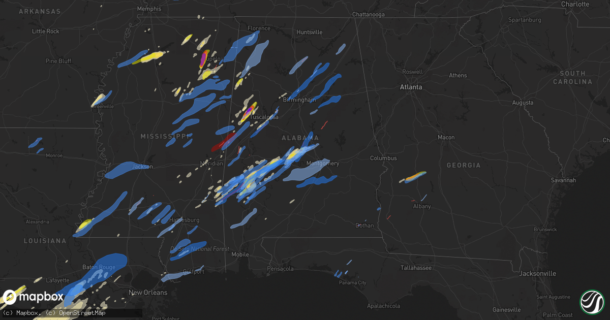
Hail Map in Alabama on March 17, 2021
Get this storm
March 17 map
$229
one time, instant access
Download today. No call, no setup
Keep the $229
Bought the map and want the full workflow? Apply the entire $229 to a subscription within 7 days. None of it is wasted.
Every map, not just this one
This buys you this map. Subscription and you get every map we run, in the markets you choose from a few cities to whole states to nationwide. Plus real-time alerts the moment a storm fires.
Contact data
Name, contact info, occupancy, even credit band for addresses in the footprint. You go from where it hit to who to call.
Become the source they trust
Unlimited branding weather history reports on demand. You already have the documented answer ready for the property owner, and you are the one who showed up with it.
Property data and RoofTrace estimates
Pull up any address you have got, its value and the exact code rules for that jurisdiction, straight from One Click Code. Then RoofTrace estimates the squares, pitch, and roof value, priced the way you price.
Storm reports in Alabama
Alabama
| Date | Description |
|---|---|
| 03/17/20216:02 PM CDT | Structural damage along promise lane. Possible tornado. |
| 03/17/20215:52 PM CDT | Trees down near the intersection of hwy 231 and cr 33. Possible tornado. |
| 03/17/20215:43 PM CDT | A nws survey team confirmed damage from an ef-1 tornado that affected locations just northwest of oneonta in blount county. The tornado began near tim king road along h |
| 03/17/20215:18 PM CDT | Homes damaged in the pools crossroads area. |
| 03/17/20215:12 PM CDT | The tornado produced damage for 5.84 miles and was 400 yards wide at its widest point. The tornado started near the swampy area along little mulberry creek northwest of |
| 03/17/20215:05 PM CDT | Damage reported along hwy 31. Possible tornado. |
| 03/17/20214:58 PM CDT | Power lines/poles down in the 2400 block of mt. Olive rd. |
| 03/17/20214:56 PM CDT | *** 1 inj *** corrects previous tornado report from 1 sse mount olive. A nws survey team confirmed ef-0 tornado damage in the mount olive area of jefferson county. Dama |
| 03/17/20214:55 PM CDT | Damage reported along nicholsville rd. Trees down and 1 mobile home damaged. |
| 03/17/20214:54 PM CDT | Nws meteorologists surveyed damage in and north of sweet water and determined that it was consistent with an ef0 tornado. The tornado began near 3rd avenue in sweet wat |
| 03/17/20214:39 PM CDT | Multiple trees down along hwy 69. |
| 03/17/20214:34 PM CDT | This long track tornado began in the nws mobile forecast area and traveled almost 35 miles through wayne... Choctaw... And clarke counties as an ef2 tornado. It weakene |
| 03/17/20214:30 PM CDT | *** 2 inj *** campbell landing rd. In clarke county... Alabama. Tornado damage to four homes... One home is destroyed... Two people injured. Tornado estimated at 4:30pm |
| 03/17/20214:30 PM CDT | Corrects previous tornado report from 1 w maytown. A nws survey team confirmed ef-1 tornado damage in the maytown area of jefferson county. Trees were snapped and uproo |
| 03/17/20214:30 PM CDT | Significant tree and power line damage on highway 69 in morvin... Alabama from tornado at 4:30pm. Verified by a trained spotter. |
| 03/17/20214:20 PM CDT | Several homes on stilts were severely damaged in the west bend community from tornado at 4:20pm. Emergency manager reported. |
| 03/17/20214:11 PM CDT | National weather service meteorologists surveyed damage just east of central mills and found it consistent with a tornado. The tornado touched down near al highway 66 w |
| 03/17/20214:07 PM CDT | Reported by spotter who was se of this location... Looking nw. |
| 03/17/20214:00 PM CDT | Four homes damaged and trees down on silas branch rd in the silas community. |
| 03/17/20213:56 PM CDT | Increasing debris signature on radar. Confirmed via drone footage and several photos/videos of a tornado moving through the silas community on social media. |
| 03/17/20213:30 PM CDT | Report from mping: 3-inch tree limbs broken; power poles broken. |
| 03/17/20213:25 PM CDT | The tornado produced damage for 3.51 miles and was 650 yards wide at its widest point. The tornado produced significant timber damage ... Some structure damage and dama |
| 03/17/20213:10 PM CDT | Damage reported in the wildwood community. Details unknown. |
| 03/17/20213:09 PM CDT | An ef1 tornado produced damage for 0.53 miles and was 150 yards wide at its widest point. Minor structure and timber damage occurred along the path. |
| 03/17/20212:31 PM CDT | Multiple homes damaged in the waterbury subdivision. |
| 03/17/20212:29 PM CDT | Nws meteorologists surveyed damage around coosa county 56 and determined that it was caused by a brief ef0 tornado. Damage was limited to an uprooted pine tree and seve |
| 03/17/20212:29 PM CDT | Tornado reported by emergency management near birmingport. |
| 03/17/20212:29 PM CDT | Roof damage to a number of houses in the city on both sides of the county line. Several businesses damaged in moundville. |
| 03/17/20212:22 PM CDT | Nws meteorologists surveyed damage south of sweet water and determined that it was consistent with an ef1 tornado. The tornado began along marengo county 6. It continue |
| 03/17/20212:22 PM CDT | Tornado likely from tds on local radar near weogufka. |
| 03/17/20212:12 PM CDT | An ef1 tornado produced damage for 22.03 miles and was 550 yards wide at its widest point. The tornado started in martin slough east of the warrior river and lifted nnw |
| 03/17/20212:05 PM CDT | Tornado observed via tv station webcam broadcast with power flash and storm chaser drone video. |
| 03/17/20212:03 PM CDT | A nws survey team confirmed a brief ef0 tornado that crossed lock and dam road just west of foscue park... Outside of the city of demopolis. Damage consisted of uproote |
| 03/17/20212:01 PM CDT | Tornado reported on the ground and causing damage east of clanton on highway 491. Radar also had a tds at this location. |
| 03/17/20211:57 PM CDT | Baseball and golfball size hail in gordo. Relayed through social media pictures. |
| 03/17/20211:56 PM CDT | An ef1 tornado produced damaged for 3.04 miles and was 500 yards wide at its widest point. The tornado was east of clanton and produced some structural damage and knock |
| 03/17/20211:26 PM CDT | Multiple trees were blown down and at least one structure was damaged near highway 24 and highway 34. Additional damage was reported along highway 53. |
| 03/17/20211:24 PM CDT | An ef1 tornado produced damage for 2.87 miles and was 150 yards wide at its widest point. Damage was observed from tom miner road east of billingsley to just north of c |
| 03/17/20211:02 PM CDT | Several trees were blown down and at least 4 structures were damaged in bluffport. Damage was reported at highway 21 and valley road. Possible tornado. |
| 03/17/202112:57 PM CDT | A nws survey team confirmed damage from an ef1 tornado that began on the south side of highway 28e just east of livingston and ended near port of epes highway on approa |
| 03/17/202112:44 PM CDT | Several trees and power lines were blown down along highway 83... Highway 84... Highway 528... And highway 26. At least one structure was damaged. Possible tornado. |
| 03/17/202112:37 PM CDT | Corrects previous tstm wnd dmg report from 4 nne ward. 20 to 30 trees blown down and minor structural damage near highway 17 and walker road. Possible tornado. |
| 03/17/202112:32 PM CDT | *** 2 inj *** ef2 tornado damage path was 5.08 miles long and 1000 yards wide at its widest point. Two minor injuries were suffered as home was destroyed near sr 14. Da |
| 03/17/202112:32 PM CDT | *** 2 inj *** an ef2 tornado produced damage for 5.08 miles and was 1000 yards wide at its widest point. Two people suffered minor injuries. The tornado began just east |
| 03/17/202112:31 PM CDT | A nws survey team confirmed damage from a brief ef-0 tornado in southern sumter county. The tornado began and ended near the intersection of walker road and highway 17. |
| 03/17/202112:31 PM CDT | Mostly dime size hail... But a few to quarter size near the lamar county airport. Hail lasted only a minute or two. |
| 03/17/202112:23 PM CDT | Corrects previous hail report from 1 ene lamar county airport. Mostly dime size hail... But a few to quarter size near the lamar county airport. Hail lasted only a minu |
| 03/17/202112:19 PM CDT | Mostly dime size hail... But a few to quarter size near the lamar county airport. Hail lasted only a minute or two. |
| 03/17/20217:59 AM CDT | At 1259 PM CDT, a severe thunderstorm was located 7 miles east of Sykes, or 14 miles west of Butler, moving northeast at 35 mph. HAZARD...60 mph wind gusts and quarter size hail. SOURCE...Radar indicated. IMPACT...Hail damage to vehicles is expected. Expect wind damage to roofs, siding, and trees. Locations impacted include... Butler, Lisman, Silas, Pennington, Gilbertown and Toxey. |
| 03/17/20215:55 AM CDT | Trees reported down in abbeville. |
| 03/17/20215:51 AM CDT | Tds observed on radar in forested area with tree damage. No structural damage reported. |
| 03/17/20215:32 AM CDT | Several trees and power lines down. |
| 03/17/20215:31 AM CDT | At 1030 PM CDT, severe thunderstorms were located along a line extending from 5 miles southeast of Wagarville to near McIntosh to 3 miles south of Citronelle, moving northeast at 60 mph. HAZARD...60 mph wind gusts. SOURCE...Radar indicated. IMPACT...Expect damage to roofs, siding, and trees. Locations impacted include... Monroeville, Jackson, Citronelle, Frisco City, Peterman, Wagarville, Leroy, Gulfcrest, Uriah, Whatley, Calvert, Mount Vernon, Excel, Beatrice, McIntosh and Movico. |
| 03/17/20215:30 AM CDT | At 1030 PM CDT, severe thunderstorms were located along a line extending from Hanover to near Lapine, moving east at 50 mph. HAZARD...60 mph wind gusts. SOURCE...Radar indicated. IMPACT...Expect damage to roofs, siding, and trees. Locations impacted include... Auburn, Alexander City, Tuskegee, Tallassee, Union Springs, Dadeville, Camp Hill, Notasulga, Midway, Milstead, Jacksons' Gap, New Site, Shorter, Franklin, Waverly, Goldville, Martin Dam, Lake Tuskegee, Beans Crossroads and Guerryton. |
| 03/17/20215:22 AM CDT | At 1022 PM CDT, severe thunderstorms were located along a line extending from near Albertville to near Pell City, moving east at 50 mph. HAZARD...60 mph wind gusts. SOURCE...Radar indicated. IMPACT...Expect damage to roofs, siding, and trees. Locations impacted include... Gadsden, Anniston, Oxford, Jacksonville, Rainbow City, Attalla, Piedmont, Hokes Bluff, Springville, Odenville, Centre, Cedar Bluff, Cobb Town, Fort McClellan, Saks, Little River Canyon National Preserve, Forney, West End-Cobb Town, Centre Municipal Airport and Glencoe. |
| 03/17/20215:06 AM CDT | At 1006 PM CDT, severe thunderstorms were located along a line extending from near Leeds to near Columbiana, moving east at 50 mph. HAZARD...60 mph wind gusts. SOURCE...Radar indicated. IMPACT...Expect damage to roofs, siding, and trees. Locations impacted include... Oxford, Talladega, Sylacauga, Pell City, Leeds, Moody, Calera, Chelsea, Childersburg, Columbiana, Wilsonville, Talladega Springs, Lincoln, Riverside, Vincent, Harpersville, Munford, Westover, Waldo and Alpine Bay Resort. |
| 03/17/20214:55 AM CDT | At 954 PM CDT, severe thunderstorms were located along a line extending from 3 miles northwest of Mosses to 4 miles south of Beechwood to 5 miles west of Greenville to 5 miles northwest of Georgiana, moving east at 50 mph. HAZARD...60 mph wind gusts. SOURCE...Radar indicated. IMPACT...Expect damage to roofs, siding, and trees. Locations impacted include... Greenville, Luverne, Rutledge, Petrey and Highland Home. |
| 03/17/20214:51 AM CDT | At 951 PM CDT, severe thunderstorms were located along a line extending from near Ashby to near Vida Junction to 9 miles northwest of Greenville, moving east at 50 mph. HAZARD...60 mph wind gusts. SOURCE...Radar indicated. IMPACT...Expect damage to roofs, siding, and trees. Locations impacted include... Montgomery, Prattville, Millbrook, Clanton, Wetumpka, Tallassee, Jemison, Goodwater, Fort Deposit, Mosses, Hayneville, Rockford, Kellyton, Weogufka, Equality, Meadville, Stewartville, Pike Road, Thorsby and Elmore. |
| 03/17/20214:08 AM CDT | Ef-1 tornado touched down from .52 miles 1 mile northeast of brantley alabama. Path was 150 yards wide at its widest and damage occurred along nelvin wallace rd. |
| 03/17/20214:08 AM CDT | Barn destroyed. |
| 03/17/20213:31 AM CDT | At 831 PM CDT, severe thunderstorms were located along a line extending from Wayne to 5 miles west of Thomasville to near Leroy to 6 miles northwest of McIntosh, moving northeast at 60 mph. HAZARD...60 mph wind gusts. SOURCE...Radar indicated. IMPACT...Expect damage to roofs, siding, and trees. Locations impacted include... Jackson, Thomasville, Camden, Grove Hill, Wagarville, Leroy, Whatley, Pine Hill, Vredenburgh, Fulton and Yellow Bluff. |
| 03/17/20213:15 AM CDT | At 814 PM CDT, a severe thunderstorm was located over Mulberry, or 11 miles east of Valley Grande, moving northeast at 35 mph. HAZARD...60 mph wind gusts and half dollar size hail. SOURCE...Radar indicated. IMPACT...Hail damage to vehicles is expected. Expect wind damage to roofs, siding, and trees. Locations impacted include... Deatsville, Autaugaville, Billingsley, Booth, Mulberry, Marbury, Vida Junction, Dawson Mill and New Prospect. |
| 03/17/20212:10 AM CDT | At 710 PM CDT, severe thunderstorms were located along a line extending from Sandersville to 8 miles west of Clara to 4 miles south of Richton to 3 miles east of Maxie, moving northeast at 55 mph. HAZARD...60 mph wind gusts. SOURCE...Radar indicated. IMPACT...Expect damage to roofs, siding, and trees. Locations impacted include... Waynesboro, Butler, Chatom, Richton, Leakesville, Clara, Deer Park, Tibbie, Beaumont, New Augusta, Lisman, Millry, McLain, State Line, Buckatunna, Silas, Fruitdale, Gilbertown and Toxey. |
| 03/17/20211:42 AM CDT | At 642 PM CDT, severe thunderstorms were located along a line extending from 7 miles southeast of Lodi to 6 miles south of Ackerman to near Burnside, moving northeast at 55 mph. HAZARD...60 mph wind gusts. SOURCE...Radar indicated. IMPACT...Expect damage to roofs, siding, and trees. Severe thunderstorms will be near... Eupora around 650 PM CDT. Nanih Waiya and Betheden around 655 PM CDT. Mathiston, Craig Springs, Clarkson and Sherwood around 700 PM CDT. Preston, Maben, Cumberland and Longview around 705 PM CDT. Starkville, Oktoc, Gholson and Pheba around 710 PM CDT. Montpelier, Sessums and Mashulaville around 715 PM CDT. Griffith around 720 PM CDT. Macon, Bent Oak, Pala Alto and Tibbee around 725 PM CDT.Other locations impacted by these severe thunderstorms includeShuqualak, Sturgis and Artesia. |
| 03/17/20211:28 AM CDT | At 628 PM CDT, a severe thunderstorm was located near Evergreen, or 8 miles north of Amory, moving northeast at 35 mph. HAZARD...60 mph wind gusts and quarter size hail. SOURCE...Radar indicated. IMPACT...Hail damage to vehicles is expected. Expect wind damage to roofs, siding, and trees. Locations impacted include... Amory, Fulton, Smithville, Tremont, New Salem, Evergreen, Clay, Abney, Eastman, Cardsville, Turon, Tilden, Bigbee, Bounds Crossroads, Jacinto and Cadamy. |
| 03/17/20211:05 AM CDT | At 605 PM CDT, a severe thunderstorm was located over Susan Moore, or 8 miles northeast of Oneonta, moving northeast at 45 mph. HAZARD...60 mph wind gusts and quarter size hail. SOURCE...Radar indicated. IMPACT...Hail damage to vehicles is expected. Expect wind damage to roofs, siding, and trees. Locations impacted include... Albertville, Boaz, Douglas, High Point, Horton, Hustleville, Rabbit Town and McVille. |
| 03/17/202112:59 AM CDT | At 559 PM CDT, a severe thunderstorm was located 9 miles southeast of Coffeeville, or 10 miles west of Grove Hill, moving northeast at 40 mph. HAZARD...60 mph wind gusts. SOURCE...Radar indicated. IMPACT...Expect damage to roofs, siding, and trees. Locations impacted include... Thomasville, Grove Hill and Fulton. |
| 03/17/202112:15 AM CDT | At 515 PM CDT, a severe thunderstorm was located 8 miles northeast of Coffeeville, or 13 miles northwest of Grove Hill, moving northeast at 40 mph. HAZARD...60 mph wind gusts and quarter size hail. SOURCE...Radar indicated. IMPACT...Hail damage to vehicles is expected. Expect wind damage to roofs, siding, and trees. Locations impacted include... Thomasville. |
| 03/16/202111:07 PM CDT | At 406 PM CDT, a severe thunderstorm was located 9 miles northwest of Belgreen, or 9 miles northeast of Red Bay, moving northeast at 30 mph. HAZARD...60 mph wind gusts and quarter size hail. SOURCE...Radar indicated. IMPACT...Hail damage to vehicles is expected. Expect wind damage to roofs, siding, and trees. Locations impacted include... Sheffield, Tuscumbia, Cherokee, Littleville, Posey Loop, Mt Hester, Cedar Creek Reservoir, Srygley Church, New Bethel and Oakland. |
| 03/16/202110:55 PM CDT | At 355 PM CDT, a severe thunderstorm was located over Consul, or 14 miles south of Uniontown, moving northeast at 50 mph. HAZARD...60 mph wind gusts and quarter size hail. SOURCE...Radar indicated. IMPACT...Hail damage to vehicles is expected. Expect wind damage to roofs, siding, and trees. This severe thunderstorm will remain over mainly rural areas of northwestern Wilcox County. |
| 03/16/202110:44 PM CDT | Multiple trees down off of highway 231. |
| 03/16/202110:43 PM CDT | A tornado touched down briefly on the east side of highway 231 on the north side of pine level in montgomery county wednesday evening. The tornado touched down on a far |
| 03/16/202110:41 PM CDT | Shingles blown of roofs and fences blown down in boykin lakes neighborhood. |
| 03/16/202110:28 PM CDT | At 327 PM CDT, a severe thunderstorm was located near Clara, or 4 miles south of Waynesboro. Other severe storms were located near Toxey and 5 miles southwest of Lavaca, moving northeast at 40 mph. HAZARD...60 mph wind gusts and quarter size hail. SOURCE...Radar indicated. IMPACT...Hail damage to vehicles is expected. Expect wind damage to roofs, siding, and trees. Locations impacted include... Waynesboro, Butler, Clara, Lisman, Silas, Pennington, Gilbertown and Toxey. |
| 03/16/202110:16 PM CDT | A few trees were blown down near the intersection of gardner road and upper kingston road. |
| 03/16/202110:13 PM CDT | A few trees were blown down along cr 20. |
| 03/16/20219:34 PM CDT | At 234 PM CDT, a severe thunderstorm was located 5 miles southeast of Waynesboro, and another was located near Coffeeville, moving northeast at 40 mph. HAZARD...60 mph wind gusts and quarter size hail. SOURCE...Radar indicated. IMPACT...Hail damage to vehicles is expected. Expect wind damage to roofs, siding, and trees. Locations impacted include... Millry, Silas and Coffeeville. |
| 03/16/20219:05 PM CDT | At 205 PM CDT, a severe thunderstorm was located 6 miles south of Putnam, or 16 miles southeast of Butler, moving northeast at 45 mph. HAZARD...60 mph wind gusts and quarter size hail. SOURCE...Radar indicated. IMPACT...Hail damage to vehicles is expected. Expect wind damage to roofs, siding, and trees. This severe thunderstorm will remain over mainly rural areas of central Choctaw and northwestern Clarke Counties. |
| 03/16/20219:03 PM CDT | At 202 PM CDT, a severe thunderstorm was located 5 miles northwest of Waynesboro, moving northeast at 45 mph. HAZARD...60 mph wind gusts and quarter size hail. SOURCE...Radar indicated. IMPACT...Hail damage to vehicles is expected. Expect wind damage to roofs, siding, and trees. Locations impacted include... Waynesboro. |
| 03/16/20218:40 PM CDT | At 140 PM CDT, a severe thunderstorm was located over Johnston Lake, or 7 miles southeast of Carrollton, moving northeast at 40 mph. HAZARD...60 mph wind gusts and quarter size hail. SOURCE...Radar indicated. IMPACT...Hail damage to vehicles is expected. Expect wind damage to roofs, siding, and trees. Locations impacted include... Gordo, Reform, Coker, Benevola, Johnston Lake, Lake Lurleen State Park, Kirk, Pioneer, Buhl, Echola, Lubbub and Elrod. |
| 03/16/20218:35 PM CDT | National weather service meteorologists surveyed damage south of white city and found it consistent with a tornado. The tornado briefly touched down along county road 4 |
| 03/16/20218:00 PM CDT | At 100 PM CDT, a severe thunderstorm was located near Porterville, or 14 miles north of Lauderdale, moving north at 45 mph. HAZARD...60 mph wind gusts and nickel size hail. SOURCE...Radar indicated. IMPACT...Expect damage to roofs, siding, and trees. This severe thunderstorm will be near... Cooksville and Paulette around 125 PM CDT.Other locations impacted by this severe thunderstorm include Scooba. |
| 03/16/20218:00 PM CDT | Possible structure damage in the gold ridge area north of simcoe on cr1524. |
| 03/16/20217:55 PM CDT | Roof blown off of tractor barn. |
| 03/16/20217:32 PM CDT | Trees and power lines down on cr747 near cr1514 intersection north of simcoe. Report relayed from ema. |
All States Impacted by Hail Map on March 17, 2021
Cities Impacted by Hail Map on March 17, 2021
- Vernon, AL
- Sulligent, AL
- Beaverton, AL
- Mount Vernon, MO
- Stotts City, MO
- Batesville, MS
- Hickory Flat, MS
- Potts Camp, MS
- Dayton, TX
- Plains, GA
- Americus, GA
- Preston, GA
- Cape Fair, MO
- Galena, MO
- Waynesboro, MS
- Aurora, MO
- Ash Grove, MO
- Reform, AL
- Gordo, AL
- Aliceville, AL
- Carrollton, AL
- Tebbetts, MO
- Bonnots Mill, MO
- Guin, AL
- Pierce City, MO
- Noel, MO
- Jonesboro, AR
- Detroit, AL
- Broaddus, TX
- Jasper, TX
- Zavalla, TX
- Pontotoc, MS
- Blue Springs, MS
- Belden, MS
- Tupelo, MS
- Hattiesburg, MS
- Grapeland, TX
- Elkhart, TX
- Sardis, MS
- Como, MS
- Campbell, AL
- Thomasville, AL
- Linden, AL
- Magnolia, AL
- Dixons Mills, AL
- Sweet Water, AL
- Garfield, AR
- Cassville, MO
- Seligman, MO
- Syracuse, MO
- Florence, MO
- Pineville, MO
- Ellaville, GA
- Andersonville, GA
- Wentworth, MO
- Stark City, MO
- Sarcoxie, MO
- Cameron, LA
- Bogue Chitto, MS
- Crane, MO
- Marionville, MO
- Eagle Rock, MO
- Washburn, MO
- Buna, TX
- Houston, MS
- Nettleton, MS
- Okolona, MS
- Hull, TX
- Liberty, TX
- Gilbertown, AL
- Toxey, AL
- Butler, AL
- Silas, AL
- Gladewater, TX
- Selma, AL
- Abbeville, LA
- Erath, LA
- Franklin, LA
- Patterson, LA
- Shannon, MS
- Houlka, MS
- Logansport, LA
- Troup, TX
- Wells, TX
- Columbia, MS
- Verona, MO
- Thomaston, AL
- Catherine, AL
- Uniontown, AL
- Safford, AL
- Marion Junction, AL
- Anderson, MO
- Goodman, MO
- Middleton, TN
- Walnut, MS
- Shubuta, MS
- Houston, TX
- Neosho, MO
- Saltillo, MS
- Springfield, MO
- Rogersville, MO
- Ozark, MO
- Sparta, MO
- Highlandville, MO
- Spokane, MO
- Rogers, AR
- Billings, MO
- Ponce De Leon, MO
- Shell Knob, MO
- Clever, MO
- Nixa, MO
- Purdy, MO
- Batson, TX
- Saratoga, TX
- Creole, LA
- Laurel, MS
- Bryan, TX
- Iola, TX
- North Zulch, TX
- Prentiss, MS
- Jefferson, TX
- Jacksonville, TX
- Bon Wier, TX
- Morgan City, LA
- Gibson, LA
- Schriever, LA
- Grand Chenier, LA
- Lake Arthur, LA
- Hollister, MO
- Port Barre, LA
- Krotz Springs, LA
- Duck Hill, MS
- Eupora, MS
- Calhoun City, MS
- Gore Springs, MS
- Stewart, MS
- Hernando, MS
- Van Buren, MO
- Fremont, MO
- Benoit, MS
- Dermott, AR
- Greenville, MS
- Eureka Springs, AR
- Fayette, AL
- Elrod, AL
- Northport, AL
- Woodville, MS
- Jefferson City, MO
- Centertown, MO
- Russellville, MO
- Hartsburg, MO
- New Bloomfield, MO
- Ashland, MO
- Lohman, MO
- Bella Vista, AR
- Fosters, AL
- Freistatt, MO
- Fairview, MO
- Sulphur Springs, AR
- Granby, MO
- Everton, MO
- Stella, MO
- Lanagan, MO
- Rocky Comfort, MO
- Monett, MO
- South West City, MO
- Miller, MO
- Gilmer, TX
- Longview, TX
- Jones, AL
- Prattville, AL
- Billingsley, AL
- Plantersville, AL
- Autaugaville, AL
- Sunshine, LA
- Plaquemine, LA
- Saint Gabriel, LA
- Baton Rouge, LA
- Addis, LA
- Forsyth, MO
- Chadwick, MO
- Garrison, MO
- Harleton, TX
- Marshall, TX
- Tulsa, OK
- Loose Creek, MO
- Fulton, MO
- Crowley, LA
- Egan, LA
- Crenshaw, MS
- Louin, MS
- Hickory, MS
- Kaplan, LA
- New Iberia, LA
- Jeanerette, LA
- Loreauville, LA
- Saint Martinville, LA
- Arlington, AL
- Pine Hill, AL
- Alberta, AL
- Crosby, MS
- Lauderdale, MS
- Geismar, LA
- Prairieville, LA
- Belle Rose, LA
- Pierre Part, LA
- New Albany, MS
- Dumas, MS
- Guntown, MS
- Luling, LA
- Hahnville, LA
- Thibodaux, LA
- Amory, MS
- Fulton, MS
- California, MO
- Sand Springs, OK
- Springdale, AR
- Fayetteville, AR
- Big Sandy, TX
- Jamestown, MO
- Latham, MO
- Baldwyn, MS
- Ripley, MS
- Booneville, MS
- Lake Village, AR
- Kirbyville, TX
- Coffeeville, AL
- Quitman, MS
- Winona, TX
- Lumberton, MS
- Stanton, TN
- Lambert, MS
- Courtland, MS
- Oxford, MS
- Marks, MS
- Nacogdoches, TX
- Coldwater, MS
- Alto, TX
- Kilgore, TX
- Chunky, MS
- Sour Lake, TX
- Middletown, MO
- Silsbee, TX
- Vidor, TX
- Saint Amant, LA
- Maurepas, LA
- Sapulpa, OK
- Ecru, MS
- McCrory, AR
- Brookwood, AL
- Moundville, AL
- Diana, TX
- Oak Vale, MS
- Monticello, MS
- Silver Creek, MS
- Pope, MS
- Oakland, MS
- Broken Arrow, OK
- Oldfield, MO
- Ava, MO
- Meridian, MS
- Echola, AL
- Mantee, MS
- Vardaman, MS
- Kennedy, AL
- Merryville, LA
- Cushing, TX
- Douglass, TX
- Kountze, TX
- Mathiston, MS
- Maben, MS
- Berwick, LA
- Baldwin, LA
- Richmond, TX
- Georgiana, AL
- Evergreen, AL
- McKenzie, AL
- Morse, LA
- Estherwood, LA
- Plantersville, MS
- Jackson, AL
- Grove Hill, AL
- Brinkley, AR
- Ralph, AL
- Knoxville, AL
- Perkinston, MS
- Poplarville, MS
- Branson, MO
- Walnut Shade, MO
- Blue Mountain, MS
- Myrtle, MS
- Pennington, AL
- Foxworth, MS
- Kokomo, MS
- East Bernard, TX
- Buhl, AL
- Mansfield, LA
- Grand Cane, LA
- Rusk, TX
- Gonzales, LA
- Harrisburg, AR
- Fisher, AR
- Liberty, MS
- Reeds Spring, MO
- Richland, GA
- Pearl River, LA
- Corning, AR
- Emelle, AL
- Nashville, AR
- Mineral Springs, AR
- Hamilton, AL
- Uriah, AL
- Versailles, MO
- Clarksburg, MO
- Barnett, MO
- Arp, TX
- Tyler, TX
- Forest, MS
- Raleigh, MS
- Gueydan, LA
- Lake Charles, LA
- Bell City, LA
- Abbeville, MS
- Cottondale, AL
- Tuscaloosa, AL
- Duncanville, AL
- Hallsville, TX
- Russellville, AL
- Tuscumbia, AL
- Quinton, AL
- Gallion, AL
- Faunsdale, AL
- Marbury, AL
- Verbena, AL
- Holcomb, MS
- Needham, AL
- Call, TX
- Karnack, TX
- Republic, MO
- Lockwood, MO
- Fortuna, MO
- Rienzi, MS
- Prairie Home, MO
- Oakman, AL
- Tipton, MO
- Overton, TX
- Hackberry, LA
- Livingston, AL
- Boligee, AL
- Buckatunna, MS
- Palestine, TX
- White Castle, LA
- Donaldsonville, LA
- Darrow, LA
- Slidell, LA
- Orange, TX
- Whitehouse, TX
- Labadieville, LA
- Napoleonville, LA
- Church Point, LA
- Branch, LA
- Rayne, LA
- Demopolis, AL
- Kellyville, OK
- Orrville, AL
- Sardis, AL
- Ward, AL
- Bellamy, AL
- Cuba, AL
- York, AL
- Clanton, AL
- Melvin, AL
- Weogufka, AL
- Sylacauga, AL
- Marion, AL
- Eutaw, AL
- Akron, AL
- Adger, AL
- Millry, AL
- Mulga, AL
- Adamsville, AL
- Oneonta, AL
- Locust Fork, AL
- Kimberly, AL
- Pinson, AL
- Brookside, AL
- Boaz, AL
- Trafford, AL
- Remlap, AL
- Warrior, AL
- Fultondale, AL
- Birmingham, AL
- Cleveland, AL
- Morris, AL
- Altoona, AL
- Docena, AL
- Gardendale, AL
- Mount Olive, AL
- Graysville, AL
- Camden, AL
- Frankville, AL
- Minter, AL
- Horton, AL
- Blountsville, AL
- Lower Peach Tree, AL
- Dickinson, AL
- Bremen, AL
- Cullman, AL
- Hanceville, AL
- Baileyton, AL
- Scooba, MS
- Porterville, MS
- Epes, AL
- Gainesville, AL
- Phil Campbell, AL
- Bear Creek, AL
- Town Creek, AL
- Spruce Pine, AL
- Hackleburg, AL
- Mount Hope, AL
- Haleyville, AL
- Tyler, AL
- Deatsville, AL
- Hope Hull, AL
- Montgomery, AL
- Letohatchee, AL
- Hayneville, AL
- Millbrook, AL
- Lowndesboro, AL
- Citronelle, AL
- Wagarville, AL
- Deer Park, AL
- Gainestown, AL
- McIntosh, AL
- Ashville, AL
- Leeds, AL
- Rainbow City, AL
- Lincoln, AL
- Ragland, AL
- Pell City, AL
- Gadsden, AL
- Vandiver, AL
- Ohatchee, AL
- Harpersville, AL
- Wilsonville, AL
- Alpine, AL
- Oxford, AL
- Vincent, AL
- Talladega, AL
- Munford, AL
- Eastaboga, AL
- Greenville, AL
- Forest Home, AL
- Highland Home, AL
- Grady, AL
- Ramer, AL
- Fitzpatrick, AL
- Fort Deposit, AL
- Lapine, AL
- Mathews, AL
- Fyffe, AL
- Dawson, AL
- Crossville, AL
- Fort Payne, AL
- Geraldine, AL
- Collinsville, AL
- Rainsville, AL
- Newton, AL
- Dothan, AL
- Shorterville, AL
- Headland, AL
- Dubach, LA
- Choudrant, LA
- Farmerville, LA
- Bernice, LA
- Downsville, LA
- Walker, LA
- Tickfaw, LA
- Delcambre, LA
- Pride, LA
- Hammond, LA
- Holden, LA
- French Settlement, LA
- Pine Grove, LA
- Denham Springs, LA
- Amite, LA
- Zachary, LA
- Springfield, LA
- Livingston, LA
- Albany, LA
- Independence, LA
- Brusly, LA
- Grosse Tete, LA
- Greenwell Springs, LA
- Carville, LA
- Baker, LA
- Port Allen, LA
- Freeburg, MO
- Westphalia, MO
- Gravette, AR
- Seymour, MO
- Tatum, TX
- Henderson, TX
- Oglethorpe, GA
- Blakely, GA
- Leesburg, GA
- Dawson, GA
- Brownsville, TN
- Whiteville, TN
- Mason, TN
- Arlington, TN
- Somerville, TN
- Farmington, AR
- Clarksdale, MS
- Alligator, MS
- Lyon, MS
- Sledge, MS
- Brookhaven, MS
- Wesson, MS
- Sontag, MS
- Monterey, LA
- Gloster, MS
- Hazlehurst, MS
- Natchez, MS
- Meadville, MS
- McCall Creek, MS
- Bude, MS
- Union Church, MS
- Roxie, MS
- Golden, MS
- Red Bay, AL
- Cleveland, MS
- Shaw, MS
- Edwards, MS
- Pearl, MS
- Utica, MS
- Richland, MS
- Bolton, MS
- Vicksburg, MS
- Flowood, MS
- Clinton, MS
- Raymond, MS
- Jackson, MS
- Port Gibson, MS
- Carthage, MS
- Louisville, MS
- McCool, MS
- Ethel, MS
- Kosciusko, MS
- Weir, MS
- Purvis, MS
- Jayess, MS
- Ruth, MS
- Sumrall, MS
- Angie, LA
- Sandy Hook, MS
- Seminary, MS
- Carson, MS
- Bassfield, MS
- Collins, MS
- Pheba, MS
- Starkville, MS
- West Point, MS
- Cedarbluff, MS
- Mississippi State, MS
- Ackerman, MS
- Sturgis, MS
- Philadelphia, MS
- Union, MS
- Brooklyn, MS
- New Augusta, MS
- Woodland, MS
- Greenwood Springs, MS
- Prairie, MS
- Aberdeen, MS
- Hamilton, MS
- Walthall, MS
- Crawford, MS
- Artesia, MS
- Columbus, MS
- Steens, MS
- De Kalb, MS
- Daleville, MS
- Macon, MS
- Shuqualak, MS
- Cherokee, AL
- Sheffield, AL
- Vina, AL
- Dennis, MS
- Muscle Shoals, AL
- Belmont, MS
- Tremont, MS
- Picayune, MS
- McLain, MS
- McHenry, MS
- Wiggins, MS
- Carriere, MS
- Lucedale, MS
- New Orleans, LA
- Long Beach, MS
- Waveland, MS
- Pearlington, MS
- Pass Christian, MS
- Bay Saint Louis, MS
- Diberville, MS
- Biloxi, MS
- Gulfport, MS
- Pinola, MS
- Inlet Beach, FL
- Vernon, FL
- Panama City Beach, FL
- Chipley, FL
- Panama City, FL


