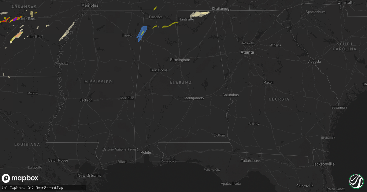
Hail Map in Alabama on March 14, 2024
Get this storm
March 14 map
$229
one time, instant access
Download today. No call, no setup
Keep the $229
Bought the map and want the full workflow? Apply the entire $229 to a subscription within 7 days. None of it is wasted.
Every map, not just this one
This buys you this map. Subscription and you get every map we run, in the markets you choose from a few cities to whole states to nationwide. Plus real-time alerts the moment a storm fires.
Contact data
Name, contact info, occupancy, even credit band for addresses in the footprint. You go from where it hit to who to call.
Become the source they trust
Unlimited branding weather history reports on demand. You already have the documented answer ready for the property owner, and you are the one who showed up with it.
Property data and RoofTrace estimates
Pull up any address you have got, its value and the exact code rules for that jurisdiction, straight from One Click Code. Then RoofTrace estimates the squares, pitch, and roof value, priced the way you price.
Storm reports in Alabama
Alabama
| Date | Description |
|---|---|
| 03/14/20246:58 AM CDT | Photos show downed tree limbs with damage to a structure in the straight mountain community of blount county. Photos viewed via social media. |
| 03/14/20246:55 AM CDT | Photos of a few trees down in the attalla area... Post via social media. |
| 03/14/20246:53 AM CDT | An nws storm survey near tenbroeck... Alabama determined an ef0 tornado occurred causing damage to a chicken house... Pole barn... And a small barn. For more informatio |
| 03/14/20246:50 AM CDT | Damage to two barn structures... Metal roofing blown off and a wall caved in. Time estimated from radar. |
| 03/14/20246:49 AM CDT | Several pine trees were snapped along sycamore dr and county road 20... With sycamore dr being blocked. |
| 03/14/20246:45 AM CDT | Trees reported down along lakeshore drive in oneonta. Report of power lines down along 2nd avenue west and along county highway 42. |
| 03/14/20246:45 AM CDT | Video and pictures of damage to barn/chicken house with metal pieces tossed. Near county road 72 and ten broeck area. Report from social media. Time estimated from rada |
| 03/14/20246:09 AM CDT | Damage to a car port... Powerpole... And a downed tree. Time estimated from radar. |
| 03/14/20246:00 AM CDT | Trees down on gum pond rd. Time estimated from radar. |
| 03/14/20245:55 AM CDT | Trees down with blockage near mccutcheon rd. Time estimated from radar. |
| 03/14/20245:55 AM CDT | Trees down and complete blockage near bess thompson road. Time estimated from radar. |
| 03/14/20245:55 AM CDT | Trees down near airport road. Time estimated from radar. |
| 03/14/20245:55 AM CDT | Trees down on hough rd. Time estimated from radar. |
| 03/14/20245:55 AM CDT | Corrects previous tstm wnd dmg report from 11 w good hope. Multiple trees down in the crane hill area. Time estimated from radar. |
| 03/14/20245:55 AM CDT | Photos from social media of trees snapped and uprooted as well as metal roofing tossed in laceys spring. Time estimated from radar. |
| 03/14/20245:55 AM CDT | Trees down on river loop rd. Time estimated from radar. |
| 03/14/20245:55 AM CDT | Tree fell on a storage shed near highway 231. Time estimated from radar. |
| 03/14/20245:55 AM CDT | Multiple trees down. Time estimated from radar. |
| 03/14/20245:52 AM CDT | Photo of a tree down across county road 1... Resulting in a motor vehicle accident. Also... A report of debris across the road near the intersection of state highway 15 |
| 03/14/20245:52 AM CDT | Photo of a tree down a |
| 03/14/20245:49 AM CDT | Corrects previous tstm wnd dmg report from 6 nne eva. Tree down with partial road blockage near eva road and chapman drive. Time estimated from radar. |
| 03/14/20245:49 AM CDT | Tree down with partial road blockage. Time estimated from radar. |
| 03/14/20245:47 AM CDT | Trees and power lines reported down near the intersection of county road 23 and county road 105 in fayette county. |
| 03/14/20245:45 AM CDT | Trees down near sample road and gum springs road. Time estimated from radar. |
| 03/14/20245:40 AM CDT | Barn damaged on community lane. Time estimated from radar. |
| 03/14/20245:39 AM CDT | Tree down with complete road blockage. Time estimated from radar. |
| 03/14/20245:39 AM CDT | Pictures and videos of damage to wooden barn on cedar creek rd between thompson rd and culver rd east of highway 31. Report from social media. Time estimated from radar |
| 03/14/20245:39 AM CDT | Corrects previous tstm wnd dmg report from 2 n falkville. Trees down on cedar creek rd. Time estimated from radar. |
| 03/14/20245:39 AM CDT | Trees down and complete blockage near cedar cove rd. Time estimated from radar. |
| 03/14/20245:39 AM CDT | Corrects previous tstm wnd dmg report from 2 ene falkville. Trees down with road blockage near mt zion road and nat key road. Time estimated from radar. |
| 03/14/20245:39 AM CDT | Trees down with road blockage. Time estimated from radar. |
| 03/14/20245:35 AM CDT | Photos of trees done... One possibly impacting a vehicle near ashridge on alabama highway 195 north of double springs. Photos via social media. |
| 03/14/20245:34 AM CDT | Report of tree down. Time estimated from radar. |
| 03/14/20245:34 AM CDT | Corrects previous tstm wnd dmg report from 2 ssw hartselle. Pictures of several trees down including minor roof damage from guy roberts road... Across barkley bridge ro |
| 03/14/20245:34 AM CDT | Tree down on residence along guy roberts road. |
| 03/14/20245:34 AM CDT | Picture of metal roof damage to a hangar at the hartselle airport. Report from social media. Time estimated from radar. |
| 03/14/20245:34 AM CDT | Pictures of several trees down including minor roof damage from guy roberts road... Across barkley bridge road to the powell road and garner road intersection. Report f |
| 03/14/20245:34 AM CDT | Trees down with complete blockage near flint pointe circle sw and ferncrest st sw. Time estimated from radar. |
| 03/14/20245:34 AM CDT | Trees down near barkley bridge rd. Time estimated from radar. |
| 03/14/20245:34 AM CDT | Trees down with blockage near nance ford rd and lee rd. Time estimated from radar. |
| 03/14/20245:34 AM CDT | Corrects previous tstm wnd dmg report from 3 sw hartselle. Trees down with road blockage near guy roberts road. Time estimated from radar. |
| 03/14/20245:34 AM CDT | Corrects previous tstm wnd dmg report from 2 ssw hartselle. Report of tree down near barkley bridge and powell road. Time estimated from radar. |
| 03/14/20245:34 AM CDT | Trees down with road blockage near garner road and powell road. Time estimated from radar. |
| 03/14/20245:34 AM CDT | Trees down with road blockage. Time estimated from radar. |
| 03/14/20245:33 AM CDT | Trees down near ray rd and tunsel rd. Time estimated from radar. |
| 03/14/20245:28 AM CDT | Trees down with road blockage. Time estimated from radar. |
| 03/14/20245:28 AM CDT | Downed power lines near norris mill rd and oak ridge lane. Times estimated from radar. |
| 03/14/20245:28 AM CDT | Corrects previous tstm wnd dmg report from 3 nnw hartselle. Trees down with road blockage near moss chapel road and highway 31. Time estimated from radar. |
| 03/14/20245:24 AM CDT | Trees were downed sporadically along mud creek rd... Ebenezer rd... And steedley rd. |
| 03/14/20245:20 AM CDT | Multiple trees down with blockage near norris mill and bowles bridge rd. Time estimated from radar. |
| 03/14/20245:13 AM CDT | Trees were downed on mcgill gin rd and at the intersection of hwy 18 & cr 34. |
| 03/14/20245:09 AM CDT | Three trees were uprooted at a residence. |
| 03/14/20245:00 AM CDT | Tree down on morris rd near pulaski pike. Time estimated from radar. |
| 03/14/20244:22 AM CDT | The roof of a barn was blown off at this location. Also... Trees 8 to 10 inches in diameter were blown down up to 1/2 mile away from the barn. |
| 03/14/20243:54 AM CDT | Report of a tree down in the riverton rose community in cherokee. Time estimated from radar. |
| 03/13/202411:02 PM CDT | Hail size estimated from pictures. |
| 03/13/202410:25 PM CDT | A local report indicates 1.00 inch wind near Russellville |
| 03/13/20247:19 PM CDT | Gym roof blown off at vina high school. Time estimated by radar. |
| 03/13/20247:15 PM CDT | Tree down on power lines. Time estimated from radar. |
All States Impacted by Hail Map on March 14, 2024
Cities Impacted by Hail Map on March 14, 2024
- Saint Augustine, IL
- Abingdon, IL
- Avon, IL
- Prairie City, IL
- Berwick, IL
- Eureka, KS
- Hamilton, KS
- Virgil, KS
- Gridley, KS
- Madison, KS
- Toronto, KS
- Yates Center, KS
- Burlington, KS
- Le Roy, KS
- Westphalia, KS
- Garnett, KS
- Waverly, KS
- Piqua, KS
- Downs, IL
- Le Roy, IL
- Ellsworth, IL
- Mora, MO
- Smithton, MO
- Florence, MO
- Otterville, MO
- Syracuse, MO
- Fortuna, MO
- Tipton, MO
- Clarksburg, MO
- Saint Anne, IL
- Momence, IL
- Kankakee, IL
- California, MO
- Latham, MO
- Pembroke Township, IL
- Lake Village, IN
- Schneider, IN
- Lowell, IN
- Tower Hill, IL
- Shelbyville, IL
- Lakewood, IL
- Martinsville, IL
- Annapolis, IL
- West York, IL
- West Union, IL
- Jefferson City, MO
- Holts Summit, MO
- Tebbetts, MO
- Indianapolis, IN
- Camby, IN
- Comanche, OK
- Duncan, OK
- Waurika, OK
- Macomb, OK
- Asher, OK
- Maud, OK
- Tecumseh, OK
- Marlow, OK
- Foster, OK
- Henrietta, TX
- Elmore City, OK
- Lindsay, OK
- Maysville, OK
- Pauls Valley, OK
- Ringling, OK
- Loco, OK
- Shawnee, OK
- Prague, OK
- Wetumka, OK
- Weleetka, OK
- Okemah, OK
- Henryetta, OK
- Okmulgee, OK
- Ringgold, TX
- Paris Crossing, IN
- Commiskey, IN
- Deputy, IN
- Madison, IN
- Lexington, IN
- Morris, OK
- Chouteau, OK
- Chamois, MO
- Twelve Mile, IN
- Arthur, IL
- Oblong, IL
- Star City, IN
- Kewanna, IN
- Crothersville, IN
- Brookston, IN
- Jasonville, IN
- Sullivan, IN
- Demotte, IN
- Farmersburg, IN
- Lewis, IN
- Shelburn, IN
- Terre Haute, IN
- Pimento, IN
- Odon, IN
- Newberry, IN
- Elnora, IN
- West Terre Haute, IN
- Sheldon, IL
- Kentland, IN
- Sedalia, MO
- Green Ridge, MO
- Ryan, OK
- Brazil, IN
- Earlsboro, OK
- Seminole, OK
- Cole Camp, MO
- Rosedale, IN
- Wanette, OK
- Herscher, IL
- Bonfield, IL
- Akron, IN
- Macy, IN
- Willow Hill, IL
- Yale, IL
- Clinton, IN
- Riley, IN
- New Goshen, IN
- Wewoka, OK
- Georgetown, IL
- Ridge Farm, IL
- Indianola, IL
- Castle, OK
- Wheatfield, IN
- Rensselaer, IN
- Fair Oaks, IN
- Paris, IL
- Wolcott, IN
- Mooresville, IN
- Monrovia, IN
- Chrisman, IL
- Holdenville, OK
- Freelandville, IN
- Sandborn, IN
- Oaktown, IN
- Bicknell, IN
- Edwardsport, IN
- Sullivan, IL
- Lovington, IL
- Paoli, OK
- Wayne, OK
- Byars, OK
- Francesville, IN
- Winamac, IN
- Byers, TX
- Vincennes, IN
- Plainville, IN
- Earl Park, IN
- Goodland, IN
- Ada, OK
- Aroma Park, IL
- Cook Sta, MO
- Onarga, IL
- Bainbridge, IN
- Roachdale, IN
- Lexington, OK
- Montezuma, IN
- Hillsdale, IN
- Pryor, OK
- Hanover, IN
- Milton, KY
- Nocona, TX
- Terral, OK
- Wynnewood, OK
- Stratford, OK
- Locust Grove, OK
- Boynton, OK
- Salina, OK
- Haskell, OK
- Vevay, IN
- Spavinaw, OK
- Porter, OK
- Taft, OK
- Gore, OK
- Jay, OK
- Vian, OK
- Grove, OK
- Park Hill, OK
- Cookson, OK
- Davis, OK
- Muskogee, OK
- South West City, MO
- Eucha, OK
- Colcord, OK
- Ghent, KY
- Florence, IN
- Warsaw, KY
- Sparta, KY
- Sanders, KY
- Glencoe, KY
- Dry Ridge, KY
- Carrollton, KY
- Sulphur, OK
- Anderson, MO
- Verona, KY
- Roff, OK
- Crittenden, KY
- Williamstown, KY
- Tahlequah, OK
- De Mossville, KY
- Falmouth, KY
- Wagoner, OK
- Gravette, AR
- Maysville, AR
- Sulphur Springs, AR
- Patriot, IN
- Butler, KY
- Foster, KY
- Eufaula, OK
- Checotah, OK
- Noel, MO
- Brooksville, KY
- Oktaha, OK
- Bella Vista, AR
- Hiwasse, AR
- Pineville, MO
- West Jefferson, OH
- London, OH
- Plain City, OH
- Hilliard, OH
- Dublin, OH
- Amlin, OH
- Galloway, OH
- Columbus, OH
- Lewis Center, OH
- Westerville, OH
- Galena, OH
- Powell, OH
- New Albany, OH
- Fort Gibson, OK
- Hulbert, OK
- Augusta, KY
- Germantown, KY
- Welling, OK
- Proctor, OK
- Mayslick, KY
- Mount Olivet, KY
- Maysville, KY
- Dover, KY
- Braggs, OK
- Bunch, OK
- Westville, OK
- Stilwell, OK
- Kansas, OK
- Watts, OK
- Stigler, OK
- Mokane, MO
- Steedman, MO
- Centralia, MO
- Sturgeon, MO
- Decatur, AR
- Gentry, AR
- Summers, AR
- Siloam Springs, AR
- Harrisburg, MO
- Fayetteville, AR
- Canehill, AR
- Lincoln, AR
- Evansville, AR
- Thompson, MO
- Mexico, MO
- Portland, MO
- Rhineland, MO
- Hermann, MO
- Springdale, AR
- Bentonville, AR
- Winslow, AR
- Prairie Grove, AR
- Farmington, AR
- West Fork, AR
- Morrow, AR
- Tollesboro, KY
- Rogers, AR
- Cave Springs, AR
- Lowell, AR
- Pea Ridge, AR
- Centerton, AR
- Bunceton, MO
- Pilot Grove, MO
- Berryville, AR
- Prairie Home, MO
- Boonville, MO
- Green Forest, AR
- Warrenton, MO
- Marthasville, MO
- Jonesburg, MO
- Goodman, MO
- Sullivan, MO
- Lonedell, MO
- Richwoods, MO
- Bourbon, MO
- Luebbering, MO
- Grubville, MO
- Dittmer, MO
- Elkins, AR
- Garfield, AR
- Laddonia, MO
- Rush Hill, MO
- Farber, MO
- Curryville, MO
- Vandalia, MO
- Porum, OK
- Middletown, MO
- Bowling Green, MO
- Mill Creek, OK
- Tishomingo, OK
- Pittsfield, IL
- Pearl, IL
- Winchester, IL
- Wallingford, KY
- Vanceburg, KY
- Hillsboro, MO
- Stonewall, OK
- Truesdale, MO
- Wright City, MO
- Foristell, MO
- Wentzville, MO
- Clever, MO
- Nixa, MO
- Ozark, MO
- Sparta, MO
- Montgomery City, MO
- Rogersville, MO
- New Florence, MO
- Fordland, MO
- Bruner, MO
- Wooldridge, MO
- Jamestown, MO
- Columbia, MO
- Oldfield, MO
- Seymour, MO
- Ava, MO
- Squires, MO
- Mansfield, MO
- Ashland, MO
- Clarksville, MO
- Sallisaw, OK
- Nebo, IL
- Eolia, MO
- Lake Saint Louis, MO
- O'Fallon, MO
- Pevely, MO
- Barnhart, MO
- Festus, MO
- Herculaneum, MO
- Webbers Falls, OK
- Waterloo, IL
- Smithton, IL
- New Athens, IL
- Tupelo, OK
- Golden Eagle, IL
- Saint Charles, MO
- Saint Peters, MO
- Drury, MO
- Norwood, MO
- Macomb, MO
- Mountain Grove, MO
- Marshfield, MO
- Hartville, MO
- Oak Grove, AR
- Lead Hill, AR
- Alpena, AR
- Omaha, AR
- Wesley, AR
- Eureka Springs, AR
- Hindsville, AR
- Huntsville, AR
- Lampe, MO
- Cedarcreek, MO
- Eagle Rock, MO
- Golden, MO
- Branson, MO
- Shell Knob, MO
- Hollister, MO
- Ridgedale, MO
- Blue Eye, MO
- Kirbyville, MO
- Marble Falls, AR
- Compton, AR
- Kingston, AR
- Ponca, AR
- Combs, AR
- Witter, AR
- Jasper, AR
- Harrison, AR
- Reeds Spring, MO
- Olive Hill, KY
- Emerson, KY
- Rockaway Beach, MO
- Grayson, KY
- Fulton, MO
- High Hill, MO
- Bellflower, MO
- Truxton, MO
- Hawk Point, MO
- Troy, MO
- Elsberry, MO
- Annada, MO
- Jacksonville, IL
- Murrayville, IL
- Woodson, IL
- Franklin, IL
- Waverly, IL
- Virden, IL
- Granite City, IL
- Konawa, OK
- Edwardsville, IL
- Williamsburg, MO
- Collinsville, IL
- Glen Carbon, IL
- Maryville, IL
- Troy, IL
- Valmeyer, IL
- Fults, IL
- Lynchburg, MO
- Grovespring, MO
- Graff, MO
- Plato, MO
- Huggins, MO
- Cabool, MO
- Houston, MO
- Vanzant, MO
- Solo, MO
- Bucyrus, MO
- Willow Springs, MO
- Elk Creek, MO
- Dora, MO
- Yellville, AR
- Theodosia, MO
- Rueter, MO
- Isabella, MO
- Protem, MO
- Kissee Mills, MO
- Peel, AR
- Oakland, AR
- Everton, AR
- Western Grove, AR
- Pyatt, AR
- Marine, IL
- Keota, OK
- La Fontaine, IN
- Bunker Hill, IN
- Marion, IN
- Miami, IN
- Highland, IL
- Amboy, IN
- Van Buren, IN
- Aviston, IL
- Warren, IN
- Montpelier, IN
- Trenton, IL
- Converse, IN
- Peru, IN
- Gans, OK
- Muldrow, OK
- Portage Des Sioux, MO
- Red Bud, IL
- Florissant, MO
- Hecker, IL
- Freeburg, IL
- Kinta, OK
- Auburn, IL
- Divernon, IL
- Pawnee, IL
- Thayer, IL
- Mascoutah, IL
- Belleville, IL
- Lenzburg, IL
- Mccurtain, OK
- Poneto, IN
- Liberty Center, IN
- Bluffton, IN
- Lebanon, IL
- Morrisonville, IL
- Potosi, MO
- Carrollton, IL
- Summerfield, IL
- Kane, IL
- Eldred, IL
- Centrahoma, OK
- Rockbridge, IL
- Saint James, MO
- Steelville, MO
- Coalgate, OK
- Greenfield, IL
- Frankfort, IN
- Colfax, IN
- Chesterfield, IL
- Medora, IL
- Saint Louis, MO
- Michigantown, IN
- Arnold, MO
- Imperial, MO
- East Alton, IL
- Wardville, OK
- South Roxana, IL
- Hartford, IL
- Stuart, OK
- Pocahontas, IL
- Fenton, MO
- Mcalester, OK
- Worden, IL
- Alhambra, IL
- Hamel, IL
- New Douglas, IL
- Livingston, IL
- East Carondelet, IL
- Blackwell, MO
- De Soto, MO
- Fletcher, MO
- Keystone, IN
- Geneva, IN
- Marietta, OK
- Roxana, IL
- Kiowa, OK
- Berne, IN
- Beulah, MO
- Edgar Springs, MO
- Lenox, MO
- Roby, MO
- Salem, MO
- Success, MO
- Licking, MO
- Raymondville, MO
- Jadwin, MO
- Eminence, MO
- Summersville, MO
- Yukon, MO
- Eunice, MO
- Hartshorn, MO
- Birch Tree, MO
- Mountain View, MO
- Caulfield, MO
- Peace Valley, MO
- Pomona, MO
- West Plains, MO
- Moody, MO
- Pottersville, MO
- Bakersfield, MO
- Elizabeth, AR
- Tecumseh, MO
- Gamaliel, AR
- Gepp, AR
- Henderson, AR
- Zanoni, MO
- Brixey, MO
- Bull Shoals, AR
- Gainesville, MO
- Gassville, AR
- Cotter, AR
- Flippin, AR
- Norfork, AR
- Summit, AR
- Lakeview, AR
- Valley Springs, AR
- Pontiac, MO
- Mountain Home, AR
- Saint Joe, AR
- Midway, AR
- Udall, MO
- Clarkridge, AR
- Calico Rock, AR
- Wasola, MO
- Hardenville, MO
- Thornfield, MO
- Prairie Du Rocher, IL
- Kempton, IN
- Forest, IN
- Russiaville, IN
- Tipton, IN
- Sharpsville, IN
- Taylorville, IL
- Bulpitt, IL
- Kincaid, IL
- Edinburg, IL
- Tovey, IL
- Goldsmith, IN
- Assumption, IL
- Stonington, IL
- Hettick, IL
- Carlinville, IL
- Rudy, AR
- Mountainburg, AR
- Columbia, IL
- Chester, AR
- Fort Smith, AR
- Barling, AR
- Lavaca, AR
- Alma, AR
- Van Buren, AR
- Dupo, IL
- Petroleum, IN
- Gillespie, IL
- Gainesville, TX
- Bokoshe, OK
- Spiro, OK
- Marissa, IL
- Addieville, IL
- Saint Libory, IL
- Litchfield, IL
- Shipman, IL
- O'Fallon, IL
- Haslet, TX
- Madill, OK
- Fort Worth, TX
- Rockford, OH
- Celina, OH
- Mendon, OH
- Hartford City, IN
- Cameron, OK
- Wabash, IN
- Inola, OK
- Wellsville, MO
- Fieldon, IL
- Kokomo, IN
- Ossian, IN
- Decatur, IN
- South Greenfield, MO
- Galveston, IN
- Walton, IN
- Markle, IN
- Walnut Shade, MO
- Dustin, OK
- Peebles, OH
- Brussels, IL
- Afton, OK
- Vinita, OK
- Thorntown, IN
- Darlington, IN
- Bradleyville, MO
- Healdton, OK
- Graham, OK
- Ratliff City, OK
- Springer, OK
- Scottsburg, IN
- Austin, IN
- Flemingsburg, KY
- Dupont, IN
- New Berlin, IL
- Scott Air Force Base, IL
- East Saint Louis, IL
- Greentown, IN
- Poteau, OK
- Huntington, IN
- Ladoga, IN
- Chelsea, OK
- Talala, OK
- Oologah, OK
- Sasakwa, OK
- Adair, OK
- Lebanon, IN
- Kirklin, IN
- Rose, OK
- Crystal City, MO
- Schell City, MO
- Monett, MO
- Purdy, MO
- Pierce City, MO
- Canadian, OK
- Hanna, OK
- Bryant, IN
- Pennville, IN
- Eldridge, MO
- Lebanon, MO
- Stoutland, MO
- Depew, OK
- Bristow, OK
- Ozark, AR
- Lamar, MO
- Auxvasse, MO
- Kingdom City, MO
- Broken Arrow, OK
- Strang, OK
- McCune, KS
- Cedarville, AR
- Aurora, MO
- Saint Jacob, IL
- Smithville, OK
- Heavener, OK
- Boles, AR
- Mena, AR
- West Alton, MO
- Powell, MO
- Washburn, MO
- Rocky Comfort, MO
- Forsyth, MO
- Taneyville, MO
- Venice, IL
- Caseyville, IL
- Lovejoy, IL
- Madison, IL
- Crawfordsville, IN
- New Bloomfield, MO
- Council Hill, OK
- Fitzhugh, OK
- Tunas, MO
- Buffalo, MO
- Milburn, OK
- White Hall, IL
- Kampsville, IL
- Liberal, MO
- Mindenmines, MO
- Windfall, IN
- Lanagan, MO
- Stella, MO
- Montreal, MO
- Mount Judea, AR
- Vendor, AR
- Galena, MO
- Kimberling City, MO
- Lagro, IN
- Bethany, IL
- Paden, OK
- Milton, IL
- Wood River, IL
- Rockville, MO
- Garrison, MO
- Chadwick, MO
- New Baden, IL
- Germantown, IL
- Bartelso, IL
- Carlyle, IL
- Albers, IL
- Camdenton, MO
- Billings, MO
- Natural Dam, AR
- Broken Bow, OK
- Ionia, MO
- Warner, OK
- Walnut, KS
- Saint Paul, KS
- Girard, KS
- Seligman, MO
- Fairview, MO
- Neosho, MO
- Stark City, MO
- Highlandville, MO
- La Russell, MO
- Chatham, IL
- Roanoke, TX
- Beggs, OK
- Indianola, OK
- Bowlegs, OK
- Uniontown, AR
- Whitefield, OK
- Swayzee, IN
- Jonesboro, IN
- Fairmount, IN
- Savanna, OK
- Butler, IL
- Moweaqua, IL
- Hillsboro, IL
- Argyle, TX
- Irving, IL
- Witt, IL
- Keller, TX
- Fort Jennings, OH
- Ottoville, OH
- Flower Mound, TX
- Krebs, OK
- Charleston, AR
- Findlay, IL
- Calvin, OK
- Saint Marys, OH
- Gas City, IN
- Mulberry, AR
- Windsor, IL
- Gays, IL
- Jamestown, IN
- Allen, OK
- Mattoon, IL
- Charleston, IL
- Sheridan, IN
- Atlanta, IN
- Nokomis, IL
- Fillmore, IL
- Arcadia, IN
- Denton, TX
- Waldron, AR
- Parks, AR
- Lewisville, TX
- Harvey, AR
- Hartshorne, OK
- Strasburg, IL
- Lamar, OK
- Ashmore, IL
- Findlay, OH
- Atwood, OK
- Coleman, OK
- Wapanucka, OK
- Caddo Gap, AR
- Norman, AR
- Lake Dallas, TX
- Little Elm, TX
- Aubrey, TX
- Fostoria, OH
- Arcadia, OH
- Alvada, OH
- Wapakoneta, OH
- New Riegel, OH
- Carey, OH
- Tiffin, OH
- Uniopolis, OH
- Whitestown, IN
- Zionsville, IN
- Dover, AR
- Pelsor, AR
- Carmel, IN
- Westfield, IN
- Noblesville, IN
- Gravelly, AR
- Bluffton, AR
- Bloomville, OH
- Republic, OH
- Attica, OH
- Summitville, IN
- Alexandria, IN
- Gaston, IN
- Muncie, IN
- Yorktown, IN
- Albany, IN
- Eaton, IN
- Wilburton, OK
- Watson, OK
- Fishers, IN
- Red Oak, OK
- Quinton, OK
- Cove, AR
- Hatfield, AR
- Lakeview, OH
- Frisco, TX
- Sycamore, OH
- New Bremen, OH
- New Knoxville, OH
- Botkins, OH
- Jackson Center, OH
- Lewistown, OH
- Belle Center, OH
- Huntsville, OH
- Prosper, TX
- Celina, TX
- Hamilton, MS
- Farmland, IN
- Parker City, IN
- Winchester, IN
- Ridgeville, IN
- Aberdeen, MS
- Pendleton, IN
- Greenwood Springs, MS
- Amory, MS
- Advance, IN
- New Washington, OH
- Atoka, OK
- Smithville, MS
- Willard, OH
- Hamilton, AL
- Tremont, MS
- Fulton, MS
- Briggsville, AR
- Danville, AR
- Russells Point, OH
- Bingham, IL
- Bonnerdale, AR
- Mount Ida, AR
- Plymouth, OH
- Shelby, OH
- Tiro, OH
- Markleville, IN
- Crowder, OK
- Millstadt, IL
- Coulterville, IL
- Oakdale, IL
- Mckinney, TX
- Nashville, IL
- Ashley, IL
- Plainview, AR
- Vina, AL
- Golden, MS
- Red Bay, AL
- Anna, TX
- New Castle, IN
- Shirley, IN
- Middletown, IN
- Kenefic, OK
- Shiloh, OH
- Greenwich, OH
- Leadwood, MO
- Irondale, MO
- Mineral Point, MO
- Davisville, MO
- Bonne Terre, MO
- Valles Mines, MO
- Cherryville, MO
- Belgrade, MO
- Bismarck, MO
- Park Hills, MO
- Cadet, MO
- Boss, MO
- Belleview, MO
- Bixby, MO
- Centerville, MO
- Viburnum, MO
- Ellington, MO
- Caledonia, MO
- French Village, MO
- Black, MO
- Bunker, MO
- Piedmont, MO
- Koshkonong, MO
- Redford, MO
- Fremont, MO
- Annapolis, MO
- Middle Brook, MO
- Van Buren, MO
- Pilot Knob, MO
- Lesterville, MO
- Alton, MO
- Arcadia, MO
- Vulcan, MO
- Ironton, MO
- Farmington, MO
- Winona, MO
- Doe Run, MO
- Bexar, AR
- Couch, MO
- Thayer, MO
- Viola, AR
- Camp, AR
- Mammoth Spring, AR
- Sturkie, AR
- Brandsville, MO
- Dolph, AR
- Salem, AR
- Raymond, OH
- West Mansfield, OH
- Marysville, OH
- Broadway, OH
- Ridgeway, OH
- Rushsylvania, OH
- Bellefontaine, OH
- Zanesfield, OH
- East Liberty, OH
- Oakland, IL
- Richwood, OH
- Oden, AR
- Trilla, IL
- Lerna, IL
- Van Alstyne, TX
- Staunton, IL
- Sorento, IL
- Jessieville, AR
- Mountain Pine, AR
- Hot Springs Village, AR
- Walshville, IL
- Panama, IL
- Donnellson, IL
- Hagerstown, IN
- Mooreland, IN
- Losantville, IN
- Coffeen, IL
- Union City, IN
- Saratoga, IN
- Ostrander, OH
- Magnetic Springs, OH
- Radnor, OH
- Belmont, MS
- Raymond, IL
- Rosamond, IL
- Pana, IL
- Oconee, IL
- Ramsey, IL
- Delaware, OH
- Caddo, OK
- Caney, OK
- Economy, IN
- Williamsburg, IN
- Modoc, IN
- Pencil Bluff, AR
- Greenville, IL
- Mulberry Grove, IL
- Smithboro, IL
- Vandalia, IL
- Richview, IL
- Hoyleton, IL
- Pocola, OK
- Woodlawn, IL
- Mount Vernon, IL
- Opdyke, IL
- Bluford, IL
- Belle Rive, IL
- Keenes, IL
- Wayne City, IL
- Sims, IL
- Fairfield, IL
- Beaver Falls, PA
- Rochester, PA
- Fombell, PA
- New Brighton, PA
- Zelienople, PA
- Harmony, PA
- Evans City, PA
- Renfrew, PA
- Connoquenessing, PA
- Butler, PA
- Beaver, PA
- Whitewright, TX
- Bono, AR
- Paragould, AR
- Sunbury, OH
- Tioga, TX
- Howe, TX
- Gunter, TX
- Blue Ridge, TX
- Leonard, TX
- Trenton, TX
- Stringtown, OK
- Lane, OK
- Thornville, OH
- Jacksontown, OH
- Heath, OH
- Hebron, OH
- Lonsdale, AR
- Paron, AR
- Benton, AR
- Glenford, OH
- Mount Perry, OH
- Hopewell, OH
- Nashport, OH
- Alexander, AR
- Little Rock, AR
- Croton, OH
- Centerburg, OH
- Johnstown, OH
- Utica, OH
- Newark, OH
- Alexandria, OH
- Granville, OH
- Saint Louisville, OH
- Zanesville, OH
- Frazeysburg, OH
- Dresden, OH
- Sims, AR
- Arkadelphia, AR
- Leola, AR
- Malvern, AR
- Westpoint, TN
- Iron City, TN
- Lawrenceburg, TN
- Loretto, TN
- Randolph, TX
- Bonham, TX
- Prattsville, AR
- Poyen, AR
- Patoka, IN
- Princeton, IN
- Saint Paris, OH
- Urbana, OH
- Celeste, TX
- Klondike, TX
- Cooper, TX
- Francisco, IN
- Roland, AR
- Patterson, MO
- Mill Spring, MO
- Ellsinore, MO
- Des Arc, MO
- Fredericktown, MO
- Silva, MO
- Patton, MO
- Marquand, MO
- Lodi, MO
- Sainte Genevieve, MO
- Marble Hill, MO
- Greenville, MO
- Clubb, MO
- Glenallen, MO
- Wappapello, MO
- Williamsville, MO
- Grandin, MO
- Oran, MO
- Chaffee, MO
- Brownwood, MO
- Whitewater, MO
- Bloomsdale, MO
- Zalma, MO
- Leopold, MO
- McGee, MO
- Lowndes, MO
- Sturdivant, MO
- Gipsy, MO
- Advance, MO
- Perryville, MO
- Bloomfield, MO
- Puxico, MO
- Bell City, MO
- Scott City, MO
- Bertrand, MO
- Friedheim, MO
- Jackson, MO
- Oak Ridge, MO
- Cape Girardeau, MO
- Vanduser, MO
- Sikeston, MO
- Millersville, MO
- Benton, MO
- Charleston, MO
- Daisy, MO
- Burfordville, MO
- Sedgewickville, MO
- Saint Mary, MO
- Ava, IL
- Cobden, IL
- Jacob, IL
- Chester, IL
- Cairo, IL
- McClure, IL
- Altenburg, MO
- Rockwood, IL
- Villa Ridge, IL
- Mounds, IL
- Miller City, IL
- Anna, IL
- Uniontown, MO
- Old Appleton, MO
- Ullin, IL
- Jonesboro, IL
- Wolf Lake, IL
- Pomona, IL
- Carbondale, IL
- Alto Pass, IL
- Makanda, IL
- Gorham, IL
- Frohna, MO
- Olive Branch, IL
- Pulaski, IL
- Murphysboro, IL
- Grand Tower, IL
- Tamms, IL
- Dongola, IL
- Thebes, IL
- Farrar, MO
- Campbell Hill, IL
- Steeleville, IL
- Ellis Grove, IL
- Modoc, IL
- Grantsburg, IL
- Belknap, IL
- Karnak, IL
- Kevil, KY
- Bardwell, KY
- Metropolis, IL
- Grand Chain, IL
- La Center, KY
- Buncombe, IL
- Goreville, IL
- Barlow, KY
- Paducah, KY
- Mound City, IL
- Vienna, IL
- Cypress, IL
- Melber, KY
- West Paducah, KY
- Cunningham, KY
- Wickliffe, KY
- Olmsted, IL
- Florence, AL
- Jonesboro, AR
- Brookland, AR
- Brookston, TX
- Sumner, TX
- Wolfe City, TX
- Summertown, TN
- Ethridge, TN
- Mount Pleasant, TN
- Mount Carmel, IL
- Allendale, IL
- Decker, IN
- Sumner, IL
- Saint Francisville, IL
- Hazleton, IN
- Monroe City, IN
- Petersburg, IN
- Loogootee, IN
- Cannelburg, IN
- Shoals, IN
- Bedford, KY
- Ashland City, TN
- English, IN
- Marengo, IN
- Palmyra, IN
- Pattonville, TX
- Paris, TX
- Blossom, TX
- Deport, TX
- Detroit, TX
- Pekin, IN
- Borden, IN
- Greenville, IN
- Clarksville, TX
- Russellville, AL
- Union City, OH
- Portland, IN
- Arcanum, OH
- New Madison, OH
- Chesterfield, MO
- Reelsville, IN
- Carbon, IN
- Cloverdale, IN
- Greencastle, IN
- Flora, IL
- Silex, MO
- Westfield, IL
- Casey, IL
- Story, AR
- Girard, IL
- Palmyra, IL
- Columbus Grove, OH
- Pandora, OH
- Rawson, OH
- Ottawa, OH
- Bluffton, OH
- Mount Cory, OH
- Hillsboro, IN
- Anderson, IN
- Alamo, IN
- Lapel, IN
- Fortville, IN
- New Ross, IN
- Waynetown, IN
- Vermilion, IL
- Berger, MO
- Savannah, TN
- Olivehill, TN
- Murray, KY
- Hazel, KY
- Sulligent, AL
- Nettleton, MS
- Columbus, MS
- Detroit, AL
- West Point, MS
- Selma, IN
- Frankton, IN
- Elwood, IN
- Dunkirk, IN
- Upland, IN
- Pilot Point, TX
- Clinton, AR
- Dennard, AR
- Batchtown, IL
- Cory, IN
- Bagwell, TX
- Mansfield, AR
- Piqua, OH
- Sparkman, AR
- Carthage, AR
- Fillmore, IN
- Versailles, MO
- Barnett, MO
- Russellville, MO
- Warsaw, OH
- Gurdon, AR
- McComb, OH
- Marshall, IN
- Rockville, IN
- House Springs, MO
- Bonnie, IL
- Ina, IL
- Campbell, TX
- Commerce, TX
- Cumby, TX
- Defiance, MO
- Augusta, MO
- Worthington, IN
- Switz City, IN
- Versailles, OH
- Greenville, OH
- Bradford, OH
- Norris City, IL
- Carmi, IL
- New Harmony, IN
- Enfield, IL
- Wadesville, IN
- New Haven, IL
- Mount Vernon, IN
- Hackett, AR
- Greenwood, AR
- Uniondale, IN
- Clayton, OK
- Centerpoint, IN
- Merom, IN
- Bridgeport, IL
- Flat Rock, IL
- Lawrenceville, IL
- Claremont, IL
- Olney, IL
- Okawville, IL
- Centertown, MO
- Poseyville, IN
- Evansville, IN
- Haubstadt, IN
- Batavia, OH
- Centralia, IL
- Pittsburg, OK
- Blanco, OK
- Lamar, AR
- Ardmore, OK
- Mannsville, OK
- Daisy, OK
- Hagarville, AR
- Carlisle, IN
- Palestine, IL
- Ansonia, OH
- Loami, IL
- Robertsville, MO
- Moscow Mills, MO
- Old Monroe, MO
- Hot Springs National Park, AR
- Maumelle, AR
- Griffin, IN
- Owensville, IN
- Antlers, OK
- Finley, OK
- Rattan, OK
- Collinwood, TN
- Lyons, IN
- Bloomfield, IN
- Scotland, IN
- Royal, AR
- Glenwood, AR
- Otisco, IN
- Marysville, IN
- Harrisburg, AR
- Bethel, OK
- Scranton, AR
- New Blaine, AR
- Washington, IN
- Hardinsburg, KY
- Roann, IN
- Booneville, AR
- Magazine, AR
- Stilesville, IN
- Coatesville, IN
- Parkersburg, IL
- Calhoun, IL
- New Paris, OH
- Fountain City, IN
- Richmond, IN
- Eldorado, OH
- Port Washington, OH
- Newcomerstown, OH
- Maryland Heights, MO
- Huntington, AR
- Eckerty, IN
- Taswell, IN
- Kingston, OK
- Hodgen, OK
- Fayetteville, OH
- Grand Junction, TN
- Upper Sandusky, OH
- Mount Orab, OH
- Goshen, OH
- Hillsboro, OH
- Williamsburg, OH
- Blanchester, OH
- Lynchburg, OH
- Marshall, AR
- Labadie, MO
- Leslie, AR
- Freeburg, MO
- Cypress Inn, TN
- Hampshire, TN
- London, AR
- Russellville, AR
- Eagletown, OK
- Clarksville, AR
- Oark, AR
- Waveland, IN
- Anna, OH
- Minster, OH
- Winslow, IN
- Ector, TX
- Springville, IN
- Miller, MO
- Middle Point, OH
- Van Wert, OH
- Hector, AR
- Alexander, IL
- Pleasant Plains, IL
- Ozone, AR
- Industry, PA
- Darlington, PA
- Justin, TX
- Muenster, TX
- Logansport, IN
- New Waverly, IN
- Jerusalem, AR
- Seymour, IN
- Marshall, IL
- Sheridan, AR
- Caldwell, OH
- Bloomington, IN
- Dennison, IL
- Mason, IL
- Louisville, IL
- Edgewood, IL
- Farina, IL
- Wheatland, IN
- North Salem, IN
- Danville, IN
- Greenfield, IN
- Mccordsville, IN
- Wheaton, MO
- Hartman, AR
- West Salem, IL
- Maplewood, OH
- Sidney, OH
- Roodhouse, IL
- Manila, AR
- Neoga, IL
- Mount Vernon, OH
- Hardin, IL
- Harned, KY
- Maria Stein, OH
- Saint Henry, OH
- Tuskahoma, OK
- Blue Mound, IL
- Kinmundy, IL
- Shobonier, IL
- Vernon, IL
- Alma, IL
- Patoka, IL
- Howe, OK
- Dix, IL
- Xenia, IL
- Pleasant Plain, OH
- Midland, OH
- Montgomery, IN
- Perryville, AR
- Mount Erie, IL
- Cisne, IL
- Waynesfield, OH
- De Graff, OH
- Quincy, OH
- Dodd City, TX
- Princeton, TX
- Bailey, TX
- Melissa, TX
- Bells, TX
- Savoy, TX
- Tom Bean, TX
- Sherman, TX
- Golden Gate, IL
- High Ridge, MO
- Cedar Hill, MO
- Thackerville, OK
- Saint Peter, IL
- Branch, AR
- Bethalto, IL
- Cumberland, OH
- Powersite, MO
- Daleville, MS
- Lauderdale, MS
- Dieterich, IL
- Nashoba, OK
- Arkoma, OK
- Shady Point, OK
- Albion, IL
- Avon, IN
- Brownsburg, IN
- Noble, IL
- Clay City, IL
- Ingraham, IL
- De Kalb, MS
- Meridian, MS
- Bailey, MS
- Paris, TN
- Crestwood, KY
- Smithfield, KY
- Fort Recovery, OH
- Coldwater, OH
- Atkins, AR
- Johnsonville, IL
- Walnut Hill, IL
- Texico, IL
- Iuka, IL
- Irvington, IL
- Kell, IL
- Keyesport, IL
- Hartford, AR
- North Little Rock, AR
- Whitesboro, TX
- Big Cabin, OK
- Marked Tree, AR
- Lepanto, AR
- Dyess, AR
- Grafton, IL
- Langley, AR
- Wickes, AR
- Cecil, AR
- Waynesboro, TN
- Selmer, TN
- Adamsville, TN
- Stantonville, TN
- Newton, IL
- Hohenwald, TN
- Shirley, AR
- Linton, IN
- Crossville, IL
- Grayville, IL
- Jeffersonville, IN
- Louisville, KY
- Haileyville, OK
- Coshocton, OH
- Clay City, IN
- Bowling Green, IN
- Ewing, IL
- Stewardson, IL
- Baldwin, IL
- Modesto, IL
- Rinard, IL
- Eureka, MO
- Glenarm, IL
- Waltonville, IL
- Rushville, OH
- Somerset, OH
- Chandlersville, OH
- New Lexington, OH
- Roseville, OH
- Cottage Grove, TN
- Puryear, TN
- Bellevue, TX
- Everton, MO
- Conesville, OH
- Pittsboro, IN
- Lizton, IN
- Scotland, AR
- Ratcliff, AR
- Wister, OK
- Roland, OK
- Paris, AR
- Altus, AR
- Pettigrew, AR
- Dyer, AR
- Fletcher, OH
- Conover, OH
- Washington, MO
- Moscow, TN
- Hickory Valley, TN
- La Grange, TN
- Caraway, AR
- Sandoval, IL
- Benton, IL
- Macedonia, IL
- Stover, MO
- State University, AR
- New Haven, MO
- Crooksville, OH
- New Washington, IN
- Nabb, IN
- Tippecanoe, OH
- Gnadenhutten, OH
- Uhrichsville, OH
- Kimbolton, OH
- Paoli, IN
- Hardinsburg, IN
- Bone Gap, IL
- Fairview Heights, IL
- Morris Chapel, TN
- Crump, TN
- Breese, IL
- Salem, IL
- Hoffman, IL
- Beckemeyer, IL
- Odin, IL
- Willshire, OH
- New Hampshire, OH
- Grissom Arb, IN
- New Market, IN
- Kingman, IN
- Veedersburg, IN
- Ingalls, IN
- Mount Sterling, MO
- Morrison, MO
- Linn, MO
- Clifton, TN
- Hasty, AR
- Pindall, AR
- Millersport, OH
- Pickerington, OH
- Buckeye Lake, OH
- Carroll, OH
- Canal Winchester, OH
- Baltimore, OH
- Grannis, AR
- Garvin, OK
- Palmer, IL
- Rives, TN
- Idabel, OK
- Mount Hope, AL
- Town Creek, AL
- Moulton, AL
- Trinity, AL
- Hillsboro, AL
- Decatur, AL
- Pulaski, TN
- Tanner, AL
- Ballinger, TX
- Talpa, TX
- Valera, TX
- Coleman, TX
- Bangs, TX
- Santa Anna, TX
- Santo, TX
- Lipan, TX
- Weatherford, TX
- Millsap, TX
- Granbury, TX
- Joelton, TN
- Millington, TN
- Ivanhoe, TX
- Ravenna, TX
- Helena, AR
- Lexa, AR
- West Helena, AR
- Cabot, AR
- Jacksonville, AR
- Milltown, IN
- Lewisville, AR
- Rossville, IN
- Ardmore, AL
- Elkmont, AL
- Athens, AL
- Toney, AL
- Turners Station, KY
- New Liberty, KY
- Worthville, KY
- Amity, AR
- Otwell, IN
- Rowena, TX
- Norton, TX
- Chillicothe, OH
- Pecan Gap, TX
- New Castle, KY
- Campbellsburg, KY
- Grapevine, AR
- White Hall, AR
- Butlerville, IN
- Horse Branch, KY
- Honey Grove, TX
- Windom, TX
- Roxton, TX
- Petty, TX
- Clarksdale, MS
- Crumrod, AR
- Alligator, MS
- Stuttgart, AR
- Saint Charles, AR
- Holly Grove, AR
- Marvell, AR
- Mead, OK
- Valley View, TX
- Calhoun, KY
- Utica, KY
- Smackover, AR
- Ranger, TX
- Eastland, TX
- Magnolia, AR
- Junction City, AR
- Emerson, AR
- El Dorado, AR
- Stevenson, AL
- Clarendon, AR
- Biscoe, AR
- Des Arc, AR
- Brinkley, AR
- Jonesville, KY
- Owenton, KY
- Prospect, TN
- Valliant, OK
- Jefferson, TX
- Karnack, TX
- Lonoke, AR
- Ladonia, TX
- Altheimer, AR
- Sherrill, AR
- Sherwood, AR
- Pottsboro, TX
- Austin, AR
- Conway, AR
- Almyra, AR
- Spruce Pine, AL
- Hazen, AR
- Carlisle, AR
- Princeton, AL
- Hartsburg, MO
- Kingston, OH
- Laurelville, OH
- Hattieville, AR
- Cleveland, AR
- Cynthiana, KY
- Berry, KY
- Manitou, KY
- Hanson, KY
- Dixon, KY
- Slaughters, KY
- Leighton, AL
- Lake City, AR
- Leitchfield, KY
- Scott, AR
- Little Rock Air Force Base, AR
- Kirby, AR
- Dierks, AR
- Umpire, AR
- Vine Grove, KY
- Ekron, KY
- Clarks Hill, IN
- Humnoke, AR
- Ulm, AR
- Wabbaseka, AR
- Tucker, AR
- England, AR
- Hopkinsville, KY
- North Vernon, IN
- De Witt, AR
- Arlington, TN
- Talihina, OK
- Mellwood, AR
- Pearcy, AR
- Elaine, AR
- Collinsville, TX
- Tyronza, AR
- Traskwood, AR
- Dundee, MS
- Sledge, MS
- Coahoma, MS
- Sulphur, KY
- Pendleton, KY
- Enloe, TX
- Mabelvale, AR
- Hollytree, AL
- Estillfork, AL
- Scottsboro, AL
- Corinth, KY
- Sadieville, KY
- Cotton Plant, AR
- Lake Creek, TX
- Mountain View, AR
- Fox, AR
- Bauxite, AR
- Salem, IN
- Campbellsburg, IN
- Humphrey, AR
- Memphis, TN
- Rhome, TX
- Perry Park, KY
- Bethlehem, KY
- Lockport, KY
- Newhope, AR
- Herndon, KY
- Honobia, OK
- Irvington, KY
- La Grange, KY
- Shelbyville, KY
- Phil Campbell, AL
- Fackler, AL
- New Market, AL
- Bridgeport, AL
- Gurley, AL
- Huntsville, AL
- Ardmore, TN
- Arthur City, TX
- Ozona, TX
- Dryden, TX
- Eldorado, TX
- Sonora, TX
- Minden, LA
- Christoval, TX
- Taylor, AR
- Marshall, TX
- Shelby, MS
- Duncan, MS
- Gunnison, MS
- Ida, LA
- Hosston, LA
- Vivian, LA
- Rodessa, LA
- Snow Lake, AR
- Stephenville, TX
- Winters, TX
- Oil City, LA
- Haynesville, LA
- Homer, LA
- Athens, LA
- Newark, TX
- Azle, TX
- Loving, NM
- Iraan, TX
- Sheffield, TX
- Monticello, AR
- Merigold, MS
- Lyon, MS
- Mingus, TX
- Leoma, TN
- Doddridge, AR
- Mound Bayou, MS
- Decatur, TX
- Bradley, AR
- Plain Dealing, LA
- Water Valley, MS
- Lovington, NM
- Caledonia, MS
- Gattman, MS
- Ponder, TX
- Shongaloo, LA
- Hazelwood, MO
- Bridgeton, MO
- Pleasureville, KY
- Mount Victory, OH
- La Rue, OH
- Austin, TX
- Catawissa, MO
- Union, MO
- Saint Clair, MO
- Saint Albans, MO
- Villa Ridge, MO
- Del Valle, TX
- Havana, AR
- Pacific, MO
- Adamsville, OH
- South Bloomingville, OH
- Rockbridge, OH
- Logan, OH
- Jerseyville, IL
- Brighton, IL
- Fidelity, IL
- Webster, KY
- New Albany, MS
- Steens, MS
- Belvidere, TN


