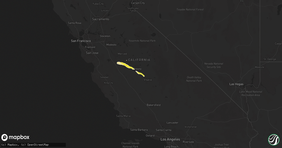
Hail Map on March 12, 2023
Get this storm
March 12 map
$229
one time, instant access
Download today. No call, no setup
Keep the $229
Bought the map and want the full workflow? Apply the entire $229 to a subscription within 7 days. None of it is wasted.
Every map, not just this one
This buys you this map. Subscription and you get every map we run, in the markets you choose from a few cities to whole states to nationwide. Plus real-time alerts the moment a storm fires.
Contact data
Name, contact info, occupancy, even credit band for addresses in the footprint. You go from where it hit to who to call.
Become the source they trust
Unlimited branding weather history reports on demand. You already have the documented answer ready for the property owner, and you are the one who showed up with it.
Property data and RoofTrace estimates
Pull up any address you have got, its value and the exact code rules for that jurisdiction, straight from One Click Code. Then RoofTrace estimates the squares, pitch, and roof value, priced the way you price.
States Impacted by Hail Map on March 12, 2023
Storm reports
Alabama
| Date | Description |
|---|---|
| 03/12/202312:02 PM CDT | Houston co 911 reports a tree down on waldo meadows rd near barnes rd. |
| 03/12/202310:38 AM CDT | Powerline down near cr15 and cr50. Location estimated. Time estimated via radar. |
| 03/12/202310:19 AM CDT | Powerline down along highway 166 near the elementary school. Location estimated. Time stamp estimated via radar. |
| 03/12/20239:26 AM CDT | Multiple trees down in the city of lanett... Some on homes... Generally in the vicinity of cherry drive and 1st street. |
| 03/12/20239:16 AM CDT | Trees down on interstate 85 near mm 79. |
| 03/12/20239:13 AM CDT | Tree down on county road 299. |
| 03/12/20238:52 AM CDT | Tree down near county road 11 and county road 37. |
| 03/12/20238:17 AM CDT | Wind damage involving utility poles down... Trees down... Roof shingles off... And sign damage. |
California
| Date | Description |
|---|---|
| 03/12/20236:55 PM CDT | Nws employee reports inch-sized hail east of firebaugh. |
| 03/11/20239:57 PM CST | Chp reports power pole broken in half and power lines on roadway on s fowler ave north of e kamm ave. |
| 03/11/20239:31 PM CST | Chp reports 30 foot tree in roadway on e saginaw ave west of temperance. |
| 03/11/20238:58 PM CST | Chp reports flooding on avenue 360. |
| 03/11/20238:55 PM CST | Chp reports flooding on highland ave at e dinuba ave. |
| 03/11/20238:22 PM CST | Chp reports tree and power lines caught on fire at s clovis ave north of e floral ave. |
| 03/11/20238:16 PM CST | Chp reports tree and power lines down on s fowler ave at e mountain view ave. |
| 03/11/20238:15 PM CST | Chp reports power pole and lines down on s chestnut ave at e dinuba ave. |
| 03/11/20238:14 PM CST | Chp reports tree crashed into house on s orange ave north of e dinuba ave. |
| 03/11/20238:11 PM CST | Chp reports tree damaged car on e nebraska ave at s clovis ave. |
| 03/11/20238:08 PM CST | Chp reports tree down on w saginaw ave west of elm. |
| 03/11/20238:04 PM CST | Chp reports tree down on e adams at s maple. Thunderstorm wind. |
| 03/11/20238:01 PM CST | Corrects previous tstm wnd dmg report from 6 sw fowler. Chp reports downed power lines e nebraska ave at s chestnut ave. |
New Mexico
| Date | Description |
|---|---|
| 03/11/20237:23 PM CST | Asos station kcqc clines corners 1 sse. |
Mississippi
| Date | Description |
|---|---|
| 03/12/20235:14 PM CDT | Reported in the brewer community. |
| 03/12/20235:07 PM CDT | Hail pictured next to a quarter along with a video of dime to quarter sized hail stones just south of quitman. |
| 03/12/20235:06 PM CDT | Occurred near quitman. |
| 03/12/20238:50 AM CDT | Tree blown down on divide rd reported by em. |
| 03/12/20238:40 AM CDT | Tree blown down at e lincoln rd @ carmel-new hope rd. |
| 03/12/20238:40 AM CDT | Corrects previous tstm wnd dmg report from 3 e topeka. Tree blown down on divide rd reported by em. |
| 03/12/20237:24 AM CDT | Large tree across hwy 553. |
| 03/11/20238:35 PM CST | Report from mping: quarter |
| 03/11/20238:31 PM CST | Multiple pictures sent via social media from wlox of hail around nickel to possibly ping pong size or larger along vidalia rd near necos. |
| 03/11/20238:25 PM CST | Pictures sent to wlox of hail around nickel to half dollar size covering the ground. Possibly larger hail in photo. Sent via social media. |
Florida
| Date | Description |
|---|---|
| 03/12/20234:30 PM CDT | Wakulla co 911 reports a tree fell onto a power line near iroquois rd. |
| 03/12/20233:32 PM CDT | Multiple reports of nickel to quarter-sized hail in hosford. Hail was falling for about 4 minutes. |
| 03/12/20233:05 PM CDT | Jefferson co 911 reports a tree fell onto a power line on lake rd near simpson rd. |
| 03/12/20231:09 PM CDT | Several trees and powerlines down near the intersection of gilberts mill road and kent road. Time estimated by radar. |
| 03/12/202312:20 PM CDT | Trees down on highway 162 west of old us road. Time estimated by radar. |
| 03/12/20231:20 AM CST | Em received a report from the alachua county sheriffs office saying trees were knocked down along se 57th ave. Also... A trampoline was blown into the neighbors yard. T |
| 03/12/202312:49 AM CST | Asos station kgnv gainesville. |
| 03/11/20236:30 PM CST | Lafayette co 911 reports a tree on a power line on e us 27 near county road 412. |
Georgia
| Date | Description |
|---|---|
| 03/12/20232:15 PM CDT | Awos station kbhc baxley muni. |
| 03/12/20232:15 PM CDT | Appling county em reports doors blown off their hinges at the baxley municipal airport hangers and airplanes. Time estimated by awos kbhc gust timing. |
| 03/12/20231:50 PM CDT | Thomas co 911 reports a tree down across hwy 33 at woodhaven rd. |
| 03/12/20231:35 PM CDT | Colquitt co 911 reports a cable line down on talmadge dt. |
| 03/12/20231:12 PM CDT | Mitchell co 911 reports a tree down on glausier st. |
| 03/12/20231:10 PM CDT | Mitchell co 911 reports a power line down on hwy 93. |
| 03/12/20231:07 PM CDT | Trees down on railroad street. Time estimated by radar. |
| 03/12/20231:02 PM CDT | Tree down on stagecoach road. Time estimated by radar. |
| 03/12/202311:15 AM CDT | Lee county 911 reports a tree down on pettis rd. |
Cities Impacted by Hail Map on March 12, 2023
- Union Church, MS
- Port Gibson, MS
- Hermanville, MS
- Pattison, MS
- Lorman, MS
- Waterproof, LA
- McCall Creek, MS
- Brookhaven, MS
- Fayette, MS
- Saint Joseph, LA
- Natchez, MS
- Meadville, MS
- Wesson, MS
- Baxley, GA
- Alma, GA
- Surrency, GA
- Odum, GA
- Hosford, FL
- Sopchoppy, FL
- Tallahassee, FL
- Telogia, FL
- Bristol, FL
- Ponce De Leon, FL
- Raleigh, MS
- Vernon, FL
- Chipley, FL
- Florence, MS
- Terry, MS
- Mize, MS
- Braxton, MS
- Caryville, FL
- Hahira, GA
- Barney, GA
- Morven, GA
- Crystal Springs, MS
- Grand Ridge, FL
- Dos Palos, CA
- Firebaugh, CA
- Madera, CA
- Taylorsville, MS
- Bay Springs, MS
- Louin, MS
- Pachuta, MS
- Quitman, MS
- Shubuta, MS
- Kerman, CA
- Fresno, CA
- Biola, CA
- Selma, CA
- Fowler, CA
- Kingsburg, CA
- Dinuba, CA
- Kiln, MS
- Pass Christian, MS
- Gulfport, MS
- Saucier, MS
- Traver, CA
- Chowchilla, CA
- Bonifay, FL
- Gilbertown, AL
- Needham, AL
- Harrisville, MS
- Pinola, MS
- Georgetown, MS
- Melvin, AL
- Altha, FL
- Magee, MS
- Toxey, AL
- Lacombe, LA
- Laurel, MS
- Paulding, MS
- Vossburg, MS
- Quincy, FL
- Bell City, LA
- Cameron, LA
- Lacassine, LA
- New Orleans, LA
- Slidell, LA
- Biloxi, MS
- Diamondhead, MS
- Long Beach, MS
- Vancleave, MS
- Panacea, FL
- Holt, FL
- Alachua, FL
- Gainesville, FL
- Hawthorne, FL
- Ormond Beach, FL