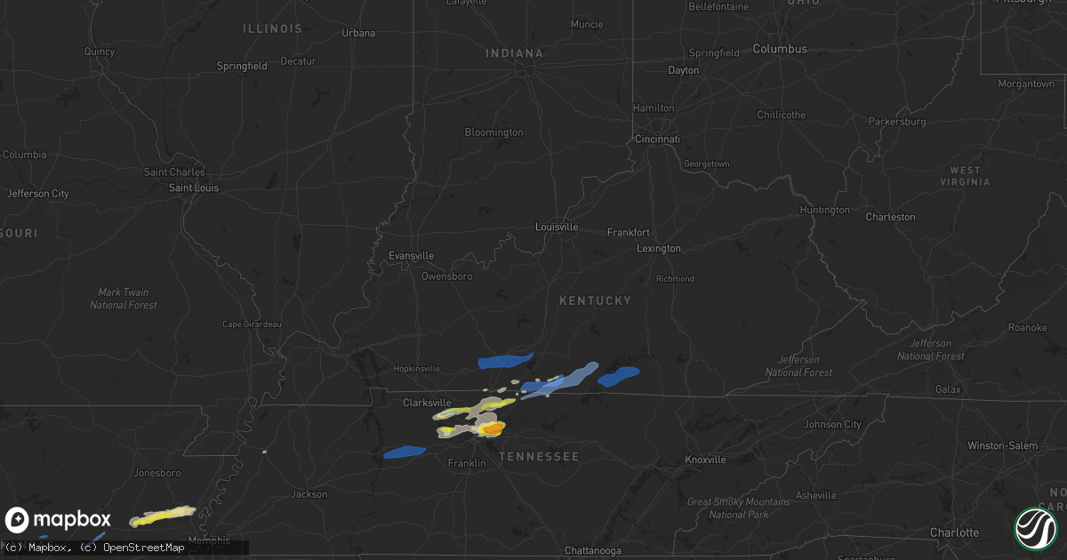
Hail Map in Kentucky on February 28, 2021
Get this storm
February 28 map
$229
one time, instant access
Download today. No call, no setup
Keep the $229
Bought the map and want the full workflow? Apply the entire $229 to a subscription within 7 days. None of it is wasted.
Every map, not just this one
This buys you this map. Subscription and you get every map we run, in the markets you choose from a few cities to whole states to nationwide. Plus real-time alerts the moment a storm fires.
Contact data
Name, contact info, occupancy, even credit band for addresses in the footprint. You go from where it hit to who to call.
Become the source they trust
Unlimited branding weather history reports on demand. You already have the documented answer ready for the property owner, and you are the one who showed up with it.
Property data and RoofTrace estimates
Pull up any address you have got, its value and the exact code rules for that jurisdiction, straight from One Click Code. Then RoofTrace estimates the squares, pitch, and roof value, priced the way you price.
Storm reports in Kentucky
Kentucky
| Date | Description |
|---|---|
| 02/28/20216:27 AM CST | Power lines down along poor farm road on the north side of murray. Time estimated from radar. |
| 02/28/20213:38 AM CST | At 937 AM CST, a severe thunderstorm was located near Memphis Junction, moving east at 60 mph. HAZARD...60 mph wind gusts. SOURCE...Radar indicated. IMPACT...Expect damage to roofs, siding, and trees. Locations impacted include... Bowling Green, Scottsville, Crestmoor, Memphis Junction, Mount Victor, Woodburn, Hardcastle, Allen Springs, West Fork and Rich Pond. |
| 02/28/20213:20 AM CST | At 920 PM EST, a severe thunderstorm was located over Zula, or 9 miles southwest of Monticello, moving east at 60 mph. HAZARD...60 mph wind gusts and penny size hail. SOURCE...Radar indicated. IMPACT...Expect damage to roofs, siding, and trees. Locations impacted include... Monticello, Whitley City, Burnside, Slavens, Susie, Sloans Valley, Barrier, Parnell, Gregory, Bronston, Slickford and Ritner. |
| 02/28/20212:14 AM CST | At 814 PM CST, severe thunderstorms were located along a line extending from 8 miles southwest of Jamestown to 7 miles west of Zula to near Albany, moving east at 60 mph. HAZARD...60 mph wind gusts. SOURCE...Radar indicated. IMPACT...Expect damage to roofs, siding, and trees. Locations impacted include... Albany, Desda, Cartwright, Snow, Cundiff, Savage, Ida, Seventy Six, Hobart and Aaron. |
| 02/28/202112:48 AM CST | At 647 PM CST, a severe thunderstorm was located near Springfield, moving east at 55 mph. HAZARD...60 mph wind gusts and penny size hail. SOURCE...Radar indicated. IMPACT...Expect damage to roofs, siding, and trees. Locations impacted include... Gallatin, Springfield, Hendersonville, Goodlettsville, White House, Millersville, Greenbrier, Coopertown, Westmoreland, Ridgetop, Cross Plains, Portland, Pleasant View, Orlinda, Mitchellville, Black Jack, Bethpage, Oak Grove, Bledsoe Creek State Park and Cottontown.This includes the following highways... Interstate 65 between mile markers 99 and 121. Interstate 24 between mile markers 25 and 31. |
| 02/27/20218:43 PM CST | Top portion of house blown off. Reports of a possible tornado. |
| 02/27/20218:30 PM CST | Substantial damage on 1009 n about 2.5 miles down from highway 90. Possible tornado. |
| 02/27/20218:22 PM CST | The national weather service survey concluded that a tornado tracked out of clinton county and briefly into wayne county... Before dissipating. Debris from clinton coun |
| 02/27/20218:18 PM CST | Ef1 tornado on the ground for 4 minutes... Continuing into far western portions of wayne county. It caused several uprooted and or snapped trees and structural damage t |
| 02/27/20218:18 PM CST | Reported several structures damaged along hwy 558. Time estimated from radar. |
| 02/27/20217:52 PM CST | Hwy 90 w had a road closure due to a downed utility pole. |
| 02/27/20217:44 PM CST | One tree down. |
All States Impacted by Hail Map on February 28, 2021
Cities Impacted by Hail Map on February 28, 2021
- Justin, TX
- Ponder, TX
- Tyronza, AR
- Turrell, AR
- Earle, AR
- Cherry Valley, AR
- Franklin, KY
- Portland, TN
- Sherman, TX
- Denison, TX
- Cartwright, OK
- Sadler, TX
- Pottsboro, TX
- Colbert, OK
- Pilot Point, TX
- Aubrey, TX
- Sawyer, OK
- Fort Towson, OK
- Westmoreland, TN
- Lebanon, TN
- Mount Juliet, TN
- Hendersonville, TN
- Whites Creek, TN
- Old Hickory, TN
- Goodlettsville, TN
- Gallatin, TN
- Nashville, TN
- Madison, TN
- Bennington, OK
- Boswell, OK
- Bokchito, OK
- Quitman, AR
- Wynne, AR
- Gilmore, AR
- Hickory Ridge, AR
- Marked Tree, AR
- Merkel, TX
- Tuscola, TX
- Greenbrier, TN
- White House, TN
- Whitesboro, TX
- Durant, OK
- Hendrix, OK
- Calera, OK
- Atoka, OK
- Story, AR
- Rosston, TX
- Muenster, TX
- Decatur, TX
- Era, TX
- Gainesville, TX
- Hugo, OK
- Cottontown, TN
- Bethpage, TN
- Chapmansboro, TN
- Cedar Hill, TN
- Ashland City, TN
- Pleasant View, TN
- Clarksville, TN
- Rhome, TX
- Fountain Run, KY
- Joelton, TN
- Leola, AR
- Malvern, AR
- Valley View, TX
- Adolphus, KY
- White Bluff, TN
- Scottsville, KY
- Springfield, TN
- Charlotte, TN
- Hermitage, TN
- Cross Plains, TN
- Southside, TN
- Tompkinsville, KY
- Mount Hermon, KY
- Parkin, AR
- Dyersburg, TN
- Red Boiling Springs, TN
- Lewisville, AR
- Riverdale, GA
- Oakland, KY
- Woodburn, KY
- Alvaton, KY
- Rockfield, KY
- Auburn, KY
- Glasgow, KY
- Bowling Green, KY
- Park City, KY
- Smiths Grove, KY
- Gamaliel, KY
- Holland, KY
- Monticello, KY
- Albany, KY
- Alpha, KY
- Burkesville, KY
- Krum, TX
- Grant, OK
- Valliant, OK
- Garvin, OK
- Potts Camp, MS
- Waterford, MS
- Abbeville, MS
- Holly Springs, MS
- Hickory Flat, MS
- Waverly, TN
- Hurricane Mills, TN
- Dickson, TN
- McEwen, TN
- Lafayette, TN
- Jamestown, KY
- Searcy, AR
- Griffithville, AR
- Augusta, AR
- Romance, AR
- Mount Vernon, AR
- Okolona, AR
- Gurdon, AR
- Delight, AR
- Arkadelphia, AR
- McCaskill, AR


