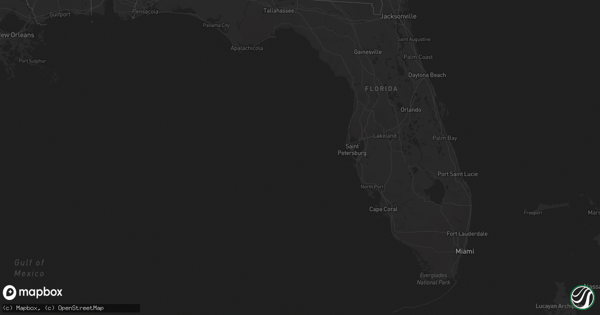
Hail Map in Florida on February 24, 2012
Get this storm
February 24 map
$229
one time, instant access
Download today. No call, no setup
Keep the $229
Bought the map and want the full workflow? Apply the entire $229 to a subscription within 7 days. None of it is wasted.
Every map, not just this one
This buys you this map. Subscription and you get every map we run, in the markets you choose from a few cities to whole states to nationwide. Plus real-time alerts the moment a storm fires.
Contact data
Name, contact info, occupancy, even credit band for addresses in the footprint. You go from where it hit to who to call.
Become the source they trust
Unlimited branding weather history reports on demand. You already have the documented answer ready for the property owner, and you are the one who showed up with it.
Property data and RoofTrace estimates
Pull up any address you have got, its value and the exact code rules for that jurisdiction, straight from One Click Code. Then RoofTrace estimates the squares, pitch, and roof value, priced the way you price.
Storm reports in Florida
Florida
| Date | Description |
|---|---|
| 02/24/20121:22 PM CST | Tree down making road impassable at centerville road near chemonie crossing. |
| 02/24/20121:22 PM CST | Tre down on veterans memorial drive about 2 miles south of the florida/georgia state line blocking 1 lane of traffic |
| 02/24/20121:18 PM CST | 1 tree down on capital circle and village way |
| 02/24/201211:37 AM CST | Tree down 3 miles south of malone in jackson county. |
| 02/24/201210:48 AM CST | Tree down 3 miles south of malone in jackson county. |
All States Impacted by Hail Map on February 24, 2012
Cities Impacted by Hail Map on February 24, 2012
- Aiken, SC
- Warrenville, SC
- North Augusta, SC
- Augusta, GA
- Grovetown, GA
- Graniteville, SC
- Beech Island, SC
- Gloverville, SC
- Montgomery, AL
- Quinton, VA
- Sandston, VA
- Midlothian, VA
- Henrico, VA
- Richmond, VA
- Chesterfield, VA
- Mechanicsville, VA
- Harlem, GA
- Equality, AL
- Pine Mountain, GA
- Lagrange, GA
- West Point, GA
- Alma, GA
- Nicholls, GA
- Douglas, GA
- Axson, GA
- Millwood, GA
- Richlands, NC
- Rose Hill, NC
- Trenton, NC
- Pink Hill, NC
- Kenansville, NC
- Beulaville, NC
- Magnolia, NC
- Sparta, GA
- Columbia, SC
- Elgin, SC
- Hopkins, SC
- Camden, AL
- Pine Hill, AL
- Thomasville, AL
- Arlington, AL
- Catherine, AL
- Lenox, GA
- Enigma, GA
- Hephzibah, GA
- Thomson, GA
- Dearing, GA
- Mitchell, GA
- Warrenton, GA
- Jewell, GA
- Eatonton, GA
- Tobaccoville, NC
- Chester, VA
- Hayneville, AL
- Wingate, MD
- Vienna, MD
- Toddville, MD
- Crapo, MD
- Lugoff, SC
- Norwood, GA
- Monticello, GA
- Jackson, GA
- Flovilla, GA
- Barnesville, GA
- Forsyth, GA
- Ridgeway, SC
- Blythewood, SC
- Savannah, GA
- Pearson, GA
- Nashville, GA
- Willacoochee, GA
- Tyler, AL
- Minter, AL
- Tybee Island, GA
- Norman Park, GA
- Moultrie, GA
- Sumner, GA
- Omega, GA
- Doerun, GA
- Letohatchee, AL
- Hope Hull, AL
- Sardis, AL
- Warm Springs, GA
- Greenville, GA
- Dadeville, AL
- Alexander City, AL
- Waverly, AL
- Lanett, AL
- Camp Hill, AL
- Lafayette, AL
- Jacksons Gap, AL
- Crewe, VA
- Amelia Court House, VA
- Blackstone, VA
- Bascom, FL
- Greenwood, FL
- Rembert, SC
- Allendale, SC
- Saint Stephen, SC
- Pineville, SC
- Tifton, GA
- Pooler, GA
- Leroy, AL
- Wagarville, AL
- Locust Grove, GA
- Richmond Hill, GA
- Milledgeville, GA
- Hillsboro, GA
- Milner, GA
- Vredenburgh, AL
- Whatley, AL
- Franklin, AL
- Orrum, NC
- Fairmont, NC
- Lake View, SC
- Turkey, NC
- Warsaw, NC
- Fort Stewart, GA
- Hinesville, GA
- Ludowici, GA
- Beaumont, MS
- Neely, MS
- New Augusta, MS
- Hattiesburg, MS
- Patuxent River, MD
- Jackson, AL
- Seaford, DE
- Baxley, GA
- Alberta, AL
- East Bend, NC
- Germanton, NC
- Pinnacle, NC
- King, NC
- Walnut Cove, NC
- Griffin, GA
- State Line, MS
- Leakesville, MS
- Purvis, MS
- Wedgefield, SC
- Lexington Park, MD
- Saint Matthews, SC
- Petal, MS
- Richton, MS
- Federalsburg, MD
- Surrency, GA
- Frisco City, AL
- Grove Hill, AL
- Gainestown, AL
- Hogansville, GA
- Grantville, GA
- Sylvania, GA
- Hazlehurst, GA
- Franklin, GA
- Glennville, GA
- Pinewood, SC
- Cameron, SC
- Orangeburg, SC
- Haddock, GA
- Zebulon, GA
- Lumberton, MS
- McLain, MS
- North, SC
- Camden, SC
- Peterman, AL
- Sumter, SC
- Winston Salem, NC
- Rural Hall, NC
- Williamson, GA
- Sale City, GA
- Camilla, GA
- Pfafftown, NC
- Five Points, AL
- Mershon, GA
- Covington, GA
- Mansfield, GA
- Lowndesboro, AL
- Monroeville, AL
- Fleming, GA
- Ambrose, GA
- Roanoke, AL
- Selma, AL
- Lane, SC
- Trenton, SC
- Deer Park, AL
- Sunflower, AL
- Tibbie, AL
- Hartsfield, GA
- Rhodesdale, MD
- Alapaha, GA
- Deep Run, NC
- Bladenboro, NC
- Clarkton, NC
- Evergreen, NC
- Hickory, NC
- Stony Point, NC
- Conover, NC
- Claremont, NC


