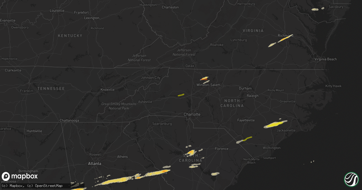
Hail Map on February 24, 2012
Get this storm
February 24 map
$229
one time, instant access
Download today. No call, no setup
Keep the $229
Bought the map and want the full workflow? Apply the entire $229 to a subscription within 7 days. None of it is wasted.
Every map, not just this one
This buys you this map. Subscription and you get every map we run, in the markets you choose from a few cities to whole states to nationwide. Plus real-time alerts the moment a storm fires.
Contact data
Name, contact info, occupancy, even credit band for addresses in the footprint. You go from where it hit to who to call.
Become the source they trust
Unlimited branding weather history reports on demand. You already have the documented answer ready for the property owner, and you are the one who showed up with it.
Property data and RoofTrace estimates
Pull up any address you have got, its value and the exact code rules for that jurisdiction, straight from One Click Code. Then RoofTrace estimates the squares, pitch, and roof value, priced the way you price.
States Impacted by Hail Map on February 24, 2012
Storm reports
South Carolina
| Date | Description |
|---|---|
| 02/24/20124:35 PM CST | Tree down on car on north magnolia ave. |
| 02/24/20124:12 PM CST | 2 homes damaged. 1 shed destroyed. Numerous trees down. Reports along 300 block of forks road. Time estimated based on radar. |
| 02/24/20124:11 PM CST | 1 home destroyed. Roof blown off a house. Powerlines down. |
| 02/24/20124:09 PM CST | A national weather service damage survey team has confirmed that an ef-1 tornado touched down near islandton south carolina. The winds were estimated to be 85 to 90 mph |
| 02/24/20124:06 PM CST | Trees down along hopewell road. |
| 02/24/20124:06 PM CST | Possible tornado. 3 houses damaged. 1 destroyed. No injuries. 582 jamison road near islandton. Time estimated based on radar. |
| 02/24/20123:53 PM CST | Trees down along augusta stage coach road. |
| 02/24/20121:38 PM CST | Public reported half dollar size hail |
| 02/24/20121:26 PM CST | Trees down blocking twin church rd near peniel rd and matthews ln. |
| 02/24/201212:58 PM CST | Public report half dollar size hail |
| 02/24/201212:51 PM CST | The sumter emergency manager and sheriff reported a tornado with intermittent touchdowns from sparkleberry landing rd...near lake marion...to west avenue on the southwe |
| 02/24/201212:50 PM CST | Several large limbs blown from tree tops and across pine needles rd near i-95. |
| 02/24/201212:50 PM CST | 10 inch diameter oak tree snapped on tiffany dr. |
| 02/24/201212:48 PM CST | Public report of golf ball size hail |
| 02/24/201212:47 PM CST | Public report of golf ball size hail |
| 02/24/201212:25 PM CST | Public reported trees down in rembert area |
| 02/24/201212:20 PM CST | Emergency manager reported trees down along hwy 321 from woodford to north from bow echo winds. |
| 02/24/201212:15 PM CST | Broadcast media reported a tornado touched down near the town of north. |
| 02/24/201212:07 PM CST | Nws storm survey has confirmed an ef-2 tornado touched down near the aiken/lexington county line. The winds were estimated to have reached up to 130 mph. The path lengt |
| 02/24/201211:48 AM CST | Trees down in granitville. Wind estimated at 70 mph. |
| 02/24/201211:48 AM CST | Golf ball size hail reported in granitville. |
| 02/24/201211:45 AM CST | Shingles off building near lanney walker blvd and gordon highway estimated wind gusts to 60 mph |
| 02/24/201211:45 AM CST | At lanney walker blvd and gordon highway |
| 02/24/201211:40 AM CST | Trees down on pine log road south aiken |
| 02/24/201211:40 AM CST | Power lines and trees down on highway 21. |
| 02/24/201211:40 AM CST | Trees down in roadway us 321 at pinegrove road reported by sc highway patrol. |
| 02/24/201211:40 AM CST | Tree on mobile home on bath lake road burnettetown reported by skywarn. |
| 02/24/201211:40 AM CST | Trees reported down in north augusta. |
Maryland
| Date | Description |
|---|---|
| 02/24/20123:00 PM CST | Widespread trees and power lines down across the area. Some power poles are snapped. |
| 02/24/20123:00 PM CST | Numerous trees down and poles snapped near miles circle. |
| 02/24/20122:52 PM CST | A local report indicates 1.00 inch wind near PATUXENT RIVER NAS |
| 02/24/20122:51 PM CST | Tree down at 348 radiance dr |
| 02/24/20122:50 PM CST | Tractor trailer blown over |
| 02/24/20121:51 PM CST | A local report indicates 60 MPH wind near 1 ENE NORTHWOOD |
Tennessee
| Date | Description |
|---|---|
| 02/24/20128:38 AM CST | Quarter sized hail near rogersville. |
| 02/24/20128:38 AM CST | Trees down near rogersville. |
Florida
| Date | Description |
|---|---|
| 02/24/20121:22 PM CST | Tree down making road impassable at centerville road near chemonie crossing. |
| 02/24/20121:22 PM CST | Tre down on veterans memorial drive about 2 miles south of the florida/georgia state line blocking 1 lane of traffic |
| 02/24/20121:18 PM CST | 1 tree down on capital circle and village way |
| 02/24/201211:37 AM CST | Tree down 3 miles south of malone in jackson county. |
| 02/24/201210:48 AM CST | Tree down 3 miles south of malone in jackson county. |
Georgia
| Date | Description |
|---|---|
| 02/24/20124:11 PM CST | Tree down on powerline. |
| 02/24/20124:08 PM CST | A trained spotter reported several large trees blown down in shelman bluff. Time estimated from radar. |
| 02/24/20124:06 PM CST | A trained weather spotter reported several trees blown down across youngman road. Time estimated from radar. |
| 02/24/20123:20 PM CST | Public report of trees down and trampolines flipped in screven. Time estimated by radar. |
| 02/24/20123:11 PM CST | Tree down on powerline. |
| 02/24/20123:11 PM CST | Power lines down across yard. |
| 02/24/20123:11 PM CST | Powerlines down down and sparking on fence near the intersection of 65th street and habersham street. |
| 02/24/20123:11 PM CST | Tree blown down on top of cars. |
| 02/24/20123:07 PM CST | A nws damage survey team has determined the damage observed south of downtown savannah near hunter army airfield was caused by straight line winds and not a tornado. Pe |
| 02/24/20123:03 PM CST | 5 homes and a few cars damaged along with a power pole snapped in half near dutchtown road and middleground road. Time estimated by radar. |
| 02/24/20123:03 PM CST | 3 homes damaged and several oak trees down near windsor forest high school. Time estimated by radar. |
| 02/24/20123:02 PM CST | Numerous trees reported down across southern portions of chatham county. |
| 02/24/20122:55 PM CST | Tree reported down near river road by 911 call center. Time estimated by radar. |
| 02/24/20122:42 PM CST | Several powerlines down near the intersection of wilshire blvd and white bluff road. |
| 02/24/20122:30 PM CST | 2 trees down and pea size hail on meadow road. |
| 02/24/20122:20 PM CST | Powerlines down near highway 203. Time estimated by radar. |
| 02/24/20122:10 PM CST | A tree in the road was reported on bennett still highway. |
| 02/24/20121:59 PM CST | The glennville post office reported trees down along georgia state road 205 between glennville and daisy. Time estimated from radar. |
| 02/24/20121:16 PM CST | Scattered trees down in the northern part of the county. |
| 02/24/20121:04 PM CST | Scattered trees down in the northern part of the county. |
| 02/24/201212:50 PM CST | 1 tree down near county line |
| 02/24/201212:50 PM CST | Public report on the walb-tv facebook page of a barn blown down near the tift/cook county line just off of i-75. |
| 02/24/201212:45 PM CST | Public report via walb-tv facebook page of bent trampoline...busted siding...and furniture blown against a fence near cotton. |
| 02/24/201212:45 PM CST | Confirmed ef0 tornado touched down in the vicinity of ellenton omega road and traveled northeastward around 3 miles while skipping up and down before lifting permanentl |
| 02/24/201211:58 AM CST | Trees and telephone lines down in camilla. |
| 02/24/201211:41 AM CST | Media reports estimated one inch hail in north augusta. |
| 02/24/201211:40 AM CST | A local report indicates 1.25 inch wind near 1 N AUGUSTA |
| 02/24/201211:40 AM CST | Numerous trees down and dime size hail at alexander drive and washington road. |
| 02/24/201211:30 AM CST | A local report indicates 1.00 inch wind near GROVETOWN |
| 02/24/201211:25 AM CST | One inch hail reported in harlem ga. |
| 02/24/201211:20 AM CST | Law enforcement reports numerous trees and power lines down across the southern portion of the county. |
| 02/24/201211:15 AM CST | Trees down on hwy 278 just north of i-20 west of thompson |
| 02/24/201211:15 AM CST | Trees and power lines down in dearing area. |
| 02/24/201211:11 AM CST | One tree down on grady bell road. |
| 02/24/201210:54 AM CST | A spotter reported this event to this office. |
| 02/24/201210:30 AM CST | A few trees down in camak. |
| 02/24/201210:27 AM CST | A couple of trees blown down in norwood. |
| 02/24/201210:23 AM CST | Power line down in the twin bridges area. |
| 02/24/201210:20 AM CST | 10-15 trees down in the vicinity of hwy 11 and clay tillman rd. |
| 02/24/201210:20 AM CST | One tree down on hwy 129. |
| 02/24/201210:15 AM CST | More than a dozen trees down from around hwy 83s and clay road south to the county line. |
| 02/24/20129:45 AM CST | The putnam 911 center reported trees down along route 129 and trees down in eatonton as well as traffic lights out. |
| 02/24/20129:36 AM CST | 911 center reported a tree limb down in zebulon. |
| 02/24/20129:20 AM CST | 10-15 trees down in the vicinity of hwy 11 and clay tillman rd. |
| 02/24/20129:18 AM CST | The 911 center reported a few trees and a few powerlines blown down near us hwy 278. |
| 02/24/20129:15 AM CST | More than a dozen trees down from around hwy 83s and clay road south to the county line. |
| 02/24/20129:05 AM CST | The 911 center reported a few power lines down along willow run road. |
| 02/24/20128:55 AM CST | Several trees were blown down near u.s. Highway 129. |
| 02/24/20128:05 AM CST | A tree was blown down near adams road and georgia highway 18 in troup county. |
| 02/24/20128:05 AM CST | A local report indicates 1.75 inch wind near 6 SE LAGRANGE |
Ohio
| Date | Description |
|---|---|
| 02/24/201211:16 AM CST | Large branches broken. |
North Carolina
| Date | Description |
|---|---|
| 02/24/20124:45 PM CST | One tree down between western blvd. And hillsborough st. |
| 02/24/20124:25 PM CST | One tree down |
| 02/24/20124:13 PM CST | One tree down at nc 87 and l and w lane |
| 02/24/20124:10 PM CST | One tree down on a power pole on walter street. |
| 02/24/20124:06 PM CST | Scattered trees and power lines down throughout the county. |
| 02/24/20123:41 PM CST | Several trees down from hurdle mills to the orange county line |
| 02/24/20123:41 PM CST | One tree down |
| 02/24/20123:40 PM CST | Power pole broken and power lines down on erect rd. |
| 02/24/20123:24 PM CST | Tree down at south main street in denton |
| 02/24/20123:23 PM CST | Tree down on power line at old cedar falls rd. |
| 02/24/20123:23 PM CST | Tree down at cedar falls rd and henley country rd. |
| 02/24/20123:17 PM CST | Tree down at hwy 64 at davidson randolph county line |
| 02/24/20123:05 PM CST | Tree down on westridge rd. |
| 02/24/20123:04 PM CST | Multiple reports of trees down in northern greensboro. |
| 02/24/20122:59 PM CST | Trees down at 6868 styers ferry rd. |
| 02/24/20122:56 PM CST | Shed roof blown off. |
| 02/24/20122:56 PM CST | Trees down |
| 02/24/20122:49 PM CST | Trees down at the intersection of 7154 martin ferry rd. And donnaha rd. |
| 02/24/20122:35 PM CST | One tree down on interstate business 40. |
| 02/24/20122:31 PM CST | Tree down at the intersection of barney hall rd and high point rd. |
| 02/24/20122:23 PM CST | Trees down at 6868 styers ferry rd. |
| 02/24/20122:20 PM CST | Quarter size hail reported on highway 41 |
| 02/24/20122:15 PM CST | Quarter size hail. Chicken coop and goat house both destroyed. Time estimated by radar. |
| 02/24/20122:05 PM CST | Spotter reported quarter size hail nw of richlands |
| 02/24/20121:57 PM CST | *** 1 inj *** duplin co emergency manager relayed major mobile home damage with 1 vehicle totaled and 1 injury. |
| 02/24/20121:55 PM CST | Broadcast media relayed public report of quarter size hail in beulaville. |
| 02/24/20121:50 PM CST | Broadcast media relayed report of quarter to golf ball sized hail just south of beulaville |
| 02/24/20121:49 PM CST | Trees down at the intersection of 7154 martin ferry rd. And donnaha rd. |
| 02/24/20121:47 PM CST | Emergency manager relayed report of powerlines down north of kenansville on williams road. |
| 02/24/20121:45 PM CST | Numerous trees down in tobaccoville. |
| 02/24/20121:45 PM CST | Report relayed from media... Public reports trees down in magnolia with hail. |
| 02/24/20121:45 PM CST | Near golf ball sized hail and numerous trees down in tobaccoville. |
| 02/24/20121:31 PM CST | Near intersection of snow creek road and springs road. |
| 02/24/20121:30 PM CST | Nickel to quarter hail in riverbend park. |
| 02/24/20121:16 PM CST | Nickel to quarter size hail fell for 5 minutes starting at 216 pm. |
| 02/24/201211:36 AM CST | Tin roof blown off out-building. |
Mississippi
| Date | Description |
|---|---|
| 02/24/20128:28 AM CST | Numerous pine trees were snapped and are blocking the roads approximately five miles south of state line...ms. |
| 02/24/20128:00 AM CST | A local report indicates 1.75 inch wind near NEW AUGUSTA |
| 02/24/20127:39 AM CST | Occurred on jb horne rd along with 50 mph winds. |
Alabama
| Date | Description |
|---|---|
| 02/24/201212:01 PM CST | A few trees were blown down near eufaula. Winds were estimated around 50 mph. |
| 02/24/201211:30 AM CST | A few trees were blown down in northern barbour county near comer. Winds were estimated around 50 mph. |
| 02/24/201210:56 AM CST | Emergency manager reported a horse shed that was blown over and destroyed along n. Goshen road. |
| 02/24/201210:43 AM CST | A few trees were blown down in far southern montgomery county near highway 231. Winds were estimated around 50 mph. |
| 02/24/201210:26 AM CST | Tree down along mill pond road. Crews dispatched to clear roadway. Winds est at 40kts. |
| 02/24/201210:24 AM CST | Quarter size hail reported along county road 33. |
| 02/24/201210:24 AM CST | Several trees were blown down near interstate 65. |
| 02/24/201210:05 AM CST | Numerous trees reported down along i-65 near greenville |
| 02/24/20129:50 AM CST | Moth ball to quarter size hail was reported near the wilcox and dallas county line. Some of the hail was covering the ground. |
| 02/24/20129:43 AM CST | Several trees were blown down near interstate 65. |
| 02/24/20129:40 AM CST | Large branches and a tree knocked down between wetumpka and eclectic. Winds estimated around 45 mph. |
| 02/24/20129:30 AM CST | A tree was blown down on redland road and blocked the roadway. The winds were estimated around 40 mph. |
| 02/24/20129:26 AM CST | A tree was blown down near holtville and blocked the roadway. Winds were estiamted around 40 mph. |
| 02/24/20129:25 AM CST | A local report indicates 1.00 inch wind near HAYNEVILLE |
| 02/24/20129:17 AM CST | Tree damage reported on bridalwood path roughly a half mile northeast of where harper head start school was damaged. |
| 02/24/20129:15 AM CST | Harper headstart school sustained roof damage. |
| 02/24/20129:11 AM CST | A tree was blown down on bond road near deatsville and it blocked the roadway. Winds were estimated around 40 mph. |
| 02/24/20127:50 AM CST | Several pine trees were snapped and one utility building was overturned in the city of lanett. |
| 02/24/20126:49 AM CST | A tree fell into the roadway and a vehicle ran into it. Winds were estimated around 45 mph. |
Virginia
| Date | Description |
|---|---|
| 02/24/20125:25 PM CST | Ef0 tornado damaged several buildings and downed trees. |
| 02/24/20125:25 PM CST | Several reports of wind damage in the the davis creek and marina area. |
| 02/24/20124:30 PM CST | Trees down |
| 02/24/20123:48 PM CST | 1.25 to 1.5 inch hail reported by observer |
| 02/24/20123:45 PM CST | Golfball size hail reported at chippenham and rte 10 |
| 02/24/20123:44 PM CST | 1 inch hail reported at the chesterfield county airport |
| 02/24/20123:31 PM CST | Trees down on hitesburg church rd |
| 02/24/20123:30 PM CST | Hail covering the ground quala and spring run |
| 02/24/20121:35 PM CST | Tree down on power line |
| 02/24/201212:52 PM CST | Trees down across shooting creek road. |
| 02/24/201212:50 PM CST | 2 large trees were blown down in the town of amherst. |
| 02/24/201212:34 PM CST | Power lines down on burnt chimney road |
| 02/24/201212:30 PM CST | Tree down |
| 02/24/201212:30 PM CST | A few large tree limbs were blown down in the community of fincastle. |
| 02/24/201212:27 PM CST | Tree down on colonial road. |
| 02/24/201212:25 PM CST | Tree down |
| 02/24/20129:05 AM CST | A local report indicates 1.00 inch wind near GATE CITY |
| 02/24/20129:05 AM CST | One tree down on majestic drive. |
Delaware
| Date | Description |
|---|---|
| 02/24/20123:17 PM CST | A local report indicates 1.00 inch wind near BLADES |
| 02/24/20123:17 PM CST | Roof blown off... Wires down... Poles down... Large tree down |
Cities Impacted by Hail Map on February 24, 2012
- Aiken, SC
- Warrenville, SC
- North Augusta, SC
- Augusta, GA
- Grovetown, GA
- Graniteville, SC
- Beech Island, SC
- Gloverville, SC
- Montgomery, AL
- Quinton, VA
- Sandston, VA
- Midlothian, VA
- Henrico, VA
- Richmond, VA
- Chesterfield, VA
- Mechanicsville, VA
- Harlem, GA
- Equality, AL
- Pine Mountain, GA
- Lagrange, GA
- West Point, GA
- Alma, GA
- Nicholls, GA
- Douglas, GA
- Axson, GA
- Millwood, GA
- Richlands, NC
- Rose Hill, NC
- Trenton, NC
- Pink Hill, NC
- Kenansville, NC
- Beulaville, NC
- Magnolia, NC
- Sparta, GA
- Columbia, SC
- Elgin, SC
- Hopkins, SC
- Camden, AL
- Pine Hill, AL
- Thomasville, AL
- Arlington, AL
- Catherine, AL
- Lenox, GA
- Enigma, GA
- Hephzibah, GA
- Thomson, GA
- Dearing, GA
- Mitchell, GA
- Warrenton, GA
- Jewell, GA
- Eatonton, GA
- Tobaccoville, NC
- Chester, VA
- Hayneville, AL
- Wingate, MD
- Vienna, MD
- Toddville, MD
- Crapo, MD
- Lugoff, SC
- Norwood, GA
- Monticello, GA
- Jackson, GA
- Flovilla, GA
- Barnesville, GA
- Forsyth, GA
- Ridgeway, SC
- Blythewood, SC
- Savannah, GA
- Pearson, GA
- Nashville, GA
- Willacoochee, GA
- Tyler, AL
- Minter, AL
- Tybee Island, GA
- Norman Park, GA
- Moultrie, GA
- Sumner, GA
- Omega, GA
- Doerun, GA
- Letohatchee, AL
- Hope Hull, AL
- Sardis, AL
- Warm Springs, GA
- Greenville, GA
- Dadeville, AL
- Alexander City, AL
- Waverly, AL
- Lanett, AL
- Camp Hill, AL
- Lafayette, AL
- Jacksons Gap, AL
- Crewe, VA
- Amelia Court House, VA
- Blackstone, VA
- Bascom, FL
- Greenwood, FL
- Rembert, SC
- Allendale, SC
- Saint Stephen, SC
- Pineville, SC
- Tifton, GA
- Pooler, GA
- Leroy, AL
- Wagarville, AL
- Locust Grove, GA
- Richmond Hill, GA
- Milledgeville, GA
- Hillsboro, GA
- Milner, GA
- Vredenburgh, AL
- Whatley, AL
- Franklin, AL
- Orrum, NC
- Fairmont, NC
- Lake View, SC
- Turkey, NC
- Warsaw, NC
- Fort Stewart, GA
- Hinesville, GA
- Ludowici, GA
- Beaumont, MS
- Neely, MS
- New Augusta, MS
- Hattiesburg, MS
- Patuxent River, MD
- Jackson, AL
- Seaford, DE
- Baxley, GA
- Alberta, AL
- East Bend, NC
- Germanton, NC
- Pinnacle, NC
- King, NC
- Walnut Cove, NC
- Griffin, GA
- State Line, MS
- Leakesville, MS
- Purvis, MS
- Wedgefield, SC
- Lexington Park, MD
- Saint Matthews, SC
- Petal, MS
- Richton, MS
- Federalsburg, MD
- Surrency, GA
- Frisco City, AL
- Grove Hill, AL
- Gainestown, AL
- Hogansville, GA
- Grantville, GA
- Sylvania, GA
- Hazlehurst, GA
- Franklin, GA
- Glennville, GA
- Pinewood, SC
- Cameron, SC
- Orangeburg, SC
- Haddock, GA
- Zebulon, GA
- Lumberton, MS
- McLain, MS
- North, SC
- Camden, SC
- Peterman, AL
- Sumter, SC
- Winston Salem, NC
- Rural Hall, NC
- Williamson, GA
- Sale City, GA
- Camilla, GA
- Pfafftown, NC
- Five Points, AL
- Mershon, GA
- Covington, GA
- Mansfield, GA
- Lowndesboro, AL
- Monroeville, AL
- Fleming, GA
- Ambrose, GA
- Roanoke, AL
- Selma, AL
- Lane, SC
- Trenton, SC
- Deer Park, AL
- Sunflower, AL
- Tibbie, AL
- Hartsfield, GA
- Rhodesdale, MD
- Alapaha, GA
- Deep Run, NC
- Bladenboro, NC
- Clarkton, NC
- Evergreen, NC
- Hickory, NC
- Stony Point, NC
- Conover, NC
- Claremont, NC