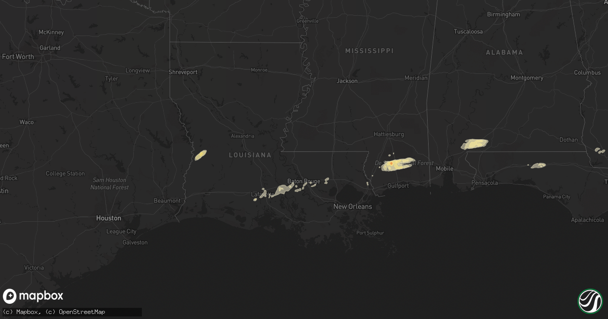
Hail Map in Louisiana on February 18, 2012
Get this storm
February 18 map
$229
one time, instant access
Download today. No call, no setup
Keep the $229
Bought the map and want the full workflow? Apply the entire $229 to a subscription within 7 days. None of it is wasted.
Every map, not just this one
This buys you this map. Subscription and you get every map we run, in the markets you choose from a few cities to whole states to nationwide. Plus real-time alerts the moment a storm fires.
Contact data
Name, contact info, occupancy, even credit band for addresses in the footprint. You go from where it hit to who to call.
Become the source they trust
Unlimited branding weather history reports on demand. You already have the documented answer ready for the property owner, and you are the one who showed up with it.
Property data and RoofTrace estimates
Pull up any address you have got, its value and the exact code rules for that jurisdiction, straight from One Click Code. Then RoofTrace estimates the squares, pitch, and roof value, priced the way you price.
Storm reports in Louisiana
Louisiana
| Date | Description |
|---|---|
| 02/18/201212:40 PM CST | Several trees blown down. |
| 02/18/201212:35 PM CST | Several trees blown down. |
| 02/18/201212:15 PM CST | Several trees blown down on cars vicinity of green street north of abita springs. |
| 02/18/201212:15 PM CST | Sherrifs office reported several trees blown down in north and northeast portion of parish from north of covington to near bush. |
| 02/18/201212:12 PM CST | Nws survey conducted in abita springs. Damage is mainly trees and some powerlines all in one direction. Damage is widespread and lacks a clear path. Survey results show |
| 02/18/201211:40 AM CST | Several trees blown down. Time based on radar. |
| 02/18/201211:35 AM CST | Several trees blown down. Time based on radar. |
| 02/18/201211:10 AM CST | Sheriffs office reported several trees down in southwest portion of parish in the vicinity of highway 16 and 1033. |
| 02/18/201210:40 AM CST | One tree was blown down in the st grarbiel area. |
| 02/18/201210:35 AM CST | Nickel to quarter sized hail observed by west baton rouge sheriffs in port allen. |
| 02/18/201210:20 AM CST | Tree blown down along with power line. |
| 02/18/201210:15 AM CST | Several large limbs snapped. Small metal storage sheds displaced. |
| 02/18/20129:45 AM CST | Public reported winds of 50 to 60 mph along ambassador caffrey boulevard |
| 02/18/20129:43 AM CST | A local report indicates 1.00 inch wind near BREAUX BRIDGE |
| 02/18/20129:30 AM CST | Katc report of estimated 75 mph wind gust on the south side of lafayette with the bow echo. |
| 02/18/20129:30 AM CST | Public reported floor shaking and freight train sound |
| 02/18/20129:10 AM CST | Power poles were blown down. |
| 02/18/20129:00 AM CST | Power lines and trees down from ih10 along la hwy 26 to about 3 miles south of ih10 |
| 02/18/20128:53 AM CST | A weak tornado touched down along highway 14 and 717 near klondike...ripped part of a metal roof off a barn...snapped a couple of telephone poles and trees. This tornad |
| 02/18/20128:04 AM CST | A local report indicates 63 MPH wind near 4 WNW GRAND LAKE |
| 02/18/20128:00 AM CST | A local report indicates 60 MPH wind near 10 E GRAND LAKE |
| 02/18/20127:50 AM CST | Power lines blown down. |
| 02/18/20127:45 AM CST | Tree reported across beglis parkway in sulphur. |
Cities Impacted by Hail Map on February 18, 2012
- San Saba, TX
- Voca, TX
- Saint Martinville, LA
- Grosse Tete, LA
- Adel, GA
- Atmore, AL
- Perdido, AL
- Flomaton, AL
- Brewton, AL
- Goldthwaite, TX
- Perkinston, MS
- Wiggins, MS
- Iron City, GA
- Brinson, GA
- Sparks, GA
- Moultrie, GA
- Maurice, LA
- Rayne, LA
- Kaplan, LA
- Coolidge, GA
- Meigs, GA
- Lucedale, MS
- Poplarville, MS
- McHenry, MS
- Picayune, MS
- Carriere, MS
- Duson, LA
- Ochlocknee, GA
- Richland Springs, TX
- Nashville, GA
- Abita Springs, LA
- Tifton, GA
- Lenox, GA
- Omega, GA
- Livingston, LA
- Springfield, LA
- Holden, LA
- Saucier, MS
- Vancleave, MS
- Berlin, GA
- Deridder, LA
- Merryville, LA
- Leesville, LA
- Norman Park, GA
- Ellenton, GA
- Pelham, GA
- Camilla, GA
- Whigham, GA
- Sale City, GA
- Fredonia, TX
- Mason, TX
- Brady, TX
- Funston, GA
- Lakeland, GA
- Hartsfield, GA
- Westville, FL
- Ponce De Leon, FL
- Defuniak Springs, FL
- Bainbridge, GA
- Doerun, GA
- Brooklyn, MS
- Lafayette, LA
- Carencro, LA
- Sunshine, LA
- Plaquemine, LA
- Pearl River, LA
- Valdosta, GA
- Broussard, LA
- Breaux Bridge, LA
- Denham Springs, LA
- Baton Rouge, LA
- Stockton, AL
- Little River, AL
- Pavo, GA
- Barney, GA
- Lumberton, MS
- Albany, LA
- Hammond, LA
- Addis, LA
- Port Allen, LA
- Prairieville, LA
- Greenville, FL


