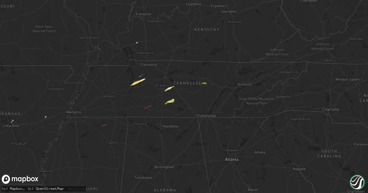
Hail Map in Tennessee on February 16, 2023
Get this storm
February 16 map
$229
one time, instant access
Download today. No call, no setup
Keep the $229
Bought the map and want the full workflow? Apply the entire $229 to a subscription within 7 days. None of it is wasted.
Every map, not just this one
This buys you this map. Subscription and you get every map we run, in the markets you choose from a few cities to whole states to nationwide. Plus real-time alerts the moment a storm fires.
Contact data
Name, contact info, occupancy, even credit band for addresses in the footprint. You go from where it hit to who to call.
Become the source they trust
Unlimited branding weather history reports on demand. You already have the documented answer ready for the property owner, and you are the one who showed up with it.
Property data and RoofTrace estimates
Pull up any address you have got, its value and the exact code rules for that jurisdiction, straight from One Click Code. Then RoofTrace estimates the squares, pitch, and roof value, priced the way you price.
Storm reports in Tennessee
Tennessee
| Date | Description |
|---|---|
| 02/16/20235:40 PM CST | Reports of trees down and structural damage on steagall road at wade brown road. Possible tornado. |
| 02/16/20235:15 PM CST | Numerous reports of hail up to quarter size in shelbyville. |
| 02/16/20235:00 PM CST | Three power poles were broken with power lines down on highway 64 in the bedford community. |
| 02/16/20234:40 PM CST | Corrects previous tstm wnd dmg report from 6 nne lewisburg. Reports of trees down and structural damage on steagall road at wade brown road. Possible tornado. |
| 02/16/20234:30 PM CST | Spiky ping pong ball size hail report near triune via twitter. |
| 02/16/20233:54 PM CST | Damage to buildings and trees down in and around ethridge. Possible tornado. |
| 02/16/20233:45 PM CST | Damage to homes and trees down near north bradley rd and mt lebanon rd. Possible tornado. |
| 02/16/20231:53 PM CST | Ping pong ball size hail reported on hurricane creek road. |
| 02/16/20231:45 PM CST | Trees and powerlines were down from near big hill pond state park... To friendship road... To feddie davis road. Minor structure damage to a few homes was observed. Pos |
| 02/16/20231:40 PM CST | Twitter photo showed ping pong ball size hail near hurricane mills. |
| 02/16/20231:40 PM CST | Facebook photo showed quarter size hail south of waverly. |
| 02/16/20236:20 AM CST | Numerous tree limbs down along dollar hill road near the intersection with carnal road. |
| 02/15/20236:19 PM CST | Trees down on mack floyd road. |
| 02/15/20236:10 PM CST | A tree was blown down on monterey highway near yankeetown church. |
All States Impacted by Hail Map on February 16, 2023
Cities Impacted by Hail Map on February 16, 2023
- Wheatley, AR
- North Little Rock, AR
- Sherwood, AR
- Widener, AR
- Marianna, AR
- Forrest City, AR
- Princeton, KY
- Dawson Springs, KY
- Mize, MS
- Waverly, TN
- Hurricane Mills, TN
- Ripley, MS
- McEwen, TN
- Dickson, TN
- Lawrenceburg, TN
- Ethridge, TN
- Erin, TN
- Holladay, TN
- College Grove, TN
- Arrington, TN
- Rockvale, TN
- Murfreesboro, TN
- Smyrna, TN
- Lewisburg, TN
- Belfast, TN
- Shelbyville, TN
- Sparta, TN
- Eagleville, TN
- Thompsons Station, TN
- Petersburg, TN


