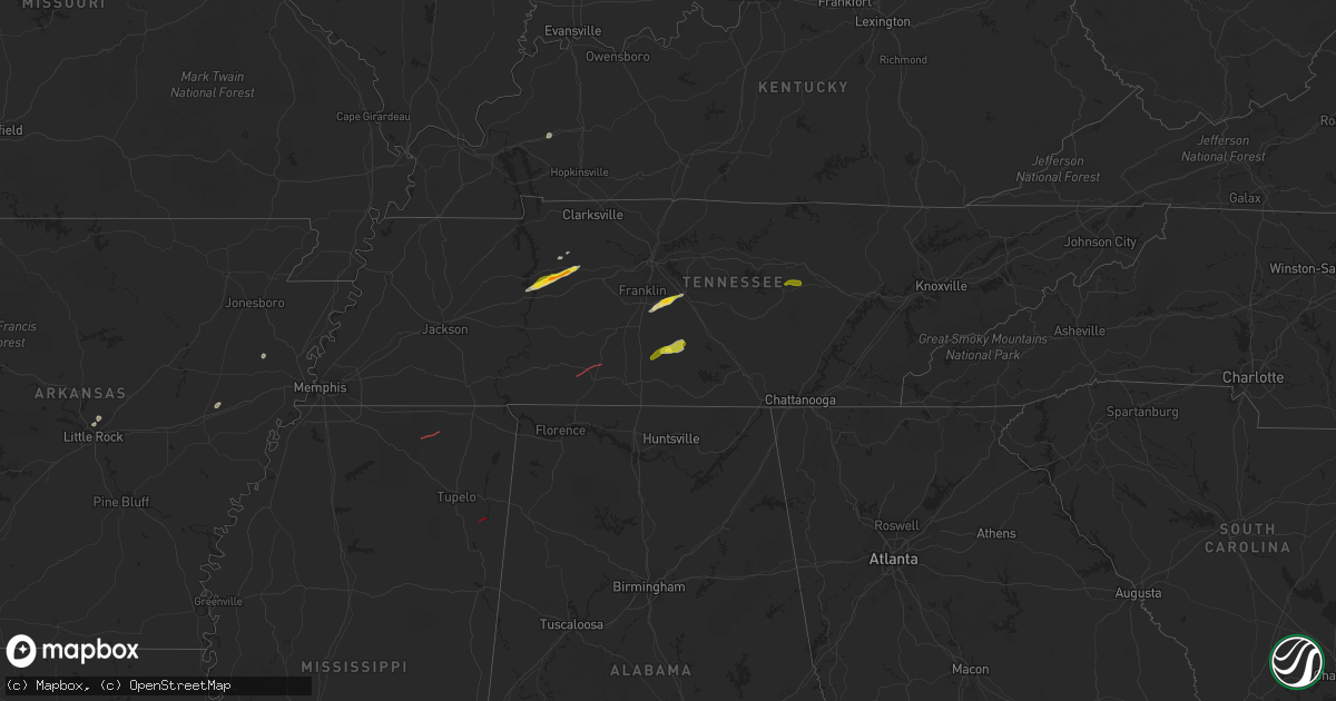
Hail Map on February 16, 2023
Get this storm
February 16 map
$229
one time, instant access
Download today. No call, no setup
Keep the $229
Bought the map and want the full workflow? Apply the entire $229 to a subscription within 7 days. None of it is wasted.
Every map, not just this one
This buys you this map. Subscription and you get every map we run, in the markets you choose from a few cities to whole states to nationwide. Plus real-time alerts the moment a storm fires.
Contact data
Name, contact info, occupancy, even credit band for addresses in the footprint. You go from where it hit to who to call.
Become the source they trust
Unlimited branding weather history reports on demand. You already have the documented answer ready for the property owner, and you are the one who showed up with it.
Property data and RoofTrace estimates
Pull up any address you have got, its value and the exact code rules for that jurisdiction, straight from One Click Code. Then RoofTrace estimates the squares, pitch, and roof value, priced the way you price.
States Impacted by Hail Map on February 16, 2023
Storm reports
Georgia
| Date | Description |
|---|---|
| 02/16/20233:35 AM CST | Tree down at park ave and dallas st. |
| 02/16/20233:35 AM CST | Tree down at jefferson st and brownwood ave. |
| 02/16/20233:35 AM CST | Corrects previous tstm wnd dmg report from 1 sw lagrange. Tree down at park ave and dallas st. |
| 02/16/20233:35 AM CST | Roof collapsed and windows knocked out at dds wecare health department building. |
| 02/16/20233:35 AM CST | Tree down at calumet center rd and old mill rd n. |
| 02/16/20233:35 AM CST | Tree down at cannon st and whitesville st. |
| 02/16/20233:35 AM CST | Tree down at union st and hamilton st. |
Pennsylvania
| Date | Description |
|---|---|
| 02/16/20233:31 AM CST | Media reported downed tree and wires on beechwood blvd and phillips ave |
Virginia
| Date | Description |
|---|---|
| 02/16/20232:46 AM CST | Tree across road. |
Tennessee
| Date | Description |
|---|---|
| 02/16/20235:40 PM CST | Reports of trees down and structural damage on steagall road at wade brown road. Possible tornado. |
| 02/16/20235:15 PM CST | Numerous reports of hail up to quarter size in shelbyville. |
| 02/16/20235:00 PM CST | Three power poles were broken with power lines down on highway 64 in the bedford community. |
| 02/16/20234:40 PM CST | Corrects previous tstm wnd dmg report from 6 nne lewisburg. Reports of trees down and structural damage on steagall road at wade brown road. Possible tornado. |
| 02/16/20234:30 PM CST | Spiky ping pong ball size hail report near triune via twitter. |
| 02/16/20233:54 PM CST | Damage to buildings and trees down in and around ethridge. Possible tornado. |
| 02/16/20233:45 PM CST | Damage to homes and trees down near north bradley rd and mt lebanon rd. Possible tornado. |
| 02/16/20231:53 PM CST | Ping pong ball size hail reported on hurricane creek road. |
| 02/16/20231:45 PM CST | Trees and powerlines were down from near big hill pond state park... To friendship road... To feddie davis road. Minor structure damage to a few homes was observed. Pos |
| 02/16/20231:40 PM CST | Facebook photo showed quarter size hail south of waverly. |
| 02/16/20231:40 PM CST | Twitter photo showed ping pong ball size hail near hurricane mills. |
| 02/16/20236:20 AM CST | Numerous tree limbs down along dollar hill road near the intersection with carnal road. |
| 02/15/20236:19 PM CST | Trees down on mack floyd road. |
| 02/15/20236:10 PM CST | A tree was blown down on monterey highway near yankeetown church. |
Mississippi
| Date | Description |
|---|---|
| 02/16/20234:00 PM CST | Hwy 25s tree damage on itawamba/monroe county line. |
| 02/16/20233:52 PM CST | Trained spotter reported tornado west of smithville. Radar debris signature also present. |
| 02/16/20232:26 PM CST | Powerlines down and tin debris scattered across bassfield cemetery road. Possible tornado. |
| 02/16/20231:40 PM CST | Trees and powerlines down near highway 15 between faulkner and ripley. Possible tornado. |
| 02/16/20231:40 PM CST | Damage to a few businesses on north side of ripley. |
| 02/16/20231:27 PM CST | Radar confirmed tornado by tds. |
| 02/16/202312:47 PM CST | Several trees and large branches knocked down near the highway 72 and curtis road intersection. |
| 02/16/202311:16 AM CST | Mobile home flipped and two other homes damaged from likely tornado...reported by lincoln county em. |
Kentucky
| Date | Description |
|---|---|
| 02/16/20233:45 PM CST | Tree down on piney branch road in the livingston area. Public report relayed through tv media. |
| 02/16/20233:40 PM CST | Tree down on us 25. |
| 02/16/20233:10 PM CST | Powerline reported down at 2211 west highway 80. Time estimated from radar. |
| 02/16/20232:51 PM CST | Trees down on mobile home along west road near highway 80. |
| 02/16/20232:50 PM CST | Roof to ace hardware in russell springs blown off... And damage to stephens store next to ace hardware as well. Time estimated based on radar. |
Cities Impacted by Hail Map on February 16, 2023
- Wheatley, AR
- North Little Rock, AR
- Sherwood, AR
- Widener, AR
- Marianna, AR
- Forrest City, AR
- Princeton, KY
- Dawson Springs, KY
- Mize, MS
- Waverly, TN
- Hurricane Mills, TN
- Ripley, MS
- McEwen, TN
- Dickson, TN
- Lawrenceburg, TN
- Ethridge, TN
- Erin, TN
- Holladay, TN
- College Grove, TN
- Arrington, TN
- Rockvale, TN
- Murfreesboro, TN
- Smyrna, TN
- Lewisburg, TN
- Belfast, TN
- Shelbyville, TN
- Sparta, TN
- Eagleville, TN
- Thompsons Station, TN
- Petersburg, TN