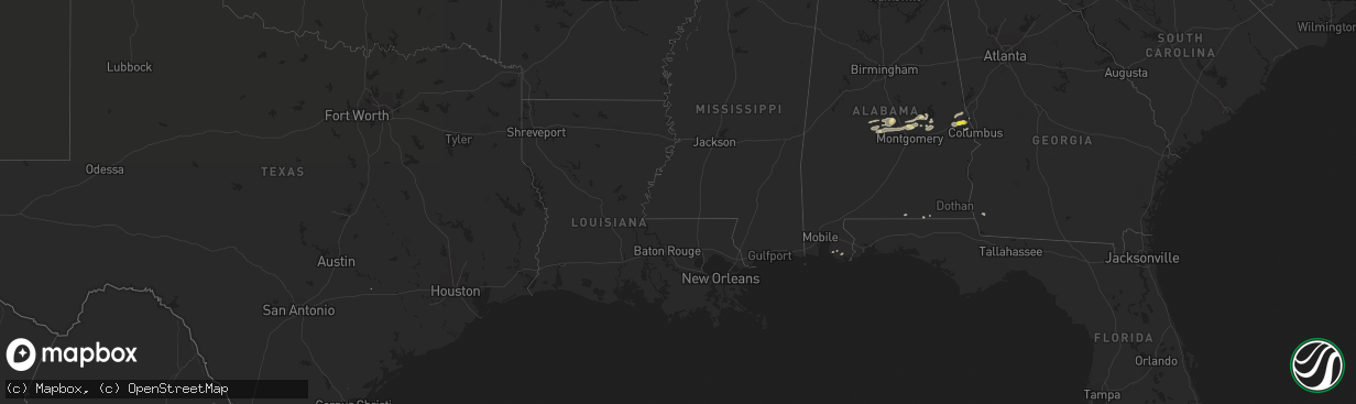
Hail Map in Georgia on February 7, 2018
The weather event in Georgia on February 7, 2018 includes Hail map. 3 states and 37 cities were impacted and suffered possible damage. The total estimated number of properties impacted is 0.
Want more than just the map?
Turn this storm into a full workflow.
- Owner + property data so you know who to knock
- OnDemand branded weather history reports to win the "did we even have hail?" argument
- RoofTrace estimate so reps stop guessing numbers at the door
Bought this map? Upgrade within 7 days and we'll credit the $230. (10-15 min setup call)
Hail
0
Estimated number of impacted properties by a 1.00" hail or larger0
Estimated number of impacted properties by a 1.75" hail or larger0
Estimated number of impacted properties by a 2.50" hail or largerStorm reports in Georgia
Georgia
| Date | Description |
|---|---|
| 02/07/201812:55 PM CST | Telephone or cable lines were downed near wells ave and mlk jr dr not blocking the road. |
| 02/07/201812:02 PM CST | Multiple trees and powerlines down in the 1500 block of the chester-cochran highway. |
| 02/07/201810:54 AM CST | Large tree fell onto interstate 20 blocking all lanes on one side of i20 |
| 02/07/201810:11 AM CST | Multiple trees reported down near the intersection of rock church rd and junction city st and on sand pit rd. |
| 02/07/201810:11 AM CST | Multiple trees reported down on broadwood cir in junction city. |
| 02/07/201810:10 AM CST | An ef-0 tornado touched down 3 miles west of junction city... Downing nearly one hundred trees in and around junction city and also slightly damaging a small barn befor |
| 02/07/20189:15 AM CST | Tree reported down at intersection of hwy 219 and hopewell church rd. |
| 02/07/20188:07 AM CST | A large swath of trees were down just north of the intersection of buggus rd and noles rd... 4 miles se of texas... Ga. The highest estimated wind speeds were 95 mph... |
| 02/07/20188:05 AM CST | Multiple trees reported down on 300 block of ridge rd in heard county. |
| 02/07/20188:04 AM CST | Multiple trees down near victory road and highway 219. |
| 02/07/20187:58 AM CST | Multiple trees down along huff road. |
| 02/07/20186:44 AM CST | Tree uprooted and fell onto a duplex on kaiser st within the city of bremen causing damage to the roof... Walls... Carport and a couple nearby vehicles. Half a dozen ot |
| 02/07/20186:43 AM CST | Roof damage at an apartment complex on kaiser st. Within the city of bremen. 4 trees reported down at this location. |
| 02/07/20184:56 AM CST | At 1056 AM CST, a severe thunderstorm was located near Headland, moving east at 20 mph. HAZARD...60 mph wind gusts. SOURCE...Radar indicated. IMPACT...Expect damage to roofs, siding, and trees. Locations impacted include... Headland, Kinsey, Webb, Newville, Haleburg, Tumbleton, Kirkland Crossroads, Blackwood, Sigma, Capps, Grandberry Crossroads, Pearce, Pleasant Plains, Goldberg Field, Headland Municipal A/P, Dancey, Miller and Balkum. |
| 02/07/20183:08 AM CST | At 908 AM CST, a severe thunderstorm was located near Bleecker, or 9 miles southeast of Opelika, moving east at 55 mph. HAZARD...60 mph wind gusts and nickel size hail. SOURCE...Radar indicated. IMPACT...Expect damage to roofs, siding, and trees. Locations impacted include... Smiths, Smiths Station, Bleecker, Griffen Mill, Goat Rock Lake and Bartletts Ferry Dam. |
| 02/06/20188:34 PM CST | At 234 PM EST/134 PM CST/, a severe thunderstorm was located near Marianna, moving east at 50 mph. HAZARD...60 mph wind gusts. SOURCE...Radar indicated. IMPACT...Expect damage to roofs, siding, and trees. Locations impacted include... Blountstown, Marianna, Chattahoochee, Sneads, Cottondale, Grand Ridge, Greenwood, Altha, Alford, Moose Pond, Ocheesee, Selman, Chipola, Camps Head, Lovedale, Kennys Mill, Dellwood, Buena Vista, Red Oak and Orange Hill. |
| 02/06/20187:50 PM CST | At 150 PM EST, a severe thunderstorm was located near Putney, moving east at 30 mph. HAZARD...60 mph wind gusts. SOURCE...Radar indicated. IMPACT...Expect damage to roofs, siding, and trees. Locations impacted include... Albany, Putney, Baconton, East Albany, Marine Corps Logistics Base, Turner City, Bridgeboro, Stocks, Radium Springs, Forrester, Lockett Crossing, Sylvester Airport, South Albany, Southwest Ga Regional A/P, Parkerville, Palmyra, Red Rock, Acree, Lester and Pritchetts. |
Cities Impacted by Hail Map on February 7, 2018
- Tallassee, AL
- Billingsley, AL
- Prattville, AL
- Jones, AL
- Plantersville, AL
- Verbena, AL
- Marbury, AL
- Selma, AL
- Florala, AL
- Iron City, GA
- Colquitt, GA
- Donalsonville, GA
- Autaugaville, AL
- Wetumpka, AL
- Booth, AL
- Elmore, AL
- Coosada, AL
- Millbrook, AL
- Deatsville, AL
- Salem, AL
- Opelika, AL
- Elberta, AL
- Foley, AL
- Auburn, AL
- Titus, AL
- Alexander City, AL
- Equality, AL
- Eclectic, AL
- Samson, AL
- Cusseta, AL
- Valley, AL
- Muldoon, TX
- Geneva, AL
- Phenix City, AL
- Smiths Station, AL
- Hamilton, GA
- Dadeville, AL


