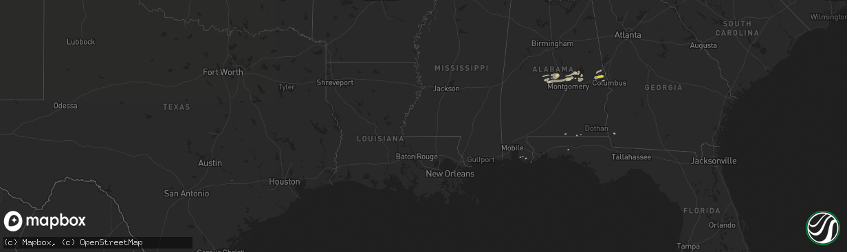
Hail Map on February 7, 2018
The weather event on February 7, 2018 includes Hail map. 3 states and 37 cities were impacted and suffered possible damage. The total estimated number of properties impacted is 1,005.
Want more than just the map?
Turn this storm into a full workflow.
- Owner + property data so you know who to knock
- OnDemand branded weather history reports to win the "did we even have hail?" argument
- RoofTrace estimate so reps stop guessing numbers at the door
Bought this map? Upgrade within 7 days and we'll credit the $230. (10-15 min setup call)
Hail
1,005
Estimated number of impacted properties by a 1.00" hail or larger0
Estimated number of impacted properties by a 1.75" hail or larger0
Estimated number of impacted properties by a 2.50" hail or largerStorm reports
Alabama
| Date | Description |
|---|---|
| 02/07/201812:14 PM CST | 6 mobile homes damaged. 1 with significant damage. |
| 02/07/201812:12 PM CST | Tree down across the carport of a residence. |
| 02/07/20187:27 AM CST | Report of uprooted trees in jemison from social media. |
| 02/07/20187:16 AM CST | Nws meteorologists surveyed damage in extreme southern marengo county and determined it was the result of a tornado. The tornado touched down in the nicholsville commun |
| 02/07/20187:04 AM CST | Nws meteorologists surveyed damage in central autauga county and determined that the damage was consistent with an ef0 tornado. The tornado touched down just to the wes |
| 02/07/20186:49 AM CST | Debris in roadway near intersection of alabama highway 191 and u.s. Highway 31 in jemison. |
| 02/07/20186:40 AM CST | Corrects previous tstm wnd dmg report from jemison. Report of uprooted trees in jemison from social media. Corrected for estimated time. |
| 02/07/20186:37 AM CST | Tree fell across railroad tracks near jemison. |
| 02/07/20186:15 AM CST | Tree reported down near cuba. |
| 02/07/20186:05 AM CST | Corrects previous tstm wnd dmg report from jemison. Debris in roadway near intersection of alabama highway 191 and u.s. Highway 31 in jemison. Corrected event time. |
| 02/07/20186:05 AM CST | Corrects previous tstm wnd dmg report from jemison. Tree fell across railroad tracks near jemison. Corrected event time. |
| 02/07/20186:05 AM CST | Roof damage to at least 2 structures at the intersection of church st and 25th st... And multiple trees down in the surrounding area. Reports/photos via social media. T |
| 02/07/20186:03 AM CST | A tornado began near cr-42 and cr-25 and produced very minor damage along cr-42 until it reached the intersection of cr-42 and cr-38. Here... The tornado intensified an |
| 02/07/20184:34 AM CST | At 1034 AM CST, a severe thunderstorm was located 5 miles north of Laurel Hill, or 9 miles west of Florala, moving east at 35 mph. HAZARD...60 mph wind gusts and quarter size hail. SOURCE...Radar indicated. IMPACT...Hail damage to vehicles is expected. Expect wind damage to roofs, siding, and trees. Locations impacted include... Florala and Lockhart. |
| 02/07/20184:25 AM CST | At 1025 AM CST, a severe thunderstorm was located near Perdido Beach, or 8 miles north of Orange Beach, moving east at 45 mph. HAZARD...60 mph wind gusts and quarter size hail. SOURCE...Radar indicated. IMPACT...Hail damage to vehicles is expected. Expect wind damage to roofs, siding, and trees. Locations impacted include... Pensacola, Ferry Pass, Brent, West Pensacola, Ensley, Warrington, Gulf Breeze, Orange Beach, Goulding, Lillian, Myrtle Grove, Oriole Beach, Navarre, Perdido Beach, Elberta, Pensacola Beach and Navarre Beach. |
| 02/07/20181:02 AM CST | At 702 AM CST, severe thunderstorms were located along a line extending from Billingsley to near Burnsville, moving east at 45 mph. HAZARD...60 mph wind gusts and penny size hail. SOURCE...Radar indicated. IMPACT...Expect damage to roofs, siding, and trees. Locations impacted include... Prattville, Millbrook, Deatsville, Billingsley, Booth, Plecher, Marbury, Vida Junction, Pooles Crossroads, Dawson Mill and New Prospect. |
| 02/07/201812:23 AM CST | At 623 AM CST, a severe thunderstorm was located 7 miles southeast of Marion, moving east at 50 mph. HAZARD...60 mph wind gusts. SOURCE...Radar indicated. IMPACT...Expect damage to roofs, siding, and trees. Locations impacted include... Valley Grande, Paul M Grist State Park, Valley Creek Junction, Plantersville, Suttle, Radford, Sprott, Barrett Creek and Summerfield. |
| 02/06/201811:46 PM CST | At 546 AM CST, severe thunderstorms were located along a line extending from near Greensboro Municipal Airport to 6 miles north of Chickasaw State Park to near Jefferson, moving east at 50 mph. HAZARD...60 mph wind gusts and penny size hail. SOURCE...Radar indicated. IMPACT...Expect damage to roofs, siding, and trees. Locations impacted include... Demopolis, Marion, Greensboro, Linden, Uniontown, Jefferson, Newbern, Faunsdale, Dayton, Greensboro Municipal Airport, Vaiden, Pin Hook, Arcola, Chickasaw State Park, Perry County Correctional Center, Judson College, Old Spring Hill, Gallion, Folsom and Vaiden Field Airport. |
| 02/06/201810:13 PM CST | At 413 AM CST, a severe thunderstorm was located near Duffee, or 13 miles west of Meridian, moving east at 45 mph. HAZARD...60 mph wind gusts and quarter size hail. SOURCE...Radar indicated. IMPACT...Hail damage to vehicles is expected. Expect wind damage to roofs, siding, and trees. This severe thunderstorm will be near... Meridian, Suqualena and Nellieburg around 425 AM CST. Marion and Daleville around 435 AM CST. Meridian Station around 440 AM CST. Toomsuba around 445 AM CST. Lauderdale and Kewanee around 450 AM CST. Other locations impacted by this severe thunderstorm include Chunky. |
Florida
| Date | Description |
|---|---|
| 02/07/201812:08 PM CST | 65mph wind gust at the mossy cove weatherflow site on the bay near axelson point. |
| 02/07/20185:06 AM CST | At 1105 AM CST, a severe thunderstorm was located near Samson, or 13 miles west of Geneva, moving east at 45 mph. HAZARD...60 mph wind gusts. SOURCE...Radar indicated. IMPACT...Expect damage to roofs, siding, and trees. Locations impacted include... Geneva, Hartford, Samson, Esto, Coffee Springs, Black, Chancellor, Kellys Crossroads, Lytle, Marl, Logan Field Municipal A/P, Geneva Municipal A/P, Hendrix Crossroad, Somerset, Earlytown, Hacoda, Spears, Pera, Eunola and Weeks. |
| 02/06/20187:09 PM CST | At 109 PM EST/1209 PM CST/, a severe thunderstorm was located near Cottonwood, moving east at 35 mph. HAZARD...60 mph wind gusts. SOURCE...Radar indicated. IMPACT...Expect damage to roofs, siding, and trees. Locations impacted include... Cottonwood, Graceville, Dothan, Ashford, Cowarts, Malone, Avon, Madrid, Gordon, Campbellton, Jakin, Bascom, Memphis, Saffold, Pansey, Crosby, Grangeburg, Garretts Crossroads, Wilson Mill and Southern Junction. |
Georgia
| Date | Description |
|---|---|
| 02/07/201812:55 PM CST | Telephone or cable lines were downed near wells ave and mlk jr dr not blocking the road. |
| 02/07/201812:02 PM CST | Multiple trees and powerlines down in the 1500 block of the chester-cochran highway. |
| 02/07/201810:54 AM CST | Large tree fell onto interstate 20 blocking all lanes on one side of i20 |
| 02/07/201810:11 AM CST | Multiple trees reported down near the intersection of rock church rd and junction city st and on sand pit rd. |
| 02/07/201810:11 AM CST | Multiple trees reported down on broadwood cir in junction city. |
| 02/07/201810:10 AM CST | An ef-0 tornado touched down 3 miles west of junction city... Downing nearly one hundred trees in and around junction city and also slightly damaging a small barn befor |
| 02/07/20189:15 AM CST | Tree reported down at intersection of hwy 219 and hopewell church rd. |
| 02/07/20188:07 AM CST | A large swath of trees were down just north of the intersection of buggus rd and noles rd... 4 miles se of texas... Ga. The highest estimated wind speeds were 95 mph... |
| 02/07/20188:05 AM CST | Multiple trees reported down on 300 block of ridge rd in heard county. |
| 02/07/20188:04 AM CST | Multiple trees down near victory road and highway 219. |
| 02/07/20187:58 AM CST | Multiple trees down along huff road. |
| 02/07/20186:44 AM CST | Tree uprooted and fell onto a duplex on kaiser st within the city of bremen causing damage to the roof... Walls... Carport and a couple nearby vehicles. Half a dozen ot |
| 02/07/20186:43 AM CST | Roof damage at an apartment complex on kaiser st. Within the city of bremen. 4 trees reported down at this location. |
| 02/07/20184:56 AM CST | At 1056 AM CST, a severe thunderstorm was located near Headland, moving east at 20 mph. HAZARD...60 mph wind gusts. SOURCE...Radar indicated. IMPACT...Expect damage to roofs, siding, and trees. Locations impacted include... Headland, Kinsey, Webb, Newville, Haleburg, Tumbleton, Kirkland Crossroads, Blackwood, Sigma, Capps, Grandberry Crossroads, Pearce, Pleasant Plains, Goldberg Field, Headland Municipal A/P, Dancey, Miller and Balkum. |
| 02/07/20183:08 AM CST | At 908 AM CST, a severe thunderstorm was located near Bleecker, or 9 miles southeast of Opelika, moving east at 55 mph. HAZARD...60 mph wind gusts and nickel size hail. SOURCE...Radar indicated. IMPACT...Expect damage to roofs, siding, and trees. Locations impacted include... Smiths, Smiths Station, Bleecker, Griffen Mill, Goat Rock Lake and Bartletts Ferry Dam. |
| 02/06/20188:34 PM CST | At 234 PM EST/134 PM CST/, a severe thunderstorm was located near Marianna, moving east at 50 mph. HAZARD...60 mph wind gusts. SOURCE...Radar indicated. IMPACT...Expect damage to roofs, siding, and trees. Locations impacted include... Blountstown, Marianna, Chattahoochee, Sneads, Cottondale, Grand Ridge, Greenwood, Altha, Alford, Moose Pond, Ocheesee, Selman, Chipola, Camps Head, Lovedale, Kennys Mill, Dellwood, Buena Vista, Red Oak and Orange Hill. |
| 02/06/20187:50 PM CST | At 150 PM EST, a severe thunderstorm was located near Putney, moving east at 30 mph. HAZARD...60 mph wind gusts. SOURCE...Radar indicated. IMPACT...Expect damage to roofs, siding, and trees. Locations impacted include... Albany, Putney, Baconton, East Albany, Marine Corps Logistics Base, Turner City, Bridgeboro, Stocks, Radium Springs, Forrester, Lockett Crossing, Sylvester Airport, South Albany, Southwest Ga Regional A/P, Parkerville, Palmyra, Red Rock, Acree, Lester and Pritchetts. |
Mississippi
| Date | Description |
|---|---|
| 02/07/201812:00 AM CST | At 600 AM CST, a severe thunderstorm was located over Fort Adams, or 17 miles northeast of Simmesport, moving east at 50 mph. HAZARD...60 mph wind gusts. SOURCE...Radar indicated. IMPACT...Expect damage to roofs, siding, and trees. Locations impacted include... Centreville, Woodville, Gloster, Fort Adams and Crosby. |
| 02/06/201810:12 PM CST | At 411 AM CST, a severe thunderstorm was located over Terry, or near Byram, moving east at 45 mph. HAZARD...60 mph wind gusts and quarter size hail. SOURCE...Radar indicated. IMPACT...Hail damage to vehicles is expected. Expect wind damage to roofs, siding, and trees. This severe thunderstorm will be near... Byram around 415 AM CST. Whites around 420 AM CST. Richland and Florence around 425 AM CST. Star and Monterey around 430 AM CST. Piney Woods around 435 AM CST. Cato around 445 AM CST. Johns around 450 AM CST. Pelahatchie around 455 AM CST. Other locations impacted by this severe thunderstorm include Puckett. |
| 02/06/20187:34 PM CST | At 134 AM CST, severe thunderstorms were located along a line extending from 10 miles northeast of Smyrna to near Zama to near Carthage, moving east at 60 mph. HAZARD...60 mph wind gusts. SOURCE...Radar indicated. IMPACT...Expect damage to roofs, siding, and trees. Severe thunderstorms will be near... Philadelphia, Louisville, Pearl River, Stallo and Mcmillan around 150 AM CST. Millcreek and Burnside around 155 AM CST. Betheden around 200 AM CST. Nanih Waiya around 205 AM CST. Other locations impacted by these severe thunderstorms includeNoxapater. |
| 02/06/20187:01 PM CST | At 101 AM CST, severe thunderstorms were located along a line extending from near Pickens to near Way to near Canton, moving east at 50 mph. HAZARD...60 mph wind gusts. SOURCE...Radar indicated. IMPACT...Expect damage to roofs, siding, and trees. Severe thunderstorms will be near... Cameron around 105 AM CST. Newport and Camden around 110 AM CST. Farmhaven and Thomastown around 120 AM CST. Smyrna and Singleton around 130 AM CST. Carthage and Renfroe around 135 AM CST. Other locations impacted by these severe thunderstorms includeRedwater. |
Cities Impacted by Hail Map on February 7, 2018
- Tallassee, AL
- Billingsley, AL
- Prattville, AL
- Jones, AL
- Plantersville, AL
- Verbena, AL
- Marbury, AL
- Selma, AL
- Florala, AL
- Iron City, GA
- Colquitt, GA
- Donalsonville, GA
- Autaugaville, AL
- Wetumpka, AL
- Booth, AL
- Elmore, AL
- Coosada, AL
- Millbrook, AL
- Deatsville, AL
- Salem, AL
- Opelika, AL
- Elberta, AL
- Foley, AL
- Auburn, AL
- Titus, AL
- Alexander City, AL
- Equality, AL
- Eclectic, AL
- Samson, AL
- Cusseta, AL
- Valley, AL
- Muldoon, TX
- Geneva, AL
- Phenix City, AL
- Smiths Station, AL
- Hamilton, GA
- Dadeville, AL