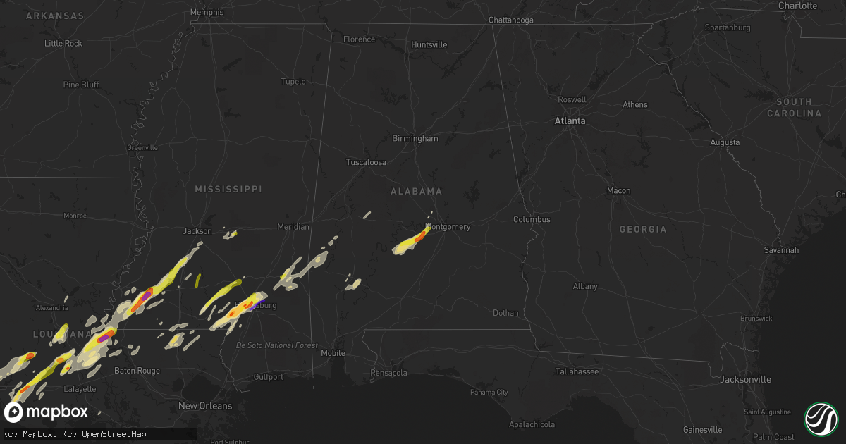
Hail Map in Alabama on January 20, 2017
Get this storm
January 20 map
$229
one time, instant access
Download today. No call, no setup
Keep the $229
Bought the map and want the full workflow? Apply the entire $229 to a subscription within 7 days. None of it is wasted.
Every map, not just this one
This buys you this map. Subscription and you get every map we run, in the markets you choose from a few cities to whole states to nationwide. Plus real-time alerts the moment a storm fires.
Contact data
Name, contact info, occupancy, even credit band for addresses in the footprint. You go from where it hit to who to call.
Become the source they trust
Unlimited branding weather history reports on demand. You already have the documented answer ready for the property owner, and you are the one who showed up with it.
Property data and RoofTrace estimates
Pull up any address you have got, its value and the exact code rules for that jurisdiction, straight from One Click Code. Then RoofTrace estimates the squares, pitch, and roof value, priced the way you price.
Storm reports in Alabama
Alabama
| Date | Description |
|---|---|
| 01/20/20175:55 AM CST | Ef1 tornado with 90 mph winds downed trees and damaged outbuildings near us highway 43. |
| 01/20/20175:53 AM CST | Damage reported to a home just south of octagon in marengo county. Trees down. Bricks from exterior in shower. Possible tornado. Via social media. |
| 01/20/20175:53 AM CST | Damage reported to a home just south of octagon in marengo county at the intersection of hummingbird ln and pillie rd. Trees down. Bricks from exterior in shower. Possi |
| 01/20/20175:38 AM CST | Tree down on highway 69. Another tree down on bashi road. |
| 01/20/20175:37 AM CST | Trees reported down near putnam baptist church. Possible tornado. |
| 01/20/20175:31 AM CST | A tornado continued from choctaw county into southeastern marengo county. The tornado crossed the river and ended near putnam. The damage was consistent with ef1 wind d |
| 01/20/20175:29 AM CST | A tornado continued from choctaw county into southeastern marengo county. The tornado crossed the river and ended near putnam. The damage was consistent with ef1 wind d |
| 01/20/20175:14 AM CST | *** 4 inj *** likely tornado produced major tree and power line damage across chapel hill road and pleasant hill road areas. Damage to 20-25 residences some with major |
| 01/20/20175:14 AM CST | *** 4 inj *** the tornado first touched down on clark road and continued 15 miles to the northeast to the choctaw and marengo county line. 4 homes were destroyed... Inc |
| 01/20/20175:14 AM CST | Reports of trees and power lines down on parts of chapel hill road and pleasant hill road. Also some structural damage reported but extent of the damage not known at th |
All States Impacted by Hail Map on January 20, 2017
Cities Impacted by Hail Map on January 20, 2017
- Ville Platte, LA
- Eunice, LA
- Mamou, LA
- Church Point, LA
- Opelousas, LA
- Houston, TX
- Branch, LA
- Hayneville, AL
- Sardis, AL
- Pine Apple, AL
- Tyler, AL
- Lowndesboro, AL
- Minter, AL
- Camden, AL
- Rosharon, TX
- Fresno, TX
- Manvel, TX
- Pearland, TX
- Orange, TX
- Cameron, LA
- Vinton, LA
- Lettsworth, LA
- Gloster, MS
- McCall Creek, MS
- Brookhaven, MS
- Woodville, MS
- Meadville, MS
- Crosby, MS
- Roxie, MS
- Union Church, MS
- Hazlehurst, MS
- Natchez, MS
- Bude, MS
- Hattiesburg, MS
- Petal, MS
- Lumberton, MS
- Columbia, MS
- Foxworth, MS
- Sumrall, MS
- Sulphur, LA
- Vidor, TX
- Beaumont, TX
- Buna, TX
- Starks, LA
- Angola, LA
- Batchelor, LA
- Kokomo, MS
- Jayess, MS
- Oak Vale, MS
- Tylertown, MS
- Whatley, AL
- Grove Hill, AL
- Kinder, LA
- Mittie, LA
- Reeves, LA
- Oberlin, LA
- Krotz Springs, LA
- Port Barre, LA
- Fordoche, LA
- Arnaudville, LA
- Washington, LA
- Palmetto, LA
- Melville, LA
- Livingston, TX
- Iowa, LA
- Welsh, LA
- Warren, TX
- Woodville, TX
- Elton, LA
- New Roads, LA
- Morganza, LA
- Ventress, LA
- Livonia, LA
- Waynesboro, MS
- East Bernard, TX
- Needville, TX
- Rosenberg, TX
- Wharton, TX
- Boling, TX
- Beasley, TX
- Hockley, TX
- Montgomery, TX
- Plantersville, TX
- Magnolia, TX
- Waller, TX
- Sugar Land, TX
- Richmond, TX
- Kirbyville, TX
- Inez, TX
- Jackson, AL
- Ragley, LA
- Hankamer, TX
- Devers, TX
- Cheneyville, LA
- Saint Landry, LA
- Fluker, LA
- Roseland, LA
- Newbern, AL
- Faunsdale, AL
- Brandon, MS
- Pulaski, MS
- Pelahatchie, MS
- Morton, MS
- Wesson, MS
- Crystal Springs, MS
- Ellisville, MS
- Moselle, MS
- Purvis, MS
- Sandy Hook, MS
- Laurel, MS
- Shubuta, MS
- Wallisville, TX
- Anahuac, TX
- Liberty, TX
- Baytown, TX
- Poplarville, MS
- Jennings, LA
- Basile, LA
- Sour Lake, TX
- Nome, TX
- Call, TX
- Deweyville, TX
- Lumberton, TX
- Dequincy, LA
- China, TX
- Greensburg, LA
- Victoria, TX
- Edna, TX
- Gilbertown, AL
- Toxey, AL
- Buckatunna, MS
- Needham, AL
- Silas, AL
- Butler, AL
- Quitman, MS
- Goodrich, TX
- Friendswood, TX
- Florence, MS
- Bunkie, LA
- Lake Charles, LA
- Saint Francisville, LA
- Plaucheville, LA
- Monterey, LA
- Simmesport, LA
- Amite, LA
- Franklinton, LA
- Kentwood, LA
- Mount Hermon, LA
- Roanoke, LA
- Bell City, LA
- Lacassine, LA
- Deville, LA
- Pineville, LA
- Oakdale, LA
- Bassfield, MS
- Prentiss, MS
- Carson, MS
- Liberty, MS
- Smithdale, MS
- Hamshire, TX
- Winnie, TX
- Dry Creek, LA
- Ethel, LA
- Slaughter, LA
- Zachary, LA
- Moreauville, LA
- Marksville, LA
- Osyka, MS
- Magnolia, MS
- Collins, MS
- Prattville, AL
- Conroe, TX
- Jasper, TX
- Newton, TX
- Wiergate, TX
- Bellaire, TX
- Pennington, AL
- Chester, TX
- Morse, LA
- Gueydan, LA
- Lake Arthur, LA
- Missouri City, TX
- Breaux Bridge, LA
- Lottie, LA
- Glen Flora, TX
- El Campo, TX
- Ovett, MS
- Angie, LA
- Shepherd, TX
- Hempstead, TX
- Jackson, LA
- Evangeline, LA
- Louise, TX
- South Houston, TX
- Jeanerette, LA
- Terry, MS
- Iota, LA
- Seminary, MS
- Sontag, MS
- Monticello, MS


