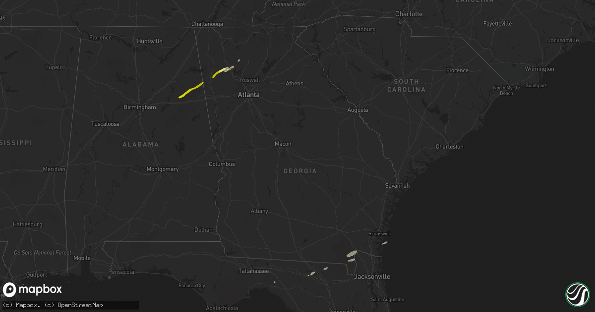
Hail Map in Georgia on January 11, 2014
Get this storm
January 11 map
$229
one time, instant access
Download today. No call, no setup
Keep the $229
Bought the map and want the full workflow? Apply the entire $229 to a subscription within 7 days. None of it is wasted.
Every map, not just this one
This buys you this map. Subscription and you get every map we run, in the markets you choose from a few cities to whole states to nationwide. Plus real-time alerts the moment a storm fires.
Contact data
Name, contact info, occupancy, even credit band for addresses in the footprint. You go from where it hit to who to call.
Become the source they trust
Unlimited branding weather history reports on demand. You already have the documented answer ready for the property owner, and you are the one who showed up with it.
Property data and RoofTrace estimates
Pull up any address you have got, its value and the exact code rules for that jurisdiction, straight from One Click Code. Then RoofTrace estimates the squares, pitch, and roof value, priced the way you price.
Storm reports in Georgia
Georgia
| Date | Description |
|---|---|
| 01/11/20143:46 PM CST | Powerline down near the intersection of coffee bluff road and white bluff ave. |
| 01/11/20143:28 PM CST | Powerline down near the intersection of coffee bluff road and white bluff ave. |
| 01/11/20143:25 PM CST | Power lines reported down on dilworth st. That caused multiple fires. Also a large tree down near intersection of seagrove street and w. Bryant street. |
| 01/11/20142:53 PM CST | Tree down reported on black creek church road. |
| 01/11/20142:47 PM CST | Liberty county 911 call center ports a tree down on eb cooper highway near riceboro. |
| 01/11/20142:47 PM CST | Tree down reported at the intersection of cay creek road and charlie butler road. |
| 01/11/20142:25 PM CST | Power line down off of n macon st. |
| 01/11/20141:40 PM CST | Tree down on river road |
| 01/11/20141:30 PM CST | Tree down on judy ln |
| 01/11/20141:27 PM CST | Warning point reported a tree down at the 37000 block of highway 23. |
| 01/11/20141:25 PM CST | Large tree branches down on jerry jones road reported on social media |
| 01/11/20141:20 PM CST | Tree down on madison hwy |
| 01/11/201412:40 PM CST | Sheriff dispatch reported a couple of trees down along hwy 25 near the richmond county line. |
| 01/11/201412:30 PM CST | Sheriff dispatch reported a couple of trees down on the south side of augusta. |
| 01/11/201411:58 AM CST | One tree reported down in the wrens area. |
| 01/11/201411:45 AM CST | Numerous trees down in sandersville area. Power out in some parts of town. Possible tornado |
| 01/11/201411:18 AM CST | Possible tornado. Multiple trees down in irwinton and trees down 3 miles east of irwington along hwy 57. |
| 01/11/201411:11 AM CST | Ten trees have been reported blown down across the county. |
| 01/11/201411:06 AM CST | Two trees down on sandefur road near houston lake road and one tree down at lake joy road and sandefur road. |
| 01/11/201410:20 AM CST | A porch was blown off the front of a home on jackson rd. Several trees were blown down in the county as well. |
| 01/11/20148:17 AM CST | Multiple trees down across county. Time estimated from radar. |
| 01/11/20148:10 AM CST | Tree down on carreytown rd near hwy 106 |
| 01/11/20148:06 AM CST | Tree down on hwy 326 near rock pillow rd |
| 01/11/20147:59 AM CST | Tree donw on dortch road in eastanolle |
| 01/11/20147:59 AM CST | The coweta county 911 center reported a power line down on willow lake road and east highway 34 and trees down at south hwy 29 and lowery rd... The 4700 block of corint |
| 01/11/20147:55 AM CST | Power lines down on west currahee street |
| 01/11/20147:55 AM CST | One tree down at demascus road and prospect road. |
| 01/11/20147:55 AM CST | Spotter reported a 64mph gust with tree limbs down. |
| 01/11/20147:50 AM CST | Numerous trees down |
| 01/11/20147:42 AM CST | Tree down on duncan bridge road in baldwin |
| 01/11/20147:42 AM CST | Tree down on york drive in cornelia |
| 01/11/20147:35 AM CST | Approximately 10 trees and powerlines down across the eastern portion of the county. |
| 01/11/20147:32 AM CST | 50 to 60 mph winds in vinings. Corrected for the time |
| 01/11/20147:25 AM CST | 50 to 60 mph winds in vinings. Corrected for the time |
| 01/11/20147:25 AM CST | One tree down at ebenezer road and troupe smith road. |
| 01/11/20147:25 AM CST | Approximately 10 trees and powerlines down across the western portion of the county. |
| 01/11/20147:15 AM CST | One tree was blown down. |
| 01/11/20147:10 AM CST | *** 2 inj *** trees down on mobile home. 2 people trapped and transported to local hospital for injuries |
| 01/11/20147:05 AM CST | Numerous trees down throughout cherokee county. Particulary hwy 140 and e. Cherokee drive area |
| 01/11/20146:53 AM CST | Numerous trees and powerlines down on prior station road and piedmont hwy |
| 01/11/20146:37 AM CST | A brief ef-0 tornado touched down in cherokee county georgia just after 730 am in the morning. Although the total path was 3 miles...the tornado skipped along the groun |
| 01/11/20146:32 AM CST | 50 to 60 mph winds in vinings |
Cities Impacted by Hail Map on January 11, 2014
- Live Oak, FL
- Perry, FL
- White, GA
- Rome, GA
- Kingston, GA
- Cartersville, GA
- Taylorsville, GA
- Manor, GA
- Saint George, GA
- Folkston, GA
- Waleska, GA
- Lake City, FL
- White Springs, FL
- Jasper, FL
- Saint Marys, GA
- Hilliard, FL
- Fruitland Park, FL
- The Villages, FL
- Anniston, AL
- Piedmont, AL
- Weaver, AL
- Jacksonville, AL
- Cedartown, GA
- Silver Creek, GA
- Aragon, GA


