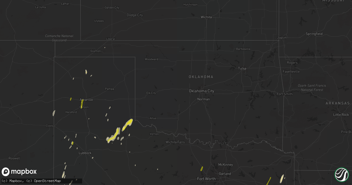
Hail Map in Oklahoma on December 26, 2018
Get this storm
December 26 map
$229
one time, instant access
Download today. No call, no setup
Keep the $229
Bought the map and want the full workflow? Apply the entire $229 to a subscription within 7 days. None of it is wasted.
Every map, not just this one
This buys you this map. Subscription and you get every map we run, in the markets you choose from a few cities to whole states to nationwide. Plus real-time alerts the moment a storm fires.
Contact data
Name, contact info, occupancy, even credit band for addresses in the footprint. You go from where it hit to who to call.
Become the source they trust
Unlimited branding weather history reports on demand. You already have the documented answer ready for the property owner, and you are the one who showed up with it.
Property data and RoofTrace estimates
Pull up any address you have got, its value and the exact code rules for that jurisdiction, straight from One Click Code. Then RoofTrace estimates the squares, pitch, and roof value, priced the way you price.
Storm reports in Oklahoma
Oklahoma
| Date | Description |
|---|---|
| 12/26/20184:01 AM CST | At 1001 PM CST, severe thunderstorms were located along a line extending from 2 miles west of Okmulgee to 4 miles southeast of Henryetta to 4 miles northeast of Scipio, moving northeast at 40 mph. HAZARD...60 mph wind gusts. SOURCE...Radar indicated. IMPACT...Expect damage to roofs, siding, and trees. Locations in or near the path include... Muskogee... Okmulgee... Wagoner... Eufaula... Coweta... Henryetta... Checotah... Haskell... Warner... Morris... Dewar... Porum... Okay... Porter... Schulter... Crowder... Oktaha... Taft... Boynton... Canadian...This includes Interstate 40 in Oklahoma between mile markers 237 and279. |
| 12/26/20183:32 AM CST | At 932 PM CST, severe thunderstorms were located along a line extending from 4 miles northeast of Wetumka to 5 miles southeast of Gerty, moving east at 30 mph. HAZARD...60 mph wind gusts. SOURCE...Radar indicated. IMPACT...Expect damage to roofs, siding, and trees. Locations impacted include... Wetumka, Dustin, Calvin, Stuart, Lamar, Gerty and Horntown. |
| 12/26/20183:08 AM CST | At 907 PM CST, a severe thunderstorm was located 7 miles south of Cromwell, moving northeast at 50 mph. HAZARD...60 mph wind gusts. SOURCE...Radar indicated. IMPACT...Expect damage to roofs, siding, and trees. Locations in or near the path include... Okmulgee... Okemah... Henryetta... Morris... Weleetka... Dewar... Schulter... Grayson... Hanna... Bearden... Hoffman... Clearview... Stidham... Raiford... Bald Hill... Vivian... Okmulgee State Park... Lake Eufaula State Park... Pharoah... Hitchita...This includes Interstate 40 in Oklahoma between mile markers 212 and258. |
| 12/26/20182:40 AM CST | At 840 PM CST, severe thunderstorms were located along a line extending from 3 miles east of St. Louis to 3 miles east of Konawa to near Ada to 5 miles west of Pontotoc, moving northeast at 50 mph. HAZARD...60 mph wind gusts. SOURCE...Radar indicated. IMPACT...Expect damage to roofs, siding, and trees. Locations impacted include... Ada, Seminole, Holdenville, Coalgate, Wewoka, Konawa, Wetumka, Byng, Maud, Allen, Roff, Stonewall, Bowlegs, Tupelo, Mill Creek, Francis, Calvin, Cromwell, Fitzhugh and St. Louis. |
| 12/26/20181:55 AM CST | At 755 PM CST, severe thunderstorms were located along a line extending from near Oklahoma City to 4 miles south of Washington to 4 miles southwest of Wynnewood, moving northeast at 60 mph. HAZARD...60 mph wind gusts. SOURCE...Radar indicated. IMPACT...Expect damage to roofs, siding, and trees. Locations impacted include... Oklahoma City, Norman, southeastern Edmond, Moore, Midwest City, Shawnee, Del City, Ada, Newcastle, Blanchard, Tecumseh, Pauls Valley, Purcell, Bethany, Mustang, Choctaw, Warr Acres, Noble, Tuttle and Harrah. |
| 12/26/201812:38 AM CST | At 637 PM CST, severe thunderstorms were located along a line extending from near Cache to near Cookietown to 4 miles southeast of Petrolia to 7 miles northwest of Newport, moving northeast at 60 mph. HAZARD...70 mph wind gusts. SOURCE...Radar indicated. IMPACT...Expect considerable tree damage. Damage is likely to mobile homes, roofs, and outbuildings. Locations impacted include... Wichita Falls, Lawton, Duncan, Burkburnett, Anadarko, Marlow, Henrietta, Walters, Waurika, Cache, Elgin, Comanche, Apache, Geronimo, Rush Springs, Bray, Fletcher, Cyril, Grandfield and Temple. |
| 12/26/201812:23 AM CST | At 623 PM CST, severe thunderstorms were located along a line extending from 9 miles west of Elk City to 7 miles west of Dill City to 3 miles north of Roosevelt to 6 miles southeast of Snyder, moving northeast at 60 mph. HAZARD...70 mph wind gusts. SOURCE...Radar indicated. IMPACT...Expect considerable tree damage. Damage is likely to mobile homes, roofs, and outbuildings. Locations impacted include... Elk City, Weatherford, Clinton, Sayre, Hobart, Cordell, Granite, Burns Flat, Carnegie, Snyder, Sentinel, Tipton, Blair, Arapaho, Mountain View, Fort Cobb, Hammon, Dill City, Canute and Corn. |
| 12/25/201811:55 PM CST | At 555 PM CST, severe thunderstorms were located along a line extending from 5 miles northwest of Davidson to 4 miles south of Harrold to 4 miles north of Lake Kickapoo to 5 miles north of Olney, moving northeast at 60 mph. HAZARD...70 mph wind gusts. SOURCE...Radar indicated. IMPACT...Expect considerable tree damage. Damage is likely to mobile homes, roofs, and outbuildings. Locations impacted include... Wichita Falls, western Lawton, Vernon, Burkburnett, Frederick, Henrietta, Walters, Archer City, Iowa Park, Cache, Electra, Holliday, Geronimo, Grandfield, Temple, Petrolia, Scotland, Byers, Dean and Chattanooga. |
| 12/25/201811:40 PM CST | At 540 PM CST, severe thunderstorms were located along a line extending from 4 miles southwest of Erick to 8 miles east of Vinson to 5 miles northwest of Olustee to 5 miles south of Odell, moving northeast at 50 mph. HAZARD...60 mph wind gusts. SOURCE...Radar indicated. IMPACT...Expect damage to roofs, siding, and trees. Locations impacted include... Altus, Elk City, Sayre, Hobart, Mangum, Hollis, Cheyenne, Granite, Snyder, Erick, Sentinel, Tipton, Blair, Chillicothe, Olustee, Eldorado, Lone Wolf, Mountain Park, Carter and Roosevelt. |
| 12/25/201811:00 PM CST | At 500 PM CST, severe thunderstorms were located along a line extending from 7 miles southwest of Dodson to 3 miles southwest of Goodlett to 6 miles southeast of Crowell, moving northeast at 40 mph. HAZARD...60 mph wind gusts and quarter size hail. SOURCE...Radar indicated. IMPACT...Hail damage to vehicles is expected. Expect wind damage to roofs, siding, and trees. Locations impacted include... Vernon, Quanah, Hollis, Crowell, Chillicothe, Eldorado, Gould, Thalia, Vinson, Duke, Margaret, Goodlett, Lockett, Medicine Mound, Odell, McQueen, Lazare, Rayland, Copper Breaks State Park and McKnight. |
| 12/25/201810:13 PM CST | At 412 PM CST, a severe thunderstorm was located over Northfield, or 19 miles southwest of Childress, moving northeast at 50 mph. This storm produced quarter size hail in Matador at 350 pm. HAZARD...Half dollar size hail. SOURCE...Radar indicated. IMPACT...Damage to vehicles is expected. Locations impacted include... Childress, Northfield, Tell, Cee Vee and Estelline. |
| 12/25/20188:24 PM CST | Power outages reported in south purcell |
| 12/25/20188:17 PM CST | Em reports a trailer with the roof peeled back and barn damage. |
| 12/25/20188:01 PM CST | Asos measurement |
| 12/25/20188:01 PM CST | Asos measurement. Corrected position |
| 12/25/20187:58 PM CST | A local report indicates 60 MPH wind near PAULS VALLEY |
| 12/25/20187:07 PM CST | A local report indicates 71 MPH wind near 6 S STERLING |
| 12/25/20187:02 PM CST | Roof blown off of house. Time is radar estimate. |
| 12/25/20186:44 PM CST | Measured at se 60th and woodlawn in se lawton |
| 12/25/20186:26 PM CST | Power outages on the west side of lawton |
| 12/25/20186:26 PM CST | Asos measurement |
All States Impacted by Hail Map on December 26, 2018
Cities Impacted by Hail Map on December 26, 2018
- Harleton, TX
- Jefferson, TX
- Floydada, TX
- Lockney, TX
- Leakey, TX
- Rio Frio, TX
- Rocksprings, TX
- Del Rio, TX
- Brackettville, TX
- Uvalde, TX
- Camp Wood, TX
- Barksdale, TX
- Junction, TX
- Jacksonville, TX
- Troup, TX
- Goldsmith, TX
- Buckholts, TX
- Comstock, TX
- Monahans, TX
- Crane, TX
- Dryden, TX
- Apple Springs, TX
- Groveton, TX
- Temple, TX
- Andrews, TX
- Normangee, TX
- Ozona, TX
- Littlefield, TX
- Plains, TX
- Seminole, TX
- Dripping Springs, TX
- Johnson City, TX
- Childress, TX
- Floresville, TX
- Tulia, TX
- Canton, TX
- Eustace, TX
- Mabank, TX
- Stratford, TX
- Rosebud, TX
- Burlington, TX
- Cameron, TX
- Hillsboro, TX
- Grapeland, TX
- Crockett, TX
- Thorndale, TX
- Bartlett, TX
- Mountain Home, TX
- Hooker, OK
- Avinger, TX
- Pearsall, TX
- Jourdanton, TX
- Charlotte, TX
- Blanco, TX
- Sunray, TX
- Channing, TX
- Pointblank, TX
- Buchanan Dam, TX
- Tell, TX
- Paducah, TX
- Midway, TX
- Kennard, TX
- Wells, TX
- Pollok, TX
- Trinity, TX
- Amarillo, TX
- Whitehouse, TX
- Rice, TX
- Round Mountain, TX
- Clarendon, TX
- Itasca, TX
- Grandview, TX
- Covington, TX
- Eddy, TX
- Lott, TX
- Matador, TX
- Canyon, TX
- Roaring Springs, TX
- Woodson, TX
- Slaton, TX
- Broadview, NM
- Seagraves, TX
- Dickens, TX
- Calvert, TX
- Denver City, TX
- Concan, TX
- Granger, TX
- Holland, TX
- Sonora, TX
- Jonesboro, TX
- Levelland, TX
- Rogers, TX
- Taylor, TX
- Bullard, TX
- Amherst, TX
- Elkhart, TX
- Italy, TX
- Forreston, TX
- Sudan, TX
- Cotulla, TX
- Rule, TX
- Old Glory, TX
- Welch, TX
- Hunt, TX
- Pipe Creek, TX
- Mason, TX
- Turkey, TX
- Lampasas, TX
- Spicewood, TX
- Sutherland Springs, TX
- La Vernia, TX
- Texico, NM
- New Waverly, TX
- Huntsville, TX
- Willis, TX
- Fieldton, TX
- Tyler, TX
- Vega, TX
- Azle, TX
- Boyd, TX
- Rhome, TX
- Newark, TX
- Arp, TX
- Big Sandy, TX
- Palestine, TX
- Gilmer, TX
- Winona, TX
- Rusk, TX
- Gladewater, TX


