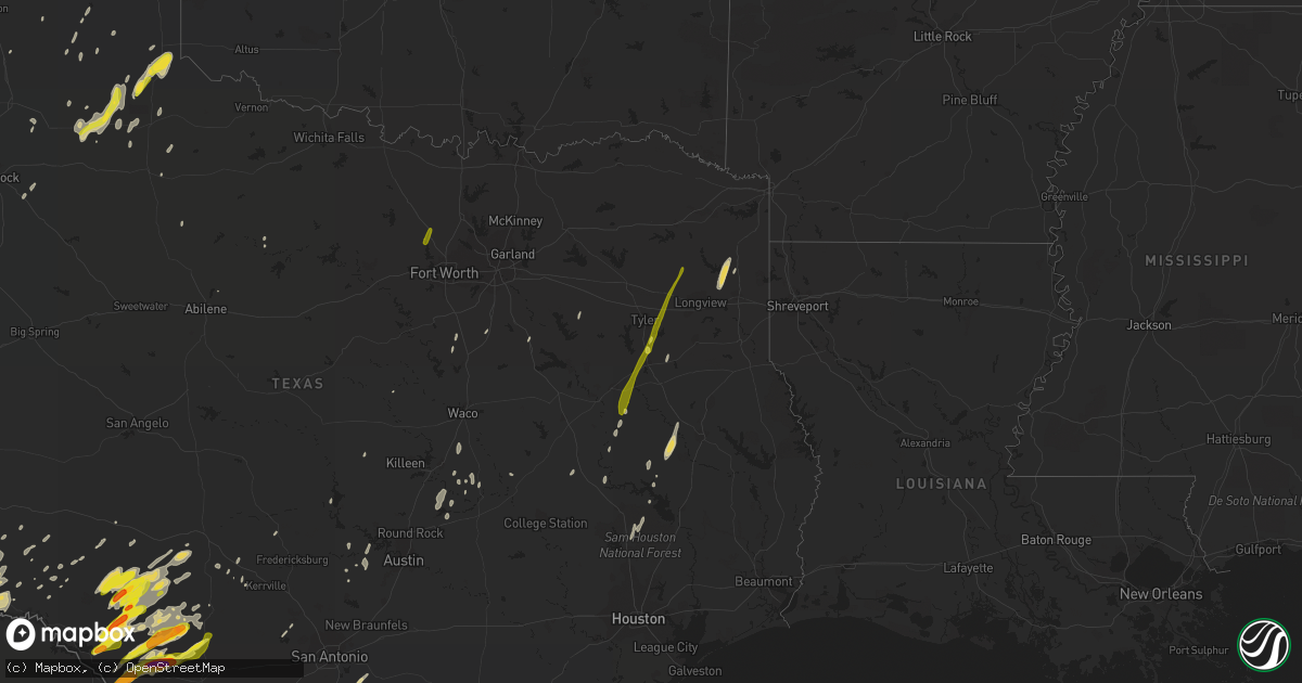
Hail Map on December 26, 2018
Get this storm
December 26 map
$229
one time, instant access
Download today. No call, no setup
Keep the $229
Bought the map and want the full workflow? Apply the entire $229 to a subscription within 7 days. None of it is wasted.
Every map, not just this one
This buys you this map. Subscription and you get every map we run, in the markets you choose from a few cities to whole states to nationwide. Plus real-time alerts the moment a storm fires.
Contact data
Name, contact info, occupancy, even credit band for addresses in the footprint. You go from where it hit to who to call.
Become the source they trust
Unlimited branding weather history reports on demand. You already have the documented answer ready for the property owner, and you are the one who showed up with it.
Property data and RoofTrace estimates
Pull up any address you have got, its value and the exact code rules for that jurisdiction, straight from One Click Code. Then RoofTrace estimates the squares, pitch, and roof value, priced the way you price.
States Impacted by Hail Map on December 26, 2018
Storm reports
Texas
| Date | Description |
|---|---|
| 12/26/20185:45 PM CST | Large metal barn blown over at the northern edge of breckenridge |
| 12/26/20184:51 PM CST | Power line blown down in the vicinity of clyde. |
| 12/26/20184:46 PM CST | A local report indicates 63 MPH wind near 2 NNE WEINERT |
| 12/26/20184:35 PM CST | Carports blown over cars. |
| 12/26/20184:32 PM CST | Txdot abilene district reported a large highway sign blown down along the winters freeway. |
| 12/26/20184:24 PM CST | Several reports of minor damage northeast of clarendon. Windows blown out of a home... Trees damaged... And some minor roof damage. |
| 12/26/20183:50 PM CST | Hail up to quarter size covering highway 62 in and around matador |
| 12/26/20183:50 PM CST | A couple of trees were blown... Damaging a greenhouse and roof of a shed at a residence. Damage photo was shared via social media. |
| 12/26/20183:40 PM CST | Preliminary info indicates a tornado damaged 3 silos and caused minor property damage. Witnesses observed a tall funnel cloud around this time. Time of event estimated. |
| 12/26/20183:29 PM CST | Minor wind damage was reported in rotan. Report relayed by abilene district coordinator for the texas division of emergency management. |
| 12/26/20183:26 PM CST | A local report indicates 63 MPH wind near 5 W ROTAN |
| 12/26/20183:24 PM CST | A local report indicates 62 MPH wind near 11 SW SWEETWATER |
| 12/26/20183:06 PM CST | Quarter sized hail reported just south of the randall county feed yard. |
| 12/26/20183:00 PM CST | There was a tin roof blown off a local business... A couple of trees were blown over... And an 18 wheeler about 15 miles south of snyder on highway 84 was blown over. T |
| 12/26/20182:56 PM CST | Carport blown over in turkey ridge. Nearby mesonet gusted to 54mph. |
| 12/26/20182:15 PM CST | Measured thunderstorm wind gust at big spring- mcmahon-wrinkle airport. |
| 12/26/20182:05 PM CST | A local report indicates 1.00 inch wind near LITTLEFIELD |
| 12/26/20181:10 PM CST | Roof blown off home on douglas drive. |
| 12/26/201812:40 PM CST | Public reported quarter size hail on highway 385... 1.5 miles north of andrews. |
| 12/26/201812:14 PM CST | Trees reported down county-wide. |
| 12/26/201811:35 AM CST | Tree down on cr 2225 near jenkins... Cr 4108 near daingerfield... Both with downed power lines... Also tree down reported on fm 144 near cason. |
| 12/26/201811:35 AM CST | Tree reported down on cr 2225 near jenkins with downed power line. |
| 12/26/201811:32 AM CST | Tree reported down on fm 144 near cason. |
| 12/26/20185:30 AM CST | Minor roof damage to business. |
| 12/26/20185:30 AM CST | Billboard downed. |
| 12/26/20185:25 AM CST | Corrects time from previous tstm wnd dmg report from hemphill. Tree reported down on hwy 83. |
| 12/26/20185:18 AM CST | At 1118 PM CST, a severe thunderstorm was located 9 miles northeast of Rockdale, moving east at 40 mph. Milano is in the path of this storm. HAZARD...70 mph wind gusts. SOURCE...Radar indicated. IMPACT...Expect considerable tree damage. Damage is likely to mobile homes, roofs, and outbuildings. Locations impacted include... Milano. |
| 12/26/20184:50 AM CST | At 1049 PM CST, a severe thunderstorm was located 9 miles north of Thorndale, or 11 miles northwest of Rockdale, moving east at 35 mph. HAZARD...60 mph wind gusts and quarter size hail. SOURCE...Radar indicated. IMPACT...Hail damage to vehicles is expected. Expect wind damage to roofs, siding, and trees. Locations impacted include... Rockdale, Cameron, Bartlett, Little River-Academy, Thorndale, Rogers, Holland, Buckholts and Milano. |
| 12/26/20184:43 AM CST | At 1042 PM CST, a severe thunderstorm was located near Canyon Lake Dam, moving east at 35 mph. HAZARD...60 mph wind gusts. SOURCE...Radar indicated. IMPACT...Expect damage to roofs, siding, and trees. Locations impacted include... San Marcos, Wimberley, Canyon Lake Dam and Canyon Lake. |
| 12/26/20184:25 AM CST | At 1024 PM CST, a severe thunderstorm was located over Granger, moving east at 30 mph. HAZARD...60 mph wind gusts and penny size hail. SOURCE...Radar indicated. IMPACT...Expect damage to roofs, siding, and trees. Locations impacted include... Granger, Granger Dam, Laneport, Hare and Hoxie. |
| 12/26/20184:15 AM CST | At 1014 PM CST, a severe thunderstorm was located near Big Sandy, or 7 miles west of Gladewater, moving north at 50 mph. HAZARD...60 mph wind gusts and quarter size hail. SOURCE...Radar indicated. IMPACT...Hail damage to vehicles is expected. Expect wind damage to roofs, siding, and trees. Locations impacted include... Mount Pleasant, White Oak, Gladewater, Gilmer, Pittsburg, Leesburg, Daingerfield, Hughes Springs, Lone Star, Big Sandy, Ore City, Clarksville City, East Mountain, Cason, Cookville, Rocky Branch, Rosewood, Liberty City, Jenkins and West Mountain. |
| 12/26/20183:56 AM CST | At 955 PM CST, a severe thunderstorm was located near Apple Springs, moving north at 60 mph. HAZARD...60 mph wind gusts and quarter size hail. SOURCE...Radar indicated. IMPACT...Hail damage to vehicles is expected. Expect wind damage to roofs, siding, and trees. Locations impacted include... Nacogdoches, Hudson, Alto, Garrison, Wells, Morrill, Pollok, Sacul, New Salem, Forest, Douglass, Trawick, Cushing, Appleby, Mount Enterprise, Reklaw, Clawson, Central, Glenfawn and Linwood. |
| 12/26/20183:55 AM CST | At 955 PM CST, a severe thunderstorm was located 8 miles east of Kennard, or 9 miles northwest of Apple Springs, moving north at 75 mph. HAZARD...Quarter size hail. SOURCE...Radar indicated. IMPACT...Damage to vehicles is expected. Locations impacted include... Centralia. |
| 12/26/20183:54 AM CST | At 953 PM CST, a severe thunderstorm was located near Bullard, or near Whitehouse, moving north at 60 mph. HAZARD...60 mph wind gusts and quarter size hail. SOURCE...Radar indicated. IMPACT...Hail damage to vehicles is expected. Expect wind damage to roofs, siding, and trees. Locations impacted include... Tyler, Jacksonville, Kilgore, Whitehouse, Overton, Bullard, Troup, Arp, Mount Selman, Liberty City, Mixon, New Chapel Hill, Winona, Red Springs and Laird Hill. |
| 12/26/20183:54 AM CST | At 954 PM CST, a severe thunderstorm was located near Serenada, moving east at 40 mph. HAZARD...60 mph wind gusts. SOURCE...Radar indicated. IMPACT...Expect damage to roofs, siding, and trees. Locations impacted include... Georgetown, Granger, Serenada, Bartlett, Jarrell, Sun City, Theon, Walburg and Schwertner. |
| 12/26/20183:18 AM CST | At 918 PM CST, a severe thunderstorm was located 7 miles southwest of Seven Points, or 10 miles west of Gun Barrel City, moving northeast at 50 mph. HAZARD...60 mph wind gusts. SOURCE...Radar indicated. IMPACT...Expect damage to roofs, siding, and trees. Locations impacted include... Gun Barrel City, Mabank, Tool, Kerens, Seven Points, Kemp, Trinidad, Grays Prairie, Enchanted Oaks, Payne Springs, Oak Grove, Goodlow and Powell. |
| 12/26/20183:00 AM CST | Large tree down on cars. |
| 12/26/20182:18 AM CST | At 817 PM CST, severe thunderstorms were located along a line extending from near Lewisville to near Grandview, moving east at 40 mph. Severe thunderstorms occasionally produce short-lived tornadoes, and this may be the case with this line of storms. HAZARD...60 mph wind gusts. SOURCE...Radar indicated. IMPACT...Expect damage to roofs, siding, and trees. Locations impacted include... Dallas, Garland, Irving, Grand Prairie, Mesquite, Carrollton, Richardson, Mansfield, Rowlett, Desoto, Grapevine, Cedar Hill, Wylie, Coppell, Duncanville, Lancaster, Waxahachie, Farmers Branch, Balch Springs and University Park.This includes the following highways... Interstate 35E between mile markers 398 and 445. Interstate 20 between mile markers 454 and 484. Interstate 30 between mile markers 32 and 63. INTERSTATE 635 INTERSTATE 820 Interstate 45 between mile markers254 and 284. |
| 12/26/20182:01 AM CST | At 801 PM CST, severe thunderstorms were located along a line extending from 7 miles northwest of Barksdale to 8 miles west of Spofford, moving northeast at 35 mph. HAZARD...60 mph wind gusts and quarter size hail. SOURCE...Radar indicated. IMPACT...Hail damage to vehicles is expected. Expect wind damage to roofs, siding, and trees. Locations impacted include... Brackettville, Leakey, Spofford, Vanderpool, Hunt, Camp Wood, Laguna, Barksdale, Tuff, Vance, Waltonia, Kerr Wildlife Management Area, Dabney, Cline, Anacacho, Reagan Wells, Alamo Village, Blewett, Rio Frio and Mountain Home. |
| 12/26/20181:25 AM CST | At 725 PM CST, severe thunderstorms were located along a line extending from 4 miles southwest of Verden to 4 miles northwest of Bray to near Velma to 5 miles southeast of Grady, moving northeast at 60 mph. HAZARD...60 mph wind gusts. SOURCE...Radar indicated. IMPACT...Expect damage to roofs, siding, and trees. Locations impacted include... Southwestern Oklahoma City, Ardmore, Chickasha, Newcastle, Blanchard, Anadarko, Pauls Valley, Purcell, Davis, Mustang, Tuttle, Lone Grove, Slaughterville, Lindsay, Healdton, Wynnewood, Lexington, Goldsby, Wilson and Maysville. |
| 12/26/20181:15 AM CST | Trees reported down county-wide. |
| 12/26/20181:10 AM CST | At 710 PM CST, severe thunderstorms were located along a line extending from near Telegraph to 16 miles southwest of Rocksprings, moving northeast at 35 mph. HAZARD...60 mph wind gusts and quarter size hail. SOURCE...Radar indicated. IMPACT...Hail damage to vehicles is expected. Expect wind damage to roofs, siding, and trees. Locations impacted include... Rocksprings, Vance, Us-83 Near The Kerr- Kimble County Line, The Intersection Of I-10 And Us 290, Us- 377 Near The Kimble- Edwards County Line, Devil's Sinkhole State Natural Area and I- 10 Near The Kimble-Kerr County Line. |
| 12/26/20181:06 AM CST | At 706 PM CST, a severe thunderstorm was located near Lake View, or 7 miles north of Del Rio, moving northeast at 30 mph. HAZARD...60 mph wind gusts and quarter size hail. SOURCE...Radar indicated. IMPACT...Hail damage to vehicles is expected. Expect wind damage to roofs, siding, and trees. Locations impacted include... Del Rio, Lake View, Amistad Village, Amistad Recreation Area - Diablo East, Amistad Recreation Area - Black Brush Point, Amanda, Laughlin AFB, Amistad Recreation Area - Long Point, Val Verde Park, Standart, Carta Valley, Cienegas Terrace, Amistad Recreation Area - San Pedro Canyon, Kickapoo Cavern State Park, Amistad Recreation Area - 277 North Campground and Amistad Recreation Area - 277 South Boat Ramp. |
| 12/26/20181:06 AM CST | Trees down near highway 43 and rosborough springs road. |
| 12/26/20181:00 AM CST | Multiple reports trees down madison county including hwy 21w near midway. |
| 12/26/201812:45 AM CST | Large tree downed |
| 12/26/201812:45 AM CST | Car port damaged. |
| 12/26/201812:44 AM CST | Trees reported down on highway 251 between queen city and bloomberg. |
| 12/26/201812:30 AM CST | Chicken coop destroyed. |
| 12/26/201812:30 AM CST | Storage shed damaged. |
| 12/26/201812:20 AM CST | Trees downed on fm974 and edge cutoff road |
| 12/26/201812:14 AM CST | Corrects previous tstm wnd dmg report from redwater. Trees reported down county-wide. |
| 12/26/201812:12 AM CST | At 612 PM CST, severe thunderstorms were located along a line extending from 11 miles east of Olney to 10 miles south of Bryson, moving east at 60 mph. HAZARD...60 mph wind gusts. SOURCE...Radar indicated. IMPACT...Expect damage to roofs, siding, and trees. Locations impacted include... Jacksboro, Bryson and Newport. |
| 12/26/201812:09 AM CST | At 609 PM CST, severe thunderstorms were located along a line extending from 17 miles north of Rocksprings to near Amistad Recreation Area - Long Point, moving east at 35 mph. HAZARD...Two inch hail and 60 mph wind gusts. SOURCE...Radar indicated. IMPACT...People and animals outdoors will be injured. Expect hail damage to roofs, siding, windows, and vehicles. Expect wind damage to roofs, siding, and trees. Locations impacted include... Rocksprings, Amistad Recreation Area - Long Point, Carta Valley, Us-377 Near The Kimble- Edwards County Line, Devil's Sinkhole State Natural Area, Amistad Recreation Area - 277 North Campground, Amistad Recreation Area - 277 South Boat Ramp, Kickapoo Cavern State Park and Amistad Recreation Area - San Pedro Canyon. |
| 12/25/201811:37 PM CST | Corrects previous tstm wnd dmg report from 3 s daingerfield. Tree down on cr 4108 near daingerfield... With downed power lines. |
| 12/25/201811:37 PM CST | Tree reported down on hwy 83. |
| 12/25/201811:35 PM CST | Corrects previous tstm wnd dmg report from 3 s daingerfield. Tree down on cr 2225 near jenkins... Cr 4108 near daingerfield... Both with downed power lines... Also tree |
| 12/25/201811:32 PM CST | Corrects previous tstm wnd dmg report from 5 w daingerfield. Tree reported down on fm 144 near cason. |
| 12/25/201811:30 PM CST | At 530 PM CST, severe thunderstorms were located along a line extending from 11 miles southwest of Westover to near Breckenridge, moving northeast at 50 mph. HAZARD...60 mph wind gusts. SOURCE...Radar indicated. IMPACT...Expect damage to roofs, siding, and trees. Locations impacted include... Graham, Olney and Newcastle. |
| 12/25/201811:17 PM CST | At 517 PM CST, severe thunderstorms were located along a line extending from 18 miles south of Sonora to Loma Alta, moving east at 20 mph. HAZARD...60 mph wind gusts and half dollar size hail. SOURCE...Radar indicated. IMPACT...Hail damage to vehicles is expected. Expect wind damage to roofs, siding, and trees. Locations impacted include... Loma Alta, Us-277 Near The Sutton- Edwards County Line and Vinegarone. |
| 12/25/201811:15 PM CST | Trees reported down county-wide by law enforcement. |
| 12/25/201811:15 PM CST | Trees reported down and a few power lines on west side of the county. |
| 12/25/201811:10 PM CST | Trees reported on hwy 11 and 1519 north and also in pittsburg martin luther king drive and garrett. Power out reported in whispering hills area on fm21. |
| 12/25/201811:07 PM CST | At 507 PM CST, severe thunderstorms were located along a line extending from near Albany to near Cross Plains, moving east at 45 mph. HAZARD...60 mph wind gusts. SOURCE...Radar indicated. IMPACT...Expect damage to roofs, siding, and trees. Locations impacted include... Breckenridge, Eastland, Cisco, Ranger, Gorman, Rising Star, Necessity, Gunsight, Crystal Falls, Carbon and Us- 180 Near The Shackelford-Stephens County Line.This includes Interstate 20 between mile markers 324 and 363. |
| 12/25/201810:41 PM CST | At 440 PM CST, severe thunderstorms were located along a line extending from near Lake Stamford Marina to 6 miles southeast of Lawn, moving east at 35 mph. HAZARD...60 to 65 mph wind gusts. SOURCE...Radar indicated. IMPACT...Expect damage to roofs, siding, and trees. Severe thunderstorms will be near, Oplin around 450 PM CST. Rowden around 510 PM CST. Fort Griffin around 520 PM CST. Cross Plains around 530 PM CST.Other locations impacted by these severe thunderstorms includeImpact, Mccarty Lake, Admiral, Big Country Baptist Assembly, LakeFort Phantom Hill, Us-283 Near The Callahan-Shackelford County Line, Kirby Lake, Us-180 Near The Shackelford-Stephens County Line, The Intersection Of Us-180 And Farm Road 600 and I-20 Near The Callahan-Eastland County Line.This includes Interstate 20 between Mile Markers 283 and 323. |
| 12/25/201810:27 PM CST | Tree down cr 294 and hwy 64e; tree down 5170 county estate drive; tree with power line down 11600 block of cr 246s; also tree down 13300 block of cr472; and power lines |
| 12/25/201810:20 PM CST | At 419 PM CST, severe thunderstorms were located along a line extending from near Stamford to 6 miles southeast of Bradshaw, moving east at 35 mph. HAZARD...60 mph wind gusts. SOURCE...Radar indicated. IMPACT...Expect damage to roofs, siding, and trees. Severe thunderstorms will be near, Avoca around 435 PM CST. Stamford around 445 PM CST Abilene around 440 PM CSTOther locations impacted by these severe thunderstorms includeFunston, Impact, The Intersection Of Us-180 And Ranch Road 126, Lake Abilene, Camp Tonkawa, Tuxedo, Shep,Lake Fort Phantom Hill, The Intersection Of Us-180 And Farm Road 600 and Ovalo.This includes Interstate 20 between Mile Markers 261 and 302. |
| 12/25/201810:18 PM CST | At 418 PM CST, a severe thunderstorm was located near Rendon, moving north at 60 mph. HAZARD...60 mph wind gusts. SOURCE...Radar indicated. IMPACT...Expect damage to roofs, siding, and trees. Locations impacted include... Fort Worth, Arlington, Grand Prairie, Mansfield, Euless, Bedford, Grapevine, Haltom City, Keller, Hurst, Burleson, Cleburne, Southlake, Watauga, Colleyville, Saginaw, Crowley, Forest Hill, Richland Hills and Kennedale.This includes the following highways... Interstate 35W between mile markers 27 and 67. Interstate 20 between mile markers 433 and 453. Interstate 30 between mile markers 12 and 31. INTERSTATE 635 INTERSTATE 820 |
| 12/25/20189:59 PM CST | A local report indicates 1.00 inch wind near 1 WNW WHITEHOUSE |
| 12/25/20189:56 PM CST | Quarter sized hail was reported and measured in the city of whitehouse. Reports came in via ham radio... And pictures were shared via social media. |
| 12/25/20189:50 PM CST | Reports of quarter sized hail in bullard. |
| 12/25/20189:45 PM CST | A local report indicates 1.00 inch wind near 5 NW GRAPELAND |
| 12/25/20189:39 PM CST | At 338 PM CST, a severe thunderstorm was located over Matador, moving northeast at 40 mph. HAZARD...Golf ball size hail. SOURCE...Radar indicated. IMPACT...People and animals outdoors will be injured. Expect damage to roofs, siding, windows, and vehicles. Locations impacted include... Matador and Roaring Springs. |
| 12/25/20189:31 PM CST | At 331 PM CST, a severe thunderstorm was located over Aurora, or 7 miles northeast of Briar, moving north at 75 mph. HAZARD...60 mph wind gusts and quarter size hail. SOURCE...Radar indicated. IMPACT...Hail damage to vehicles is expected. Expect wind damage to roofs, siding, and trees. Locations impacted include... Sanger, Briar, Pecan Acres, Krum, New Fairview, Aurora, Boyd, Rhome, Ponder and Newark.This includes Interstate 35 between mile markers 480 and 481. |
| 12/25/20189:29 PM CST | At 328 PM CST, a severe thunderstorm was located over Grandview, or 10 miles south of Alvarado, moving north at 45 mph. HAZARD...60 mph wind gusts and quarter size hail. SOURCE...Radar indicated. IMPACT...Hail damage to vehicles is expected. Expect wind damage to roofs, siding, and trees. Locations impacted include... Mansfield, Cedar Hill, Midlothian, Alvarado, Venus, Grandview and Maypearl.This includes Interstate 35W between mile markers 15 and 28. |
| 12/25/20188:59 PM CST | At 258 PM CST, a severe thunderstorm was located 4 miles northwest of Canyon, moving north at 50 mph. HAZARD...Half dollar size hail. SOURCE...Radar indicated. IMPACT...Damage to vehicles is expected. Locations impacted include... Amarillo, Canyon, Lake Tanglewood, Mescalero Park, Bushland, Valley De Oro, Umbarger and Timbercreek Canyon. |
| 12/25/20188:48 PM CST | At 247 PM CST, severe thunderstorms were located along a line extending from 6 miles southeast of Terrell County Gas Plant to near Pumpville to 16 miles southwest of Osman, moving east at 35 mph. HAZARD...60 mph wind gusts and quarter size hail. SOURCE...Radar indicated. IMPACT...Hail damage to vehicles is expected. Expect wind damage to roofs, siding, and trees. Locations impacted include... Comstock, Juno, Langtry, Pandale, Pumpville, Amistad Acres, Seminole Canyon State Park, Shumla, Box Canyon, Osman, Amistad Recreation Area - Rock Quarry Campground, Bakers Crossing, Amistad Recreation Area - Pecos River Boat Ramp, Hackberry Crossing and Salem Point. |
| 12/25/20188:41 PM CST | At 237 PM CST, severe thunderstorms were located along a line extending from 16 miles northeast of Sheffield to 19 miles northeast of Terrell County Gas Plant, moving northeast at 45 mph. HAZARD...60 mph wind gusts and quarter size hail. SOURCE...Radar indicated. IMPACT...Hail damage to vehicles is expected. Expect wind damage to roofs, siding, and trees. Severe thunderstorms will be near, Ozona around 305 PM CST.Other locations impacted by these severe thunderstorms include TheIntersection Of Us 190 And Highway 163, The Intersection Of RanchRoad 2083 And Highway 405, The Intersection Of Highway 163 And RanchRoad 1973, I-10 Near The Crockett-Pecos County Line, Ft Lancaster, The Intersection Of I-10 And Highway 405, The Intersection Of I-10 And Highway 290, Us-190 Near The Crockett-Sutton County Line and I-10 Near The Crockett-Sutton County Line.This includes Interstate 10 between Mile Markers 327 and 379. |
| 12/25/20188:35 PM CST | Broken glass and debris visible on streets in old east dallas and fair park. |
| 12/25/20188:33 PM CST | At 232 PM CST, severe thunderstorms were located along a line extending from 8 miles northwest of Gail to 7 miles northeast of Garden City to 8 miles west of Reagan County Airport, moving east at 55 mph. At 215 pm, a 70 mph wind gust was reported in Big Spring. HAZARD...70 mph wind gusts. SOURCE...Radar indicated. IMPACT...Expect considerable tree damage. Damage is likely to mobile homes, roofs, and outbuildings. Locations impacted include... Big Spring, Snyder, Colorado City, Big Lake, Garden City, Gail, Coahoma, Loraine, Forsan, Sand Springs, Lake Colorado City, Lake Colorado City State Park, Inadale, Luther, Fluvanna, Colorado City Airport, J B Thomas Reservoir, Reagan County Airport, Champion Creek Reservoir and Westbrook.This includes Interstate 20 between mile markers 172 and 228. |
| 12/25/20188:31 PM CST | At 230 PM CST, a severe thunderstorm was located over Vega, moving north at 25 mph. HAZARD...Half dollar size hail. SOURCE...Radar indicated. IMPACT...Damage to vehicles is expected. Locations impacted include... Vega and Boys Ranch. |
| 12/25/20188:31 PM CST | More pictures of quarter to golf ball sized hail found on twitter. Time estimated via radar. |
| 12/25/20188:30 PM CST | Picture of 2 inch hail found on facebook. Report location is estimated but came from a ranch near the kdfx radar. |
| 12/25/20188:29 PM CST | At 228 PM CST, severe thunderstorms were located along a line extending from 12 miles southwest of Sheffield to 24 miles southwest of Pumpville, moving east at 55 mph. HAZARD...60 mph wind gusts and quarter size hail. SOURCE...Radar indicated. IMPACT...Hail damage to vehicles is expected. Expect wind damage to roofs, siding, and trees. Locations impacted include... Terrell County Gas Plant. |
| 12/25/20188:15 PM CST | Picture forwards on twitter of half-dollar size hail. |
| 12/25/20187:58 PM CST | Roof blown off a small extention on the west side of building near kfdx studio |
| 12/25/20186:34 PM CST | Power outages across large portions of northern wichita falls |
| 12/25/20186:30 PM CST | Minor roof damage and some trees down. |
| 12/25/20186:23 PM CST | Asos measurement |
| 12/25/20186:10 PM CST | Fire dept reports 2 barns destroyed... A house with all windows blown out by debris... A barn wrapped in power lines... And 4 power poles down. Time is radar estimate. |
| 12/25/20186:10 PM CST | Power out over entire town of archer city. |
| 12/25/20186:00 PM CST | Boat dock detatched and completely destroyed... Shingles removed from roof... And heavy damage to back porch |
Louisiana
| Date | Description |
|---|---|
| 12/26/20182:30 AM CST | Tree reported down on hwy 5 south of keachi. |
| 12/26/20182:18 AM CST | Tree down on hermosa drive in shreveport reported on social media. |
| 12/26/20181:47 AM CST | Widespread trees down across the entire parish... South of haughton... In plain dealing... North benton... And many other locations. |
Oklahoma
| Date | Description |
|---|---|
| 12/26/20184:01 AM CST | At 1001 PM CST, severe thunderstorms were located along a line extending from 2 miles west of Okmulgee to 4 miles southeast of Henryetta to 4 miles northeast of Scipio, moving northeast at 40 mph. HAZARD...60 mph wind gusts. SOURCE...Radar indicated. IMPACT...Expect damage to roofs, siding, and trees. Locations in or near the path include... Muskogee... Okmulgee... Wagoner... Eufaula... Coweta... Henryetta... Checotah... Haskell... Warner... Morris... Dewar... Porum... Okay... Porter... Schulter... Crowder... Oktaha... Taft... Boynton... Canadian...This includes Interstate 40 in Oklahoma between mile markers 237 and279. |
| 12/26/20183:32 AM CST | At 932 PM CST, severe thunderstorms were located along a line extending from 4 miles northeast of Wetumka to 5 miles southeast of Gerty, moving east at 30 mph. HAZARD...60 mph wind gusts. SOURCE...Radar indicated. IMPACT...Expect damage to roofs, siding, and trees. Locations impacted include... Wetumka, Dustin, Calvin, Stuart, Lamar, Gerty and Horntown. |
| 12/26/20183:08 AM CST | At 907 PM CST, a severe thunderstorm was located 7 miles south of Cromwell, moving northeast at 50 mph. HAZARD...60 mph wind gusts. SOURCE...Radar indicated. IMPACT...Expect damage to roofs, siding, and trees. Locations in or near the path include... Okmulgee... Okemah... Henryetta... Morris... Weleetka... Dewar... Schulter... Grayson... Hanna... Bearden... Hoffman... Clearview... Stidham... Raiford... Bald Hill... Vivian... Okmulgee State Park... Lake Eufaula State Park... Pharoah... Hitchita...This includes Interstate 40 in Oklahoma between mile markers 212 and258. |
| 12/26/20182:40 AM CST | At 840 PM CST, severe thunderstorms were located along a line extending from 3 miles east of St. Louis to 3 miles east of Konawa to near Ada to 5 miles west of Pontotoc, moving northeast at 50 mph. HAZARD...60 mph wind gusts. SOURCE...Radar indicated. IMPACT...Expect damage to roofs, siding, and trees. Locations impacted include... Ada, Seminole, Holdenville, Coalgate, Wewoka, Konawa, Wetumka, Byng, Maud, Allen, Roff, Stonewall, Bowlegs, Tupelo, Mill Creek, Francis, Calvin, Cromwell, Fitzhugh and St. Louis. |
| 12/26/20181:55 AM CST | At 755 PM CST, severe thunderstorms were located along a line extending from near Oklahoma City to 4 miles south of Washington to 4 miles southwest of Wynnewood, moving northeast at 60 mph. HAZARD...60 mph wind gusts. SOURCE...Radar indicated. IMPACT...Expect damage to roofs, siding, and trees. Locations impacted include... Oklahoma City, Norman, southeastern Edmond, Moore, Midwest City, Shawnee, Del City, Ada, Newcastle, Blanchard, Tecumseh, Pauls Valley, Purcell, Bethany, Mustang, Choctaw, Warr Acres, Noble, Tuttle and Harrah. |
| 12/26/201812:38 AM CST | At 637 PM CST, severe thunderstorms were located along a line extending from near Cache to near Cookietown to 4 miles southeast of Petrolia to 7 miles northwest of Newport, moving northeast at 60 mph. HAZARD...70 mph wind gusts. SOURCE...Radar indicated. IMPACT...Expect considerable tree damage. Damage is likely to mobile homes, roofs, and outbuildings. Locations impacted include... Wichita Falls, Lawton, Duncan, Burkburnett, Anadarko, Marlow, Henrietta, Walters, Waurika, Cache, Elgin, Comanche, Apache, Geronimo, Rush Springs, Bray, Fletcher, Cyril, Grandfield and Temple. |
| 12/26/201812:23 AM CST | At 623 PM CST, severe thunderstorms were located along a line extending from 9 miles west of Elk City to 7 miles west of Dill City to 3 miles north of Roosevelt to 6 miles southeast of Snyder, moving northeast at 60 mph. HAZARD...70 mph wind gusts. SOURCE...Radar indicated. IMPACT...Expect considerable tree damage. Damage is likely to mobile homes, roofs, and outbuildings. Locations impacted include... Elk City, Weatherford, Clinton, Sayre, Hobart, Cordell, Granite, Burns Flat, Carnegie, Snyder, Sentinel, Tipton, Blair, Arapaho, Mountain View, Fort Cobb, Hammon, Dill City, Canute and Corn. |
| 12/25/201811:55 PM CST | At 555 PM CST, severe thunderstorms were located along a line extending from 5 miles northwest of Davidson to 4 miles south of Harrold to 4 miles north of Lake Kickapoo to 5 miles north of Olney, moving northeast at 60 mph. HAZARD...70 mph wind gusts. SOURCE...Radar indicated. IMPACT...Expect considerable tree damage. Damage is likely to mobile homes, roofs, and outbuildings. Locations impacted include... Wichita Falls, western Lawton, Vernon, Burkburnett, Frederick, Henrietta, Walters, Archer City, Iowa Park, Cache, Electra, Holliday, Geronimo, Grandfield, Temple, Petrolia, Scotland, Byers, Dean and Chattanooga. |
| 12/25/201811:40 PM CST | At 540 PM CST, severe thunderstorms were located along a line extending from 4 miles southwest of Erick to 8 miles east of Vinson to 5 miles northwest of Olustee to 5 miles south of Odell, moving northeast at 50 mph. HAZARD...60 mph wind gusts. SOURCE...Radar indicated. IMPACT...Expect damage to roofs, siding, and trees. Locations impacted include... Altus, Elk City, Sayre, Hobart, Mangum, Hollis, Cheyenne, Granite, Snyder, Erick, Sentinel, Tipton, Blair, Chillicothe, Olustee, Eldorado, Lone Wolf, Mountain Park, Carter and Roosevelt. |
| 12/25/201811:00 PM CST | At 500 PM CST, severe thunderstorms were located along a line extending from 7 miles southwest of Dodson to 3 miles southwest of Goodlett to 6 miles southeast of Crowell, moving northeast at 40 mph. HAZARD...60 mph wind gusts and quarter size hail. SOURCE...Radar indicated. IMPACT...Hail damage to vehicles is expected. Expect wind damage to roofs, siding, and trees. Locations impacted include... Vernon, Quanah, Hollis, Crowell, Chillicothe, Eldorado, Gould, Thalia, Vinson, Duke, Margaret, Goodlett, Lockett, Medicine Mound, Odell, McQueen, Lazare, Rayland, Copper Breaks State Park and McKnight. |
| 12/25/201810:13 PM CST | At 412 PM CST, a severe thunderstorm was located over Northfield, or 19 miles southwest of Childress, moving northeast at 50 mph. This storm produced quarter size hail in Matador at 350 pm. HAZARD...Half dollar size hail. SOURCE...Radar indicated. IMPACT...Damage to vehicles is expected. Locations impacted include... Childress, Northfield, Tell, Cee Vee and Estelline. |
| 12/25/20188:24 PM CST | Power outages reported in south purcell |
| 12/25/20188:17 PM CST | Em reports a trailer with the roof peeled back and barn damage. |
| 12/25/20188:01 PM CST | Asos measurement. Corrected position |
| 12/25/20188:01 PM CST | Asos measurement |
| 12/25/20187:58 PM CST | A local report indicates 60 MPH wind near PAULS VALLEY |
| 12/25/20187:07 PM CST | A local report indicates 71 MPH wind near 6 S STERLING |
| 12/25/20187:02 PM CST | Roof blown off of house. Time is radar estimate. |
| 12/25/20186:44 PM CST | Measured at se 60th and woodlawn in se lawton |
| 12/25/20186:26 PM CST | Asos measurement |
| 12/25/20186:26 PM CST | Power outages on the west side of lawton |
Cities Impacted by Hail Map on December 26, 2018
- Harleton, TX
- Jefferson, TX
- Floydada, TX
- Lockney, TX
- Leakey, TX
- Rio Frio, TX
- Rocksprings, TX
- Del Rio, TX
- Brackettville, TX
- Uvalde, TX
- Camp Wood, TX
- Barksdale, TX
- Junction, TX
- Jacksonville, TX
- Troup, TX
- Goldsmith, TX
- Buckholts, TX
- Comstock, TX
- Monahans, TX
- Crane, TX
- Dryden, TX
- Apple Springs, TX
- Groveton, TX
- Temple, TX
- Andrews, TX
- Normangee, TX
- Ozona, TX
- Littlefield, TX
- Plains, TX
- Seminole, TX
- Dripping Springs, TX
- Johnson City, TX
- Childress, TX
- Floresville, TX
- Tulia, TX
- Canton, TX
- Eustace, TX
- Mabank, TX
- Stratford, TX
- Rosebud, TX
- Burlington, TX
- Cameron, TX
- Hillsboro, TX
- Grapeland, TX
- Crockett, TX
- Thorndale, TX
- Bartlett, TX
- Mountain Home, TX
- Hooker, OK
- Avinger, TX
- Pearsall, TX
- Jourdanton, TX
- Charlotte, TX
- Blanco, TX
- Sunray, TX
- Channing, TX
- Pointblank, TX
- Buchanan Dam, TX
- Tell, TX
- Paducah, TX
- Midway, TX
- Kennard, TX
- Wells, TX
- Pollok, TX
- Trinity, TX
- Amarillo, TX
- Whitehouse, TX
- Rice, TX
- Round Mountain, TX
- Clarendon, TX
- Itasca, TX
- Grandview, TX
- Covington, TX
- Eddy, TX
- Lott, TX
- Matador, TX
- Canyon, TX
- Roaring Springs, TX
- Woodson, TX
- Slaton, TX
- Broadview, NM
- Seagraves, TX
- Dickens, TX
- Calvert, TX
- Denver City, TX
- Concan, TX
- Granger, TX
- Holland, TX
- Sonora, TX
- Jonesboro, TX
- Levelland, TX
- Rogers, TX
- Taylor, TX
- Bullard, TX
- Amherst, TX
- Elkhart, TX
- Italy, TX
- Forreston, TX
- Sudan, TX
- Cotulla, TX
- Rule, TX
- Old Glory, TX
- Welch, TX
- Hunt, TX
- Pipe Creek, TX
- Mason, TX
- Turkey, TX
- Lampasas, TX
- Spicewood, TX
- Sutherland Springs, TX
- La Vernia, TX
- Texico, NM
- New Waverly, TX
- Huntsville, TX
- Willis, TX
- Fieldton, TX
- Tyler, TX
- Vega, TX
- Azle, TX
- Boyd, TX
- Rhome, TX
- Newark, TX
- Arp, TX
- Big Sandy, TX
- Palestine, TX
- Gilmer, TX
- Winona, TX
- Rusk, TX
- Gladewater, TX