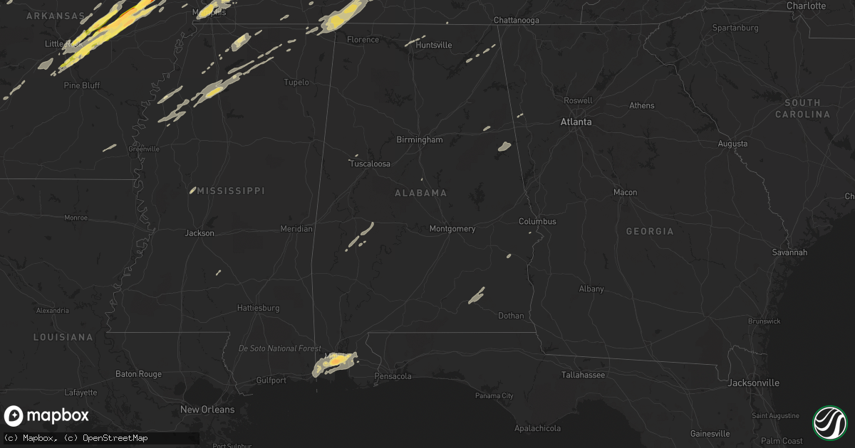
Hail Map in Alabama on December 23, 2015
Get this storm
December 23 map
$229
one time, instant access
Download today. No call, no setup
Keep the $229
Bought the map and want the full workflow? Apply the entire $229 to a subscription within 7 days. None of it is wasted.
Every map, not just this one
This buys you this map. Subscription and you get every map we run, in the markets you choose from a few cities to whole states to nationwide. Plus real-time alerts the moment a storm fires.
Contact data
Name, contact info, occupancy, even credit band for addresses in the footprint. You go from where it hit to who to call.
Become the source they trust
Unlimited branding weather history reports on demand. You already have the documented answer ready for the property owner, and you are the one who showed up with it.
Property data and RoofTrace estimates
Pull up any address you have got, its value and the exact code rules for that jurisdiction, straight from One Click Code. Then RoofTrace estimates the squares, pitch, and roof value, priced the way you price.
Storm reports in Alabama
Alabama
| Date | Description |
|---|---|
| 12/23/20157:30 AM CST | Media reports trees across roadway at fort lake road and gaston loop road |
| 12/23/20157:00 AM CST | 2 inch hail reported via broadcast media. Size estimated from viewer photo. |
| 12/23/20156:48 AM CST | Trees and power lines down on old pascagoula rd. Near carrol plantation rd. Time estimated via radar. |
| 12/23/20156:30 AM CST | Trees across the road at fort lake rd and gaston loop rd. Time estimated from radar. |
| 12/23/20154:29 AM CST | Tornado debris signature confirmed by dual-pol radar data. |
| 12/23/20153:45 AM CST | Tornado debris signature confirmed by dual-pol radar data. |
| 12/23/201512:10 AM CST | Tree down. Time estimated from radar. |
| 12/23/201512:10 AM CST | Tree down across the road. Time estimated from radar. |
| 12/23/201512:10 AM CST | Tree down in elba. Time estimated from radar. |
| 12/22/20157:05 PM CST | Houses damaged along cr 40 just south of the tennessee line. Damage corresponds to tornado debris signature from dual pol radar. Time estimated from radar. |
| 12/22/20157:00 PM CST | Small trees down along county road 54 between cr 14 and 21. Time estimated from radar. |
| 12/22/20157:00 PM CST | Ef-2 tornado snapped and uprooted numerous trees...damaged several single family homes...and one church along its 7.4 mile path. Max wind speed 115 mph. Max path width |
| 12/22/20157:00 PM CST | Small trees down along county road 54 between cr 14 and 21. Time estimated from radar. |
All States Impacted by Hail Map on December 23, 2015
Cities Impacted by Hail Map on December 23, 2015
- Jonesboro, AR
- Bay, AR
- Harrisburg, AR
- Weiner, AR
- Memphis, TN
- Dickson, TN
- Ledbetter, KY
- Grand Bay, AL
- Daphne, AL
- Mobile, AL
- Theodore, AL
- Mason, TN
- Stanton, TN
- Owensboro, KY
- Brighton, TN
- Cordova, TN
- Proctor, AR
- Marion, AR
- Arlington, TN
- Atoka, TN
- West Memphis, AR
- Covington, TN
- Millington, TN
- Clay, KY
- Ariton, AL
- Brundidge, AL
- Jack, AL
- Lutts, TN
- Hohenwald, TN
- Michie, TN
- Glen, MS
- Burnsville, MS
- Waynesboro, TN
- Iron City, TN
- Iuka, MS
- Counce, TN
- Savannah, TN
- Cypress Inn, TN
- Collinwood, TN
- Lawrenceburg, TN
- Waterloo, AL
- Utica, KY
- Kuttawa, KY
- Cloverport, KY
- Manitou, KY
- Brookport, IL
- Smithland, KY
- Eddyville, KY
- Tiline, KY
- Rhodelia, KY
- Tell City, IN
- Hawesville, KY
- Payneville, KY
- Burna, KY
- Salem, KY
- Arlington, KY
- Philpot, KY
- Uniontown, KY
- Slaughters, KY
- Boaz, KY
- Whitesville, KY
- Derby, IN
- Central, IN
- Henderson, KY
- Corydon, KY
- Madisonville, KY
- Corydon, IN
- Morganfield, KY
- Rome, IN
- Hickory, KY
- Dixon, KY
- Sturgis, KY
- Elizabeth, IN
- Sebree, KY
- Melber, KY
- Nebo, KY
- Paducah, KY
- Battletown, KY
- Providence, KY
- Hardinsburg, KY
- Grand Rivers, KY
- Hanson, KY
- Waverly, KY
- Dawson Springs, KY
- Robards, KY
- Rumsey, KY
- Symsonia, KY
- Cunningham, KY
- Gilbertsville, KY
- Calhoun, KY
- Fancy Farm, KY
- Lanesville, IN
- Mayfield, KY
- Stephensport, KY
- Benton, KY
- Princeton, KY
- Bardwell, KY
- Clinton, KY
- Calvert City, KY
- Mauckport, IN
- Cannelton, IN
- Lewisport, KY
- Maceo, KY
- Fredonia, KY
- Marion, KY
- Union Star, KY
- Magnolia, AL
- Cumberland City, TN
- Erin, TN
- Saint Francis, AR
- Campbell, MO
- Piggott, AR
- Mena, AR
- Harvest, AL
- Paris, MO
- Cherry Valley, AR
- Little Rock, AR
- Redfield, AR
- Lonoke, AR
- Sheridan, AR
- Hickory Ridge, AR
- Carlisle, AR
- Biscoe, AR
- Keo, AR
- Scott, AR
- England, AR
- Des Arc, AR
- Hensley, AR
- Hazen, AR
- McCrory, AR
- Augusta, AR
- Griffithville, AR
- Colt, AR
- Cotton Plant, AR
- Wynne, AR
- Hickman, KY
- Mounds, IL
- Dresden, TN
- Palmersville, TN
- Cottage Grove, TN
- Paris, TN
- Puryear, TN
- Water Valley, KY
- Wingo, KY
- Sedalia, KY
- Martin, TN
- Kirksey, KY
- Fulton, KY
- South Fulton, TN
- Dukedom, TN
- Beebe, AR
- Ward, AR
- Austin, AR
- Cabot, AR
- McRae, AR
- Thomaston, AL
- Uniontown, AL
- Faunsdale, AL
- Linden, AL
- Bradford, TN
- Gleason, TN
- Greenfield, TN
- Henry, TN
- McKenzie, TN
- Friendship, TN
- Dyersburg, TN
- Newbern, TN
- English, IN
- Branchville, IN
- Leopold, IN
- Wickes, AR
- Vandervoort, AR
- Cove, AR
- Bono, AR
- Walnut Ridge, AR
- Benton, MS
- Yazoo City, MS
- Ashdown, AR
- Ogden, AR
- Farmington, KY
- Roundhill, KY
- Jetson, KY
- Bowling Green, KY
- Brownsville, KY
- Echola, AL
- Elrod, AL
- Myrtle, MS
- Ripley, MS
- Blue Mountain, MS
- Hickory Flat, MS
- Ripley, TN
- Brownsville, TN
- Pope, MS
- Oakland, MS
- Enid, MS
- Barlow, KY
- Enterprise, AL
- Elba, AL
- New Brockton, AL
- Plainview, AR
- Hurricane Mills, TN
- McEwen, TN
- Senatobia, MS
- Como, MS
- East Prairie, MO
- Clarksdale, MS
- Duncan, MS
- Alligator, MS
- Searcy, AR
- Judsonia, AR
- Liberty, IL
- Payson, IL
- Holly Springs, MS
- Byhalia, MS
- Boonville, IN
- Tennyson, IN
- Russellville, AR
- Elkton, KY
- Hopkinsville, KY
- Trenton, KY
- Pembroke, KY
- Tiptonville, TN
- Lake City, AR
- Portageville, MO
- Steele, MO
- Kennett, MO
- Senath, MO
- Hayti, MO
- Black Oak, AR
- Fisher, AR
- Bragg City, MO
- Leachville, AR
- Arbyrd, MO
- Monette, AR
- Wardell, MO
- Gobler, MO
- Hornersville, MO
- Cardwell, MO
- Crofton, KY
- White Plains, KY
- Graham, KY
- Bremen, KY
- Charlestown, IN
- Dell, AR
- Trumann, AR
- Caraway, AR
- Manila, AR
- Marked Tree, AR
- Quincy, IL
- Palmyra, MO
- Fowler, IL
- Murray, KY
- Hardin, KY
- Cadiz, KY
- Rutherford, TN
- Kenton, TN
- Almo, KY
- Cerulean, KY
- Hazel, KY
- Dexter, KY
- Sharon, TN
- Big Rock, TN
- Oak Grove, KY
- Herndon, KY
- Courtland, MS
- Charleston, MS
- Coldwater, MS
- Summertown, TN
- Vienna, IL
- Belknap, IL
- Falls Of Rough, KY
- Texarkana, TX
- Wedowee, AL
- Woodland, AL
- Parma, MO
- Essex, MO
- Mount Vernon, TX
- Mendon, IL
- Henagar, AL
- Pisgah, AL
- Drew, MS
- Cleveland, MS
- Tutwiler, MS
- Ruleville, MS
- Merigold, MS
- Sims, AR
- Monroe, TN
- Byrdstown, TN
- Mount Vernon, IN
- Buchanan, GA
- Tallapoosa, GA
- Greenbrier, TN
- Springfield, TN
- Paragould, AR
- Donaldson, AR
- Vanleer, TN
- Marmaduke, AR
- Rector, AR
- Taylor, MS
- Oxford, MS
- Sardis, MS
- Alba, TX
- Quitman, TX
- Frankfort, KY
- Dardanelle, AR
- Delaware, AR
- De Mossville, KY
- Crittenden, KY
- Morning View, KY
- Parks, AR
- Dubois, IN
- Jasper, IN
- Livingston, TN
- Allons, TN
- Hilham, TN
- Annona, TX
- Cleveland, AR
- Clinton, AR
- Center Ridge, AR
- Scotland, AR
- Greenway, AR
- Michigan City, MS
- Lamar, MS
- Halls, TN
- Patterson, MO
- Athens, AL
- Tanner, AL
- Henning, TN
- Seale, AL
- Central City, KY
- Beaver Dam, KY
- Drakesboro, KY
- Rockport, KY
- Lambert, MS
- Batesville, MS
- Water Valley, MS
- Grand Chain, IL
- Karnak, IL
- Ullin, IL
- Jacksonville, AR
- North Little Rock, AR
- Caneyville, KY
- Olaton, KY
- Horse Branch, KY
- Dyer, TN
- Trenton, TN
- Lewisburg, KY
- Tyronza, AR
- New Albany, IN
- Newport, AR
- Tennessee Ridge, TN
- Stewart, TN
- Lockesburg, AR
- Fordsville, KY
- Hartford, KY
- Greenville, KY
- Powderly, KY
- Oden, AR
- Mendenhall, MS
- Ursa, IL
- Ashland City, TN
- Hamburg, AR
- Potts Camp, MS
- Coatsburg, IL
- Taylor, MO
- Camp Point, IL
- Charlotte, TN
- Earle, AR
- Cash, AR
- Irvington, AL
- Crawfordsville, AR
- Beech Grove, AR
- Swifton, AR
- Alicia, AR
- Evansville, IN
- Harned, KY
- Irvington, KY
- Webster, KY
- Dover, TN
- Buchanan, TN
- Union City, TN
- Graham, AL
- Heflin, AL
- Lineville, AL
- Cromwell, KY
- Smithville, TN
- Beedeville, AR
- Scroggins, TX
- Winnsboro, TX
- Anniston, AL
- Guston, KY
- Brandenburg, KY
- Ekron, KY
- Rienzi, MS
- Nashville, AR
- Clarksville, TX
- Garvin, OK
- Idabel, OK
- Monroe City, MO
- Catron, MO
- Dexter, MO
- Matthews, MO
- Bertrand, MO
- Sikeston, MO
- Bernie, MO
- Lawrenceburg, KY
- Mount Eden, KY
- Watson, OK
- Bath Springs, TN
- Decaturville, TN
- Amagon, AR
- Traskwood, AR
- Benton, AR
- Bauxite, AR
- Liberty, TN
- Cairo, IL
- Pulaski, IL
- Mound City, IL
- Villa Ridge, IL
- Charleston, MO
- Olmsted, IL
- Kevil, KY
- Dyess, AR
- Dowelltown, TN
- Fairhope, AL
- Stapleton, AL
- Moss Point, MS
- Loxley, AL
- Somerville, TN
- Sharon Grove, KY
- Atkins, AR
- Hattieville, AR
- Middleton, TN
- Sulphur, IN
- Centerville, TN
- Dutton, AL
- Section, AL
- Pinola, MS
- Newhebron, MS
- Crenshaw, MS
- Langston, AL
- Talco, TX
- Boyle, MS
- Jemison, AL
- Elora, TN
- Hampshire, TN
- Mount Pleasant, TN
- Keokuk, IA
- Spring Hill, TN
- Corinth, MS
- Fulton, AR
- Only, TN
- Shelby, MS
- Lyon, MS
- Bald Knob, AR
- Dermott, AR
- Earlington, KY
- Munfordville, KY
- Upton, KY
- Brookland, AR
- Ider, AL
- Waddy, KY
- Arkadelphia, AR
- Westport, TN
- Pleasant View, TN
- Joelton, TN
- Washington, AR
- Malden, MO
- Bethel Springs, TN
- Adamsville, TN
- Linden, TN
- Clayton, AL
- Midway, AL
- Obion, TN
- Ridgely, TN
- Caruthersville, MO
- Blytheville, AR
- Cooter, MO
- Hornbeak, TN
- Troy, TN
- Gordo, AL
- Abbeville, MS
- Mabelvale, AR
- Dumas, MS
- Prospect, KY
- Jeffersonville, IN
- Sellersburg, IN
- Okolona, AR
- Havana, AR
- Paris, AR
- Clarkson, KY
- Danville, AR
- Waldron, AR
- New Concord, KY
- Turrell, AR
- Gates, TN
- Sweet Water, AL
- Goodlettsville, TN
- Foreman, AR
- Simpson, IL
- Hickory Plains, AR
- Hannibal, MO
- Clayton, IL


