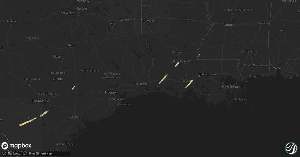
Hail Map in Texas on December 21, 2013
Get this storm
December 21 map
$229
one time, instant access
Download today. No call, no setup
Keep the $229
Bought the map and want the full workflow? Apply the entire $229 to a subscription within 7 days. None of it is wasted.
Every map, not just this one
This buys you this map. Subscription and you get every map we run, in the markets you choose from a few cities to whole states to nationwide. Plus real-time alerts the moment a storm fires.
Contact data
Name, contact info, occupancy, even credit band for addresses in the footprint. You go from where it hit to who to call.
Become the source they trust
Unlimited branding weather history reports on demand. You already have the documented answer ready for the property owner, and you are the one who showed up with it.
Property data and RoofTrace estimates
Pull up any address you have got, its value and the exact code rules for that jurisdiction, straight from One Click Code. Then RoofTrace estimates the squares, pitch, and roof value, priced the way you price.
Storm reports in Texas
Texas
| Date | Description |
|---|---|
| 12/21/20132:35 PM CST | Report from jasper county sheriff on numerous trees down between fm777 and fm1747 near hwy190 |
| 12/21/20132:25 PM CST | Report from jasper sheriff of damage to a home in mt union with additional trees down |
| 12/21/20132:25 PM CST | Tyler em reports a roof torn off of harris grocery convenience store and blown across the street |
| 12/21/20132:15 PM CST | Trees and power line down |
| 12/21/20132:10 PM CST | Numerous trees and power lines down. 27000 people without power. |
| 12/21/20132:10 PM CST | Trees down throughout the southern part of the county |
| 12/21/20131:50 PM CST | Trees down |
| 12/21/20131:50 PM CST | Trees down |
| 12/21/20131:28 PM CST | Broken windshields at state police office. Downed trees as well and throughout town. |
All States Impacted by Hail Map on December 21, 2013
Cities Impacted by Hail Map on December 21, 2013
- Cotulla, TX
- Youngsville, LA
- Abbeville, LA
- New Iberia, LA
- Broussard, LA
- Erath, LA
- Saint Martinville, LA
- Pleasanton, TX
- Floresville, TX
- Falls City, TX
- Big Wells, TX
- Charlotte, TX
- Pearsall, TX
- Iowa, LA
- Kinder, LA
- Lake Charles, LA
- La Grange, TX
- West Point, TX
- Ville Platte, LA
- Oakdale, LA
- Muldoon, TX
- Woodville, MS
- Hackberry, LA
- Grosse Tete, LA
- Sweet Water, AL


