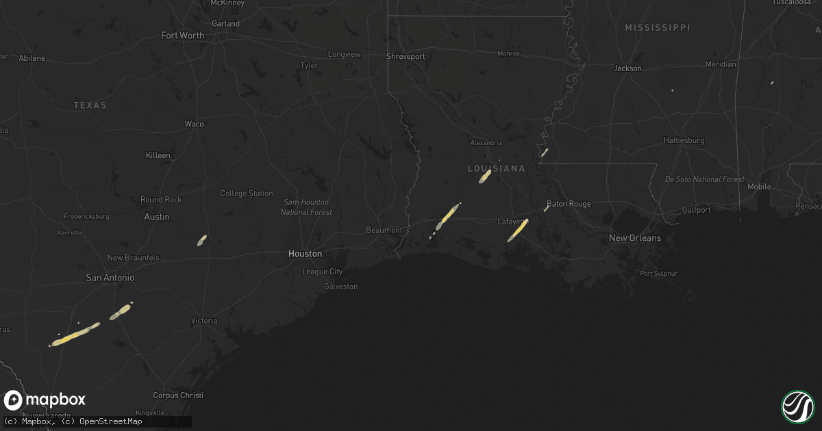
Hail Map on December 21, 2013
Get this storm
December 21 map
$229
one time, instant access
Download today. No call, no setup
Keep the $229
Bought the map and want the full workflow? Apply the entire $229 to a subscription within 7 days. None of it is wasted.
Every map, not just this one
This buys you this map. Subscription and you get every map we run, in the markets you choose from a few cities to whole states to nationwide. Plus real-time alerts the moment a storm fires.
Contact data
Name, contact info, occupancy, even credit band for addresses in the footprint. You go from where it hit to who to call.
Become the source they trust
Unlimited branding weather history reports on demand. You already have the documented answer ready for the property owner, and you are the one who showed up with it.
Property data and RoofTrace estimates
Pull up any address you have got, its value and the exact code rules for that jurisdiction, straight from One Click Code. Then RoofTrace estimates the squares, pitch, and roof value, priced the way you price.
States Impacted by Hail Map on December 21, 2013
Storm reports
Alabama
| Date | Description |
|---|---|
| 12/21/20131:35 AM CST | Roof peeled back from mobile home along scott branch road. Report relayed by madison county ema. |
| 12/20/201310:12 PM CST | A tree was reported down on east avenue/cr 497. |
| 12/20/20139:34 PM CST | Multiple trees reported down approaching waterloo on the westbound lane. |
| 12/20/20138:58 PM CST | Cwop station dw9506 reported a wind gust to 63 mph. |
| 12/20/20138:55 PM CST | Tree reported down on riverton rose trail. |
West Virginia
| Date | Description |
|---|---|
| 12/21/20132:50 AM CST | Trees down on sugarland road |
| 12/21/20132:30 AM CST | Power lines and trees down throughout county. Tree across terry hill rd.... Large signage blown down in belington. |
| 12/21/20132:30 AM CST | Widespread trees down. Near queens...and in extreme northern and southern upshur county |
| 12/21/20132:15 AM CST | Trees down. Route 50 near marion... Rushing fork... And quietdale |
| 12/21/20132:15 AM CST | Trees down in rosemont... Oak grove and irontown in taylor county |
| 12/21/20132:15 AM CST | Trees down in frametown and heaters. Power outages remain in gassaway |
| 12/21/20132:14 AM CST | Trees down everywhere in brooke county |
| 12/21/20132:00 AM CST | Trees down on jesse run road and on murphy run road |
| 12/21/20131:45 AM CST | Trees down in baldwin and sand fork |
| 12/21/20131:42 AM CST | Scattered trees down |
| 12/21/20131:32 AM CST | Tree down in kenova wv |
| 12/21/20131:30 AM CST | A few trees down through lincoln county. |
| 12/21/20131:30 AM CST | Trees limbs down across phone and power lines along route 33 |
| 12/21/20131:15 AM CST | Trees down knocking down powerlines. |
| 12/21/20131:08 AM CST | A local report indicates 60 MPH wind near 3 SSE WILLIAMSTOWN |
| 12/21/20131:05 AM CST | Tree down in chapmanville |
| 12/21/20131:00 AM CST | Trees down around the county. Buffalo...culloden |
| 12/21/20131:00 AM CST | Trees down in reedy... Spencer... And at robertson ridge |
| 12/21/20131:00 AM CST | 10 ft x 10ft section of shingles ripped off home. |
| 12/21/201312:40 AM CST | Large tree powerpole down on camden ave |
| 12/21/201312:40 AM CST | Tree fell on house and vehicle at 3956 beechwood dr. |
Pennsylvania
| Date | Description |
|---|---|
| 12/21/20134:28 AM CST | Large tree down across state route 30 1 mile east route 18 intersection. |
| 12/21/20133:15 AM CST | Wires down around stoystown |
| 12/21/20132:45 AM CST | Tree blocking roadway at rt 322 and knox dale rd |
| 12/21/20132:18 AM CST | Trees and wires down...centered around the south hills |
| 12/21/20132:10 AM CST | A few trees down throughout the county |
| 12/21/20131:59 AM CST | Trees down across county |
| 12/21/20131:40 AM CST | A couple of trees down |
Louisiana
| Date | Description |
|---|---|
| 12/21/20135:33 PM CST | A few trees down in the area. |
| 12/21/20135:28 PM CST | A couple power lines down. |
| 12/21/20135:13 PM CST | Numerous trees down |
| 12/21/20134:40 PM CST | Trees down |
| 12/21/20134:40 PM CST | Report of a powerline snapped at the tim mcgraw sports complex on gin road in rayville. |
| 12/21/20134:30 PM CST | Reports of a tree down on highway 15 near alto. |
| 12/21/20134:16 PM CST | A portion of the roof of the strauss theater on the ulm campus was removed. |
| 12/21/20134:12 PM CST | Trees down county wide. |
| 12/21/20134:12 PM CST | Tree downed on highway 139. |
| 12/21/20134:02 PM CST | Tree across hwy 151 |
| 12/21/20134:01 PM CST | Trees and power lines down |
| 12/21/20134:00 PM CST | Trees down across western parish. |
| 12/21/20133:46 PM CST | Trees and power lines downm across the parish |
| 12/21/20133:45 PM CST | 6 large trees down... One crushing a vehicle... On dean road... 1 mile east of farmerville |
| 12/21/20133:45 PM CST | Trees and power lines down. Structures damaged. There were no injuries. |
| 12/21/20133:43 PM CST | An ef1 tornado touched down near downsville la causing damage to several trees and a barn. |
| 12/21/20133:30 PM CST | Trees and power lines down across the city |
| 12/21/20133:30 PM CST | Trees andf power lines down parish wide |
| 12/21/20133:05 PM CST | Trees down throughout the parish |
| 12/21/20133:00 PM CST | Numerous trees and power lines down |
| 12/21/20132:55 PM CST | Tree down on i-20 |
| 12/21/20132:26 PM CST | Several trees down |
| 12/21/20131:50 PM CST | Several trees down |
| 12/21/20131:46 PM CST | Trees down |
| 12/21/20131:25 PM CST | Trees down |
| 12/21/201312:40 PM CST | Trees down throughout the parish |
| 12/21/201312:38 PM CST | Trees down. |
| 12/21/201312:30 PM CST | Trees down |
| 12/21/201311:32 AM CST | Tree down. |
Indiana
| Date | Description |
|---|---|
| 12/20/20138:55 PM CST | Scattered trees were reported down throughout the county due to thunderstorm winds. |
| 12/20/20138:50 PM CST | 2 trees down |
| 12/20/20138:41 PM CST | Scattered trees were reported down across the eastern portions of ripley county due to thunderstorm winds. Some of these trees fell on roadways and knocked down power l |
| 12/20/20137:37 PM CST | Tree was down last night along paoli pike just south of buffalo trail. |
| 12/20/20137:21 PM CST | Pine tree blown over. May have been easier to fall because of the saturated grounds. |
| 12/20/20137:11 PM CST | Relayed report from dispatch of several trees down on the west side of the county |
| 12/20/20136:40 PM CST | With torrential rain near downtown rockport. |
Mississippi
| Date | Description |
|---|---|
| 12/21/20135:57 PM CST | Storm survey indicated ef1 tornado with path length of 6.2 miles...path width of 200 yards. Began 10.1 miles southwest of senatobia and ended five minutes later 4.3 mil |
| 12/21/20135:43 PM CST | Utility poles and lines reported down in the lula and moon lake areas. |
| 12/21/20135:43 PM CST | Home damaged along fleet harbour rd near the coahoma county line. Power flashes also reported from another source. Possible tornado. |
| 12/21/20135:40 PM CST | *** 1 fatal *** mobile home overturned and slammed into a tree. |
| 12/21/20135:30 PM CST | 64mph wind gust measured at cleveland awos. |
| 12/21/20135:25 PM CST | Trees down. Power poles down on hwy 8. Shed destroyed. Shingles blown off a house. |
| 12/21/20135:25 PM CST | This tornado continued from chicot co arkansas into bolivar co. Numerous power poles were snapped...a well built tractor shed was destroyed and several farm buildings w |
| 12/21/20135:22 PM CST | *** 1 fatal *** mobile home overturned and slammed into a tree. |
| 12/21/20135:22 PM CST | *** 1 fatal *** storm survey rated ef2 with estimated maximum wind of 120 mph... Path length of 10.4 miles...and maximum width of 300 yards. Major damage to mobile home |
| 12/21/20135:20 PM CST | Mobile home damaged near rena lara. |
| 12/21/20135:19 PM CST | *** 1 fatal *** storm survey rated ef2 with estimated maximum wind of 120 mph... Path length of 10.4 miles...and maximum width of 300 yards. Major damage to mobile home |
| 12/21/20135:12 PM CST | A few trees were uprooted just w of hwy 1. Report relayed via social media. |
| 12/21/20134:12 PM CST | Tree downed on highway 139. |
| 12/20/20139:53 PM CST | Damage all around northeast panola county...major building damage on hwy 315w near the panola and quitman county line. Farm damage on intersection of landfill and sprin |
| 12/20/20139:00 PM CST | A tree was reported down on snow road. |
| 12/20/20138:00 PM CST | 80 mph wind measured by a storm chaser. Another 68 mph wind reported near the same location. |
| 12/20/20137:32 PM CST | A few trees were down along with a power pole along hwy 407. |
| 12/20/20137:30 PM CST | Power lines and trees down on the north side of town. |
| 12/20/20137:27 PM CST | Few trees down near scottland rd. |
| 12/20/20137:20 PM CST | Several trees down in town and northern portions of the county. |
| 12/20/20137:15 PM CST | Trees down on highways 12 and 17. |
| 12/20/20137:05 PM CST | Reports of two trees down on highway 17 near black hawk. |
| 12/20/20137:01 PM CST | Report of a tree down on county road 216 near valley hill community. |
| 12/20/20137:00 PM CST | Several trees down on the west side of the county. |
| 12/20/20136:55 PM CST | Numerous trees down on various county roads. |
| 12/20/20136:37 PM CST | A couple trees and power lines were down. |
| 12/20/20136:30 PM CST | Large trees down. Lots of limbs broken. Estimated 50-60 mph wind. Power is out. |
| 12/20/20136:30 PM CST | Tree down on money rd. |
| 12/20/20136:20 PM CST | Numerous trees and power lines down...some trees blocking roadways. |
| 12/20/20136:20 PM CST | *** 2 inj *** car blown off the roadway along i-55 at yellow dog road jaws of life required in the rescue. Also atc fitness roof blown off at i-55 and senatobia road. M |
| 12/20/20136:05 PM CST | Trees and powerlines reported down within the city limits. |
Ohio
| Date | Description |
|---|---|
| 12/21/20131:21 AM CST | Trees down on bay road |
| 12/21/20131:19 AM CST | Trees down |
| 12/21/20131:17 AM CST | Trees down around county. Trampolene launched. |
| 12/21/20131:17 AM CST | Trees down on sr 151 |
| 12/21/20131:07 AM CST | Trees and power lines down |
| 12/21/20131:05 AM CST | Scattered trees down...including 5 large ones |
| 12/21/20131:05 AM CST | Two to three trees down in the county. |
| 12/21/20131:00 AM CST | Couple of trees down. |
| 12/21/20131:00 AM CST | Tree fell on house. |
| 12/21/201312:58 AM CST | Trees down on canton road |
| 12/21/201312:51 AM CST | Trees down...scattered around county |
| 12/21/201312:40 AM CST | Tree on house at 806 e main st |
| 12/21/201312:40 AM CST | A few trees down. |
| 12/21/201312:36 AM CST | Shingles blown off roof and chimney blown down. |
| 12/21/201312:35 AM CST | A local report indicates 64 MPH wind near ALBANY |
| 12/21/201312:34 AM CST | Multiple trees down on red devil rd in flatwood ky |
| 12/21/201312:32 AM CST | A local report indicates 65 MPH wind near PROCTORVILLE |
| 12/21/201312:29 AM CST | Tree down in willow wood oh at 2845 township rd |
| 12/21/201312:22 AM CST | Powerpole down at 125 remy rd |
| 12/21/201312:20 AM CST | Tree and power poll down with power lines on the house at 1018 tick ridge rd. |
| 12/21/201312:15 AM CST | Many trees down across the county. |
| 12/21/201312:15 AM CST | A few trees down. |
| 12/21/201312:05 AM CST | Large limb down. |
| 12/21/201312:05 AM CST | A couple of trees down. |
| 12/21/201312:00 AM CST | Powerpole down at intersection of cr1 and us52 |
| 12/21/201312:00 AM CST | One tree down in newbury. |
| 12/20/201311:55 PM CST | 6 inch tree limb knocked down by wind. |
| 12/20/201311:55 PM CST | Several trees down countywide |
| 12/20/201311:53 PM CST | 2 trees down on stewart hollow rd. Also structural damage to house on meadow lane in wheelersburg. |
| 12/20/201311:49 PM CST | Shingles were blown off of a roof and porch was damaged due to thunderstorm winds. |
| 12/20/201311:47 PM CST | 6 inch diameter branch down |
| 12/20/201311:45 PM CST | Trees down on lines on shyville rd |
| 12/20/201311:45 PM CST | Numerous trees and power lines down countywide |
| 12/20/201311:45 PM CST | Multiple trees down on red devil rd in flatwood ky |
| 12/20/201311:42 PM CST | Trees downed power lines on sr 125. |
| 12/20/201311:40 PM CST | Trees down. Corrected date. |
| 12/20/201311:38 PM CST | Christmas lawn decorations blown away. |
| 12/20/201311:30 PM CST | A few trees down across the county |
| 12/20/201311:30 PM CST | Numerous trees down in the western part of the county |
| 12/20/201311:25 PM CST | A local report indicates 60 MPH wind near WOOSTER |
| 12/20/201311:15 PM CST | Powerlines and trees were blown down. |
| 12/20/201311:15 PM CST | Multiple trees down. Portion of a barn blown down. 3 buildings destroyed. |
| 12/20/201311:10 PM CST | One tree knocked tree. |
| 12/20/201311:05 PM CST | Roads were closed due to trees and power lines blown down countywide. Also had 2 to 4 inches of water on roadways. |
| 12/20/201311:00 PM CST | Roof torn off building. 2 people trapped inside building. |
| 12/20/201311:00 PM CST | Trees down and power lines down. This also occurred in ripley and aberdeen. |
| 12/20/201311:00 PM CST | Numerous trees down in vicinity of mansfield. |
| 12/20/201310:45 PM CST | A couple of trees down |
| 12/20/201310:35 PM CST | Widespread trees down and power outages. Four buildings damaged especially the north end of town...near route 96 and 13. |
| 12/20/201310:34 PM CST | Numerous trees and several power lines down in and around marion. Semi blown over in the vicinity of marion. |
| 12/20/201310:20 PM CST | Pole building destroyed in new winchester. |
| 12/20/201310:13 PM CST | One tree limb down on berlin rd. |
| 12/20/201310:10 PM CST | One power pole down at hawkins rd and smith rd |
| 12/20/201310:00 PM CST | 2 trees down |
| 12/20/201310:00 PM CST | Silo damaged near la rue. Time estimated from radar |
| 12/20/20139:52 PM CST | A couple of trees and power lines were reported down in the area due to thunderstorm winds. A power pole was also blown over along state route 31 south of route 190. |
| 12/20/20139:50 PM CST | One tree down on sr 48 near nutt rd. |
| 12/20/20139:48 PM CST | Scattered trees were reported down in the western portions of clark county due to thunderstorm winds. |
| 12/20/20139:40 PM CST | A couple trees down |
| 12/20/20139:34 PM CST | A local report indicates 65 MPH wind near VANDALIA |
| 12/20/20139:30 PM CST | Barn damage in hunstville. |
| 12/20/20139:28 PM CST | A business sustained roof damage due to thunderstorm winds. Two by fours from the damaged roofing were blown into the roof and garage of a nearby residence. A garage wa |
| 12/20/20139:20 PM CST | 2 large oak trees downed. Winds est 70-80 mph |
| 12/20/20139:09 PM CST | Several trees down |
| 12/20/20139:04 PM CST | A local report indicates 58 MPH wind near SIDNEY |
| 12/20/20139:03 PM CST | A local report indicates 74 MPH wind near SIDNEY |
| 12/20/20139:03 PM CST | Corrected location |
| 12/20/20138:50 PM CST | Large tree down. Corrected date. |
| 12/20/20138:47 PM CST | A local report indicates 58 MPH wind near KVES VERSAILLES APT |
| 12/20/20138:30 PM CST | A local report indicates 71 MPH wind near UNION CITY |
Illinois
| Date | Description |
|---|---|
| 12/20/20138:20 PM CST | Roof of mcclean county high school partially torn off. Major water damage to gymnasium. |
Kentucky
| Date | Description |
|---|---|
| 12/21/20135:45 PM CST | Late report. Power lines down across riley road near u.s. 641 intersection. |
| 12/21/20135:35 PM CST | A power pole down along with power lines |
| 12/21/20135:35 PM CST | On highway 641 between murray and almo...construction barrels were blown into the highway. Also...a trampoline was in the middle of the road |
| 12/21/20135:35 PM CST | A local report indicates 67 MPH wind near MURRAY |
| 12/21/20135:31 PM CST | Several trees down...power poles snapped and power line down on the following roads...charles miller road...coles campground road...highway 783...west fort road...highw |
| 12/21/20135:31 PM CST | Updated report from jackson school road. |
| 12/21/20135:27 PM CST | Some structural damage to a house in the city of coldwater. Also some power outages. |
| 12/21/20135:05 PM CST | Power outages |
| 12/21/20133:35 PM CST | Measured at fire department personnel home in benton kentucky. |
| 12/21/201312:40 AM CST | Tree reported down due to high winds on town hill road at highway 30w. |
| 12/21/201312:30 AM CST | Tree down on stoney fork road. Time estimated off of radar. |
| 12/21/201312:20 AM CST | Trees down on sexton creek...highway 577. |
| 12/21/201312:05 AM CST | One tree down on flat mary road. |
| 12/21/201312:05 AM CST | Trees down on highways 847 and 1503. |
| 12/21/201312:02 AM CST | A local report indicates 60 MPH wind near 1 SSE RODBURN |
| 12/20/201311:55 PM CST | Several trees down on highway 25 and on hazel patch road. |
| 12/20/201311:52 PM CST | Trees down on willard johnson road. |
| 12/20/201311:35 PM CST | Several trees down including one on a house. |
| 12/20/201311:35 PM CST | Trees down on red hill road. |
| 12/20/201311:30 PM CST | Roof damage occurred to a home in vanceburg due to thunderstorm winds. Scattered trees were downed around the county as well...with some road closures reported due to t |
| 12/20/201311:30 PM CST | Tree fell on car due to high winds on hwy 70...one and half miles off us-150. |
| 12/20/201311:30 PM CST | Kentucky mesonet |
| 12/20/201311:30 PM CST | Multiple large trees uprooted. Power lines down. Some roof damage in morehead area. |
| 12/20/201311:30 PM CST | Trees down on furnace road and halls road. |
| 12/20/201311:30 PM CST | Multiple trees down around somerset. Power pole snapped with powerlines down onto vehicles. |
| 12/20/201311:27 PM CST | Reports of several power outages across the northern and eastern extent of montgomery county. |
| 12/20/201311:25 PM CST | Several trees downed by thunderstorm winds. |
| 12/20/201311:25 PM CST | Trees down on power lines. |
| 12/20/201311:20 PM CST | Several trees down on mccormick road and scattered across the rest of the county. |
| 12/20/201311:12 PM CST | Large tree down on some power lines |
| 12/20/201311:12 PM CST | Several trees down in flemingsburg and around the county. |
| 12/20/201311:10 PM CST | Multiple reports of trees down across the town due to thunderstorm winds. |
| 12/20/201311:09 PM CST | Spotter called in estimated 55-60 mph wind gusts |
| 12/20/201311:05 PM CST | Trees down on powerlines. |
| 12/20/201311:05 PM CST | At mason county mesonet station |
| 12/20/201311:02 PM CST | Large tree down over highway 558. |
| 12/20/201311:00 PM CST | Numerous trees blocking roads across the county. |
| 12/20/201310:55 PM CST | Nicholas county mesonet measured 67.2 mph wind gust |
| 12/20/201310:52 PM CST | Multiple large trees down in and around jamestown |
| 12/20/201310:49 PM CST | A local report indicates 64 MPH wind near MOUNT OLIVET |
| 12/20/201310:48 PM CST | A downed tree put a hole in the roof of a residence |
| 12/20/201310:44 PM CST | Trees and power lines reported down across danville |
| 12/20/201310:44 PM CST | Barn destroyed and several trees uprooted snapped. Neighbors barn gone as well as several trees. |
| 12/20/201310:41 PM CST | Ef1 tornado damaged or destroyed many barns...power lines and poles down or snapped...and many soft and hardwood trees snapped...twisted...and uprooted. Several homes a |
| 12/20/201310:41 PM CST | Power pole snapped in the town of nicholasville |
| 12/20/201310:40 PM CST | Trees down blocking new zion rd |
| 12/20/201310:39 PM CST | Siding ripped from a household at 2020 armstrong mill road |
| 12/20/201310:37 PM CST | Relayed report of damage to a double-wide as the storms moved through last night. Had power lines in the kitchen. |
| 12/20/201310:37 PM CST | Large tree down over highway 206 |
| 12/20/201310:34 PM CST | Two trees down on hwy 330. Several other trees down across the county. |
| 12/20/201310:31 PM CST | 57 knot wind gust reported at the lex asos |
| 12/20/201310:30 PM CST | Metal roof of a barn moved onto hwy 1842. Estimated wind speed 65 mph. |
| 12/20/201310:30 PM CST | Two barns damaged...a garage...and a roof on a double wide. Several trees snapped on dutch chapel road. |
| 12/20/201310:29 PM CST | Ef1 tornado damaged several homes...barns...and outbuildings. Trees and power poles snapped and uprooted. |
| 12/20/201310:28 PM CST | Multiple trees reported down in woodford county... Particularly on old frankfort pike and midway road. |
| 12/20/201310:25 PM CST | Several trees down across southern part of grant county...including along hwy 330. |
| 12/20/201310:24 PM CST | Spotter called in report of 61 mph measured wind gust |
| 12/20/201310:23 PM CST | Twitter report of two barns destroyed near western elementary...along with several signs twisted. |
| 12/20/201310:22 PM CST | Spotter called in report of measured wind gust of 60 mph |
| 12/20/201310:15 PM CST | Franklin county mesonet reported 62.7 mph wind gust |
| 12/20/201310:15 PM CST | Franklin county mesonet reported 62.7 mph wind gust |
| 12/20/201310:14 PM CST | Spotter measured 82 mph wind gust. Report via facebook. |
| 12/20/201310:12 PM CST | Spotter reported 60 mph estimated wind gust with heavy rain |
| 12/20/201310:12 PM CST | Tree down on a residential property in the indian hills subdivision. |
| 12/20/201310:12 PM CST | Large tree downed along with multiple power lines on us 62 between starhill dr and lock road east of lawrenceburg. |
| 12/20/201310:10 PM CST | Tree reported down across old sheep pen road via twitter. Christmas tree at the capitol also reported down. |
| 12/20/201310:10 PM CST | Multiple reports south of wilkinson blvd and north of east main street of trees down on roads and power poles down and blown transformers. Reports gathered from dispatc |
| 12/20/201310:09 PM CST | Fft asos reported gust of 51 knots |
| 12/20/201310:07 PM CST | Ef1 from 2.9 w to 3.1 ne of campbellsville |
| 12/20/201310:06 PM CST | 63 mph wind |
| 12/20/201310:05 PM CST | Report of trees down at the campbellsville country club... Possibly with tops twisted off. |
| 12/20/201310:05 PM CST | Metcalfe county mesonet reported 70 mph wind gust |
| 12/20/201310:03 PM CST | Twitter report of a tree down across old sheep pen road west of frankfort. Time estimated based on radar. |
| 12/20/201310:02 PM CST | Trees reported down in the county via facebook. Estimated wind gusts to be greater than 50 mph. |
| 12/20/201310:01 PM CST | Trees down in wheatley and new liberty areas. |
| 12/20/201310:00 PM CST | Trees and power lines reported down as well as structural damage to buildings... Including roofs |
| 12/20/201310:00 PM CST | Several small hardwood trees down along pleasant valley road near creek. Wind speed estimated at 65 mph. Time estimated by radar. |
| 12/20/20139:58 PM CST | Trees reported down in vine grove |
| 12/20/20139:55 PM CST | Barn roof reported blown off via dispatch. Trees also reported down across the county. |
| 12/20/20139:53 PM CST | Couple of large trees down |
| 12/20/20139:43 PM CST | Media relayed report of measured 72 mph wind gust in bardstown |
| 12/20/20139:42 PM CST | Damage reported in the horse cave area to structures... Roofs... And barns down. Trees and power lines reported down as well. |
| 12/20/20139:42 PM CST | Damage reported to shed roof |
| 12/20/20139:42 PM CST | Media reports numerous trees and power lines down in haywood near glasgow and cave city |
| 12/20/20139:41 PM CST | Considerable amounts of damage reported in the cave city area with numerous trees down...roofs damaged...and other structural damage. |
| 12/20/20139:40 PM CST | High winds lasted a couple minutes followed by torrential downpour. |
| 12/20/20139:38 PM CST | Multiple reports of trees... Limbs... Power lines... And other debris down on roadways throughout the city. Several power outages reported. |
| 12/20/20139:37 PM CST | Several trees reported down with power outages in radcliff |
| 12/20/20139:35 PM CST | Spotter reported 60 mph estimated wind gust with heavy rain. Time estimated from radar. |
| 12/20/20139:30 PM CST | Barn roof reported blown off via dispatch. Trees also reported down across the county. Time estimated based on radar. |
| 12/20/20139:30 PM CST | Report received via facebook of 61 mph wind gust with 3 inch tree limbs down |
| 12/20/20139:30 PM CST | Numerous large tree branches down in alexandria and surrounding areas. |
| 12/20/20139:29 PM CST | Tree limbs reported down in the shepherdsville area with 1-2 inch limbs down on hwy 61 and hwy 245. |
| 12/20/20139:25 PM CST | Large tree limbs reported down as well as minor damage to out buildings |
| 12/20/20139:25 PM CST | Spotter reported peak gust of 59 mph on scottsville road. Also reported lots of trees and power lines down. |
| 12/20/20139:24 PM CST | Minor damage to outbuildings |
| 12/20/20139:24 PM CST | Strong winds snapped a 30-foot section off the top of a large radio tower |
| 12/20/20139:20 PM CST | Hardin county mesonet reported 67.4 mph wind gust |
| 12/20/20139:20 PM CST | One of the warren county mesonets reported 60.2 mph wind gust |
| 12/20/20139:18 PM CST | Trees reported down with one blocking gold city road. Store front window busted out on main street along with power outages. |
| 12/20/20139:16 PM CST | Bwg asos reported 54 knot wind gust. Power outages reported in the area. |
| 12/20/20139:14 PM CST | Report received via facebook of 67 mph wind gust in western edmonson county |
| 12/20/20139:11 PM CST | Several trees reported down with power outages in radcliff. Time estimated based on radar. |
| 12/20/20139:10 PM CST | Trees reported down in vine grove. Time estimated based on radar. |
| 12/20/20139:10 PM CST | Trees reported down with one blocking gold city road. Store front window busted out on main street along with power outages. Time estimated from radar. |
| 12/20/20139:10 PM CST | Simpson county mesonet reported 62.5 mph gust |
| 12/20/20139:08 PM CST | Damage reported to shed roof. Time estimated based on radar. |
| 12/20/20139:05 PM CST | Trees reported down in mcdaniels |
| 12/20/20138:59 PM CST | Numerous trees down county wide |
| 12/20/20138:55 PM CST | Damage to signs and porches |
| 12/20/20138:48 PM CST | Trees reported down in mcdaniels. Time estimated based on radar. |
| 12/20/20138:40 PM CST | One and half foot diametere tree uprooted at 123 moreland drive. Tree in yard and not blocking road or any structure. |
| 12/20/20138:24 PM CST | Report of trees down on preston hwy near bennett lane |
| 12/20/20138:20 PM CST | Corrected for county location. Roof of mcclean county high school partially torn off. Major water damage to gymnasium. |
| 12/20/20138:20 PM CST | Section of roofing removed from garage attached to house. |
| 12/20/20138:11 PM CST | Report via metrosafe of tree down on cecil ave. |
| 12/20/20138:07 PM CST | Highway 68 west and bypass. |
| 12/20/20138:06 PM CST | Measured at highways 117 and 164 in western christian county. |
| 12/20/20138:05 PM CST | A local report indicates 83 MPH wind near HOPKINSVILLE |
| 12/20/20138:04 PM CST | Multiple reports via metrosafe of power lines down... Transformers on fire... And power outages across the metro area |
| 12/20/20138:02 PM CST | Tree reported down by metrosafe near cannons lane and pee wee reese road |
| 12/20/20137:51 PM CST | Report via metrosafe of tree down on cecil ave. Time estimated based on radar. |
| 12/20/20137:35 PM CST | Trees reported down in hardinsburg |
| 12/20/20136:47 PM CST | Relayed by storm spotters. |
| 12/20/20136:40 PM CST | Trees down and power outage across from owensboro catholic high school. |
| 12/20/20136:38 PM CST | Report from owensboro airport asos. Widespread tree and power line damage reported in the community. |
| 12/20/20136:08 PM CST | Reported near montgomery at interstate 24 by trigg county spotter chief. |
Texas
| Date | Description |
|---|---|
| 12/21/20132:35 PM CST | Report from jasper county sheriff on numerous trees down between fm777 and fm1747 near hwy190 |
| 12/21/20132:25 PM CST | Tyler em reports a roof torn off of harris grocery convenience store and blown across the street |
| 12/21/20132:25 PM CST | Report from jasper sheriff of damage to a home in mt union with additional trees down |
| 12/21/20132:15 PM CST | Trees and power line down |
| 12/21/20132:10 PM CST | Numerous trees and power lines down. 27000 people without power. |
| 12/21/20132:10 PM CST | Trees down throughout the southern part of the county |
| 12/21/20131:50 PM CST | Trees down |
| 12/21/20131:50 PM CST | Trees down |
| 12/21/20131:28 PM CST | Broken windshields at state police office. Downed trees as well and throughout town. |
Arkansas
| Date | Description |
|---|---|
| 12/21/20135:10 PM CST | A couple of trees and power lines down. |
| 12/21/20135:10 PM CST | A couple trees and power lines down. |
| 12/21/20135:00 PM CST | The national weather service has confirmed that an ef-1 tornado briefly touched down saturday night. The storm crossed the chicot and desha county line twice damaging f |
| 12/21/20134:57 PM CST | Update...4 18 wheelers flipped...5 houses heavily damaged...15 houses with minor damage...numerous trees and powerpoles down...hwy 65 shut down...and 2 injuries. |
| 12/21/20134:51 PM CST | Four homes were damaged near halley. The damage was generally minor according to the report. |
| 12/21/20134:51 PM CST | *** 2 inj *** numerous power poles snapped...two eighteen wheelers flipped over causing 2 minor injuries. Damage occurred to several homes and farm buildings and heavy |
| 12/21/20134:49 PM CST | Numerous powerlines were blown down north of highway 208 and near highway 65. Possible tornado. Relayed via nws little rock. |
| 12/21/20134:45 PM CST | Powerlines down along hwy 165. |
| 12/21/20134:43 PM CST | Large tree was blown down on a house along hwy 165 in the boydell community. |
| 12/21/20134:42 PM CST | A few power lines down. |
| 12/21/20134:19 PM CST | Multiple trees down...some snapped along with a few power lines down. This was near co rd 4 just west of hwy 425. Possible tornado. A few additional trees were down to |
| 12/21/20134:15 PM CST | A few trees down across co roads. |
| 12/21/20134:14 PM CST | Trees down in the area of co rd 229 and hwy 133. |
| 12/21/20134:12 PM CST | Tree downed on a house in downtown crossett. |
| 12/21/20133:39 PM CST | Trees and power lines down on highway 38 west of hughes. Damage associated with a possible tornado. Distance west of town estimated. |
| 12/21/20133:38 PM CST | Semis overturned on interstate forty near mile marker 276. Sheriff reported tornado on the ground and then relayed the report to trained spotter. |
| 12/21/20133:29 PM CST | *** 3 inj *** possible tornado. Two houses completely destroyed. Three houses with significant roof damage. One serious injury and 2 minor injuries. Numerous trees and |
| 12/21/20133:29 PM CST | Roof blown off house on highway 38 near hughes. Possible tornado. |
| 12/21/20132:44 PM CST | Measured wind gust of 58 mph. |
Tennessee
| Date | Description |
|---|---|
| 12/21/20134:23 PM CST | Utility poles down along west liberty ave in covington. |
| 12/21/201311:28 AM CST | Trees knocked down on eldad road. Power out in parts of fayetteville. |
| 12/21/201311:27 AM CST | Trees knocked down on west campbell street. |
| 12/21/201311:14 AM CST | Trees knocked down on highway 231 at chester ridge. |
| 12/21/20132:40 AM CST | Couple trees down. |
| 12/21/20131:00 AM CST | Several trees and power lines down in lancing. |
| 12/21/201312:50 AM CST | Few trees and power lines down in deer lodge. |
| 12/21/201312:42 AM CST | Powerlines down. |
| 12/21/201312:40 AM CST | Couple trees down. |
| 12/21/201312:40 AM CST | Couple trees down. |
| 12/21/201312:09 AM CST | A few large trees down in the county. |
| 12/20/201311:55 PM CST | A few trees and power lines down across the northern end of the county. |
| 12/20/201311:50 PM CST | A few trees down across the county. |
| 12/20/201311:41 PM CST | Trees down across the county...especially near the putnam county border. |
| 12/20/201311:35 PM CST | 8 inch diameter tree limbs were knocked down on spring creek road. |
| 12/20/201311:32 PM CST | Trees were knocked down on cumberland springs road. |
| 12/20/201311:32 PM CST | Trees were knocked down on five points road. |
| 12/20/201311:32 PM CST | Trees were knocked down on highway 130 near motlow college. Power lines also down. |
| 12/20/201311:29 PM CST | Multiple power outages reported across cannon county. |
| 12/20/201311:28 PM CST | Trees knocked down on eldad road. Power out in parts of fayetteville. |
| 12/20/201311:27 PM CST | Trees knocked down on west campbell street. |
| 12/20/201311:22 PM CST | Trees and power lines down across the county. |
| 12/20/201311:14 PM CST | Trees knocked down on highway 231 at chester ridge. |
| 12/20/201311:13 PM CST | Tree down on tom fall rd. At southfork rd. |
| 12/20/201310:59 PM CST | Tree on house at central avenue. |
| 12/20/201310:54 PM CST | A few trees down across the county as well as a few power outages. |
| 12/20/201310:46 PM CST | Report of a tree across the road located at 384 statesville road in watertown |
| 12/20/201310:35 PM CST | A few trees down in the western part of the county near moss. |
| 12/20/201310:31 PM CST | Sonic drive in reports sign blown out. |
| 12/20/201310:26 PM CST | Watertown fire department reports 58.4 mph winds measured |
| 12/20/201310:21 PM CST | Scattered trees reported down countywide. |
| 12/20/201310:17 PM CST | A couple of trees down |
| 12/20/201310:13 PM CST | Uprooted tree at 2206 hollow tree way. Another one down along sulphur springs rd. |
| 12/20/201310:11 PM CST | Large tree down in vine area blocking southbound lane of hwy 231. |
| 12/20/201310:07 PM CST | Trees and wires down on w forrest ave along with power poles down at clearview drive and west main street. |
| 12/20/201310:07 PM CST | Smyrna airport emergency manager reports one jetstream aircraft blown over onto another aircraft. |
| 12/20/201310:06 PM CST | Two storage sheds destroyed at lowes. |
| 12/20/201310:03 PM CST | Trousdale county amateur radio operator reports power outage at end of pures bend rd at the cumberland river east of hwy 141 |
| 12/20/201310:03 PM CST | Reports of trees down hartsville pike and vance lane in lebanon |
| 12/20/20139:59 PM CST | Railroad crossing arm snapped at corner of enon springs and lowry. |
| 12/20/20139:59 PM CST | Tree down on chicken road one half mile south of lebanon on hwy 231. |
| 12/20/20139:54 PM CST | Trees down and limbs snapped at corner of sam ridley parkway and industrial blvd. Two business signs blown out as well. Winds estimated between 60-70 mph. |
| 12/20/20139:45 PM CST | 60 foot evergreen tree uprooted and minor roof damage |
| 12/20/20139:44 PM CST | Large tree down at 13700 block of old hickory blvd in the cane ridge area. Tree downed a power line and transformer. |
| 12/20/20139:42 PM CST | Tree down on residence in downtown lawrenceburg along 5th stree. |
| 12/20/20139:39 PM CST | Wide spread power outages reported in hampshire and along sr-50 betwen marshall and maury counties |
| 12/20/20139:36 PM CST | Tree blocking roadway at old nashville road adn taylor road. |
| 12/20/20139:35 PM CST | Power pole down over roadway at saddleview and cedarview drive. |
| 12/20/20139:30 PM CST | 65 plus mph measured between old smyrna road to wilson road to edmondson road |
| 12/20/20139:30 PM CST | Report of a tree down near the intersection of santa fe pike and snow creek road and a report of a tree fell on a car on knob creek road near theta pike. |
| 12/20/20139:27 PM CST | 62 mph wind gust reported from tennessee state university with their weather system on weatherbug. |
| 12/20/20139:23 PM CST | Power outages reported along hwy 64 in western lawrence county |
| 12/20/20139:23 PM CST | Wall of unfinished building collapsed and shingles blown off a home at corner of lindsley and academy place. |
| 12/20/20139:15 PM CST | Brick wall blown out of building blocking the road on whites creek pike and dickerson road |
| 12/20/20139:13 PM CST | Mulitple reports of trees down across the county. |
| 12/20/20139:13 PM CST | Tree blown down at a residence on tyree springs rd near white house high school. |
| 12/20/20139:13 PM CST | Large tree branch blown down along marlin road. |
| 12/20/20139:13 PM CST | Reports of power outages in bellevue |
| 12/20/20139:02 PM CST | Large tree down at the corner of union hill rd and whites creek pk. |
| 12/20/20139:02 PM CST | Power outages being reports in fairview |
| 12/20/20138:57 PM CST | Numerous trees down across the county. |
| 12/20/20138:57 PM CST | Trees down and several roofs damaged along asburn rd. From the 5500 block to fred perry rd. |
| 12/20/20138:48 PM CST | A barn was destroyed on turnip seed rd just off petway rd. |
| 12/20/20138:47 PM CST | Reports of power outages north of ashland city. |
| 12/20/20138:39 PM CST | Hickman county ema reports trees down and power lines down in centeville proper. |
| 12/20/20138:39 PM CST | Power outages reported in cedar hill and adams. |
| 12/20/20138:35 PM CST | Numerous trees down. Estimated winds over 60 mph. |
| 12/20/20138:20 PM CST | Coffee landing road closed due to downded trees and powerlines. |
| 12/20/20138:20 PM CST | On hwy 70 buildings damaged and power lines arching near the humphreys dickson county line. |
| 12/20/20138:19 PM CST | A local report indicates 60 MPH wind near CLARKSVILLE |
| 12/20/20138:14 PM CST | Trees down across the county...as well as power outages countywide. |
| 12/20/20138:09 PM CST | Trees down across the county. |
| 12/20/20138:06 PM CST | Trees reported down along richland ave and hwy 13 |
| 12/20/20138:02 PM CST | Reports of trees down on hwy 49 north of houston stewart county line. |
| 12/20/20137:54 PM CST | Roof was blown off of a home on frank earhart road in dover. |
| 12/20/20137:46 PM CST | Trees down along birdsong... Danville and lick creek roads |
| 12/20/20137:30 PM CST | Siding damaged and gutters ripped off home along hwy 54. |
| 12/20/20137:16 PM CST | Estimated 60mph highway 100 at hwy 18. |
| 12/20/20137:10 PM CST | Tree fell on a house located on roberts road. |
| 12/20/20137:05 PM CST | A tree fell on a house and caused considerable damage on roberts street in bemis. |
| 12/20/20137:03 PM CST | A local report indicates 63 MPH wind near 5 WSW JACKSON |
| 12/20/20136:46 PM CST | Disconnected tracter trailers overturned.the side of a metal building ripped off and numerous trees down near hwy 70 and bratt thomas road. |
| 12/20/20136:30 PM CST | Trees and powerlines down county wide. |
| 12/20/20136:25 PM CST | Germantown pkwy and popler estimated 65mph wind along with dime size hail. |
| 12/20/20136:12 PM CST | Tree on home. |
Maryland
| Date | Description |
|---|---|
| 12/21/20133:03 AM CST | Trees down on underwood road |
Cities Impacted by Hail Map on December 21, 2013
- Cotulla, TX
- Youngsville, LA
- Abbeville, LA
- New Iberia, LA
- Broussard, LA
- Erath, LA
- Saint Martinville, LA
- Pleasanton, TX
- Floresville, TX
- Falls City, TX
- Big Wells, TX
- Charlotte, TX
- Pearsall, TX
- Iowa, LA
- Kinder, LA
- Lake Charles, LA
- La Grange, TX
- West Point, TX
- Ville Platte, LA
- Oakdale, LA
- Muldoon, TX
- Woodville, MS
- Hackberry, LA
- Grosse Tete, LA
- Sweet Water, AL