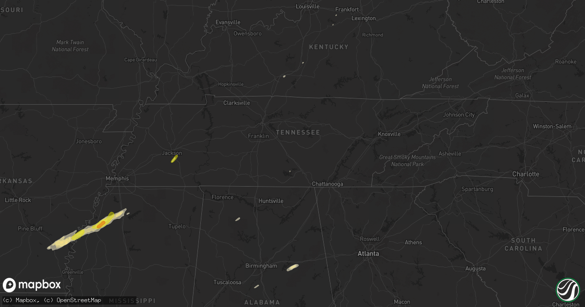
Hail Map in Tennessee on December 1, 2018
Get this storm
December 1 map
$229
one time, instant access
Download today. No call, no setup
Keep the $229
Bought the map and want the full workflow? Apply the entire $229 to a subscription within 7 days. None of it is wasted.
Every map, not just this one
This buys you this map. Subscription and you get every map we run, in the markets you choose from a few cities to whole states to nationwide. Plus real-time alerts the moment a storm fires.
Contact data
Name, contact info, occupancy, even credit band for addresses in the footprint. You go from where it hit to who to call.
Become the source they trust
Unlimited branding weather history reports on demand. You already have the documented answer ready for the property owner, and you are the one who showed up with it.
Property data and RoofTrace estimates
Pull up any address you have got, its value and the exact code rules for that jurisdiction, straight from One Click Code. Then RoofTrace estimates the squares, pitch, and roof value, priced the way you price.
Storm reports in Tennessee
Tennessee
| Date | Description |
|---|---|
| 12/01/20181:55 PM CST | Quarter sized hail in blue goose. |
| 12/01/20185:45 AM CST | At 1144 PM CST, a severe thunderstorm was located 7 miles northwest of Dunlap, moving northeast at 60 mph. HAZARD...60 mph wind gusts. SOURCE...Radar indicated. IMPACT...Expect damage to roofs, siding, and trees. Locations impacted include... Dunlap, Brayton and Palio. |
| 12/01/20185:19 AM CST | At 1119 PM CST, severe thunderstorms were located along a line extending from near Spencer to 10 miles west of Pikeville to 9 miles northwest of Dunlap, moving northeast at 40 mph. HAZARD...60 mph wind gusts. SOURCE...Radar indicated. IMPACT...Expect damage to roofs, siding, and trees. Locations impacted include... Pikeville, Melvine, Fall Creek Falls State Park, Mount Crest and Old Cumberland. |
| 12/01/20185:15 AM CST | At 1115 PM CST, a severe thunderstorm was located 9 miles south of Spencer, moving east at 50 mph. HAZARD...60 mph wind gusts. SOURCE...Radar indicated. IMPACT...Expect damage to roofs, siding, and trees. Locations impacted include... Fall Creek Falls State Park. |
| 11/30/201811:50 PM CST | Trees down along state route 8 on cagle mountain. |
| 11/30/201811:45 PM CST | Several trees down across big springs gap rd. |
All States Impacted by Hail Map on December 1, 2018
Cities Impacted by Hail Map on December 1, 2018
- South Pekin, IL
- Pekin, IL
- Manito, IL
- Green Valley, IL
- Liberty, IN
- Brookville, IN
- Eaton, OH
- Camden, OH
- Girard, IL
- Waggoner, IL
- Sardis, MS
- Como, MS
- Hanna City, IL
- Elmwood, IL
- Glasford, IL
- Brimfield, IL
- Edwards, IL
- Trivoli, IL
- Canton, IL
- Huntsville, IL
- Clayton, IL
- Browning, IL
- Bath, IL
- Pleasant Plains, IL
- New Berlin, IL
- Springfield, IL
- Topeka, IL
- Forest City, IL
- Palmyra, IL
- Franklin, IL
- Waverly, IL
- Loveland, OH
- Maineville, OH
- Morrisonville, IL
- Harvel, IL
- Carrollton, IL
- Kane, IL
- Rockbridge, IL
- Fieldon, IL
- Alexandria, KY
- Cincinnati, OH
- Stonington, IL
- Niantic, IL
- Taylorville, IL
- Mount Auburn, IL
- Decatur, IL
- Harristown, IL
- Warrensburg, IL
- Blue Mound, IL
- Farmington, IL
- Yates City, IL
- Marion, AL
- Lyon, MS
- Sledge, MS
- Coahoma, MS
- Marks, MS
- Selma, AL
- Litchfield, IL
- Mount Olive, IL
- Staunton, IL
- Butler, IL
- Benld, IL
- Raymond, IL
- Edinburg, IL
- Palmer, IL
- Arlington, GA
- Morgan, GA
- Leary, GA
- Albany, GA
- Dry Branch, GA
- Jeffersonville, GA
- Bon Secour, AL
- Gulf Shores, AL
- Foley, AL
- Talladega, AL
- Defuniak Springs, FL
- Crestview, FL
- California, KY
- Medora, IL
- Jerseyville, IL
- Easton, IL
- Laurel Hill, FL
- Lewistown, IL
- Astoria, IL
- Havana, IL
- Oakfield, GA
- Leesburg, GA
- Munford, AL
- Lincoln, AL
- Enterprise, AL
- Watson, AR
- Tichnor, AR
- Dumas, AR
- Westville, FL
- Dayton, KY
- Newport, KY
- Fort Thomas, KY
- Macon, IL
- Kilbourne, IL
- Chandlerville, IL
- Cantrall, IL
- Loami, IL
- Greenfield, IL
- Beardstown, IL
- Frederick, IL
- Chambersburg, IL
- Versailles, IL
- Meredosia, IL
- Virden, IL
- Divernon, IL
- Auburn, IL
- Crumrod, AR
- Duncan, MS
- Crenshaw, MS
- Clarksdale, MS
- Snow Lake, AR
- Alligator, MS
- Tillar, AR
- Cochran, GA
- Samson, AL
- Coffee Springs, AL
- Melbourne, KY
- Ponce De Leon, FL
- Williamsport, IN
- Boswell, IN
- Ambia, IN
- Montevallo, AL
- Owenton, KY
- Dry Ridge, KY
- Osgood, IN
- Greensburg, IN
- Eglin Afb, FL
- Buffalo, IL
- Mechanicsburg, IL
- Griggsville, IL
- Illiopolis, IL
- Bluffton, GA
- Cuthbert, GA
- Edison, GA
- Fort Gaines, GA
- Coleman, GA
- Pinson, TN
- Oreana, IL
- Moulton, AL
- Danville, AL
- East Peoria, IL
- Groveland, IL
- Fidelity, IL
- Chesterfield, IL
- Lumpkin, GA
- Kathleen, GA
- Warner Robins, GA
- Bonaire, GA
- Amelia, OH
- Hartford, AL
- Holton, IN
- Waddy, KY
- Latonia, KY
- Bellevue, KY
- Clinton, IL
- Wapella, IL
- Morning View, KY
- De Mossville, KY
- Estill Springs, TN
- Elba, AL
- New Brockton, AL
- Daleville, AL
- Pensacola, FL
- Horse Cave, KY
- Munfordville, KY
- Florala, AL
- Ozark, AL
- Mason, OH
- West Chester, OH
- Caryville, FL
- Chaplin, KY
- Bloomfield, KY
- Maroa, IL
- Gould, AR
- Elberta, AL
- Lillian, AL
- Newville, AL
- Slocomb, AL
- Newton, AL
- Dothan, AL
- Midland City, AL
- Le Roy, IL
- Chancellor, AL
- Pawnee, IL
- Arenzville, IL
- Chapin, IL
- Dawson, IL
- Riverton, IL
- Rochester, IL
- Hettick, IL
- Carlinville, IL
- Blakely, GA
- Virginia, IL
- Senatobia, MS
- Mellwood, AR
- Pickens, AR
- Bowling Green, KY
- Oakland, KY
- Covington, KY
- Sarah, MS
- Farmersville, IL
- Beech Bluff, TN
- Jackson, TN
- Medon, TN


