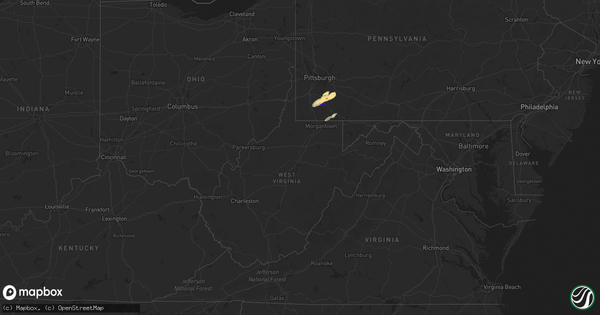
Hail Map in West Virginia on November 27, 2022
Get this storm
November 27 map
$229
one time, instant access
Download today. No call, no setup
Keep the $229
Bought the map and want the full workflow? Apply the entire $229 to a subscription within 7 days. None of it is wasted.
Every map, not just this one
This buys you this map. Subscription and you get every map we run, in the markets you choose from a few cities to whole states to nationwide. Plus real-time alerts the moment a storm fires.
Contact data
Name, contact info, occupancy, even credit band for addresses in the footprint. You go from where it hit to who to call.
Become the source they trust
Unlimited branding weather history reports on demand. You already have the documented answer ready for the property owner, and you are the one who showed up with it.
Property data and RoofTrace estimates
Pull up any address you have got, its value and the exact code rules for that jurisdiction, straight from One Click Code. Then RoofTrace estimates the squares, pitch, and roof value, priced the way you price.
Storm reports in West Virginia
West Virginia
| Date | Description |
|---|---|
| 11/27/20221:03 PM CST | Tree down near rt 18 north and nutter fork. |
| 11/27/202212:52 PM CST | Tree down in greenwood. |
| 11/27/202212:43 PM CST | Power lines down... Time estimate from radar |
| 11/27/202212:19 PM CST | Wood county 911 center advised they received a call from a citizen that there was a large tree down on route 14. No more information was received as the caller got disc |
| 11/26/20228:21 PM CST | At 221 PM EST, a severe thunderstorm was located over Granville, or over Star City, moving northeast at 50 mph. HAZARD...60 mph wind gusts. SOURCE...Radar indicated. IMPACT...Expect damage to trees and power lines, resulting in some power outages. Locations impacted include... Morgantown, Uniontown, Connellsville, Westover, Star City, Masontown, South Connellsville, Farmington, Point Marion, Granville, Brookhaven, and Cassville.This includes the following highways... Interstate 68 in West Virginia between mile markers 1 and 15. Interstate 79 in Pennsylvania between mile markers 0 and 1. Interstate 79 in West Virginia between mile markers 147 and 160. |
| 11/26/20227:45 PM CST | At 144 PM EST, a severe thunderstorm was located near Pennsboro, or near Harrisville, moving northeast at 55 mph. HAZARD...60 mph wind gusts. SOURCE...Radar indicated. IMPACT...Expect damage to roofs, siding, and trees. Locations impacted include... Harrisville, Pennsboro, West Union, Ellenboro, Alma, Mountain, Lima, Greenwood, Pike, Center Point, Canton and Highland.This includes Route 50 in West Virginia between mile markers 36 and51, and near mile marker 54. |
All States Impacted by Hail Map on November 27, 2022
Cities Impacted by Hail Map on November 27, 2022
- West Newton, PA
- Monongahela, PA
- Donora, PA
- Monessen, PA
- Belle Vernon, PA
- Coal Center, PA
- Perryopolis, PA
- Daisytown, PA
- Elco, PA
- Allenport, PA
- Fayette City, PA
- California, PA
- Roscoe, PA
- Stockdale, PA
- Newell, PA
- Brownsville, PA
- Dawson, PA
- Wickhaven, PA
- Smithton, PA
- Fredericktown, PA
- Dunlevy, PA
- Charleroi, PA
- Ruffs Dale, PA
- Herminie, PA
- New Stanton, PA
- Clarksville, PA
- La Belle, PA
- Millsboro, PA
- Beallsville, PA
- Scenery Hill, PA
- East Millsboro, PA
- Hunker, PA
- Grindstone, PA
- Waynesburg, PA
- Vestaburg, PA
- Denbo, PA
- Marianna, PA
- Richeyville, PA
- Webster, PA
- Scottdale, PA
- Jefferson, PA
- Farmington, PA
- Ohiopyle, PA
- Smithfield, PA
- Morgantown, WV
- Fairchance, PA
- Lake Lynn, PA
- Rices Landing, PA
- Star Junction, PA
- Hiller, PA
- Allison, PA


