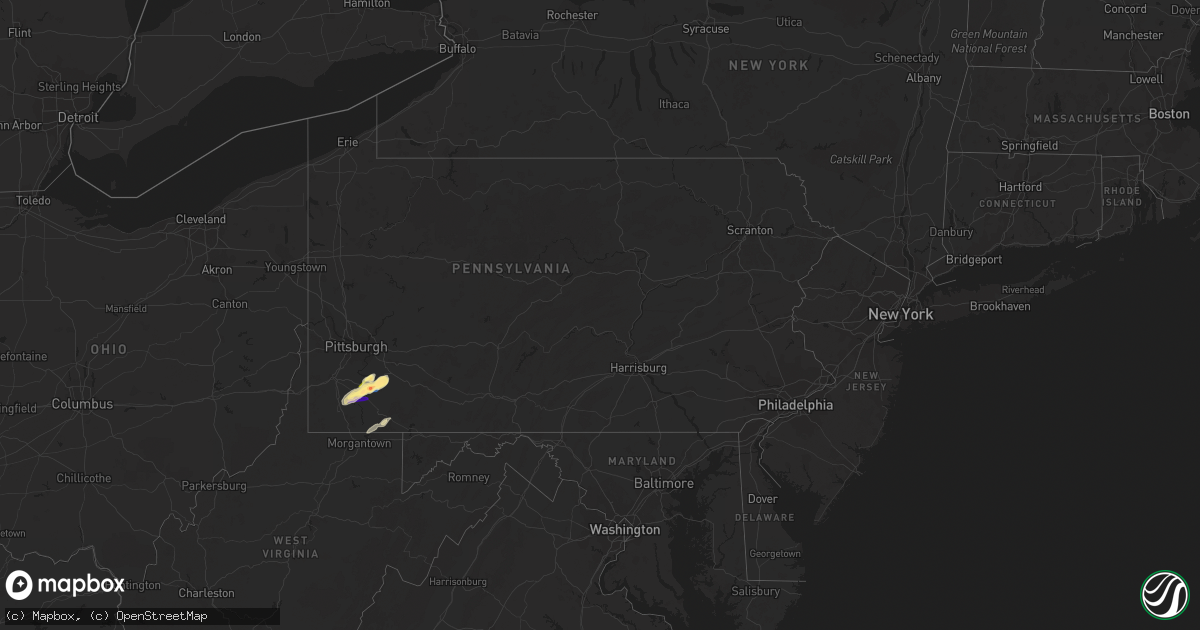
Hail Map in Pennsylvania on November 27, 2022
Get this storm
November 27 map
$229
one time, instant access
Download today. No call, no setup
Keep the $229
Bought the map and want the full workflow? Apply the entire $229 to a subscription within 7 days. None of it is wasted.
Every map, not just this one
This buys you this map. Subscription and you get every map we run, in the markets you choose from a few cities to whole states to nationwide. Plus real-time alerts the moment a storm fires.
Contact data
Name, contact info, occupancy, even credit band for addresses in the footprint. You go from where it hit to who to call.
Become the source they trust
Unlimited branding weather history reports on demand. You already have the documented answer ready for the property owner, and you are the one who showed up with it.
Property data and RoofTrace estimates
Pull up any address you have got, its value and the exact code rules for that jurisdiction, straight from One Click Code. Then RoofTrace estimates the squares, pitch, and roof value, priced the way you price.
Storm reports in Pennsylvania
Pennsylvania
| Date | Description |
|---|---|
| 11/27/20222:37 PM CST | Sporadic reports of trees and wires down across the greater johnstown area... Including westmont... The city of johnstown... Stonycreek twp... And east taylor twp. |
| 11/27/20222:21 PM CST | Multiple trees uprooted. |
| 11/27/20222:20 PM CST | Trees down along route 30 |
| 11/27/20222:19 PM CST | Multiple trees down in fairfield township. Trees down on houses. |
| 11/27/20222:16 PM CST | Multiple trees and wires down in the area |
| 11/27/20221:57 PM CST | A local report indicates 1.00 inch wind near 1 SW GREENSBURG |
| 11/27/20221:52 PM CST | Multiple trees down |
| 11/27/20221:50 PM CST | A local report indicates 2.00 inch wind near 1 ESE BANNING |
| 11/27/20221:48 PM CST | A local report indicates 1.50 inch wind near 1 S WICKHAVEN |
| 11/27/20221:47 PM CST | Siding holes in west side of house with dented cars reported. |
| 11/27/20221:47 PM CST | Wind measured with anemometer. Time estimated from radar. |
| 11/27/20221:47 PM CST | Public call reporting ping pong to golf ball sized hail with damage to screens... Car roofs... And houses. |
| 11/27/20221:44 PM CST | Tree down across crabapple road. Time estimated from radar. |
| 11/27/20221:44 PM CST | Public reported photo of 2 inch hail with measurment. |
| 11/27/20221:44 PM CST | A local report indicates 1.25 inch wind near LOWBER |
| 11/27/20221:40 PM CST | A local report indicates 1.75 inch wind near CALIFORNIA |
| 11/27/20221:40 PM CST | Donora fire chief reports several sheared off utility poles. |
| 11/27/20221:40 PM CST | Several trees and utility poles down |
| 11/27/20221:39 PM CST | Roof partially blown off of a house |
| 11/27/20221:38 PM CST | A local report indicates 1.25 inch wind near 1 S NEWELL |
| 11/27/20221:37 PM CST | Storm spotter reported quarter size hail in the town of monessen at 2:37 pm. |
| 11/27/20221:37 PM CST | Numerous trees and wires down in the eastern portion of the county |
| 11/27/20221:37 PM CST | Golf ball size hail reported at california university |
| 11/27/20221:28 PM CST | Multiple trees down |
| 11/27/20221:07 PM CST | Tree down across crabapple road. Time estimated from radar. |
| 11/26/20229:18 PM CST | At 318 PM EST, a severe thunderstorm was located over Ligonier, moving northeast at 55 mph. HAZARD...60 mph wind gusts and penny size hail. SOURCE...Radar indicated. IMPACT...Expect damage to roofs, siding, and trees. Locations impacted include... Johnstown, Westmont, Windber, Ebensburg, Belmont, Nanty-Glo, Portage, Northern Cambria, Geistown, Southmont, Patton and Cresson. |
| 11/26/20229:14 PM CST | At 313 PM EST, severe thunderstorms were located along a line extending from 6 miles northwest of Blairsville to near Derry to 6 miles north of Seven Springs, moving northeast at 60 mph. HAZARD...60 mph wind gusts. SOURCE...Radar indicated. IMPACT...Expect damage to trees and power lines, resulting in some power outages. Locations impacted include... Indiana, Latrobe, Homer City, McChesneytown-Loyalhanna, Blairsville, Derry, Ligonier, Black Lick, Clymer, Saltsburg, New Florence, and New Alexandria.This includes Pennsylvania Turnpike between mile markers 90 and 99. |
| 11/26/20228:41 PM CST | At 240 PM EST, severe thunderstorms were located along a line extending from near Monroeville to near Monongahela, moving northeast at 55 mph. HAZARD...60 mph wind gusts. SOURCE...Radar indicated. IMPACT...Expect damage to trees and power lines, resulting in some power outages. Locations impacted include... Penn Hills, Monroeville, Greensburg, McKeesport, Indiana, Jeannette, Homer City, Apollo, Plum, West Mifflin, Murrysville, and Jefferson Hills.This includes the following highways... Pennsylvania Turnpike between mile markers 52 and 69. Interstate 376 in Pennsylvania between mile markers 81 and 84. |
| 11/26/20228:29 PM CST | At 228 PM EST, a severe thunderstorm was located over Fredericktown-Millsboro, or 10 miles northeast of Waynesburg, moving northeast at 60 mph. HAZARD...60 mph wind gusts and quarter size hail. SOURCE...Radar indicated. IMPACT...Minor hail damage to vehicles is possible. Expect wind damage to trees and power lines, resulting in some power outages. Locations impacted include... Greensburg, Jeannette, Latrobe, Monessen, California, Donora, Mount Pleasant, Scottdale, Monongahela, Charleroi, McChesneytown-Loyalhanna, and Blairsville.This includes the following highways... Interstate 70 in Pennsylvania between mile markers 31 and 57. Pennsylvania Turnpike between mile markers 68 and 96. Interstate 79 in Pennsylvania between mile markers 27 and 28. |
| 11/26/20227:21 PM CST | At 120 PM EST, a severe thunderstorm was located 8 miles northwest of Sistersville, or 9 miles south of Woodsfield, moving northeast at 60 mph. HAZARD...60 mph wind gusts. SOURCE...Radar indicated. IMPACT...Expect damage to trees and power lines, resulting in some power outages. Locations impacted include... Wheeling, Moundsville, New Martinsville, Bellaire, Woodsfield, Shadyside, McMechen, Powhatan Point, Glen Dale, Bridgeport, Benwood, and Brookside.This includes Interstate 70 in Ohio between mile markers 221 and 225. |
All States Impacted by Hail Map on November 27, 2022
Cities Impacted by Hail Map on November 27, 2022
- West Newton, PA
- Monongahela, PA
- Donora, PA
- Monessen, PA
- Belle Vernon, PA
- Coal Center, PA
- Perryopolis, PA
- Daisytown, PA
- Elco, PA
- Allenport, PA
- Fayette City, PA
- California, PA
- Roscoe, PA
- Stockdale, PA
- Newell, PA
- Brownsville, PA
- Dawson, PA
- Wickhaven, PA
- Smithton, PA
- Fredericktown, PA
- Dunlevy, PA
- Charleroi, PA
- Ruffs Dale, PA
- Herminie, PA
- New Stanton, PA
- Clarksville, PA
- La Belle, PA
- Millsboro, PA
- Beallsville, PA
- Scenery Hill, PA
- East Millsboro, PA
- Hunker, PA
- Grindstone, PA
- Waynesburg, PA
- Vestaburg, PA
- Denbo, PA
- Marianna, PA
- Richeyville, PA
- Webster, PA
- Scottdale, PA
- Jefferson, PA
- Farmington, PA
- Ohiopyle, PA
- Smithfield, PA
- Morgantown, WV
- Fairchance, PA
- Lake Lynn, PA
- Rices Landing, PA
- Star Junction, PA
- Hiller, PA
- Allison, PA


