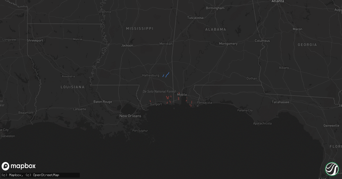
Hail Map in Alabama on October 29, 2022
Get this storm
October 29 map
$229
one time, instant access
Download today. No call, no setup
Keep the $229
Bought the map and want the full workflow? Apply the entire $229 to a subscription within 7 days. None of it is wasted.
Every map, not just this one
This buys you this map. Subscription and you get every map we run, in the markets you choose from a few cities to whole states to nationwide. Plus real-time alerts the moment a storm fires.
Contact data
Name, contact info, occupancy, even credit band for addresses in the footprint. You go from where it hit to who to call.
Become the source they trust
Unlimited branding weather history reports on demand. You already have the documented answer ready for the property owner, and you are the one who showed up with it.
Property data and RoofTrace estimates
Pull up any address you have got, its value and the exact code rules for that jurisdiction, straight from One Click Code. Then RoofTrace estimates the squares, pitch, and roof value, priced the way you price.
Storm reports in Alabama
Alabama
| Date | Description |
|---|---|
| 10/29/20226:03 PM CDT | Video of tornado on broadcast media northwest of spanish fort. |
| 10/29/20225:17 PM CDT | Numerous damage reports around magnolia springs of trees and power lines down. First responders report visual and touchdown. |
| 10/29/20225:03 PM CDT | 911 reports damage to a house near tung ave due to a possible tornado. |
| 10/29/20223:16 AM CDT | At 816 PM CDT, a severe thunderstorm was located near State Line, or 14 miles west of Chatom, moving northeast at 25 mph. HAZARD...60 mph wind gusts. SOURCE...Radar indicated. IMPACT...Expect damage to roofs, siding, and trees. Locations impacted include... Millry and Buckatunna. |
| 10/28/20227:02 PM CDT | Social media photos of damage in bon secour due to possible tornado. |


