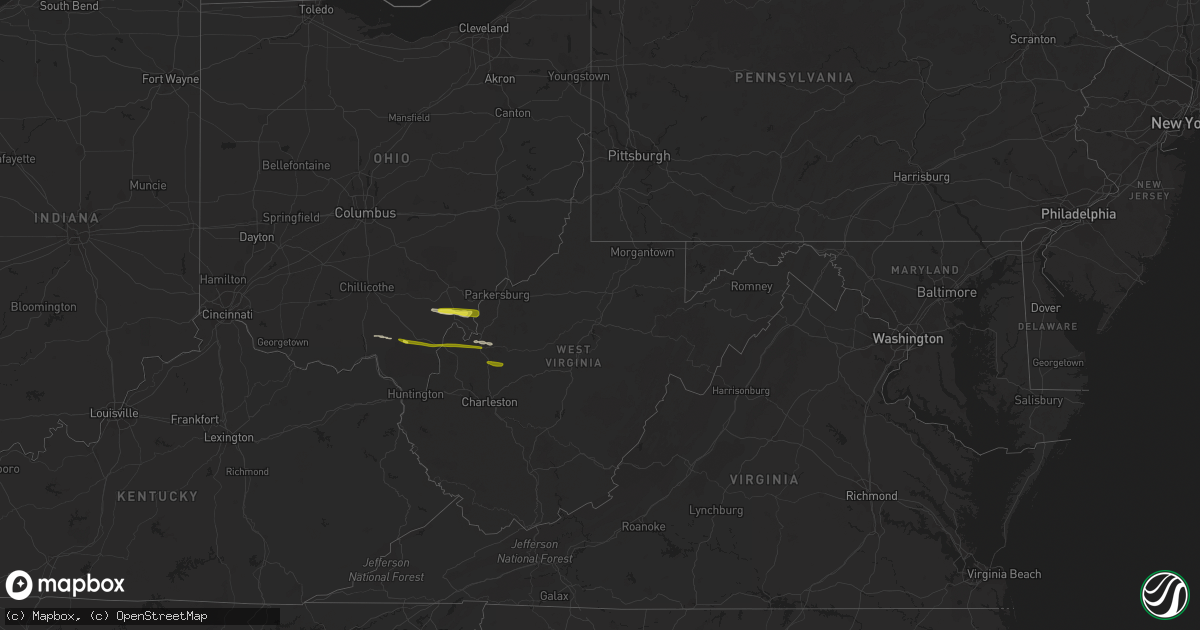
Hail Map in West Virginia on October 28, 2018
Get this storm
October 28 map
$229
one time, instant access
Download today. No call, no setup
Keep the $229
Bought the map and want the full workflow? Apply the entire $229 to a subscription within 7 days. None of it is wasted.
Every map, not just this one
This buys you this map. Subscription and you get every map we run, in the markets you choose from a few cities to whole states to nationwide. Plus real-time alerts the moment a storm fires.
Contact data
Name, contact info, occupancy, even credit band for addresses in the footprint. You go from where it hit to who to call.
Become the source they trust
Unlimited branding weather history reports on demand. You already have the documented answer ready for the property owner, and you are the one who showed up with it.
Property data and RoofTrace estimates
Pull up any address you have got, its value and the exact code rules for that jurisdiction, straight from One Click Code. Then RoofTrace estimates the squares, pitch, and roof value, priced the way you price.
Storm reports in West Virginia
West Virginia
| Date | Description |
|---|---|
| 10/28/20186:38 PM CDT | Mping report of one inch hail |
| 10/28/20186:22 PM CDT | Quarter sized hail observed at the 911 call center in ripley |
| 10/28/20183:20 AM CDT | At 819 PM EDT, severe thunderstorms were located along a line extending from near Holly River State to 9 miles southeast of Sutton to near Birch River, moving east at 50 mph. HAZARD...60 mph wind gusts and quarter size hail. SOURCE...Radar indicated. IMPACT...Hail damage to vehicles is expected. Expect wind damage to roofs, siding, and trees. Locations impacted include... Sutton, Webster Springs, Gassaway, Addison (Webster Springs), Birch River, Big Otter, Holly River State, Harrison, Mingo, Cowen, Durbin, Flatwoods, Cheat Bridge, Upper Glade, Pickens, Waneta, Boggs, Little Birch, Hacker Valley and Bergoo.This includes Interstate 79 between mile markers 36 and 68. |
| 10/28/20182:19 AM CDT | At 719 PM EDT, severe thunderstorms were located along a line extending from 8 miles northwest of Spencer to near Ripley, moving east at 50 mph. HAZARD...60 mph wind gusts and quarter size hail. SOURCE...Radar indicated. IMPACT...Hail damage to vehicles is expected. Expect wind damage to roofs, siding, and trees. Locations impacted include... Ripley, Spencer, Arnoldsburg, Reedy, Millstone and Leroy. |
| 10/28/20181:29 AM CDT | At 629 PM EDT, a severe thunderstorm was located near Albany, moving east at 45 mph. HAZARD...60 mph wind gusts and quarter size hail. SOURCE...Radar indicated. IMPACT...Hail damage to vehicles is expected. Expect wind damage to roofs, siding, and trees. Locations impacted include... Forked Run State Park, Tuppers Plains, Belleville, Reedsville, Darwin and Harrisonville. |
| 10/27/20187:40 PM CDT | Multiple trees and power lines down at 5922 erbacon road |
All States Impacted by Hail Map on October 28, 2018
Cities Impacted by Hail Map on October 28, 2018
- Pomeroy, OH
- Long Bottom, OH
- Reedsville, OH
- Rutland, OH
- Oak Hill, OH
- Racine, OH
- Ripley, WV
- Sandyville, WV
- Cottageville, WV
- Le Roy, WV
- Langsville, OH
- Albany, OH
- Minford, OH
- Lucasville, OH
- Ravenswood, WV
- Shade, OH
- Gallipolis, OH
- Patriot, OH
- Thurman, OH
- Henderson, WV
- Leon, WV
- Mount Alto, WV
- Letart, WV
- Bidwell, OH
- Evans, WV
- Gallipolis Ferry, WV
- Point Pleasant, WV
- Advent, WV
- Kenna, WV
- Gandeeville, WV


