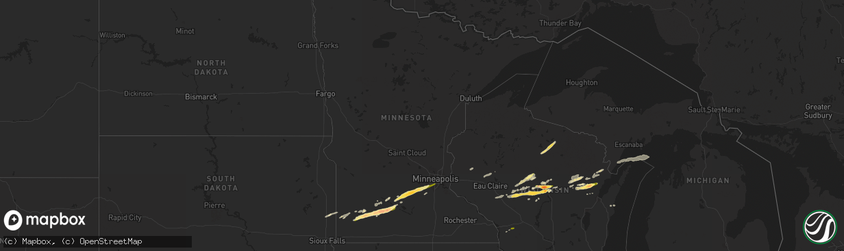
Hail Map in Minnesota on October 24, 2023
The weather event in Minnesota on October 24, 2023 includes Hail and Wind maps. 8 states and 163 cities were impacted and suffered possible damage. The total estimated number of properties impacted is 32,478.
Want more than just the map?
Turn this storm into a full workflow.
- Owner + property data so you know who to knock
- OnDemand branded weather history reports to win the "did we even have hail?" argument
- RoofTrace estimate so reps stop guessing numbers at the door
Bought this map? Upgrade within 7 days and we'll credit the $230. (10-15 min setup call)
Hail
Wind
32,478
Estimated number of impacted properties by a 1.00" hail or larger6,200
Estimated number of impacted properties by a 1.75" hail or larger1,816
Estimated number of impacted properties by a 2.50" hail or largerStorm reports in Minnesota
Minnesota
| Date | Description |
|---|---|
| 10/24/20232:05 PM CDT | Reported via facebook. |
| 10/24/20232:04 PM CDT | Report with photos via twitter. |
| 10/24/20231:55 PM CDT | Report with photo via twitter. |
| 10/24/20231:30 PM CDT | A local report indicates 1.50 inch wind near 1 S Essig |
| 10/24/20231:27 PM CDT | Delayed report. Relayed from spotter. House and vehicle damage. |
| 10/24/20231:20 PM CDT | Report via media. Includes photo. Size of hail estimated by photo. Time of report estimated by radar. |
| 10/24/20231:20 PM CDT | Report via media. Includes photo. Size of hail estimat |
| 10/24/20231:18 PM CDT | Brown county em received reports of golf ball to tennis ball size hail west of sleepy eye. Also some reports of windshield damage. |
| 10/24/20231:15 PM CDT | A local report indicates 1.50 inch wind near 1 NNE Arlington |
| 10/24/20231:10 PM CDT | Report with photo sent via facebook messenger. |
| 10/24/20231:06 PM CDT | Report with photo measurement sent via facebook messenger. |
| 10/24/20231:05 PM CDT | Reports of quarter to golf ball size hail in springfield... Mn sent via nwschat. |
| 10/24/20231:00 PM CDT | Report with photos sent via nwschat. |
| 10/24/20231:00 PM CDT | Reported via facebook. Photo with ruler shows largest stones around 1.5 inches. |
| 10/24/202312:50 PM CDT | Reported via facebook. Photo shows hail next to a quarter. Estimated golfball sized from photo. Time estimated by radar. |
| 10/24/202312:45 PM CDT | Reported via facebook. Photo of hail next to quarter. Time estimated. |
| 10/24/202312:33 PM CDT | Ground covered white from hail. |
| 10/24/202312:32 PM CDT | Time is estimated from radar. |
| 10/24/202312:28 PM CDT | A local report indicates 1.75 inch wind near 5 NE Dovray |
| 10/24/202312:15 PM CDT | Picture via social media. |
| 10/24/202312:13 PM CDT | A local report indicates 1.00 inch wind near 2 W Currie |
| 10/24/202312:03 PM CDT | Ground covered in nickel to quarter size hail. |
All States Impacted by Hail Map on October 24, 2023
Cities Impacted by Hail Map on October 24, 2023
- Marshfield, WI
- Hewitt, WI
- Auburndale, WI
- Milladore, WI
- Junction City, WI
- Mosinee, WI
- Humbird, WI
- Neillsville, WI
- Chili, WI
- Granton, WI
- Stratford, WI
- Edgar, WI
- Shawano, WI
- Slayton, MN
- Lake Wilson, MN
- Currie, MN
- Westbrook, MN
- Walnut Grove, MN
- Revere, MN
- Lamberton, MN
- Sanborn, MN
- Springfield, MN
- Bonduel, WI
- Cecil, WI
- Krakow, WI
- Oconto Falls, WI
- Green Valley, WI
- Gibbon, MN
- Winthrop, MN
- Gaylord, MN
- Arlington, MN
- Glencoe, MN
- Spencer, WI
- Loyal, WI
- Ringle, WI
- Schofield, WI
- Greenwood, WI
- Athens, WI
- Stetsonville, WI
- Abbotsford, WI
- Dorchester, WI
- Leopolis, WI
- Tilleda, WI
- Storden, MN
- Willard, WI
- Fairchild, WI
- Kewaunee, WI
- Owen, WI
- Curtiss, WI
- Colby, WI
- Franklin, MN
- Fairfax, MN
- Tracy, MN
- Wittenberg, WI
- Hatley, WI
- Rosholt, WI
- Animas, NM
- Osseo, WI
- Sleepy Eye, MN
- Green Isle, MN
- Henderson, MN
- New Ulm, MN
- Norwood Young America, MN
- Belle Plaine, MN
- Carver, MN
- Cologne, MN
- Hamburg, MN
- Lena, WI
- Abrams, WI
- Oconto, WI
- Chaska, MN
- Shakopee, MN
- Savage, MN
- Minneapolis, MN
- Eden Prairie, MN
- Gillett, WI
- Tucson, AZ
- Cashton, WI
- Norwalk, WI
- Fort Hancock, TX
- Sparta, WI
- Pyote, TX
- Wink, TX
- Monahans, TX
- Pulaski, WI
- Bloomer, WI
- Seymour, WI
- Prairie Farm, WI
- Gresham, WI
- Bowler, WI
- Pipestone, MN
- Pecos, TX
- Balmorhea, TX
- Rhinelander, WI
- Harshaw, WI
- Ruthton, MN
- Jordan, MN
- Tomahawk, WI
- Flandreau, SD
- Keshena, WI
- Colfax, WI
- Downing, WI
- Clear Lake, WI
- Boyceville, WI
- Washington Island, WI
- Morgan, MN
- Clements, MN
- Wabasso, MN
- Redwood Falls, MN
- Mount Lemmon, AZ
- Lake Tomahawk, WI
- Clintonville, WI
- Holland, MN
- Woodstock, MN
- Garvin, MN
- Jeffers, MN
- Crivitz, WI
- Porterfield, WI
- Pound, WI
- Peshtigo, WI
- Lafayette, MN
- Withee, WI
- Carlsbad, NM
- Eunice, NM
- Hobbs, NM
- Jal, NM
- Monument, NM
- Seminole, TX
- Coleman, WI
- Eland, WI
- Marathon, WI
- Pittsville, WI
- Chaseburg, WI
- Coon Valley, WI
- Vesper, WI
- Sells, AZ
- Tatum, NM
- Stevens Point, WI
- Kermit, TX
- Barstow, TX
- Rockland, WI
- Maljamar, NM
- Lovington, NM
- Wausau, WI
- Arpin, WI
- Wisconsin Rapids, WI
- Elkton, SD
- Neopit, WI
- Suring, WI
- Marion, WI
- Sierra Blanca, TX
- Lubbock, TX
- Wolfforth, TX
- Fort Davis, TX
- Mentone, TX
- Fort Stockton, TX
- Seagraves, TX
- Socorro, NM
- Menominee, MI
- Hays, KS
- Glenwood City, WI
- Larned, KS
- Belpre, KS


