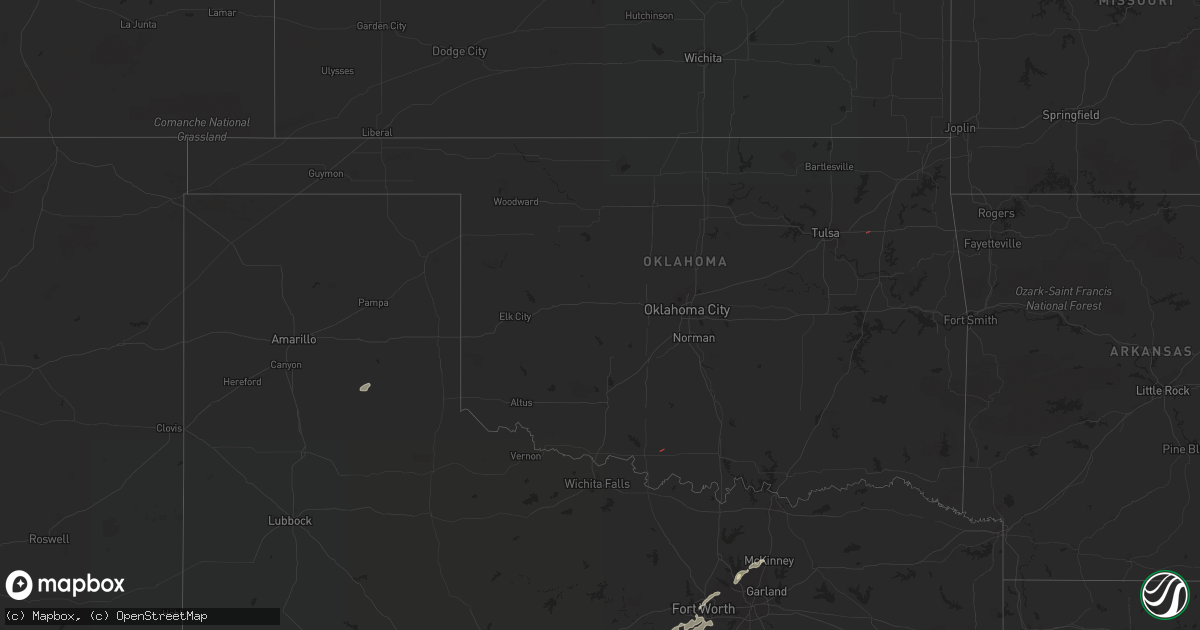
Hail Map in Oklahoma on October 24, 2022
Get this storm
October 24 map
$229
one time, instant access
Download today. No call, no setup
Keep the $229
Bought the map and want the full workflow? Apply the entire $229 to a subscription within 7 days. None of it is wasted.
Every map, not just this one
This buys you this map. Subscription and you get every map we run, in the markets you choose from a few cities to whole states to nationwide. Plus real-time alerts the moment a storm fires.
Contact data
Name, contact info, occupancy, even credit band for addresses in the footprint. You go from where it hit to who to call.
Become the source they trust
Unlimited branding weather history reports on demand. You already have the documented answer ready for the property owner, and you are the one who showed up with it.
Property data and RoofTrace estimates
Pull up any address you have got, its value and the exact code rules for that jurisdiction, straight from One Click Code. Then RoofTrace estimates the squares, pitch, and roof value, priced the way you price.
Storm reports in Oklahoma
Oklahoma
| Date | Description |
|---|---|
| 10/24/202212:55 PM CDT | Thunderstorm wind gust of 59.3 mph measured at the porter mesonet. |
| 10/24/20229:21 AM CDT | Trampoline blown across sooner road. Time based on radar. |
| 10/24/20227:17 AM CDT | At 1217 PM CDT, a severe thunderstorm was located over Verdigris, moving east at 20 mph. HAZARD...60 mph wind gusts. SOURCE...Radar indicated. IMPACT...Expect damage to roofs, siding, and trees. Locations in or near the path include... Claremore... Catoosa... Verdigris... Taiwah... Tiawah... This includes Interstate 44 between mile markers 239 and 259. |
| 10/24/20226:36 AM CDT | At 1135 AM CDT, a severe thunderstorm was located 5 miles northeast of Sand Springs, moving northeast at 40 mph. HAZARD...60 mph wind gusts. SOURCE...Radar indicated. IMPACT...Expect damage to roofs, siding, and trees. Locations in or near the path include... Tulsa... Broken Arrow... Sand Springs... Claremore... Owasso... Bixby... Sapulpa... Jenks... Glenpool... Coweta... Skiatook... Catoosa... Collinsville... Verdigris... Chelsea... Inola... Kiefer... Sperry... Oologah... Foyil...This includes Interstate 44 between mile markers 207 and 258. |
| 10/24/20225:40 AM CDT | At 1040 AM CDT, severe thunderstorms were located along a line extending from near Vanoss to near Scullin to 6 miles southwest of Mill Creek to 3 miles west of Mannsville, moving northeast at 40 mph. HAZARD...60 mph wind gusts. SOURCE...Radar indicated. IMPACT...Expect damage to roofs, siding, and trees. Locations impacted include... Ada, Holdenville, Sulphur, Tishomingo, Wewoka, Konawa, Dickson, Byng, Allen, Roff, Ravia, Stonewall, Wapanucka, Tupelo, Mill Creek, Francis, Fitzhugh, Bromide, Sasakwa and Yeager. |
| 10/24/20224:10 AM CDT | At 909 AM CDT, a severe thunderstorm was located near Moore, moving east at 30 mph. HAZARD...60 mph wind gusts. SOURCE...Radar indicated. IMPACT...Expect damage to roofs, siding, and trees. Locations impacted include... Southern Oklahoma City, northern Norman, Moore, Stanley Draper Lake and northwestern Lake Thunderbird. |
| 10/24/20224:03 AM CDT | At 903 AM CDT, a severe thunderstorm was located over southeastern Oklahoma City, or near Smith Village, moving east at 30 mph. HAZARD...60 mph wind gusts. SOURCE...Radar indicated. IMPACT...Expect damage to roofs, siding, and trees. Locations impacted include... Oklahoma City, Midwest City, Del City, Choctaw, Spencer, Jones, Nicoma Park, Tinker Air Force Base, Forest Park, Lake Aluma and Smith Village. |
| 10/23/20229:04 PM CDT | At 204 PM CDT, a severe thunderstorm was located 6 miles west of Scraper, moving east at 30 mph. HAZARD...60 mph wind gusts. SOURCE...Radar indicated. IMPACT...Expect damage to roofs, siding, and trees. Locations in or near the path include... Oaks... Scraper... |
| 10/23/20228:32 PM CDT | At 131 PM CDT, a severe thunderstorm was located near Locust Grove, moving northeast at 25 mph. HAZARD...60 mph wind gusts. SOURCE...Radar indicated. IMPACT...Expect damage to roofs, siding, and trees. Locations in or near the path include... Locust Grove... Salina... |
Cities Impacted by Hail Map on October 24, 2022
- Belton, TX
- Kempner, TX
- Copperas Cove, TX
- Lampasas, TX
- Clarendon, TX
- Llano, TX
- Valley Spring, TX
- Nolanville, TX
- San Saba, TX
- Cherokee, TX
- Temple, TX
- Killeen, TX
- Fort Hood, TX
- Harker Heights, TX
- Granbury, TX
- New Braunfels, TX
- Martindale, TX
- Canyon Lake, TX
- San Marcos, TX
- Fischer, TX
- Maxwell, TX
- Fort Worth, TX
- Tow, TX
- Frisco, TX
- Mckinney, TX
- Valera, TX
- Talpa, TX
- Coleman, TX
- Leander, TX
- Georgetown, TX
- Blanco, TX
- Wimberley, TX
- Spring Branch, TX
- Kendalia, TX
- Lockhart, TX
- Kyle, TX
- Pleasanton, TX
- Falls City, TX
- Blanket, TX
- Salado, TX
- Winters, TX
- Lawn, TX
- Comanche, TX
- Zephyr, TX
- Richland Springs, TX
- Rochelle, TX
- Hobson, TX
- Karnes City, TX
- San Antonio, TX
- Goldsboro, TX
- Novice, TX
- The Colony, TX
- Carrollton, TX
- Haltom City, TX
- North Richland Hills, TX
- Hurst, TX
- Colleyville, TX
- Cranfills Gap, TX
- Hamilton, TX
- Hico, TX
- Meridian, TX
- Iredell, TX
- Lewisville, TX
- Coppell, TX
- Mason, TX
- Florence, TX
- Burnet, TX
- Jarrell, TX
- Bertram, TX
- Briggs, TX
- Weatherford, TX
- Joshua, TX
- Crowley, TX
- Burleson, TX
- Aledo, TX
- Godley, TX
- Cresson, TX
- Tolar, TX
- Voss, TX
- Santa Anna, TX
- Ovalo, TX
- Inola, OK
- Waurika, OK
- Bangs, TX
- Brownwood, TX
- Early, TX
- Bruceville, TX
- Lott, TX
- Holland, TX
- Kosse, TX
- Thorndale, TX
- Calvert, TX
- Bartlett, TX
- Liberty Hill, TX
- Bryan, TX
- Gause, TX
- Caldwell, TX
- Bremond, TX
- Rosebud, TX
- Davilla, TX
- Granger, TX
- Reagan, TX
- Franklin, TX
- Hearne, TX
- Cameron, TX
- Little River Academy, TX
- Rogers, TX
- Moody, TX
- Marlin, TX
- Rockdale, TX
- Milano, TX
- Burlington, TX
- Chilton, TX
- Eddy, TX
- Troy, TX
- Buckholts, TX


