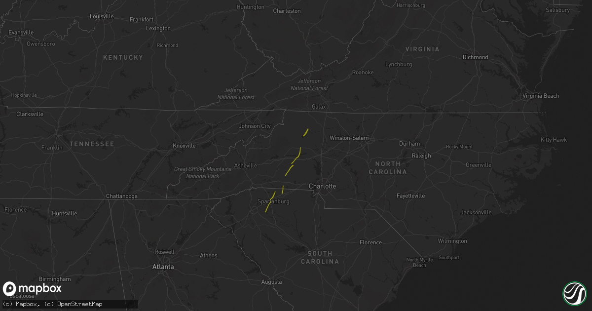
Hail Map on October 23, 2017
Get this storm
October 23 map
$229
one time, instant access
Download today. No call, no setup
Keep the $229
Bought the map and want the full workflow? Apply the entire $229 to a subscription within 7 days. None of it is wasted.
Every map, not just this one
This buys you this map. Subscription and you get every map we run, in the markets you choose from a few cities to whole states to nationwide. Plus real-time alerts the moment a storm fires.
Contact data
Name, contact info, occupancy, even credit band for addresses in the footprint. You go from where it hit to who to call.
Become the source they trust
Unlimited branding weather history reports on demand. You already have the documented answer ready for the property owner, and you are the one who showed up with it.
Property data and RoofTrace estimates
Pull up any address you have got, its value and the exact code rules for that jurisdiction, straight from One Click Code. Then RoofTrace estimates the squares, pitch, and roof value, priced the way you price.
States Impacted by Hail Map on October 23, 2017
Storm reports
Virginia
| Date | Description |
|---|---|
| 10/23/20176:57 PM CDT | A tree was blown down along valley ridge road. |
| 10/23/20176:55 PM CDT | Tree down at 750 block of sandusky drive. |
| 10/23/20176:51 PM CDT | A power line was blown down along hayes gap road. |
| 10/23/20176:40 PM CDT | Numerous large tree limbs down along franklin turnpike just south of town. |
| 10/23/20176:31 PM CDT | Thunderstorm winds downed a power pole across inman road... Temporarily closing it. |
| 10/23/20176:10 PM CDT | Thunderstorm winds downed a tree near the intersection of virginia 18 south and potts creek road. |
| 10/23/20176:06 PM CDT | Thunderstorm winds downed numerous trees in and around the community of ferrum. |
| 10/23/20176:06 PM CDT | Thunderstorm wind gusts downed numerous trees all along philpott road in franklin county. |
| 10/23/20176:05 PM CDT | In the 1000 block of country club drive...two or three large trees were blown down. |
| 10/23/20176:05 PM CDT | A tree was blown down near the intersection of highway 58 with highway 220. |
| 10/23/20176:05 PM CDT | A tree was blown down onto a power pole along meadowview lane. |
| 10/23/20176:04 PM CDT | A couple of trees were blown down in the 1600 block of meadowview lane. |
| 10/23/20176:03 PM CDT | A tree was blown down along eggleston falls road. |
| 10/23/20176:03 PM CDT | A tree was blown down along soapstone road. |
| 10/23/20175:38 PM CDT | Tree down on route 8 in carroll county near floyd county line. |
| 10/23/20175:38 PM CDT | Strong thunderstorm winds produced damage to structures and trees outside of the community of mccoy. |
| 10/23/20175:36 PM CDT | Strong thunderstorm winds caused damage to numerous trees and a few structures between bellspring and parrott... Virginia. This temporarily closed several roads includi |
| 10/23/20175:36 PM CDT | Strong thunderstorm winds caused damage to numerous trees and a few structures between bellspring and parrott... Virginia. This temporarily closed several roads includi |
| 10/23/20175:33 PM CDT | An ef1 tornado was confirmed by a nws survey team touching down near belspring virginia in pulaski county and ending near mccoy virginia in montgomery county... With a |
| 10/23/20175:32 PM CDT | Thunderstorm winds downed numerous trees within the city of radford. |
| 10/23/20175:00 PM CDT | Tree down near intersection of johnson creek road and wards gap road. |
| 10/23/20174:58 PM CDT | Thunderstorm winds brought down two trees along winterberry road. |
| 10/23/20174:58 PM CDT | Thunderstorm winds downed three large trees in a homeowners back yard along windmill road near galax... Va. |
| 10/23/20174:53 PM CDT | A nws storm survey team has confirmed an ef1 tornado touched down very briefly for about one minute just southwest of fries on twin pond lane in the town of providence. |
| 10/23/20174:45 PM CDT | Thunderstorm wind gusts brought down a utility pole at the intersection of south main street and long street in galax... Va. |
| 10/23/20172:05 AM CDT | Numerous trees downed with minor home damage along west rose garden road... Va 626. |
| 10/23/20172:00 AM CDT | Numerous trees downed with damage to 14 structures along the 1500 block of west rose garden rd . Preliminary path width 75 yards and winds of 80 mph |
| 10/23/20171:45 AM CDT | Trees and powerlines down. Road closed in vicinity of 5000 block of courthouse road. |
| 10/22/201711:35 PM CDT | Trees down on interstate 85 near mile marker 27 resulted in a tractor trailer flipping over after it struck the fallen trees. |
| 10/22/201711:07 PM CDT | Wind damage to house... Out buildings... Roof... And swimming pool. |
| 10/22/20177:35 PM CDT | Tree down at 8000 block of lee jackson highway. |
West Virginia
| Date | Description |
|---|---|
| 10/23/20175:55 PM CDT | Numerous trees down between lindside and union and elsewhere across portions of the county between 645 pm and 700 pm. |
South Carolina
| Date | Description |
|---|---|
| 10/23/20176:52 PM CDT | Warning point reported tree down at walterboro road near clubhouse road. |
| 10/23/20176:45 PM CDT | Sc highway patrol reports tree down on peirce road and red oak road. |
| 10/23/20176:44 PM CDT | Warning point reported trees down on wesley grove road and rehoboth road. |
| 10/23/20176:44 PM CDT | Warning point reported tree down on car and power lines down near the intersection of wichman street and paul street |
| 10/23/20176:39 PM CDT | Warning point reported trees down on coolers dairy road and merrick road. |
| 10/23/20176:37 PM CDT | Warning point reported trees down on sniders highway near cypress pond road. |
| 10/23/20175:28 PM CDT | Orangeburg county dispatch reported trees down on cannon bridge road. |
| 10/23/20172:36 PM CDT | Roof of a home on fariview rd. |
| 10/23/20172:30 PM CDT | 2 trees down on battleground rd. |
| 10/23/20172:12 PM CDT | Trees snapped at camelot dr and hwy 21. |
| 10/23/20172:12 PM CDT | Numerous large trees and powerlines down on w.o. Ezell rd. |
| 10/23/20172:10 PM CDT | Trees and branches down at 585 frontage rd near the milliken plant |
| 10/23/20172:01 PM CDT | Several large trees down near anderson mill rd and the tyger river. |
| 10/23/20171:56 PM CDT | Tree through mobile home on greenpond rd. Tree on roof of another mobile home... Horse barn destroyed... And numerous trees and powerlines down on greenpond rd. |
| 10/23/20171:54 PM CDT | Two houses damaged on greenpond rd |
| 10/23/20171:17 PM CDT | Trees down on will hanks rd in honea path |
| 10/22/20179:27 PM CDT | Nws storm survey confirms a tornado touchdown between inman circle and the waccamaw river. Details are available in a public information statement. |
| 10/22/20178:57 PM CDT | Large tree down in roadway |
| 10/22/20178:50 PM CDT | A tree was reported down on highway 41 near t-mart. |
| 10/22/20178:45 PM CDT | A large tree was reported down at the intersection of laughlin rd. And u.s. 301. |
| 10/22/20178:45 PM CDT | Large tree down across roadway at 3507 creek road and w. Shortcut road |
| 10/22/20178:43 PM CDT | A large tree was reportedly blocking the intersection of highway 76 and grice ferry ct. |
| 10/22/20178:32 PM CDT | Commerical sign blown down and a few tree limbs blown down. Sign blown northeastward a signficant distance. |
| 10/22/20178:29 PM CDT | Damage to outbuildings... Large tree limbs down... Metal roofing material wrapped around trees. |
| 10/22/20177:14 PM CDT | Tree down on hwy 78 near myers mayo rd. Time estimated from radar |
| 10/22/20177:07 PM CDT | Warning point reported tree down on house at the 200 block of washie road. |
| 10/22/20177:06 PM CDT | Warning point reported tree down on highway 178 near highway 78. |
| 10/22/20177:06 PM CDT | Tree down on cummings chapel rd |
Georgia
| Date | Description |
|---|---|
| 10/23/20171:15 PM CDT | Trees down on woodland way near hwy 77 |
North Carolina
| Date | Description |
|---|---|
| 10/23/20175:00 PM CDT | Tree down at highway 65 and goode road. |
| 10/23/20174:56 PM CDT | Tree down across woodfield dr. |
| 10/23/20174:55 PM CDT | Multiple trees blown down on backwoods ln and ed weaver rd. |
| 10/23/20174:50 PM CDT | A few trees blown down at tadpole trail and us hwy 64. |
| 10/23/20174:50 PM CDT | Multiple trees and power lines down across the town. |
| 10/23/20174:45 PM CDT | Many trees and powerlines down across the county particularly in pine ridge... Dobson... And mountain park. Possible microburst reported in pine ridge. |
| 10/23/20174:45 PM CDT | Large tree limbs down. |
| 10/23/20174:45 PM CDT | Thunderstorm winds downed two trees along jarvis road. |
| 10/23/20174:43 PM CDT | Strong thunderstorm winds downed several large trees and destroyed two barns and damaged another along glade valley road. |
| 10/23/20174:41 PM CDT | Thunderstorm winds damaged a mobile home along little prne road. |
| 10/23/20174:41 PM CDT | Thunderstorm winds uprooted and snapped several trees and damaged a barn along rector road. |
| 10/23/20174:35 PM CDT | Thunderstorm winds downed a tree at the intersection of wilson street and west main street. |
| 10/23/20174:35 PM CDT | Thunderstorm winds blew down a tree along shawtown road. |
| 10/23/20174:33 PM CDT | Thunderstorm winds damaged a barn located along barrett road. |
| 10/23/20174:29 PM CDT | Thunderstorm winds downed a tree along fall creek church road near jonesville. |
| 10/23/20174:24 PM CDT | A couple trees down near county line rd and hwy 901. |
| 10/23/20174:24 PM CDT | Multiple trees down on harmony hwy. |
| 10/23/20174:24 PM CDT | Significant tree damage and some structural damage to a home. |
| 10/23/20174:17 PM CDT | Several large limbs down. |
| 10/23/20174:17 PM CDT | Thunderstorm winds downed two large trees and a powerpole along little mountain church road. |
| 10/23/20174:15 PM CDT | A tree was blown down along old highway 60. |
| 10/23/20174:15 PM CDT | A tree was blown down onto a powerline near the community of wilkesboro. |
| 10/23/20174:15 PM CDT | Possible tornado. Tree down on a house on glenn dancy road. Other trees and powerlines down nearby. |
| 10/23/20174:11 PM CDT | A nws storm survey team has confirmed an ef1 tornado touched down in wilkesboro near the intersection of east main street and salem street at around 511 pm edt...remain |
| 10/23/20174:00 PM CDT | Thunderstorm winds downed a tree on a car within the community of moravian falls. |
| 10/23/20173:45 PM CDT | Trees down on icard ridge rd. |
| 10/23/20173:45 PM CDT | Numerous trees down on hwy 127 and heritage farm rd. |
| 10/23/20173:43 PM CDT | Roof off home at cathedral dr and addison ln. Numerous trees down and homes damaged in the neighborhood. |
| 10/23/20173:40 PM CDT | Public reported multiple trees snapped or uprooted. |
| 10/23/20173:40 PM CDT | Media reported many aircraft flipped and significant structural damage at the hickory airport. Possible tornado. |
| 10/23/20173:39 PM CDT | Trees down on george hildebran rd. |
| 10/23/20173:37 PM CDT | Mulitple structures damaged in hildebran. |
| 10/23/20173:35 PM CDT | Trees down on teague town rd. |
| 10/23/20173:35 PM CDT | Trees down on 127 and deerfield rd. |
| 10/23/20173:32 PM CDT | Trees down... One on a house south of hickory |
| 10/23/20173:31 PM CDT | Numerous trees down on hwy 221 by cliffside elementary school |
| 10/23/20173:31 PM CDT | Wall at hickory crawdads stadium sustained damage. |
| 10/23/20173:25 PM CDT | Trained spotter reported multiple houses with roof famage and numerous trees and power poles down along highway 10 in lincoln county. Possible tornado. |
| 10/23/20173:25 PM CDT | Tree down on home on summerow rd and mauney rd |
| 10/23/20173:20 PM CDT | Trees down and power outages on bridle path dr. |
| 10/23/20173:11 PM CDT | Trees and powerlines down on curt ledford rd and carpernters church rd. |
| 10/23/20173:05 PM CDT | Powerlines and trees down at hwy 10n and 7 pines rd |
| 10/23/20173:05 PM CDT | Tree down on a house on vic randall rd |
| 10/23/20173:04 PM CDT | Damage to a building on hwy 182 in lawndale. |
| 10/23/20173:03 PM CDT | Powerlines and large tree limbs down on west stage coach trail |
| 10/23/20173:03 PM CDT | Tree on a mobile home on deer track ln |
| 10/23/20172:56 PM CDT | Power lines down on metcalf rd near barbee rd. |
| 10/23/20172:45 PM CDT | Trees down... Some on homes. |
| 10/23/20172:42 PM CDT | Tree down on mccraw rd. |
| 10/23/20172:27 PM CDT | Tree blocking road by chesnee community fire department |
| 10/23/20172:15 PM CDT | Westerman st. At mill creek underwater |
| 10/23/20171:30 AM CDT | Spotter reported thunderstorm straight line wind damage on his property on jimmy smith road. 5 large trees were uprooted... The largest around 2 feet in diameter. One o |
| 10/23/201712:15 AM CDT | A local report indicates 58 MPH wind near FEDERAL POINT |
| 10/22/201710:45 PM CDT | Snapped trees along a path three-tenths of a mile long and 50 yards wide |
| 10/22/20179:16 PM CDT | Tree down in cerro gordo on main street. |
| 10/22/20179:15 PM CDT | Storage shed destroyed... Large tree limbs down... Trampoline thrown by the wind. |
| 10/22/20179:14 PM CDT | Large tree across talbot street and tree down on home on west columbus st. Other scattered limbs and tree damage across the city. |
| 10/22/20179:06 PM CDT | 2 trees blown down just north of old dothan road |