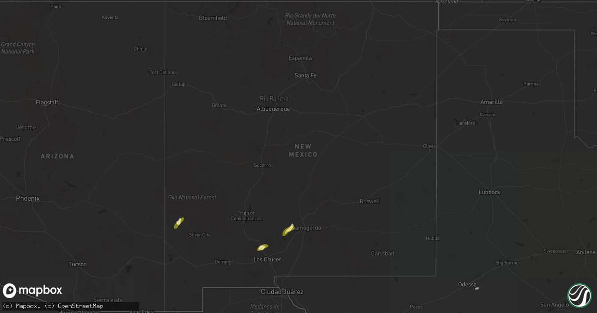
Hail Map in New Mexico on October 16, 2022
Get this storm
October 16 map
$229
one time, instant access
Download today. No call, no setup
Keep the $229
Bought the map and want the full workflow? Apply the entire $229 to a subscription within 7 days. None of it is wasted.
Every map, not just this one
This buys you this map. Subscription and you get every map we run, in the markets you choose from a few cities to whole states to nationwide. Plus real-time alerts the moment a storm fires.
Contact data
Name, contact info, occupancy, even credit band for addresses in the footprint. You go from where it hit to who to call.
Become the source they trust
Unlimited branding weather history reports on demand. You already have the documented answer ready for the property owner, and you are the one who showed up with it.
Property data and RoofTrace estimates
Pull up any address you have got, its value and the exact code rules for that jurisdiction, straight from One Click Code. Then RoofTrace estimates the squares, pitch, and roof value, priced the way you price.
Storm reports in New Mexico
New Mexico
| Date | Description |
|---|---|
| 10/16/20223:30 PM CDT | Military meteorologist reported quarter sized hail at i-25 mile marker 21. Interstate covered with hail from mile marker 20 to mile marker 25. |
| 10/16/202210:13 AM CDT | Hail the size of quarters fell for several minutes. |
| 10/15/202211:19 PM CDT | At 418 PM MDT, a severe thunderstorm was located 4 miles northwest of White Sands National Monument, moving northeast at 20 mph. HAZARD...Quarter size hail. SOURCE...Radar indicated. IMPACT...Damage to vehicles is expected. Locations impacted include... Alamogordo, White Sands National Monument, Holloman Air Force Base, Boles Acres and Lake Lucero.This includes the following highways... Highway 70 in New Mexico between mile markers 199 and 212. Highway 54 in New Mexico between mile markers 61 and 64. |
| 10/15/20229:26 PM CDT | At 226 PM MDT, a severe thunderstorm was located 6 miles northeast of Radium Springs, moving northeast at 60 mph. HAZARD...60 mph wind gusts and quarter size hail. SOURCE...Radar indicated. IMPACT...Hail damage to vehicles is expected. Expect wind damage to roofs, siding, and trees. Locations impacted include... Leasburg, Jornada Range, Radium Springs, Portions of Jornada Experimental Range, Fort Selden State Historic Site and Leasburg Dam State Park.This includes Interstate 25 in New Mexico between mile markers 14 and29. |


