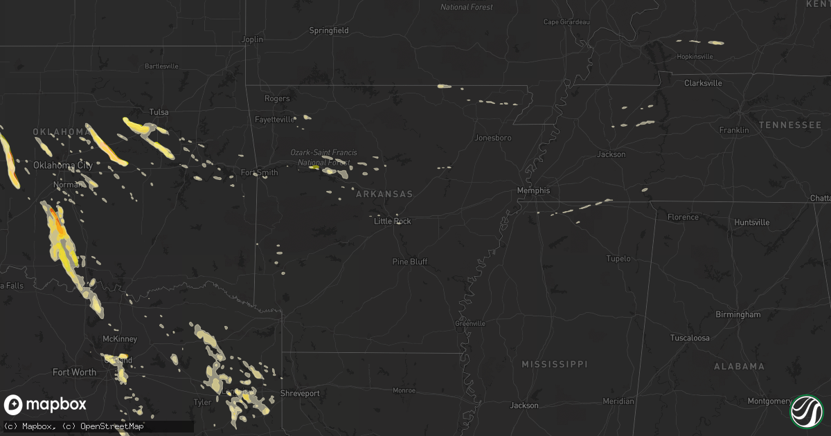
Hail Map in Arkansas on October 5, 2014
Get this storm
October 5 map
$229
one time, instant access
Download today. No call, no setup
Keep the $229
Bought the map and want the full workflow? Apply the entire $229 to a subscription within 7 days. None of it is wasted.
Every map, not just this one
This buys you this map. Subscription and you get every map we run, in the markets you choose from a few cities to whole states to nationwide. Plus real-time alerts the moment a storm fires.
Contact data
Name, contact info, occupancy, even credit band for addresses in the footprint. You go from where it hit to who to call.
Become the source they trust
Unlimited branding weather history reports on demand. You already have the documented answer ready for the property owner, and you are the one who showed up with it.
Property data and RoofTrace estimates
Pull up any address you have got, its value and the exact code rules for that jurisdiction, straight from One Click Code. Then RoofTrace estimates the squares, pitch, and roof value, priced the way you price.
Storm reports in Arkansas
Arkansas
| Date | Description |
|---|---|
| 10/05/20143:50 AM CDT | A local report indicates 1.00 inch wind near CENTER POINT |
| 10/05/20143:45 AM CDT | Several trees were downed throughout mainly the northern half of the county blocking roadways. A few chicken houses suffered minor damage as well. |
| 10/05/20143:45 AM CDT | A local report indicates 1.00 inch wind near 2 SE DIERKS |
| 10/05/20143:25 AM CDT | Winds were also estimated to be 40 mph. |
| 10/05/20143:15 AM CDT | Several trees reported down in the city. |
| 10/05/20143:10 AM CDT | Numerous trees down in the area. |
| 10/05/20142:18 AM CDT | Quarter size hail reported 5 miles northwest of atkins. |
| 10/05/20141:40 AM CDT | State police in clarksville reporting quarter size hail or larger falling in the city. |
All States Impacted by Hail Map on October 5, 2014
Cities Impacted by Hail Map on October 5, 2014
- Trezevant, TN
- Atwood, TN
- Huntingdon, TN
- Beckville, TX
- Pottsville, AR
- Keota, OK
- Alba, TX
- Ennis, TX
- Scurry, TX
- Edmond, OK
- Sapulpa, OK
- Boley, OK
- Carney, OK
- Prague, OK
- Paden, OK
- Sparks, OK
- Tryon, OK
- Perkins, OK
- Chandler, OK
- Wellston, OK
- Meridian, OK
- Carthage, TX
- Lamar, MS
- Ashland, MS
- Michigan City, MS
- Emory, TX
- Kilgore, TX
- Porter, OK
- Sallisaw, OK
- Marshall, TX
- Whitesboro, TX
- Gainesville, TX
- Collinsville, TX
- Jennings, OK
- Boynton, OK
- Mounds, OK
- Mannford, OK
- Glenpool, OK
- Bristow, OK
- Kiefer, OK
- Okmulgee, OK
- Beggs, OK
- Bixby, OK
- Council Hill, OK
- Morris, OK
- Drumright, OK
- Kellyville, OK
- Clarksville, AR
- Purcell, OK
- Ringling, OK
- Ratliff City, OK
- Duncan, OK
- Loco, OK
- Gilmer, TX
- Red Banks, MS
- Holly Springs, MS
- Bokoshe, OK
- Purdon, TX
- Flower Mound, TX
- Webbers Falls, OK
- Hattieville, AR
- Cleveland, AR
- Richardson, TX
- Wylie, TX
- Rockwall, TX
- Plano, TX
- Sachse, TX
- Rowlett, TX
- Garland, TX
- Sunnyvale, TX
- Mesquite, TX
- Dallas, TX
- Seagoville, TX
- Balch Springs, TX
- Mammoth Spring, AR
- Hallsville, TX
- Harleton, TX
- Longview, TX
- Geary, OK
- Greenfield, OK
- Lone Grove, OK
- Ardmore, OK
- Wilson, OK
- Jefferson, TX
- Pittsburg, TX
- Graham, OK
- Burneyville, OK
- Healdton, OK
- Overbrook, OK
- Huntsville, AR
- Warner, OK
- Checotah, OK
- Watonga, OK
- Depew, OK
- Marietta, OK
- Lookeba, OK
- Hinton, OK
- Stigler, OK
- Henderson, TX
- Lindsay, OK
- Tecumseh, OK
- Bee Branch, AR
- Overton, TX
- Saltillo, TX
- Addison, TX
- Lexington, OK
- Norman, OK
- Springer, OK
- Dierks, AR
- Sulphur Bluff, TX
- Mount Vernon, TX
- Piedmont, OK
- Okarche, OK
- Gracemont, OK
- Anadarko, OK
- Binger, OK
- Cove, AR
- Guthrie, OK
- Bonham, TX
- Bradford, AR
- Elmore City, OK
- Bradley, OK
- Marlow, OK
- Foster, OK
- Rush Springs, OK
- Byhalia, MS
- Ladonia, TX
- Wolfe City, TX
- Pocahontas, AR
- Arkoma, OK
- Forney, TX
- Carrollton, TX
- Norcatur, KS
- Tyler, TX
- Winona, TX
- Avinger, TX
- Fort Smith, AR
- Calumet, OK
- Luther, OK
- Talco, TX
- Mount Pleasant, TX
- Dike, TX
- Winfield, TX
- Tatum, TX
- Russellville, AR
- London, AR
- Dover, AR
- Gleason, TN
- Celina, TX
- Mckinney, TX
- Oklahoma City, OK
- Tussy, OK
- Kerens, TX
- Rice, TX
- Porum, OK
- Diana, TX
- Karnack, TX
- Mooringsport, LA
- Oktaha, OK
- Muskogee, OK
- Haskell, OK
- Lone Star, TX
- Daingerfield, TX
- De Queen, AR
- El Reno, OK
- Hennepin, OK
- Henryetta, OK
- Lindale, TX
- Macomb, OK
- Mcloud, OK
- Shawnee, OK
- Newalla, OK
- Corsicana, TX
- Barry, TX
- Danville, AR
- Belleville, AR
- Yukon, OK
- Trinidad, TX
- Big Sandy, TX
- Gladewater, TX
- Ravenden, AR
- Thayer, MO
- Ozark, AR
- Clinton, AR
- Rector, AR
- Marmaduke, AR
- Morrilton, AR
- Seminole, OK
- Savannah, TN
- Mount Enterprise, TX
- Long Branch, TX
- Chickasha, OK
- Winnsboro, TX
- Leesburg, TX
- Scroggins, TX
- Hawkins, TX
- Maysville, OK
- Blanchard, OK
- Thackerville, OK
- Davis, OK
- Alex, OK
- Ninnekah, OK
- Tioga, TX
- Chatfield, TX
- Kemp, TX
- De Berry, TX
- Waskom, TX
- Terrell, TX
- Princeton, KY
- Dawson Springs, KY
- Bruceton, TN
- Buena Vista, TN
- Mena, AR
- Brashear, TX
- Point, TX
- Cecil, AR
- Mannsville, OK
- Laneville, TX
- Sulphur Springs, TX
- Wortham, TX
- Blooming Grove, TX
- Dawson, TX
- Richland, TX
- Harrah, OK
- Jones, OK
- Potts Camp, MS
- Hernando, MS
- Middleton, TN
- Pocahontas, TN
- Dustin, OK
- Sherwood, AR
- Lafe, AR
- Little Rock, AR
- Umpire, AR
- Lewisburg, KY
- Greenville, KY
- Elkton, KY
- Roland, AR
- Falkner, MS
- Walnut, MS
- Holdenville, OK
- Springville, TN
- Paris, TN
- Noble, OK
- Ola, AR
- Meeker, OK
- Mansfield, TN
- Milan, TN
- Hartman, AR
- Wewoka, OK
- Peach Orchard, AR
- Delaplaine, AR
- Knoxville, AR
- Lamar, AR
- Arcadia, OK
- Scotland, AR
- Kingfisher, OK
- Washington, OK
- Hennessey, OK
- Cashion, OK
- Stroud, OK
- Hagarville, AR
- Center Ridge, AR
- Hector, AR
- Choctaw, OK
- Bells, TX
- Denison, TX
- Troup, TX
- Camden, TN
- Hollow Rock, TN
- Poteau, OK
- Honey Grove, TX
- Biggers, AR
- Crofton, KY
- Lake Creek, TX
- Weleetka, OK
- Ivanhoe, TX
- Pelsor, AR
- Wesley, AR
- Konawa, OK
- Asher, OK
- Colbert, OK
- Okemah, OK
- Klondike, TX
- Earlsboro, OK
- Wayne, OK
- Pauls Valley, OK
- Paoli, OK
- Minco, OK
- Union City, OK
- Davenport, OK


