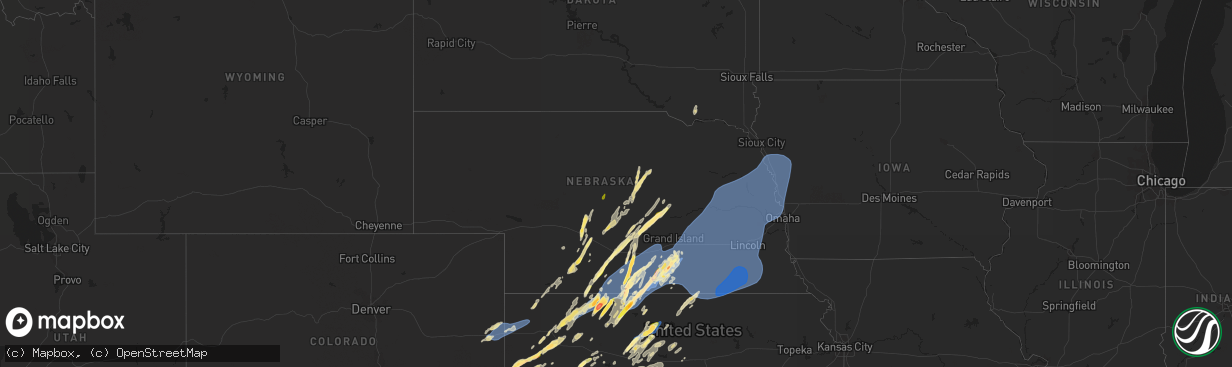
Hail Map in Nebraska on October 3, 2023
The weather event in Nebraska on October 3, 2023 includes Wind and Hail maps. 9 states and 550 cities were impacted and suffered possible damage. The total estimated number of properties impacted is 6,753.
Want more than just the map?
Turn this storm into a full workflow.
- Owner + property data so you know who to knock
- OnDemand branded weather history reports to win the "did we even have hail?" argument
- RoofTrace estimate so reps stop guessing numbers at the door
Bought this map? Upgrade within 7 days and we'll credit the $230. (10-15 min setup call)
Wind
Hail
6,753
Estimated number of impacted properties by a 1.00" hail or larger3,211
Estimated number of impacted properties by a 1.75" hail or larger1,101
Estimated number of impacted properties by a 2.50" hail or largerStorm reports in Nebraska
Nebraska
| Date | Description |
|---|---|
| 10/03/20236:59 PM CDT | Time est. From radar. |
| 10/03/20236:55 PM CDT | Photos on social media of a tree down in york. |
| 10/03/20236:51 PM CDT | Personal weather station. |
| 10/03/20236:50 PM CDT | Edit to previous tstm wnd dmg report from 1 s osceola. Photos of tree damage on the south side of town and power is out. Davis station anemometer mounted approximately |
| 10/03/20236:50 PM CDT | Photos of tree damage on the south side of town and power is out. Davis station anemometer mounted approximately 30 ft up measured a gust of 80 mph. |
| 10/03/20236:50 PM CDT | Via personal weather station. |
| 10/03/20236:49 PM CDT | Via davis weatherlink. |
| 10/03/20236:48 PM CDT | Minor tree damage reported in town. Time est. From radar and other reports. |
| 10/03/20236:40 PM CDT | Mesonet reports a gust to 61 mph. |
| 10/03/20236:35 PM CDT | Awos reports a gust to 62 mph. |
| 10/03/20236:30 PM CDT | Large tree partially uprooted in aurora per picture from em. Time estimated from radar and nearby reports. |
| 10/03/20236:29 PM CDT | A local report indicates 63 MPH wind near 5 NW Stockham |
| 10/03/20236:28 PM CDT | Co-op observer reports a gust to 60 mph. |
| 10/03/20236:28 PM CDT | Mesonet reports a gust to 62 mph. |
| 10/03/20236:22 PM CDT | Per giltner fire chief. |
| 10/03/20236:21 PM CDT | Report from mping: 1-inch tree limbs broken; shingles blown off. |
| 10/03/20236:10 PM CDT | Tree down blocking 7th st. Time estimated from radar and other nearby reports. |
| 10/03/20236:09 PM CDT | Facebook photo of a large tree limb downed by hastings college. |
| 10/03/20236:09 PM CDT | Delayed report. Report from mping: 1-inch tree limbs broken; shingles blown off. |
| 10/03/20236:08 PM CDT | Estimated 55 to 60 mph wind gusts along leading edge. |
| 10/03/20236:04 PM CDT | Mesonet reports a gust to 62 mph. |
| 10/03/20236:04 PM CDT | Edit to previous tstm wnd gst report from 4 sw hastings. Mesonet reports a gust to 62 mph. Minor tree damage via facebook photo. |
| 10/03/20236:00 PM CDT | A local report indicates 60 MPH wind near 2 N Pauline |
| 10/03/20235:51 PM CDT | Relayed via nwschat. |
| 10/03/20235:45 PM CDT | A local report indicates 60 MPH wind near Glenvil |
| 10/03/20235:43 PM CDT | Downed power lines in glenvil and pivot flipped just south of town. |
| 10/03/20235:41 PM CDT | Two trained spotters in area estimating wind gusts around 60 mph. |
| 10/03/20235:39 PM CDT | Relayed by em. |
| 10/03/20235:33 PM CDT | A local report indicates 1.75 inch wind near Ayr |
| 10/03/20235:33 PM CDT | Minor tree damage in town including a few downed trees. Nearby asos clocked a gust of 62 mph. |
| 10/03/20235:33 PM CDT | Asos reports a wind gust of 62 mph. |
| 10/03/20235:22 PM CDT | Via personal weather station. |
| 10/03/20235:15 PM CDT | Nerain observer commented about hail up to quarter size. Time estimated from radar. |
| 10/03/20234:57 PM CDT | Estimate from the south side of town. Time estimated from radar. |
| 10/03/20234:55 PM CDT | A local report indicates 73 MPH wind near 5 SSW Atlanta |
| 10/03/20234:55 PM CDT | Nerain observer commented hail up to quarter size. |
| 10/03/20234:53 PM CDT | Report on social media of quarter size hail east of macon. Time estimated from radar. |
| 10/03/20234:45 PM CDT | Brief touchdown of a weak tornado east of hazard caused minor damage to a home and tree damage in the area. |
| 10/03/20234:45 PM CDT | Photo from facebook of an unsecured metal shed blown about 40 yards. |
| 10/03/20234:40 PM CDT | A local report indicates 1.75 inch wind near 4 N Funk |
| 10/03/20234:38 PM CDT | Tin roof blown off shed and deposited around 25 yards away. |
| 10/03/20234:38 PM CDT | Social media report and photos of some damage in hollinger... Including a small metal shed destroyed. Time estimated from radar and nearby reports. |
| 10/03/20234:38 PM CDT | Straight line wind damage reported roughly along a path from a few miles east of beaver city to in and near the hollinger area. An old wood barn was destroyed and a met |
| 10/03/20234:35 PM CDT | Photo and video of a hay barn losing some of its metal roof panels. Report of unknown number of damaged power poles just to the east of this location. Time estimated fr |
| 10/03/20234:35 PM CDT | Mesonet reports a gust of 67 mph. |
| 10/03/20234:35 PM CDT | A local report indicates 60 MPH wind near 1 SSE Wilcox |
| 10/03/20234:35 PM CDT | Report via facebook of 3 damaged pivots in the area. Time estimated. |
| 10/03/20234:34 PM CDT | Delayed report. Report from mping: quarter |
| 10/03/20234:34 PM CDT | Emergency management reported crop damage in the area... At least one pivot downed... And damage to large trees at a nearby farm. Time estimated from radar. |
| 10/03/20234:30 PM CDT | Mesonet reports a 59 mph wind gust. |
| 10/03/20234:28 PM CDT | Facebook photo of a bent road sign along hwy 283 just north of the state line. Time estimated from radar. |
| 10/03/20234:20 PM CDT | Large tree branches downed. Machine shed side was blown out and steel supports were bent. |
| 10/03/20234:19 PM CDT | Photo on social media of golf ball size hail. |
| 10/03/20233:30 PM CDT | Video on social media of quarter size hail and 50 mph winds north of arapahoe. |
| 10/03/20233:15 PM CDT | Hail lasted about 20 mins. Time estimated from radar. |
| 10/03/20233:00 PM CDT | A local report indicates 1.00 inch wind near Anselmo |
| 10/02/20238:38 PM CDT | Tree limbs broken. |
| 10/02/20238:34 PM CDT | Tree limbs broken. |
| 10/02/20238:16 PM CDT | Tqe asos. |
| 10/02/20238:10 PM CDT | Measured by em. |
| 10/02/20238:10 PM CDT | Law enforcement reports widespread trees across roads in fairbury. Time estimated from radar. |
| 10/02/20237:54 PM CDT | Winds estimated 65-70 mph. Deputy reported the wind moved the car. |
| 10/02/20237:40 PM CDT | Tree down across road. |
| 10/02/20237:39 PM CDT | A tornado began southeast of the intersection of 834 road and 574 avenue. It continued northeast... Damaging several trees and outbuildings at a farm. The tornado left |
| 10/02/20237:39 PM CDT | Several snapped trees. Time estimated from radar. |
| 10/02/20237:33 PM CDT | 3 snapped power poles. Large areas of downed corn. Several trees damaged. |
| 10/02/20237:24 PM CDT | Tree down over highway 15. Time estimated from radar. |
| 10/02/20237:20 PM CDT | Roof ripped from shed. Time estimated from radar. |
| 10/02/20237:20 PM CDT | Center pivot flipped. Time estimated from radar. |
| 10/02/20237:16 PM CDT | Top of tree broken off. Time estimated by radar. |
| 10/02/20237:14 PM CDT | Large tree limb blew down on to a camper... Trapping an individual inside. No injuries reported. |
| 10/02/20237:13 PM CDT | Recorded at personal weather station. |
| 10/02/20237:12 PM CDT | Many large limbs down around columbus. At least one tree uprooted. Window blown out of community center. |
| 10/02/20237:12 PM CDT | Recorded at personal weather station. |
All States Impacted by Hail Map on October 3, 2023
Cities Impacted by Hail Map on October 3, 2023
- Chadron, NE
- Hay Springs, NE
- Rushville, NE
- Pine Ridge, SD
- Plains, TX
- Levelland, TX
- Whiteface, TX
- Sundown, TX
- Boise City, OK
- Dalhart, TX
- Keyes, OK
- Texhoma, OK
- Goodwell, OK
- Elkhart, KS
- Rolla, KS
- Richfield, KS
- Johnson, KS
- Hugoton, KS
- Guymon, OK
- Walsh, CO
- Moscow, KS
- Ulysses, KS
- Dickens, TX
- Sheridan Lake, CO
- Tribune, KS
- Weskan, KS
- Sharon Springs, KS
- Wallace, KS
- Winona, KS
- Lebanon, NE
- Wilsonville, NE
- Holbrook, NE
- Cambridge, NE
- Monument, KS
- Brady, NE
- Gothenburg, NE
- Arapahoe, NE
- Stockville, NE
- Oakley, KS
- Elwood, NE
- Rexford, KS
- Colby, KS
- Burlington, CO
- Bethune, CO
- Cozad, NE
- Smithfield, NE
- Bertrand, NE
- Logan, KS
- Phillipsburg, KS
- Kanorado, KS
- Lexington, NE
- Overton, NE
- Glade, KS
- Goodland, KS
- Elm Creek, NE
- Amherst, NE
- Alma, NE
- Kensington, KS
- Agra, KS
- Naponee, NE
- Republican City, NE
- Miller, NE
- Holdrege, NE
- Funk, NE
- Crane, TX
- Norton, KS
- Lenora, KS
- Almena, KS
- Bloomington, NE
- Franklin, NE
- Riverton, NE
- Tulia, TX
- Hale Center, TX
- Sublette, KS
- Lubbock, TX
- Healy, KS
- Park, KS
- Norcatur, KS
- Midland, TX
- Garden City, KS
- Gove, KS
- Tahoka, TX
- Liberal, KS
- Jennings, KS
- Plainview, TX
- Odessa, TX
- Spearman, TX
- Kismet, KS
- Broken Bow, NE
- Borger, TX
- Hardesty, OK
- Abernathy, TX
- Gardendale, TX
- Welch, TX
- Wayside, TX
- Hazard, NE
- Pleasanton, NE
- Ravenna, NE
- Edson, KS
- Rockville, NE
- Loup City, NE
- Orleans, NE
- Campbell, NE
- Lamesa, TX
- Ackerly, TX
- Ashton, NE
- Quinter, KS
- Collyer, KS
- Holstein, NE
- Selden, KS
- Dresden, KS
- Oberlin, KS
- Clayton, KS
- Hays, KS
- Ellis, KS
- Plainville, KS
- Farwell, NE
- Elba, NE
- Beaver City, NE
- Hendley, NE
- Oxford, NE
- Edison, NE
- Bladen, NE
- Fort Stockton, TX
- Roseland, NE
- Gail, TX
- Ayr, NE
- Minneola, KS
- Mullinville, KS
- Natoma, KS
- Stanton, TX
- Glenvil, NE
- Hastings, NE
- Wolbach, NE
- Scotia, NE
- Greensburg, KS
- Dryden, TX
- Inavale, NE
- Blue Hill, NE
- Paradise, KS
- Kinsley, KS
- Harvard, NE
- Inland, NE
- Lewis, KS
- Waldo, KS
- Osborne, KS
- Long Island, KS
- Stamford, NE
- Loomis, NE
- Atlanta, NE
- Wilcox, NE
- Axtell, NE
- Kearney, NE
- Alton, KS
- Big Spring, TX
- Trumbull, NE
- Burwell, NE
- Prairie View, KS
- Culbertson, NE
- Mason City, NE
- Bird City, KS
- Hoxie, KS
- McDonald, KS
- Stratton, CO
- Scott City, KS
- Wellfleet, NE
- Levant, KS
- Oconto, NE
- Leoti, KS
- Syracuse, KS
- McCook, NE
- Maywood, NE
- Ansley, NE
- Litchfield, NE
- Comstock, NE
- Elyria, NE
- Minden, NE
- Gaylord, KS
- Riverdale, NE
- Hildreth, NE
- Westerville, NE
- Farnam, NE
- Moorefield, NE
- Curtis, NE
- Imperial, TX
- Gem, KS
- Amelia, NE
- Ord, NE
- McCamey, TX
- Bogue, KS
- Stockton, KS
- Callaway, NE
- Arnold, NE
- Heartwell, NE
- Eustis, NE
- North Loup, NE
- Hill City, KS
- Trenton, NE
- Stratton, NE
- Atwood, KS
- Cedar, KS
- Athol, KS
- Morland, KS
- Upland, NE
- Kenesaw, NE
- Portis, KS
- Fairfield, NE
- Belpre, KS
- Garfield, KS
- Larned, KS
- Downs, KS
- Gibbon, NE
- Shelton, NE
- Juniata, NE
- Fluvanna, TX
- Smith Center, KS
- Clay Center, NE
- Wood River, NE
- Edgar, NE
- Sutton, NE
- Deweese, NE
- Geneva, NE
- Saronville, NE
- Lawrence, NE
- Doniphan, NE
- Giltner, NE
- Aurora, NE
- Grand Island, NE
- Alda, NE
- Phillips, NE
- Marquette, NE
- Hampton, NE
- Henderson, NE
- Pawnee Rock, KS
- Great Bend, KS
- Red Cloud, NE
- Guide Rock, NE
- Shickley, NE
- Nelson, NE
- Ong, NE
- Grafton, NE
- Bradshaw, NE
- Polk, NE
- Hordville, NE
- York, NE
- Clarks, NE
- Central City, NE
- Chapman, NE
- Oak, NE
- Davenport, NE
- Fairmont, NE
- McCool Junction, NE
- Stromsburg, NE
- Benedict, NE
- Snyder, TX
- Osceola, NE
- Waco, NE
- Gresham, NE
- Shelby, NE
- Silver Creek, NE
- Columbus, NE
- Duncan, NE
- Monroe, NE
- Rising City, NE
- Bellwood, NE
- Surprise, NE
- Ulysses, NE
- Utica, NE
- Beaver Crossing, NE
- David City, NE
- Platte Center, NE
- Colorado City, TX
- Staplehurst, NE
- Loraine, TX
- Creston, NE
- Schuyler, NE
- Leigh, NE
- Seward, NE
- Dwight, NE
- Humphrey, NE
- Clarkson, NE
- Bruno, NE
- Brainard, NE
- Ozona, TX
- Linwood, NE
- Rogers, NE
- Bee, NE
- Carleton, NE
- Strang, NE
- Exeter, NE
- Ohiowa, NE
- Milligan, NE
- Friend, NE
- Cordova, NE
- Dodge, NE
- North Bend, NE
- Howells, NE
- Morse Bluff, NE
- Abie, NE
- Prague, NE
- Roscoe, TX
- Sheyenne, ND
- Maddock, ND
- Oberon, ND
- Saint Michael, ND
- Bruning, NE
- Goehner, NE
- Dorchester, NE
- Milford, NE
- Garland, NE
- Weston, NE
- Valparaiso, NE
- Scribner, NE
- Devils Lake, ND
- Pleasant Dale, NE
- Raymond, NE
- Malcolm, NE
- Malmo, NE
- Cedar Bluffs, NE
- Ames, NE
- Hooper, NE
- West Point, NE
- Snyder, NE
- Lincoln, NE
- Denton, NE
- Ceresco, NE
- Colon, NE
- Wahoo, NE
- Fremont, NE
- Davey, NE
- Wisner, NE
- Oakland, NE
- Uehling, NE
- Mead, NE
- Valley, NE
- Yutan, NE
- Nickerson, NE
- Winslow, NE
- Craig, NE
- Ashland, NE
- Stanton, NE
- Beemer, NE
- Bancroft, NE
- Lyons, NE
- Rosalie, NE
- Walthill, NE
- Herman, NE
- Arlington, NE
- Sweetwater, TX
- Crary, ND
- Tekamah, NE
- Decatur, NE
- Macy, NE
- Superior, NE
- Republic, KS
- Ruskin, NE
- Deshler, NE
- Hardy, NE
- Chester, NE
- Byron, NE
- Narka, KS
- Munden, KS
- Hebron, NE
- Hubbell, NE
- Belleville, KS
- Mahaska, KS
- Fairbury, NE
- Reynolds, NE
- Webber, KS
- Belvidere, NE
- Gilead, NE
- Endicott, NE
- Alexandria, NE
- Daykin, NE
- Tobias, NE
- Western, NE
- Jansen, NE
- Plymouth, NE
- Wilber, NE
- Swanton, NE
- Crete, NE
- Morrowville, KS
- Maryneal, TX
- Diller, NE
- De Witt, NE
- Steele City, NE
- Beatrice, NE
- Sergeant Bluff, IA
- Salix, IA
- Sloan, IA
- Onawa, IA
- Whiting, IA
- Blencoe, IA
- Little Sioux, IA
- Blair, NE
- Kennard, NE
- Hallam, NE
- Clatonia, NE
- Pickrell, NE
- Martell, NE
- Roca, NE
- Waverly, NE
- Ithaca, NE
- Greenwood, NE
- Memphis, NE
- Waterloo, NE
- Bennington, NE
- Hornick, IA
- Mondamin, IA
- Modale, IA
- Washington, NE
- Elkhorn, NE
- Cortland, NE
- Hickman, NE
- Sprague, NE
- Firth, NE
- Bennet, NE
- Walton, NE
- Gretna, NE
- Omaha, NE
- Missouri Valley, IA
- Fort Calhoun, NE
- Pisgah, IA
- Moorhead, IA
- Castana, IA
- Smithland, IA
- Rodney, IA
- Anthon, IA
- Oto, IA
- Adams, NE
- Filley, NE
- Eagle, NE
- Alvo, NE
- Boys Town, NE
- Mapleton, IA
- Soldier, IA
- Danbury, IA
- Climbing Hill, IA
- Moville, IA
- Winnebago, NE
- Odell, NE
- Blue Springs, NE
- Wymore, NE
- Crescent, IA
- Logan, IA
- Magnolia, IA
- Ute, IA
- Woodbine, IA
- Virginia, NE
- Panama, NE
- Palmyra, NE
- Tecumseh, NE
- Crab Orchard, NE
- Lewiston, NE
- Sterling, NE
- Douglas, NE
- Pampa, TX
- Miami, TX
- Clarendon, TX
- Hedley, TX
- Haviland, KS
- Pratt, KS
- St John, KS
- Iuka, KS
- Turon, KS
- Stafford, KS
- Sylvia, KS
- Anselmo, NE
- Utica, KS
- Sylvan Grove, KS
- Hunter, KS
- Protection, KS
- Ashland, KS
- Lenorah, TX
- Sheffield, TX
- Olmitz, KS
- Hoisington, KS
- Harvey, ND
- Knott, TX
- Wakeeney, KS
- Bucklin, KS
- Albert, KS
- Tyndall, SD
- Bison, KS
- Otis, KS
- Pfeifer, KS
- Victoria, KS
- Mankato, KS
- Courtland, KS
- Ira, TX
- Coahoma, TX
- Meade, KS
- Dighton, KS
- Fowler, KS
- Englewood, KS
- Coldwater, KS
- Westbrook, TX
- Luray, KS
- Lucas, KS
- Macksville, KS
- Greeley, NE
- Glen Elder, KS
- Bunker Hill, KS
- Russell, KS
- Arnold, KS
- Ransom, KS
- Catharine, KS
- Scotland, SD
- Jewell, KS
- Formoso, KS
- Gorham, KS
- Rotan, TX
- Lincoln, KS
- Woodston, KS
- Walker, KS
- La Crosse, KS
- Dorrance, KS
- Claflin, KS
- Grinnell, KS
- Waldron, KS
- Burlington, OK
- Amorita, OK
- Hazelton, KS
- Kiowa, KS
- Perryton, TX
- Booker, TX
- Follett, TX
- Forgan, OK
- Sawyer, KS
- Coats, KS
- Plevna, KS
- Arcadia, NE
- Mott, ND
- Gate, OK
- Lamont, OK
- Deer Creek, OK
- Arapahoe, CO
- Medford, OK
- Manchester, OK
- Anthony, KS
- Miami, OK
- Granby, MO
- Diamond, MO
- Rush Center, KS
- Fargo, OK
- Stinnett, TX
- Shattuck, OK
- Gage, OK
- Ellsworth, KS
- Wilmore, KS


