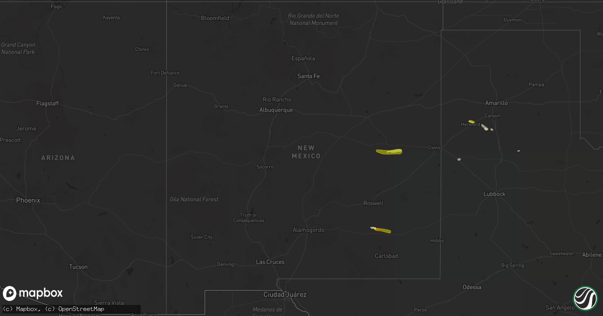
Hail Map in New Mexico on October 1, 2021
Get this storm
October 1 map
$229
one time, instant access
Download today. No call, no setup
Keep the $229
Bought the map and want the full workflow? Apply the entire $229 to a subscription within 7 days. None of it is wasted.
Every map, not just this one
This buys you this map. Subscription and you get every map we run, in the markets you choose from a few cities to whole states to nationwide. Plus real-time alerts the moment a storm fires.
Contact data
Name, contact info, occupancy, even credit band for addresses in the footprint. You go from where it hit to who to call.
Become the source they trust
Unlimited branding weather history reports on demand. You already have the documented answer ready for the property owner, and you are the one who showed up with it.
Property data and RoofTrace estimates
Pull up any address you have got, its value and the exact code rules for that jurisdiction, straight from One Click Code. Then RoofTrace estimates the squares, pitch, and roof value, priced the way you price.
Storm reports in New Mexico
New Mexico
| Date | Description |
|---|---|
| 10/01/20214:44 PM CDT | Shredded leaves off trees and some dents on cars. |
| 09/30/202110:44 PM CDT | At 344 PM MDT, a severe thunderstorm was located near Taiban, or 15 miles southeast of Fort Sumner, moving east at 30 mph. HAZARD...60 mph wind gusts and quarter size hail. SOURCE...Radar indicated. IMPACT...Hail damage to vehicles is expected. Expect wind damage to roofs, siding, and trees. Locations impacted include... Melrose, Floyd, Tolar and Taiban. This includes Highway 60 between Mile Markers 336 and 366. |
| 09/30/202110:39 PM CDT | At 339 PM MDT, a severe thunderstorm was located near Artesia, moving east at 15 mph. HAZARD...60 mph wind gusts and quarter size hail. SOURCE...Radar indicated. IMPACT...Hail damage to vehicles is expected. Expect wind damage to roofs, siding, and trees. Locations impacted include... Artesia, Atoka and Artesia Municipal Airport. |
| 09/30/202110:02 PM CDT | At 302 PM MDT, a severe thunderstorm was located 12 miles southwest of Fort Sumner, moving east at 20 mph. HAZARD...60 mph wind gusts and quarter size hail. SOURCE...Radar indicated. IMPACT...Hail damage to vehicles is expected. Expect wind damage to roofs, siding, and trees. This severe thunderstorm will remain over mainly rural areas of southeastern De Baca County. |
| 09/30/20219:35 PM CDT | At 235 PM MDT, a severe thunderstorm was located 11 miles north of Hope, moving southeast at 20 mph. HAZARD...60 mph wind gusts and quarter size hail. SOURCE...Radar indicated. IMPACT...Hail damage to vehicles is expected. Expect wind damage to roofs, siding, and trees. This severe thunderstorm will remain over mainly rural areas of central Chaves County.This includes Highway 285 near Mile Marker 79. |


