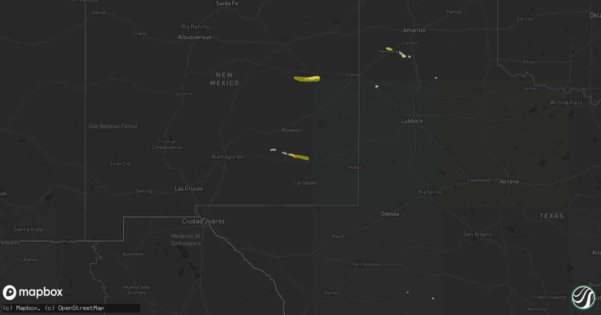
Hail Map on October 1, 2021
Get this storm
October 1 map
$229
one time, instant access
Download today. No call, no setup
Keep the $229
Bought the map and want the full workflow? Apply the entire $229 to a subscription within 7 days. None of it is wasted.
Every map, not just this one
This buys you this map. Subscription and you get every map we run, in the markets you choose from a few cities to whole states to nationwide. Plus real-time alerts the moment a storm fires.
Contact data
Name, contact info, occupancy, even credit band for addresses in the footprint. You go from where it hit to who to call.
Become the source they trust
Unlimited branding weather history reports on demand. You already have the documented answer ready for the property owner, and you are the one who showed up with it.
Property data and RoofTrace estimates
Pull up any address you have got, its value and the exact code rules for that jurisdiction, straight from One Click Code. Then RoofTrace estimates the squares, pitch, and roof value, priced the way you price.
States Impacted by Hail Map on October 1, 2021
Storm reports
Texas
| Date | Description |
|---|---|
| 10/01/20215:52 PM CDT | Hail was 2 inches deep for one mile on u.s. Highway 385 between county roads 9 and 10. |
| 10/01/20211:07 AM CDT | At 607 PM CDT, a severe thunderstorm was located 17 miles south of Alpine, moving southeast at 20 mph. HAZARD...60 mph wind gusts and half dollar size hail. SOURCE...Radar indicated. IMPACT...Hail damage to vehicles is expected. Expect wind damage to roofs, siding, and trees. Locations impacted include... Elephant Mountain and Elephant Mountain Wildlife Management Area. |
| 10/01/202112:53 AM CDT | At 553 PM CDT, a severe thunderstorm was located 15 miles southeast of Marfa, moving southeast at 20 mph. HAZARD...Ping pong ball size hail and 60 mph wind gusts. SOURCE...Radar indicated. IMPACT...People and animals outdoors will be injured. Expect hail damage to roofs, siding, windows, and vehicles. Expect wind damage to roofs, siding, and trees. Locations impacted include... Elephant Mountain and Elephant Mountain Wildlife Management Area. |
| 10/01/202112:46 AM CDT | At 546 PM CDT, a severe thunderstorm was located near Hereford, moving east at 15 mph. HAZARD...60 mph wind gusts and quarter size hail. SOURCE...Radar indicated. IMPACT...Minor damage to roofs, siding, and trees is possible. Hail damage to vehicles is expected. Locations impacted include... Hereford and Dawn. |
| 10/01/202112:05 AM CDT | At 504 PM CDT, a severe thunderstorm was located over Gallegos Elementary School, or over Cameron Park, moving southeast at 5 mph. HAZARD...60 mph wind gusts. SOURCE...Radar indicated. IMPACT...Expect damage to roofs, siding, and trees. Locations impacted include... Los Fresnos, Cameron Park, Downtown Brownsville, Southmost, Port Of Brownsville, Brownsville, Lincoln Park, B I S D Administration Building, Longoria Elementary School and Sams Memorial Stadium.This includes the following highways... Interstate Highway 69 E between mile markers 1 and 8. US Highway 281 between mile markers 836 and 838. |
| 09/30/202111:27 PM CDT | At 426 PM CDT, a severe thunderstorm was located near Arroyo City, moving southeast at 15 mph. HAZARD...60 mph wind gusts. SOURCE...Radar indicated. IMPACT...Expect damage to roofs, siding, and trees. This severe thunderstorm will remain over mainly rural areas of northeastern Cameron County. |
| 09/30/20219:34 PM CDT | At 233 PM CDT, a severe thunderstorm was located near San Perlita, or 10 miles west of Port Mansfield, moving southeast at 10 mph. HAZARD...60 mph wind gusts. SOURCE...Radar indicated. IMPACT...Expect damage to roofs, siding, and trees. Locations impacted include... San Perlita, Willamar, Port Mansfield Chamber Of Commerce, Porfirio, San Perlita High School and Port Mansfield Airport. |
New Mexico
| Date | Description |
|---|---|
| 10/01/20214:44 PM CDT | Shredded leaves off trees and some dents on cars. |
| 09/30/202110:44 PM CDT | At 344 PM MDT, a severe thunderstorm was located near Taiban, or 15 miles southeast of Fort Sumner, moving east at 30 mph. HAZARD...60 mph wind gusts and quarter size hail. SOURCE...Radar indicated. IMPACT...Hail damage to vehicles is expected. Expect wind damage to roofs, siding, and trees. Locations impacted include... Melrose, Floyd, Tolar and Taiban. This includes Highway 60 between Mile Markers 336 and 366. |
| 09/30/202110:39 PM CDT | At 339 PM MDT, a severe thunderstorm was located near Artesia, moving east at 15 mph. HAZARD...60 mph wind gusts and quarter size hail. SOURCE...Radar indicated. IMPACT...Hail damage to vehicles is expected. Expect wind damage to roofs, siding, and trees. Locations impacted include... Artesia, Atoka and Artesia Municipal Airport. |
| 09/30/202110:02 PM CDT | At 302 PM MDT, a severe thunderstorm was located 12 miles southwest of Fort Sumner, moving east at 20 mph. HAZARD...60 mph wind gusts and quarter size hail. SOURCE...Radar indicated. IMPACT...Hail damage to vehicles is expected. Expect wind damage to roofs, siding, and trees. This severe thunderstorm will remain over mainly rural areas of southeastern De Baca County. |
| 09/30/20219:35 PM CDT | At 235 PM MDT, a severe thunderstorm was located 11 miles north of Hope, moving southeast at 20 mph. HAZARD...60 mph wind gusts and quarter size hail. SOURCE...Radar indicated. IMPACT...Hail damage to vehicles is expected. Expect wind damage to roofs, siding, and trees. This severe thunderstorm will remain over mainly rural areas of central Chaves County.This includes Highway 285 near Mile Marker 79. |