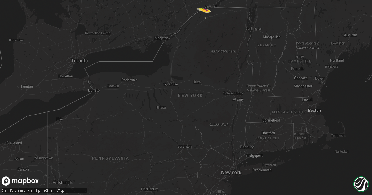
Hail Map in New York on October 1, 2019
Get this storm
October 1 map
$229
one time, instant access
Download today. No call, no setup
Keep the $229
Bought the map and want the full workflow? Apply the entire $229 to a subscription within 7 days. None of it is wasted.
Every map, not just this one
This buys you this map. Subscription and you get every map we run, in the markets you choose from a few cities to whole states to nationwide. Plus real-time alerts the moment a storm fires.
Contact data
Name, contact info, occupancy, even credit band for addresses in the footprint. You go from where it hit to who to call.
Become the source they trust
Unlimited branding weather history reports on demand. You already have the documented answer ready for the property owner, and you are the one who showed up with it.
Property data and RoofTrace estimates
Pull up any address you have got, its value and the exact code rules for that jurisdiction, straight from One Click Code. Then RoofTrace estimates the squares, pitch, and roof value, priced the way you price.
Storm reports in New York
New York
| Date | Description |
|---|---|
| 10/01/20194:10 PM CDT | Tree and wires down on gilmore ave. |
| 10/01/20194:02 PM CDT | 3 incidents of trees and limbs down across town |
| 10/01/201912:53 PM CDT | A local report indicates 2.00 inch wind near MASSENA |
| 10/01/201912:49 PM CDT | Hail size estimated slightly larger than a quarter. |
| 09/30/201911:45 PM CDT | At 444 PM EDT, a severe thunderstorm was located 13 miles west of Niagara Falls, moving east at 65 mph. HAZARD...60 mph wind gusts. SOURCE...Radar indicated. IMPACT...Expect damage to roofs, siding, and trees. Locations impacted include... Niagara Falls, North Tonawanda, Clarence, Lockport, Batavia, Kenmore, Tonawanda, Amherst, Medina and Albion. This includes Interstate 90 between exits 48A and 48. |
| 09/30/20199:48 PM CDT | At 247 PM EDT, a severe thunderstorm was located near Brainardsville, moving east at 45 mph. HAZARD...60 mph wind gusts and quarter size hail. SOURCE...Radar indicated. IMPACT...Minor hail damage to vehicles is possible. Expect wind damage to trees and powerlines. Locations impacted include... Plattsburgh, Peru, Beekmantown, Schuyler Falls, Saranac, Jericho, Dannemora, Lyon Mountain, Peasleeville, Burke, Clayburg, Merrill, Malone, South Plattsburgh, West Beekmantown, Chazy Lake, East Beekmantown, Morrisonville, Moffittsville and Cadyville. |
| 09/30/20198:49 PM CDT | At 149 PM EDT, a severe thunderstorm was located over Massena, moving east at 45 mph. HAZARD...60 mph wind gusts and quarter size hail. SOURCE...Radar indicated. IMPACT...Minor hail damage to vehicles is possible. Expect wind damage to trees and powerlines. Locations impacted include... Massena, Moira, Bangor, Bombay, Massena International Airport - Richards Field, Helena, Brasher Falls, Brushton, Lawrenceville, Malone, Dickinson, Fort Covington Center, West Bangor, Dickinson Center, South Bombay, Brasher Center, St. Lawrence State Park, Ironton, Raquette River and Winthrop. |
All States Impacted by Hail Map on October 1, 2019
Cities Impacted by Hail Map on October 1, 2019
- Boscobel, WI
- Postville, IA
- Calmar, IA
- Ossian, IA
- Waterville, IA
- Decorah, IA
- Waukon, IA
- Steuben, WI
- Harpers Ferry, IA
- Gays Mills, WI
- Dorchester, IA
- Eastman, WI
- Ferryville, WI
- Lansing, IA
- De Soto, WI
- Epworth, IA
- Durango, IA
- Dubuque, IA
- Peosta, IA
- Edgerton, WI
- Norwalk, IA
- Des Moines, IA
- Cumming, IA
- West Des Moines, IA
- Mitchellville, IA
- Colfax, IA
- Prairie City, IA
- Cuba City, WI
- Hazel Green, WI
- Kieler, WI
- Newhall, IA
- Blairstown, IA
- Luzerne, IA
- Van Horne, IA
- Monroe, WI
- Monticello, WI
- Elizabeth, IL
- Stockton, IL
- Beaver Dam, WI
- Reeseville, WI
- Columbus, WI
- Ithaca, MI
- Stanton, MI
- Edmore, MI
- Six Lakes, MI
- Bedford, IA
- New Market, IA
- Cashton, WI
- Tecumseh, NE
- Steinauer, NE
- Brasher Falls, NY
- Massena, NY
- Norfolk, NY
- Belleville, KS
- Juneau, WI
- Riverdale, MI
- Sumner, MI
- Alma, MI
- Elwell, MI
- Waterloo, IA
- Essex, IA
- Hamburg, IA
- Riverton, IA
- Sidney, IA
- Shenandoah, IA
- Farragut, IA
- Vestaburg, MI
- Maquoketa, IA
- Cresco, IA
- Vinton, IA
- Palo, IA
- Shellsburg, IA
- West Stockholm, NY
- Potsdam, NY
- Norwood, NY
- Milton, WI
- Cambridge, WI
- Janesville, WI
- Brooklyn, WI
- Fort Atkinson, WI
- Palmyra, WI
- Mukwonago, WI
- Eagle, WI
- Dousman, WI
- Albany, WI
- Jefferson, WI
- Whitewater, WI
- Stoughton, WI
- East Troy, WI
- Evansville, WI
- Jal, NM
- Randolph, IA
- Reedsburg, WI
- Table Rock, NE
- Pawnee City, NE
- Humboldt, NE
- Stella, NE
- Kendall, WI
- Wilton, WI
- Adell, WI
- Runnells, IA
- Newton, IA
- Hartford, IA
- Carlisle, IA
- Auburn, NE
- Mayville, WI
- Monticello, IA
- Hopkinton, IA
- Pleasant Hill, IA
- Altoona, IA
- Stoddard, WI
- Chaseburg, WI
- Coon Valley, WI
- Concordia, KS
- Orient, IA
- Prescott, IA
- Macksburg, IA
- Winterset, IA
- Creston, IA
- Greenfield, IA
- Kellogg, IA
- Prole, IA
- Van Meter, IA
- Windsor Heights, IA
- Clive, IA
- Wauzeka, WI
- Hanover, KS
- Mazomanie, WI
- Black Earth, WI
- Waunakee, WI
- Cross Plains, WI
- Dane, WI
- Middleton, WI
- Alburnett, IA
- Center Point, IA
- Marion, IA
- Toddville, IA
- Atkins, IA
- Keystone, IA
- Beattie, KS
- Kent, IL
- Savanna, IL
- Hanover, IL
- Laurel, IA
- Fort Atkinson, IA
- Fayette, IA
- Gilman, IA
- Tama, IA
- Howard City, MI
- Gowen, MI
- Coral, MI
- Grant, MI
- Fremont, MI
- Cedar Springs, MI
- Sidney, MI
- Greenville, MI
- Pierson, MI
- Trufant, MI
- Newaygo, MI
- Sand Lake, MI
- Waupun, WI
- Brandon, WI
- Markesan, WI
- Sauk City, WI
- Richland Center, WI
- Helena, NY
- West Bend, WI
- Lena, IL
- Pearl City, IL
- Bellevue, IA
- Mount Carroll, IL
- Burnett, WI
- Fox Lake, WI
- Randolph, WI
- Central City, IA
- Muscoda, WI
- Camp Douglas, WI
- Elroy, WI
- Green Bay, WI
- Agenda, KS
- Glasco, KS
- Twin Lake, MI
- Chase Mills, NY
- Monroe, IA
- Cedarville, IL
- Dakota, IL
- Freeport, IL
- Gotham, WI
- Lone Rock, WI
- Spring Green, WI
- Avoca, WI
- Blue River, WI
- Arena, WI
- Lewiston, NE
- South Wayne, WI
- Woodford, WI
- Browntown, WI
- Argyle, WI
- Gratiot, WI
- Horicon, WI
- Ontario, WI
- La Farge, WI
- Hillsboro, WI
- Bernard, IA
- Brownsville, WI
- Campbellsport, WI
- Lomira, WI
- Westby, WI
- Julian, NE
- Brock, NE
- Nebraska City, NE
- Lorimor, IA
- Bremen, KS
- Lynnville, IA
- Grinnell, IA
- Sully, IA
- Hudson, IA
- Johnston, IA
- Bridgeport, MI
- Brodhead, WI
- Footville, WI
- Elk Creek, NE
- Allenton, WI
- Hartford, WI
- Iron Ridge, WI
- Theresa, WI
- Afton, IA
- Fort Davis, TX
- Oakfield, WI
- Wadena, IA
- Corning, IA
- Rewey, WI
- Livingston, WI
- Platteville, WI
- Imogene, IA
- Peru, IA
- Waukee, IA
- Bevington, IA
- Martensdale, IA
- Cromwell, IA
- Booneville, IA
- Indianola, IA
- Saint Charles, IA
- Belmont, WI
- Sterling, NE
- Windsor, WI
- Deforest, WI
- Sun Prairie, WI
- Zwingle, IA
- Johnson, NE
- Edgewood, IA
- Manchester, IA
- Rock City, IL
- Malone, NY
- Oxford Junction, IA
- Baldwin, IA
- Lost Nation, IA
- Helenville, WI
- Marshall, WI
- Waucoma, IA
- Lawler, IA
- Burchard, NE
- Du Bois, NE
- Nemaha, NE
- Mauston, WI
- Norwalk, WI
- New Lisbon, WI
- Soldiers Grove, WI
- Mineral Point, WI
- East Dubuque, IL
- Rock Port, MO
- Watson, MO
- Ridgeway, IA
- Spragueville, IA
- Cascade, IA
- Farley, IA
- Loving, NM
- Viroqua, WI
- La Crosse, WI
- Frankenmuth, MI
- Clintonville, WI
- Cedar Falls, IA
- Dewar, IA
- Evansdale, IA
- Lakeview, MI
- Kewaskum, WI
- Fairwater, WI
- Washington, KS
- Morrowville, KS
- Diller, NE
- Blue Springs, NE
- Steele City, NE
- Cuba, KS
- Odell, NE
- Hollenberg, KS
- Haddam, KS
- Hutchinson, KS
- Marquette, KS
- Solomon, KS
- Junction City, KS
- Lindsborg, KS
- New Cambria, KS
- Falun, KS
- Milford, KS
- Lorraine, KS
- Riley, KS
- Brookville, KS
- Geneseo, KS
- Chapman, KS
- Salina, KS
- Abilene, KS
- Kanopolis, KS
- Ellsworth, KS
- Sullivan, WI
- Oconomowoc, WI
- Waukesha, WI
- Dunkerton, IA
- Reinbeck, IA
- Raymond, IA
- Jesup, IA
- Shubert, NE
- Vassar, MI
- Birch Run, MI
- Millington, MI
- Silverwood, MI
- Mayville, MI
- Fostoria, MI


