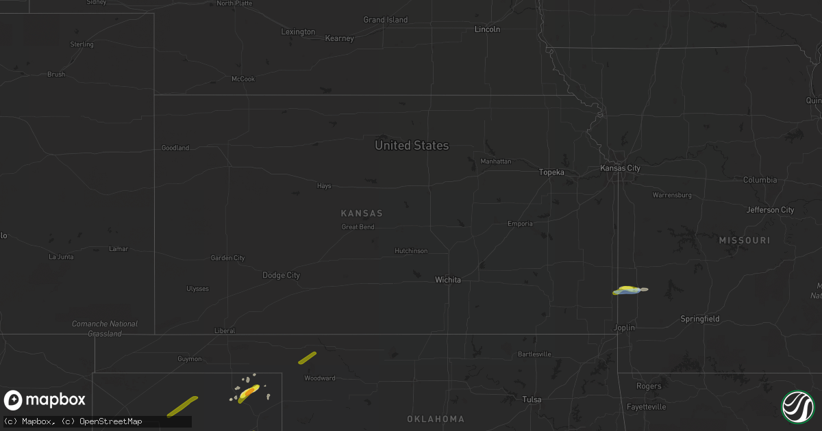
Hail Map in Kansas on September 28, 2019
Get this storm
September 28 map
$229
one time, instant access
Download today. No call, no setup
Keep the $229
Bought the map and want the full workflow? Apply the entire $229 to a subscription within 7 days. None of it is wasted.
Every map, not just this one
This buys you this map. Subscription and you get every map we run, in the markets you choose from a few cities to whole states to nationwide. Plus real-time alerts the moment a storm fires.
Contact data
Name, contact info, occupancy, even credit band for addresses in the footprint. You go from where it hit to who to call.
Become the source they trust
Unlimited branding weather history reports on demand. You already have the documented answer ready for the property owner, and you are the one who showed up with it.
Property data and RoofTrace estimates
Pull up any address you have got, its value and the exact code rules for that jurisdiction, straight from One Click Code. Then RoofTrace estimates the squares, pitch, and roof value, priced the way you price.
Storm reports in Kansas
Kansas
| Date | Description |
|---|---|
| 09/28/20193:36 AM CDT | At 835 PM CDT, a severe thunderstorm was located over Frontenac, or near Pittsburg, moving east at 20 mph. HAZARD...60 mph wind gusts and half dollar size hail. SOURCE...Radar indicated. IMPACT...Hail damage to vehicles is expected. Expect wind damage to roofs, siding, and trees. Locations impacted include... Pittsburg... Prairie State Park... Frontenac... Arma... Liberal... Mulberry... Mindenmines... Franklin... Burgess... Oakton... Croweburg... Yale... Iantha... Verdella... Lone Oak... Hannon... |
| 09/28/20191:51 AM CDT | At 650 PM CDT, a severe thunderstorm was located near Cherryvale, moving northeast at 25 mph. HAZARD...60 mph wind gusts and quarter size hail. SOURCE...Radar indicated. IMPACT...Hail damage to vehicles is expected. Expect wind damage to roofs, siding, and trees. Locations impacted include... Parsons, Mound Valley, Galesburg, Lake Parsons, Dennis, South Mound and Big Hill Lake. |
| 09/28/20191:43 AM CDT | At 643 PM CDT, a severe thunderstorm was located near Parsons, moving northeast at 20 mph. HAZARD...60 mph wind gusts and quarter size hail. SOURCE...Radar indicated. IMPACT...Hail damage to vehicles is expected. Expect wind damage to roofs, siding, and trees. Locations impacted include... Parsons. |
| 09/27/20199:26 PM CDT | At 226 PM CDT, a severe thunderstorm was located near Independence, moving northeast at 25 mph. HAZARD...60 mph wind gusts and quarter size hail. SOURCE...Radar indicated. IMPACT...Hail damage to vehicles is expected. Expect wind damage to roofs, siding, and trees. Locations impacted include... Independence, Neodesha, Fredonia, Altoona, Bolton, Sycamore, Benedict, Elk City Lake, Independence Airport and Elk City State Park. |
| 09/27/20198:42 PM CDT | Severe thunderstorm wind gusts damaged 9 outbuildings on the south side of mulberry. |
All States Impacted by Hail Map on September 28, 2019
Cities Impacted by Hail Map on September 28, 2019
- Sudan, TX
- Liberal, MO
- Lamar, MO
- Hobbs, NM
- Lovington, NM
- Salem, VA
- Higgins, TX
- Lipscomb, TX
- Laverne, OK
- Fargo, OK
- May, OK
- Pittsburgh, PA
- Carnegie, PA
- Coraopolis, PA
- Morgan, PA
- McDonald, PA
- Bridgeville, PA
- Oakdale, PA
- Imperial, PA
- Bethel Park, PA
- Presto, PA
- Booker, TX
- Eunice, NM
- Covington, VA
- Carlsbad, NM
- Elk Creek, VA
- Catawba, VA
- Cambridge, OH
- Sperryville, VA
- Woodville, VA
- Roanoke, VA
- Clinton, PA
- Perryton, TX
- Boones Mill, VA
- Salesville, OH
- Lore City, OH
- Woodland, CA
- Amherst, TX
- Jal, NM
- New Castle, VA
- Draper, VA
- Radford, VA
- Hiwassee, VA
- Galax, VA
- Hardy, VA
- Elizabeth, PA
- Newport, VA
- Sewickley, PA
- Finleyville, PA
- South Park, PA
- Clairton, PA
- Seminole, TX
- Buffalo, OK
- Canadian, TX
- Monroeville, PA
- New Kensington, PA
- Bentleyville, PA
- Causey, NM
- Fincastle, VA
- Eighty Four, PA
- Carlisle, PA
- Troutville, VA
- Daleville, VA
- Washington, PA
- Lander, WY
- Verona, PA
- Scenery Hill, PA
- Glenshaw, PA
- Monongahela, PA
- Hanover, KS
- Follett, TX
- Hummelstown, PA
- Palmyra, PA
- Annville, PA
- Grantville, PA
- Blacksburg, VA
- Murrysville, PA
- Davis, CA
- Arma, KS
- Mulberry, KS
- Franklin, KS
- Mindenmines, MO
- Beallsville, OH
- Woodsfield, OH
- Kipling, OH
- Jerusalem, OH
- Barnesville, OH
- Senecaville, OH
- Quaker City, OH
- New Concord, OH
- Export, PA
- Jeannette, PA
- Trafford, PA
- Cuddy, PA
- Sturgeon, PA
- Jacksonburg, WV
- Reader, WV
- Middlebourne, WV
- Pine Grove, WV
- Smithfield, WV
- New Martinsville, WV
- Paden City, WV
- Sardis, OH
- Porters Falls, WV
- Earth, TX
- Muleshoe, TX
- Dimmitt, TX
- Miami, TX
- Castleton, VA
- Rixeyville, VA
- Boston, VA
- Washington, VA
- Amissville, VA
- Willis, VA
- Floyd, VA
- Indian Valley, VA
- Pulaski, VA
- Dublin, VA
- Culpeper, VA
- Enochs, TX
- Pecos, TX
- Denver City, TX
- Plains, TX
- Tokio, TX
- Pampa, TX
- Cordell, OK
- Mountain View, OK
- Gotebo, OK
- Spearman, TX
- Sunray, TX
- Dumas, TX
- Morse, TX
- East Liverpool, OH
- Wellsville, OH
- New Cumberland, WV
- Georgetown, PA
- Chester, WV
- Newell, WV
- Bunola, PA
- Elrama, PA
- Harrison City, PA
- Irwin, PA
- Hershey, PA


