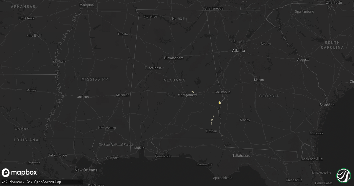
Hail Map in Alabama on September 25, 2018
Get this storm
September 25 map
$229
one time, instant access
Download today. No call, no setup
Keep the $229
Bought the map and want the full workflow? Apply the entire $229 to a subscription within 7 days. None of it is wasted.
Every map, not just this one
This buys you this map. Subscription and you get every map we run, in the markets you choose from a few cities to whole states to nationwide. Plus real-time alerts the moment a storm fires.
Contact data
Name, contact info, occupancy, even credit band for addresses in the footprint. You go from where it hit to who to call.
Become the source they trust
Unlimited branding weather history reports on demand. You already have the documented answer ready for the property owner, and you are the one who showed up with it.
Property data and RoofTrace estimates
Pull up any address you have got, its value and the exact code rules for that jurisdiction, straight from One Click Code. Then RoofTrace estimates the squares, pitch, and roof value, priced the way you price.
Storm reports in Alabama
Alabama
| Date | Description |
|---|---|
| 09/25/20186:44 PM CDT | Trees were knocked down blocking the road at eva road and latham road. Time estimated by radar. |
| 09/25/20186:40 PM CDT | Trees were knocked down blocking the road on six mile creek road. Time estimated by radar. |
| 09/25/20186:31 PM CDT | Trees and power lines were knocked down on daniels chapel road. Time estimated by radar. |
| 09/25/20183:23 PM CDT | Trees and powerlines down across the county. |
| 09/25/20183:02 PM CDT | Powerlines and limbs down on mill st. |
| 09/25/20182:52 PM CDT | Tree down on furnie folks road at hwy 52. |
| 09/25/20182:38 PM CDT | Trees and powerlines down on the 1100 block of cottonwood road. |
| 09/25/20182:36 PM CDT | Tree down at the 14000 block of cottonwood rd. |
| 09/25/20182:36 PM CDT | Trees and powerlines down on the 1400 block of mt. Zion road in cottonwood. |
| 09/24/20189:11 PM CDT | At 211 PM CDT, Doppler radar indicated a severe thunderstorm capable of producing damaging winds in excess of 60 mph. This storm was located near Marianna, and moving north at 25 mph. Locations impacted include... Marianna, Cottondale, Campbellton, Jacob City, Kynesville, Cottondale Airport, Jacobs, Ellaville and Sills. |
All States Impacted by Hail Map on September 25, 2018
Cities Impacted by Hail Map on September 25, 2018
- Wetumpka, AL
- Tallassee, AL
- Earling, IA
- Columbus, NE
- Pittsview, AL
- Eufaula, AL
- South Bend, IN
- Woodbine, IA
- Dunlap, IA
- Logan, IA
- Port Charlotte, FL
- Mondamin, IA
- Pisgah, IA
- Templeton, IA
- Clopton, AL
- Wanatah, IN
- Union Mills, IN
- La Porte, IN
- Westville, IN
- Valparaiso, IN
- Ionia, MI
- Tatum, NM
- Roswell, NM
- Panama, IA
- Abbeville, AL
- Jakin, GA
- Donalsonville, GA
- New Carlisle, IN
- Saint Petersburg, FL
- Newville, AL
- Midland City, AL
- Hobart, IN
- Lake Station, IN
- Portage, IN
- Lovington, NM
- Muir, MI
- Mount Morris, IL
- Kirkland, IL
- Milledgeville, IL
- Lake In The Hills, IL
- Chana, IL
- Maple Park, IL
- Burlington, IL
- Wauconda, IL
- Cortland, IL
- Esmond, IL
- Hampshire, IL
- Carpentersville, IL
- Crystal Lake, IL
- Byron, IL
- Fulton, IL
- Holcomb, IL
- Franklin Grove, IL
- Stillman Valley, IL
- Cary, IL
- Chadwick, IL
- Fox River Grove, IL
- Buffalo Grove, IL
- Genoa, IL
- Thomson, IL
- Dundee, IL
- Libertyville, IL
- Rochelle, IL
- Barrington, IL
- Kingston, IL
- Gilberts, IL
- Sterling, IL
- Sycamore, IL
- Davis Junction, IL
- Marengo, IL
- Elgin, IL
- Dekalb, IL
- Clare, IL
- Morrison, IL
- Oregon, IL
- Vernon Hills, IL
- Mundelein, IL
- Huntley, IL
- Woosung, IL
- Algonquin, IL
- Dixon, IL
- Ashton, IL
- Malta, IL
- Polo, IL
- Monroe Center, IL
- Lindenwood, IL
- Union, IL
- Lake Zurich, IL


