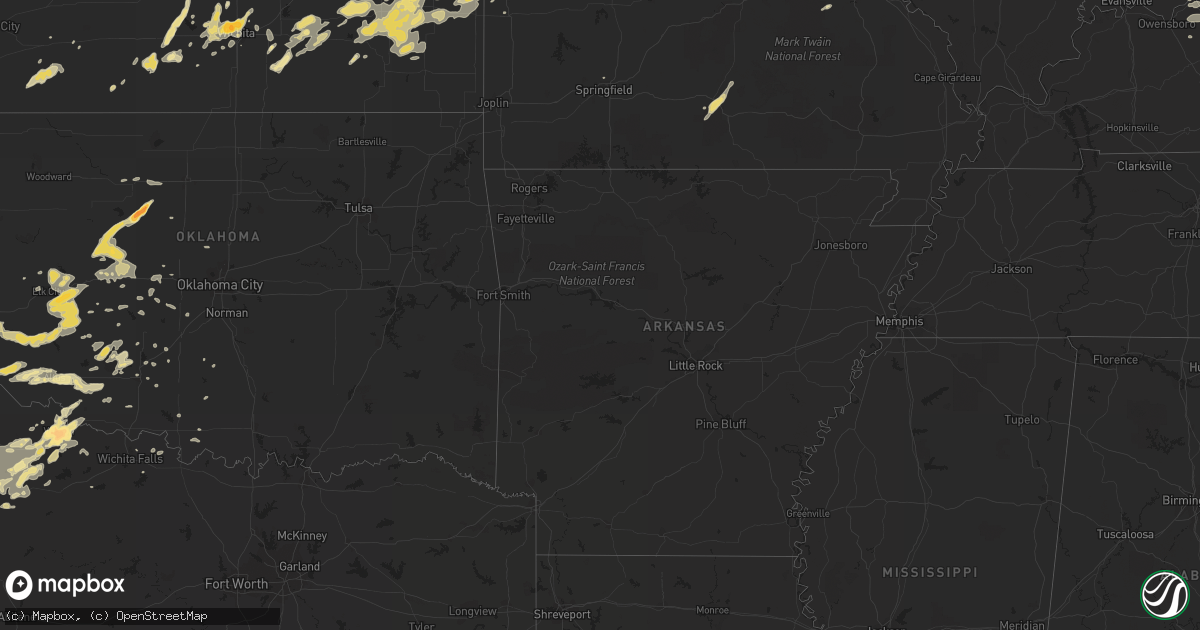
Hail Map in Kansas on September 25, 2012
Get this storm
September 25 map
$229
one time, instant access
Download today. No call, no setup
Keep the $229
Bought the map and want the full workflow? Apply the entire $229 to a subscription within 7 days. None of it is wasted.
Every map, not just this one
This buys you this map. Subscription and you get every map we run, in the markets you choose from a few cities to whole states to nationwide. Plus real-time alerts the moment a storm fires.
Contact data
Name, contact info, occupancy, even credit band for addresses in the footprint. You go from where it hit to who to call.
Become the source they trust
Unlimited branding weather history reports on demand. You already have the documented answer ready for the property owner, and you are the one who showed up with it.
Property data and RoofTrace estimates
Pull up any address you have got, its value and the exact code rules for that jurisdiction, straight from One Click Code. Then RoofTrace estimates the squares, pitch, and roof value, priced the way you price.
Storm reports in Kansas
Kansas
| Date | Description |
|---|---|
| 09/25/20126:43 PM CDT | A local report indicates 1.00 inch wind near FULTON |
| 09/25/20126:42 PM CDT | Rain was coming straight down. |
| 09/25/20126:32 PM CDT | A local report indicates 1.00 inch wind near 4 NW IOLA |
| 09/25/20126:21 PM CDT | Hail slightly larger than quarters now a couple miles north of atlanta. |
| 09/25/20126:15 PM CDT | Hail slightly larger than quarter size reported just west of atlanta. |
| 09/25/20125:53 PM CDT | Estimated 65mph winds as well. |
| 09/25/20124:53 PM CDT | A local report indicates 1.00 inch wind near PRESCOTT |
| 09/24/201210:11 PM CDT | A local report indicates 1.75 inch wind near 2 WNW DOWNTOWN WICHITA |
| 09/24/201210:04 PM CDT | A local report indicates 1.00 inch wind near 3 W WICHITA MID CONTINE |
| 09/24/20128:45 PM CDT | Power pole down in fort scott. |
| 09/24/20128:30 PM CDT | Several power lines and trees were blown down across the city. One utility pole was knocked down. |
| 09/24/20128:05 PM CDT | Power lines and large tree limbs down in chanute. No estimate on tree limb size yet |
| 09/24/20127:52 PM CDT | A local report indicates 74 MPH wind near CHANUTE |
| 09/24/20127:46 PM CDT | A local report indicates 1.00 inch wind near 6 N COLDWATER |
| 09/24/20127:33 PM CDT | A local report indicates 1.00 inch wind near 5 NW COLDWATER |
| 09/24/20127:33 PM CDT | Roof blown off an old armory building in yates center |
All States Impacted by Hail Map on September 25, 2012
Cities Impacted by Hail Map on September 25, 2012
- Reynolds Station, KY
- Fordsville, KY
- Harrisonville, MO
- Garden City, MO
- Archie, MO
- Union, MO
- Lawton, OK
- Midkiff, TX
- Strong City, KS
- Ottawa, KS
- Baldwin City, KS
- Pomona, KS
- Overbrook, KS
- Blue Mound, KS
- Mound City, KS
- Custer, KY
- Williamsburg, MO
- Montgomery City, MO
- Garden City, TX
- Big Spring, TX
- Fort Branch, IN
- Lebanon, IL
- Saint Jacob, IL
- Freeburg, IL
- Trenton, IL
- New Baden, IL
- Aviston, IL
- Albers, IL
- Germantown, IL
- Bartelso, IL
- Breese, IL
- Mascoutah, IL
- Belleville, IL
- Okawville, IL
- Highland, IL
- Steedman, MO
- Rhineland, MO
- Portland, MO
- Owensville, MO
- Bland, MO
- Fredonia, KS
- Festus, MO
- Valmeyer, IL
- Seiling, OK
- Canton, OK
- Oakwood, OK
- Wichita, KS
- Rinard, IL
- Cisne, IL
- Zenda, KS
- Spivey, KS
- Attica, KS
- Bellefontaine, OH
- West Mansfield, OH
- Zanesfield, OH
- Hobart, OK
- Shamrock, TX
- Caseyville, IL
- Lawrenceville, IL
- Summerfield, IL
- Bluford, IL
- Owensville, IN
- Carmi, IL
- Saint Libory, IL
- Iuka, IL
- Albion, IL
- Beckemeyer, IL
- Carlyle, IL
- Fairview Heights, IL
- Dix, IL
- Mill Shoals, IL
- Hoyleton, IL
- Keyesport, IL
- New Harmony, IN
- Greenville, IL
- Collinsville, IL
- Griffin, IN
- Kell, IL
- Crossville, IL
- Ellery, IL
- Dahlgren, IL
- Irvington, IL
- Bonnie, IL
- Lenzburg, IL
- Decker, IN
- Marine, IL
- Marissa, IL
- Troy, IL
- Salem, IL
- Scott Air Force Base, IL
- Keenes, IL
- Mount Carmel, IL
- Francisco, IN
- Ewing, IL
- Sims, IL
- Glen Carbon, IL
- Fairfield, IL
- Springerton, IL
- McLeansboro, IL
- Patoka, IN
- Petersburg, IN
- Allendale, IL
- Browns, IL
- Hazleton, IN
- Noble, IL
- Coulterville, IL
- Golden Gate, IL
- Alma, IL
- Belle Rive, IL
- Hoffman, IL
- Waltonville, IL
- Burnt Prairie, IL
- Sandoval, IL
- Texico, IL
- Johnsonville, IL
- Sumner, IL
- Parkersburg, IL
- Richview, IL
- Cynthiana, IN
- Odin, IL
- Centralia, IL
- Maryville, IL
- Edwardsville, IL
- Princeton, IN
- Olney, IL
- New Athens, IL
- Mount Vernon, IL
- Geff, IL
- Pocahontas, IL
- O'Fallon, IL
- Poseyville, IN
- Walnut Hill, IL
- Macedonia, IL
- Bellmont, IL
- Saint Francisville, IL
- Enfield, IL
- Haubstadt, IN
- Addieville, IL
- Barnhill, IL
- Bone Gap, IL
- Calhoun, IL
- Vincennes, IN
- Opdyke, IL
- Grayville, IL
- Woodlawn, IL
- Millstadt, IL
- Patoka, IL
- Nashville, IL
- Ashley, IL
- West Salem, IL
- Wayne City, IL
- Mount Erie, IL
- Oakdale, IL
- Clay City, IL
- Holliday, TX
- Hillsboro, IL
- Butler, IL
- Seymour, TX
- Crowell, TX
- Mclean, TX
- Rich Hill, MO
- Butler, MO
- Foster, MO
- Houston, MO
- Elk Creek, MO
- Cabool, MO
- Willow Springs, MO
- Vanzant, MO
- Robertsville, MO
- Cedar Hill, MO
- House Springs, MO
- Pacific, MO
- Catawissa, MO
- Wentzville, MO
- Wright City, MO
- Foristell, MO
- Altus, OK
- Headrick, OK
- Tribune, KS
- Urich, MO
- Pampa, TX
- Mountain View, OK
- Carnegie, OK
- Moran, KS
- Uniontown, KS
- Pretty Prairie, KS
- Cordell, OK
- Fort Stockton, TX
- Atlanta, KS
- Rock, KS
- Paducah, TX
- Dickens, TX
- Moscow Mills, MO
- Troy, MO
- Elsmore, KS
- La Harpe, KS
- Humboldt, KS
- Harrold, TX
- Vernon, TX
- Holden, MO
- Chilhowee, MO
- Yates Center, KS
- Toronto, KS
- Buffalo, KS
- Sedgwick, KS
- Colwich, KS
- Meta, MO
- Saint Elizabeth, MO
- Iberia, MO
- Dixon, MO
- Coahoma, TX
- Stephensport, KY
- Hardinsburg, KY
- Rome, IN
- Cannelton, IN
- Union Star, KY
- Scheller, IL
- Sullivan, MO
- Beaufort, MO
- Piedmont, KS
- Severy, KS
- Longton, KS
- Marysville, OH
- Richwood, OH
- Chanute, KS
- Benedict, KS
- Piqua, KS
- Lyndon, KS
- Osage City, KS
- Prescott, KS
- Mapleton, KS
- Fulton, KS
- Redfield, KS
- Rockville, MO
- Fort Scott, KS
- Hume, MO
- Pleasanton, KS
- Quenemo, KS
- Melvern, KS
- Williamsburg, KS
- Leitchfield, KY
- Saint Charles, MO
- O'Fallon, MO
- Saint Peters, MO
- Augusta, KS
- Fillmore, IL
- Dryden, TX
- Potosi, MO
- Saint Louis, MO
- Electra, TX
- Oklaunion, TX
- Frederick, OK
- Davidson, OK
- Amoret, MO
- La Cygne, KS
- Amsterdam, MO
- Southard, OK
- Watonga, OK
- Isabella, OK
- Okeene, OK
- Longdale, OK
- Hollis, OK
- Gould, OK
- Foss, OK
- Canute, OK
- Dill City, OK
- Jefferson City, MO
- Geary, OK
- Thomas, OK
- Golden Eagle, IL
- Lake Saint Louis, MO
- Old Monroe, MO
- Defiance, MO
- Winfield, MO
- Midland, TX
- Lakin, KS
- Nashville, KS
- Marathon, TX
- Cheney, KS
- Ryan, OK
- Ringling, OK
- Leon, KS
- Iola, KS
- Kincaid, KS
- Colony, KS
- Wellington, TX
- Vienna, MO
- Argyle, MO
- Belle, MO
- Freeburg, MO
- Olustee, OK
- Tipton, OK
- Indiahoma, OK
- Duke, OK
- Altus Afb, OK
- Smithton, IL
- Waterloo, IL
- Warsaw, MO
- Edwards, MO
- Fairview, OK
- Truxton, MO
- Gravois Mills, MO
- Haysville, KS
- Granite, OK
- Apache, OK
- Russellville, MO
- Pekin, IN
- Greenville, IN
- Foley, MO
- Butler, OK
- Admire, KS
- Reading, KS
- Eskridge, KS
- Allen, KS
- Climax Springs, MO
- Marthasville, MO
- Augusta, MO
- Hutchinson, KS
- Haven, KS
- Guston, KY
- Payneville, KY
- Ekron, KY
- Webster, KY
- Brandenburg, KY
- Appleton City, MO
- Osceola, MO
- Tuscumbia, MO
- Ulman, MO
- Lake Ozark, MO
- Osage Beach, MO
- Kaiser, MO
- Brumley, MO
- Chillicothe, TX
- Quanah, TX
- Wichita Falls, TX
- Battletown, KY
- Gerald, MO
- Saint Clair, MO
- Leslie, MO
- English, IN
- Palmyra, IN
- Hardinsburg, IN
- New Salisbury, IN
- Milltown, IN
- Ramsey, IN
- Depauw, IN
- Marengo, IN
- El Dorado, KS
- Beaumont, KS
- Eureka, KS
- Latham, KS
- Rosalia, KS
- Hillsboro, MO
- De Soto, MO
- Westphalia, MO
- Silex, MO
- Elsberry, MO
- Roosevelt, OK
- Saint Thomas, MO
- Lohman, MO
- Koeltztown, MO
- New Florence, MO
- Snyder, OK
- Nelson, MO
- Flora, IL
- Hamilton, KS
- Neal, KS
- Centerville, KS
- Welda, KS
- Bronson, KS
- Garnett, KS
- Galesburg, KS
- Neosho Falls, KS
- Altoona, KS
- Erie, KS
- Parker, KS
- Adrian, MO
- Virgil, KS
- Savonburg, KS
- Thayer, KS
- Fall River, KS
- Eureka, MO
- Derby, IN
- Douglass, KS
- Emporia, KS
- Laconia, IN
- Vine Grove, KY
- Litchfield, IL
- Raymond, IL
- Dow, IL
- Godfrey, IL
- Jerseyville, IL
- Holland, IN
- Eckerty, IN
- Borden, IN
- Henryville, IN
- Salem, IN
- Dubois, IN
- Fredericksburg, IN
- Celestine, IN
- Campbellsburg, IN
- French Lick, IN
- Winslow, IN
- Washington, IN
- Jasper, IN
- Mitchell, IN
- Taswell, IN
- Cannelburg, IN
- Velpen, IN
- Huntingburg, IN
- West Baden Springs, IN
- Otwell, IN
- Stendal, IN
- Loogootee, IN
- Monroe City, IN
- Shoals, IN
- Paoli, IN
- Montgomery, IN
- Loose Creek, MO
- Eugene, MO
- Dittmer, MO
- Richwoods, MO
- Bingham, IL
- Ramsey, IL
- New Haven, KY
- Bardstown, KY
- Lincolnville, KS
- Burdick, KS
- Childress, TX
- Mangum, OK
- Petrolia, TX
- Clarendon, TX
- Springfield, MO
- Wheeler, TX
- Paola, KS
- Hawesville, KY
- Wood River, IL
- East Alton, IL
- Roxana, IL
- Ostrander, OH
- Mobeetie, TX
- Rolla, MO
- Vichy, MO
- Erick, OK
- Deepwater, MO
- Lowry City, MO
- Waverly, KS
- Lebo, KS
- Columbia, IL
- Corydon, IN
- Blairstown, MO
- Creighton, MO
- Garden Plain, KS
- Benton, KS
- Bentley, KS
- Goddard, KS
- Viola, KS
- Maize, KS
- Kechi, KS
- Andale, KS
- Clearwater, KS
- Mount Hope, KS
- Valley Center, KS
- Linn Creek, MO
- Burlington, KS
- Charlestown, IN
- Sellersburg, IN
- Garden City, KS
- Willow, OK
- Lone Wolf, OK
- Kingman, KS
- Sayre, OK
- Windsor, IL
- Findlay, IL
- Brownell, KS
- Winfield, KS
- Wilsey, KS
- Fulton, MO
- East Carondelet, IL
- East Saint Louis, IL
- Grafton, IL
- Fort Cobb, OK
- Gracemont, OK
- Coldwater, KS
- Haviland, KS
- Minneola, KS
- Protection, KS
- Ashland, KS
- Boonville, IN
- Lonedell, MO
- Aspermont, TX
- Linn, MO
- Knox City, TX
- Claremont, IL
- Olean, MO
- Henley, MO
- Eldon, MO
- Rush Springs, OK
- Clinton, OK
- Shepherdsville, KY
- California, MO
- Wakeeney, KS
- Taloga, OK
- Weatherford, OK
- Custer City, OK
- Hydro, OK
- Fay, OK
- Hitchcock, OK
- Gillespie, IL
- Bunker Hill, IL
- Arnold, MO
- Ballwin, MO
- Hazelwood, MO
- Earth City, MO
- Maryland Heights, MO
- Hawk Point, MO
- Barnhart, MO
- Bridgeton, MO
- Labadie, MO
- Warrenton, MO
- Fenton, MO
- Grubville, MO
- Imperial, MO
- Chesterfield, MO
- Brussels, IL
- Pevely, MO
- Gray Summit, MO
- Wildwood, MO
- Sunrise Beach, MO
- Luebbering, MO
- Saint Ann, MO
- Florissant, MO
- Rocky Mount, MO
- Villa Ridge, MO
- Rosebud, MO
- Valley Park, MO
- High Ridge, MO
- Pana, IL
- Hammon, OK
- Rocky, OK
- Carter, OK
- Corn, OK
- Sentinel, OK
- Elk City, OK
- Bristow, IN
- Pleasant Hill, MO
- Lynnville, IN
- Oakland City, IN
- Worden, IL
- Tampa, KS
- Medicine Lodge, KS
- Liberty, KY
- Bethelridge, KY
- Lindsborg, KS
- Assaria, KS
- Binger, OK
- Hinton, OK
- Garfield, KY
- Harned, KY
- Irvington, KY
- Burden, KS
- Alton, IL
- Bethalto, IL
- Eastview, KY
- Cecilia, KY
- Du Quoin, IL
- Pinckneyville, IL
- Milton, KS
- Leavenworth, IN
- Bourbon, MO
- Loveland, OK
- Granite City, IL
- Richards, MO
- Xenia, IL
- Genoa, CO
- Greensburg, KS
- Galva, KS
- Cement, OK
- Dighton, KS
- Beeler, KS
- Minco, OK
- Anadarko, OK
- Pocasset, OK
- Richmond, KS
- Boonville, MO
- Pilot Grove, MO
- Blackwater, MO
- Osawatomie, KS
- Rantoul, KS
- Saint Croix, IN
- Branchville, IN
- Leopold, IN
- El Reno, OK
- Cuba, MO
- Calumet, OK
- Lewisport, KY
- Tell City, IN
- Le Roy, KS
- Loretto, KY
- New Hope, KY
- Lawrence, KS
- Hillsboro, KS
- Derby, KS
- Lebanon Junction, KY
- Boston, KY
- Ina, IL
- Mulberry Grove, IL
- Grandview, IN
- Evanston, IN
- Elgin, OK
- Fletcher, OK
- Cleo Springs, OK
- Hennessey, OK
- Arapaho, OK
- Lakewood, IL
- Philpot, KY
- Elizabethtown, KY
- Rineyville, KY
- Cloverport, KY
- Murdock, KS
- Vandalia, IL
- Lane, KS
- Mountain Park, OK
- Hodgenville, KY
- Tower Hill, IL
- Middletown, MO
- Henrietta, TX
- West Alton, MO
- Gotebo, OK
- Lookeba, OK
- McCracken, KS
- Syracuse, KS
- Hermann, MO
- Andover, KS
- Cadet, MO
- Blackwell, MO
- Concordia, MO
- Nancy, KY
- Brighton, IL
- Fieldon, IL
- Mcpherson, KS
- Bicknell, IN
- Clinton, MO
- Barnett, MO
- Alhambra, IL
- Lindsay, OK
- Saint James, MO
- Whitesville, KY
- Whitewater, KS
- Bowling Green, MO
- Eolia, MO
- Cashion, OK
- Benton, IL
- Gypsum, KS
- Fort Sill, OK
- Plainville, IN
- Wheatland, IN
- Ragsdale, IN
- Bruceville, IN
- Saint Albans, MO
- Staunton, IL
- Amber, OK
- Mount Olive, IL
- Walshville, IL
- Herrick, IL
- Wilmore, KS
- Ringwood, OK
- Meno, OK
- Belleview, MO
- Walters, OK
- Benjamin, TX
- Munday, TX
- Otisco, IN
- Grantsburg, IN
- Wellsville, KS
- Fults, IL
- Cyril, OK
- Waurika, OK
- Comanche, OK
- Nevada, MO
- Marion, KS
- Birdseye, IN
- Newton, KS
- Radcliff, KY
- West Point, KY
- Mauckport, IN
- Louisville, KY
- Elizabeth, IN
- Central, IN
- Drexel, MO
- Mullinville, KS
- Dorsey, IL
- Durham, KS
- Marshall, MO
- Houstonia, MO
- Duncan, OK


