Hail Map in Illinois on September 25, 2012
Get this storm
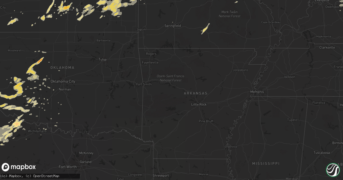
September 25 map
$229
one time, instant access
Download today. No call, no setup
Keep the $229
Bought the map and want the full workflow? Apply the entire $229 to a subscription within 7 days. None of it is wasted.
Every map, not just this one
This buys you this map. Subscription and you get every map we run, in the markets you choose from a few cities to whole states to nationwide. Plus real-time alerts the moment a storm fires.
Contact data
Name, contact info, occupancy, even credit band for addresses in the footprint. You go from where it hit to who to call.
Become the source they trust
Unlimited branding weather history reports on demand. You already have the documented answer ready for the property owner, and you are the one who showed up with it.
Property data and RoofTrace estimates
Pull up any address you have got, its value and the exact code rules for that jurisdiction, straight from One Click Code. Then RoofTrace estimates the squares, pitch, and roof value, priced the way you price.
Storm reports in Illinois
Illinois
| Date | Description |
|---|---|
| 09/25/20126:58 PM CDT | A local report indicates 1.00 inch wind near 6 N BELLMONT |
| 09/25/20126:43 PM CDT | A local report indicates 1.00 inch wind near 1 S CENTRALIA |
| 09/25/20126:31 PM CDT | Power lines down along route 3 in sauget in st. Clair county. |
| 09/25/20126:30 PM CDT | Large tree down on country side street in fairview heights. |
| 09/25/20125:48 PM CDT | Tornado damage just north of 177...first farm roof damaged with shingles gone... Roof twisted off metal sheds. |
| 09/25/20125:40 PM CDT | Tornado periodically touching down. Looking to the southwest. |
| 09/25/20125:36 PM CDT | Tornado reported by sheriffs deputies near addieville with a semi trailer blown over on i-64 at milepost 40.5. |
| 09/25/20125:36 PM CDT | Tornado reported by sheriffs deputies near addieville with a semi trailer blown over on i-64 at milepost 40.5. |
| 09/25/20125:35 PM CDT | Tornado damage just north of 177...first farm roof damaged with shingles gone... Roof twisted off metal sheds. |
| 09/25/20125:35 PM CDT | 30 foot by 80 foot metal shed destroyed. 3 farm houses damaged with partial removal of roofs. Garage doors caved in and damage to siding. |
| 09/25/20125:35 PM CDT | *** 1 inj *** one semi blown over on i64 at mile marker 44 associated with rear flank downdraft winds. One minor injury requiring hospitalization. |
| 09/25/20125:34 PM CDT | *** 1 inj *** one semi blown over when the tornado crossed i64. One minor injury requiring hospitalization. Time and location estimated from radar. |
| 09/25/20125:27 PM CDT | Quarter size hail in albers. |
| 09/25/20125:22 PM CDT | *** 1 inj *** one semi blown over when the tornado crossed i64. One minor injury requiring hospitalization. Time and location estimated from radar. |
| 09/25/20125:19 PM CDT | Tornado on ground near damiansville reported by st. Louis weather chase team. |
| 09/25/20125:18 PM CDT | Tornado on ground near damiansville reported by st. Louis weather chase team. |
| 09/25/20125:12 PM CDT | A local report indicates 1.75 inch wind near 5 E MASCOUTAH |
| 09/25/20125:11 PM CDT | Damaging shingles |
| 09/25/20125:09 PM CDT | A local report indicates 1.50 inch wind near MASCOUTAH |
| 09/25/20125:07 PM CDT | Ping pong ball size hail covering the ground at aviston. |
| 09/25/20125:05 PM CDT | Golf ball size hail covering the ground 4 se of new baden il. |
| 09/25/20124:56 PM CDT | Just below golf ball size hail. |
| 09/25/20124:55 PM CDT | Time estimated from radar. |
| 09/25/20124:50 PM CDT | Time estimated from radar. |
| 09/24/20127:02 PM CDT | A local report indicates 1.75 inch wind near 6 N BELLMONT |
All States Impacted by Hail Map on September 25, 2012
Cities Impacted by Hail Map on September 25, 2012
- Reynolds Station, KY
- Fordsville, KY
- Harrisonville, MO
- Garden City, MO
- Archie, MO
- Union, MO
- Lawton, OK
- Midkiff, TX
- Strong City, KS
- Ottawa, KS
- Baldwin City, KS
- Pomona, KS
- Overbrook, KS
- Blue Mound, KS
- Mound City, KS
- Custer, KY
- Williamsburg, MO
- Montgomery City, MO
- Garden City, TX
- Big Spring, TX
- Fort Branch, IN
- Lebanon, IL
- Saint Jacob, IL
- Freeburg, IL
- Trenton, IL
- New Baden, IL
- Aviston, IL
- Albers, IL
- Germantown, IL
- Bartelso, IL
- Breese, IL
- Mascoutah, IL
- Belleville, IL
- Okawville, IL
- Highland, IL
- Steedman, MO
- Rhineland, MO
- Portland, MO
- Owensville, MO
- Bland, MO
- Fredonia, KS
- Festus, MO
- Valmeyer, IL
- Seiling, OK
- Canton, OK
- Oakwood, OK
- Wichita, KS
- Rinard, IL
- Cisne, IL
- Zenda, KS
- Spivey, KS
- Attica, KS
- Bellefontaine, OH
- West Mansfield, OH
- Zanesfield, OH
- Hobart, OK
- Shamrock, TX
- Caseyville, IL
- Lawrenceville, IL
- Summerfield, IL
- Bluford, IL
- Owensville, IN
- Carmi, IL
- Saint Libory, IL
- Iuka, IL
- Albion, IL
- Beckemeyer, IL
- Carlyle, IL
- Fairview Heights, IL
- Dix, IL
- Mill Shoals, IL
- Hoyleton, IL
- Keyesport, IL
- New Harmony, IN
- Greenville, IL
- Collinsville, IL
- Griffin, IN
- Kell, IL
- Crossville, IL
- Ellery, IL
- Dahlgren, IL
- Irvington, IL
- Bonnie, IL
- Lenzburg, IL
- Decker, IN
- Marine, IL
- Marissa, IL
- Troy, IL
- Salem, IL
- Scott Air Force Base, IL
- Keenes, IL
- Mount Carmel, IL
- Francisco, IN
- Ewing, IL
- Sims, IL
- Glen Carbon, IL
- Fairfield, IL
- Springerton, IL
- McLeansboro, IL
- Patoka, IN
- Petersburg, IN
- Allendale, IL
- Browns, IL
- Hazleton, IN
- Noble, IL
- Coulterville, IL
- Golden Gate, IL
- Alma, IL
- Belle Rive, IL
- Hoffman, IL
- Waltonville, IL
- Burnt Prairie, IL
- Sandoval, IL
- Texico, IL
- Johnsonville, IL
- Sumner, IL
- Parkersburg, IL
- Richview, IL
- Cynthiana, IN
- Odin, IL
- Centralia, IL
- Maryville, IL
- Edwardsville, IL
- Princeton, IN
- Olney, IL
- New Athens, IL
- Mount Vernon, IL
- Geff, IL
- Pocahontas, IL
- O'Fallon, IL
- Poseyville, IN
- Walnut Hill, IL
- Macedonia, IL
- Bellmont, IL
- Saint Francisville, IL
- Enfield, IL
- Haubstadt, IN
- Addieville, IL
- Barnhill, IL
- Bone Gap, IL
- Calhoun, IL
- Vincennes, IN
- Opdyke, IL
- Grayville, IL
- Woodlawn, IL
- Millstadt, IL
- Patoka, IL
- Nashville, IL
- Ashley, IL
- West Salem, IL
- Wayne City, IL
- Mount Erie, IL
- Oakdale, IL
- Clay City, IL
- Holliday, TX
- Hillsboro, IL
- Butler, IL
- Seymour, TX
- Crowell, TX
- Mclean, TX
- Rich Hill, MO
- Butler, MO
- Foster, MO
- Houston, MO
- Elk Creek, MO
- Cabool, MO
- Willow Springs, MO
- Vanzant, MO
- Robertsville, MO
- Cedar Hill, MO
- House Springs, MO
- Pacific, MO
- Catawissa, MO
- Wentzville, MO
- Wright City, MO
- Foristell, MO
- Altus, OK
- Headrick, OK
- Tribune, KS
- Urich, MO
- Pampa, TX
- Mountain View, OK
- Carnegie, OK
- Moran, KS
- Uniontown, KS
- Pretty Prairie, KS
- Cordell, OK
- Fort Stockton, TX
- Atlanta, KS
- Rock, KS
- Paducah, TX
- Dickens, TX
- Moscow Mills, MO
- Troy, MO
- Elsmore, KS
- La Harpe, KS
- Humboldt, KS
- Harrold, TX
- Vernon, TX
- Holden, MO
- Chilhowee, MO
- Yates Center, KS
- Toronto, KS
- Buffalo, KS
- Sedgwick, KS
- Colwich, KS
- Meta, MO
- Saint Elizabeth, MO
- Iberia, MO
- Dixon, MO
- Coahoma, TX
- Stephensport, KY
- Hardinsburg, KY
- Rome, IN
- Cannelton, IN
- Union Star, KY
- Scheller, IL
- Sullivan, MO
- Beaufort, MO
- Piedmont, KS
- Severy, KS
- Longton, KS
- Marysville, OH
- Richwood, OH
- Chanute, KS
- Benedict, KS
- Piqua, KS
- Lyndon, KS
- Osage City, KS
- Prescott, KS
- Mapleton, KS
- Fulton, KS
- Redfield, KS
- Rockville, MO
- Fort Scott, KS
- Hume, MO
- Pleasanton, KS
- Quenemo, KS
- Melvern, KS
- Williamsburg, KS
- Leitchfield, KY
- Saint Charles, MO
- O'Fallon, MO
- Saint Peters, MO
- Augusta, KS
- Fillmore, IL
- Dryden, TX
- Potosi, MO
- Saint Louis, MO
- Electra, TX
- Oklaunion, TX
- Frederick, OK
- Davidson, OK
- Amoret, MO
- La Cygne, KS
- Amsterdam, MO
- Southard, OK
- Watonga, OK
- Isabella, OK
- Okeene, OK
- Longdale, OK
- Hollis, OK
- Gould, OK
- Foss, OK
- Canute, OK
- Dill City, OK
- Jefferson City, MO
- Geary, OK
- Thomas, OK
- Golden Eagle, IL
- Lake Saint Louis, MO
- Old Monroe, MO
- Defiance, MO
- Winfield, MO
- Midland, TX
- Lakin, KS
- Nashville, KS
- Marathon, TX
- Cheney, KS
- Ryan, OK
- Ringling, OK
- Leon, KS
- Iola, KS
- Kincaid, KS
- Colony, KS
- Wellington, TX
- Vienna, MO
- Argyle, MO
- Belle, MO
- Freeburg, MO
- Olustee, OK
- Tipton, OK
- Indiahoma, OK
- Duke, OK
- Altus Afb, OK
- Smithton, IL
- Waterloo, IL
- Warsaw, MO
- Edwards, MO
- Fairview, OK
- Truxton, MO
- Gravois Mills, MO
- Haysville, KS
- Granite, OK
- Apache, OK
- Russellville, MO
- Pekin, IN
- Greenville, IN
- Foley, MO
- Butler, OK
- Admire, KS
- Reading, KS
- Eskridge, KS
- Allen, KS
- Climax Springs, MO
- Marthasville, MO
- Augusta, MO
- Hutchinson, KS
- Haven, KS
- Guston, KY
- Payneville, KY
- Ekron, KY
- Webster, KY
- Brandenburg, KY
- Appleton City, MO
- Osceola, MO
- Tuscumbia, MO
- Ulman, MO
- Lake Ozark, MO
- Osage Beach, MO
- Kaiser, MO
- Brumley, MO
- Chillicothe, TX
- Quanah, TX
- Wichita Falls, TX
- Battletown, KY
- Gerald, MO
- Saint Clair, MO
- Leslie, MO
- English, IN
- Palmyra, IN
- Hardinsburg, IN
- New Salisbury, IN
- Milltown, IN
- Ramsey, IN
- Depauw, IN
- Marengo, IN
- El Dorado, KS
- Beaumont, KS
- Eureka, KS
- Latham, KS
- Rosalia, KS
- Hillsboro, MO
- De Soto, MO
- Westphalia, MO
- Silex, MO
- Elsberry, MO
- Roosevelt, OK
- Saint Thomas, MO
- Lohman, MO
- Koeltztown, MO
- New Florence, MO
- Snyder, OK
- Nelson, MO
- Flora, IL
- Hamilton, KS
- Neal, KS
- Centerville, KS
- Welda, KS
- Bronson, KS
- Garnett, KS
- Galesburg, KS
- Neosho Falls, KS
- Altoona, KS
- Erie, KS
- Parker, KS
- Adrian, MO
- Virgil, KS
- Savonburg, KS
- Thayer, KS
- Fall River, KS
- Eureka, MO
- Derby, IN
- Douglass, KS
- Emporia, KS
- Laconia, IN
- Vine Grove, KY
- Litchfield, IL
- Raymond, IL
- Dow, IL
- Godfrey, IL
- Jerseyville, IL
- Holland, IN
- Eckerty, IN
- Borden, IN
- Henryville, IN
- Salem, IN
- Dubois, IN
- Fredericksburg, IN
- Celestine, IN
- Campbellsburg, IN
- French Lick, IN
- Winslow, IN
- Washington, IN
- Jasper, IN
- Mitchell, IN
- Taswell, IN
- Cannelburg, IN
- Velpen, IN
- Huntingburg, IN
- West Baden Springs, IN
- Otwell, IN
- Stendal, IN
- Loogootee, IN
- Monroe City, IN
- Shoals, IN
- Paoli, IN
- Montgomery, IN
- Loose Creek, MO
- Eugene, MO
- Dittmer, MO
- Richwoods, MO
- Bingham, IL
- Ramsey, IL
- New Haven, KY
- Bardstown, KY
- Lincolnville, KS
- Burdick, KS
- Childress, TX
- Mangum, OK
- Petrolia, TX
- Clarendon, TX
- Springfield, MO
- Wheeler, TX
- Paola, KS
- Hawesville, KY
- Wood River, IL
- East Alton, IL
- Roxana, IL
- Ostrander, OH
- Mobeetie, TX
- Rolla, MO
- Vichy, MO
- Erick, OK
- Deepwater, MO
- Lowry City, MO
- Waverly, KS
- Lebo, KS
- Columbia, IL
- Corydon, IN
- Blairstown, MO
- Creighton, MO
- Garden Plain, KS
- Benton, KS
- Bentley, KS
- Goddard, KS
- Viola, KS
- Maize, KS
- Kechi, KS
- Andale, KS
- Clearwater, KS
- Mount Hope, KS
- Valley Center, KS
- Linn Creek, MO
- Burlington, KS
- Charlestown, IN
- Sellersburg, IN
- Garden City, KS
- Willow, OK
- Lone Wolf, OK
- Kingman, KS
- Sayre, OK
- Windsor, IL
- Findlay, IL
- Brownell, KS
- Winfield, KS
- Wilsey, KS
- Fulton, MO
- East Carondelet, IL
- East Saint Louis, IL
- Grafton, IL
- Fort Cobb, OK
- Gracemont, OK
- Coldwater, KS
- Haviland, KS
- Minneola, KS
- Protection, KS
- Ashland, KS
- Boonville, IN
- Lonedell, MO
- Aspermont, TX
- Linn, MO
- Knox City, TX
- Claremont, IL
- Olean, MO
- Henley, MO
- Eldon, MO
- Rush Springs, OK
- Clinton, OK
- Shepherdsville, KY
- California, MO
- Wakeeney, KS
- Taloga, OK
- Weatherford, OK
- Custer City, OK
- Hydro, OK
- Fay, OK
- Hitchcock, OK
- Gillespie, IL
- Bunker Hill, IL
- Arnold, MO
- Ballwin, MO
- Hazelwood, MO
- Earth City, MO
- Maryland Heights, MO
- Hawk Point, MO
- Barnhart, MO
- Bridgeton, MO
- Labadie, MO
- Warrenton, MO
- Fenton, MO
- Grubville, MO
- Imperial, MO
- Chesterfield, MO
- Brussels, IL
- Pevely, MO
- Gray Summit, MO
- Wildwood, MO
- Sunrise Beach, MO
- Luebbering, MO
- Saint Ann, MO
- Florissant, MO
- Rocky Mount, MO
- Villa Ridge, MO
- Rosebud, MO
- Valley Park, MO
- High Ridge, MO
- Pana, IL
- Hammon, OK
- Rocky, OK
- Carter, OK
- Corn, OK
- Sentinel, OK
- Elk City, OK
- Bristow, IN
- Pleasant Hill, MO
- Lynnville, IN
- Oakland City, IN
- Worden, IL
- Tampa, KS
- Medicine Lodge, KS
- Liberty, KY
- Bethelridge, KY
- Lindsborg, KS
- Assaria, KS
- Binger, OK
- Hinton, OK
- Garfield, KY
- Harned, KY
- Irvington, KY
- Burden, KS
- Alton, IL
- Bethalto, IL
- Eastview, KY
- Cecilia, KY
- Du Quoin, IL
- Pinckneyville, IL
- Milton, KS
- Leavenworth, IN
- Bourbon, MO
- Loveland, OK
- Granite City, IL
- Richards, MO
- Xenia, IL
- Genoa, CO
- Greensburg, KS
- Galva, KS
- Cement, OK
- Dighton, KS
- Beeler, KS
- Minco, OK
- Anadarko, OK
- Pocasset, OK
- Richmond, KS
- Boonville, MO
- Pilot Grove, MO
- Blackwater, MO
- Osawatomie, KS
- Rantoul, KS
- Saint Croix, IN
- Branchville, IN
- Leopold, IN
- El Reno, OK
- Cuba, MO
- Calumet, OK
- Lewisport, KY
- Tell City, IN
- Le Roy, KS
- Loretto, KY
- New Hope, KY
- Lawrence, KS
- Hillsboro, KS
- Derby, KS
- Lebanon Junction, KY
- Boston, KY
- Ina, IL
- Mulberry Grove, IL
- Grandview, IN
- Evanston, IN
- Elgin, OK
- Fletcher, OK
- Cleo Springs, OK
- Hennessey, OK
- Arapaho, OK
- Lakewood, IL
- Philpot, KY
- Elizabethtown, KY
- Rineyville, KY
- Cloverport, KY
- Murdock, KS
- Vandalia, IL
- Lane, KS
- Mountain Park, OK
- Hodgenville, KY
- Tower Hill, IL
- Middletown, MO
- Henrietta, TX
- West Alton, MO
- Gotebo, OK
- Lookeba, OK
- McCracken, KS
- Syracuse, KS
- Hermann, MO
- Andover, KS
- Cadet, MO
- Blackwell, MO
- Concordia, MO
- Nancy, KY
- Brighton, IL
- Fieldon, IL
- Mcpherson, KS
- Bicknell, IN
- Clinton, MO
- Barnett, MO
- Alhambra, IL
- Lindsay, OK
- Saint James, MO
- Whitesville, KY
- Whitewater, KS
- Bowling Green, MO
- Eolia, MO
- Cashion, OK
- Benton, IL
- Gypsum, KS
- Fort Sill, OK
- Plainville, IN
- Wheatland, IN
- Ragsdale, IN
- Bruceville, IN
- Saint Albans, MO
- Staunton, IL
- Amber, OK
- Mount Olive, IL
- Walshville, IL
- Herrick, IL
- Wilmore, KS
- Ringwood, OK
- Meno, OK
- Belleview, MO
- Walters, OK
- Benjamin, TX
- Munday, TX
- Otisco, IN
- Grantsburg, IN
- Wellsville, KS
- Fults, IL
- Cyril, OK
- Waurika, OK
- Comanche, OK
- Nevada, MO
- Marion, KS
- Birdseye, IN
- Newton, KS
- Radcliff, KY
- West Point, KY
- Mauckport, IN
- Louisville, KY
- Elizabeth, IN
- Central, IN
- Drexel, MO
- Mullinville, KS
- Dorsey, IL
- Durham, KS
- Marshall, MO
- Houstonia, MO
- Duncan, OK


