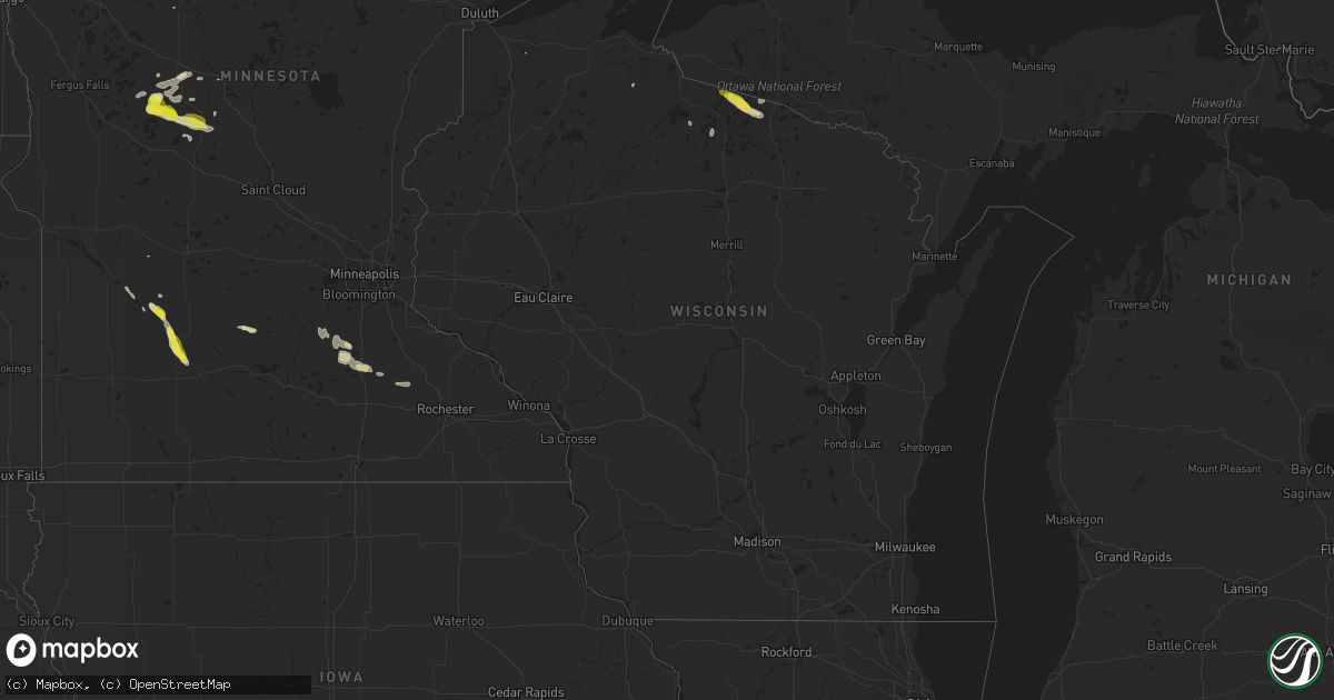
Hail Map in Wisconsin on September 23, 2020
Get this storm
September 23 map
$229
one time, instant access
Download today. No call, no setup
Keep the $229
Bought the map and want the full workflow? Apply the entire $229 to a subscription within 7 days. None of it is wasted.
Every map, not just this one
This buys you this map. Subscription and you get every map we run, in the markets you choose from a few cities to whole states to nationwide. Plus real-time alerts the moment a storm fires.
Contact data
Name, contact info, occupancy, even credit band for addresses in the footprint. You go from where it hit to who to call.
Become the source they trust
Unlimited branding weather history reports on demand. You already have the documented answer ready for the property owner, and you are the one who showed up with it.
Property data and RoofTrace estimates
Pull up any address you have got, its value and the exact code rules for that jurisdiction, straight from One Click Code. Then RoofTrace estimates the squares, pitch, and roof value, priced the way you price.
Storm reports in Wisconsin
Wisconsin
| Date | Description |
|---|---|
| 09/23/20205:01 AM CDT | At 1001 PM CDT, a severe thunderstorm was located over Johnson Lake Barrens Natural Area, or 19 miles northwest of Eagle River, moving southeast at 25 mph. HAZARD...60 mph wind gusts and quarter size hail. SOURCE...Radar indicated. IMPACT...Hail damage to vehicles is expected. Expect wind damage to roofs, siding, and trees. This severe thunderstorm will remain over mainly rural areas of central Vilas County, including the following locations... Nixon Lake Natural Area, Lac Vieux Desert, Upper Buckatabon Springs Natural Area, Star Lake, Conover, Dunn Lake Natural Area, High Lake Natural Area and Land O Lakes. |
| 09/22/202010:01 PM CDT | Trees down on rainbow lodge road. The time of this event is an estimate based on radar data. |
| 09/22/20209:54 PM CDT | Trees down at intersection of county road b and m. The time of this report is an estimate based on radar data. |
All States Impacted by Hail Map on September 23, 2020
Cities Impacted by Hail Map on September 23, 2020
- Lonsdale, MN
- Faribault, MN
- Kilkenny, MN
- Montgomery, MN
- Mellen, WI
- Winthrop, MN
- Meadow, SD
- Faith, SD
- Kenyon, MN
- Eagle Bend, MN
- Parkers Prairie, MN
- Miltona, MN
- Vining, MN
- Granite Falls, MN
- New Prague, MN
- Webster, MN
- Menahga, MN
- West Concord, MN
- Land O'Lakes, WI
- Boulder Junction, WI
- Presque Isle, WI
- Browerville, MN
- Bison, SD
- Conover, WI
- Star Lake, WI
- Eagle River, WI
- Long Prairie, MN
- Verndale, MN
- Hewitt, MN
- Deer Creek, MN
- Park Falls, WI
- Sacred Heart, MN
- Renville, MN
- Minocqua, WI
- Lac Du Flambeau, WI
- Osakis, MN
- Belle Plaine, MN
- Murdock, MN
- Clarissa, MN
- Redwood Falls, MN
- Morgan, MN
- Clements, MN
- Glyndon, MN
- Bertha, MN
- Henning, MN
- Belview, MN
- Springfield, MN
- Carlos, MN
- Gibbon, MN
- Echo, MN
- Staples, MN
- Lake Nebagamon, WI
- Motley, MN


