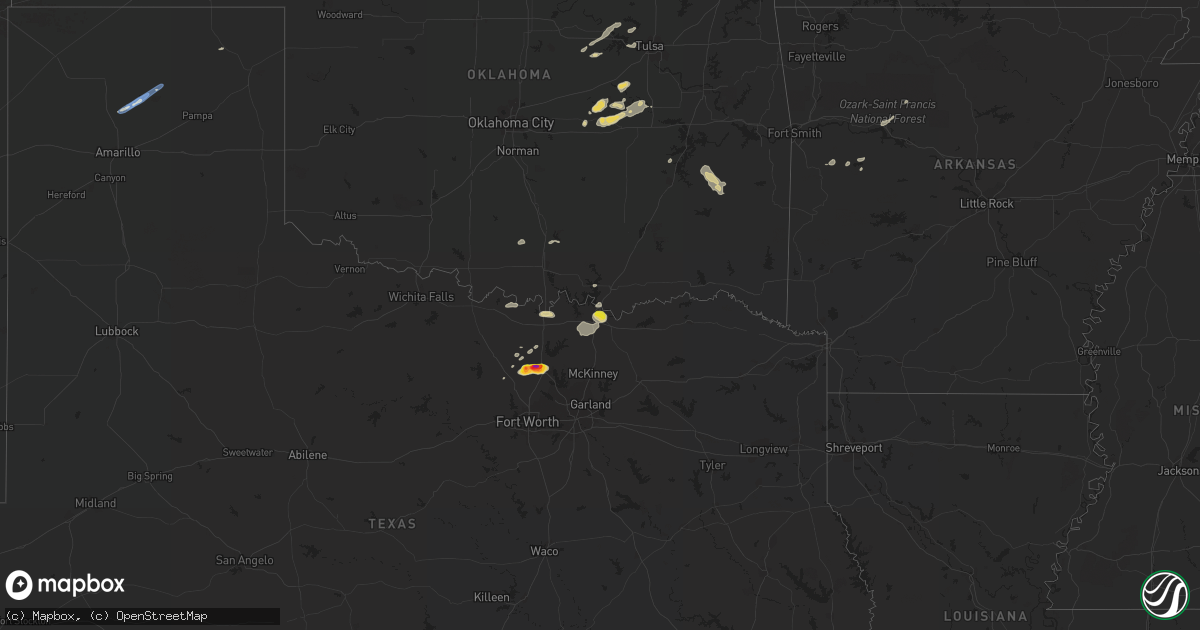
Hail Map on September 21, 2023
Get this storm
September 21 map
$229
one time, instant access
Download today. No call, no setup
Keep the $229
Bought the map and want the full workflow? Apply the entire $229 to a subscription within 7 days. None of it is wasted.
Every map, not just this one
This buys you this map. Subscription and you get every map we run, in the markets you choose from a few cities to whole states to nationwide. Plus real-time alerts the moment a storm fires.
Contact data
Name, contact info, occupancy, even credit band for addresses in the footprint. You go from where it hit to who to call.
Become the source they trust
Unlimited branding weather history reports on demand. You already have the documented answer ready for the property owner, and you are the one who showed up with it.
Property data and RoofTrace estimates
Pull up any address you have got, its value and the exact code rules for that jurisdiction, straight from One Click Code. Then RoofTrace estimates the squares, pitch, and roof value, priced the way you price.
States Impacted by Hail Map on September 21, 2023
Storm reports
Kansas
| Date | Description |
|---|---|
| 09/21/20236:25 PM CDT | A local report indicates 1.00 inch wind near 2 NE Saffordville |
| 09/20/202311:46 PM CDT | Delayed report. Large tree uprooted in mankato along with several other large branches fallen or damaged. Time estimated from radar. |
| 09/20/202310:51 PM CDT | Nickel to quarter sized hail. Time est from radar. |
| 09/20/202310:02 PM CDT | Ems spotter noted heavy dumpster moved approx 100ft in parking lot from high winds. Time approx from radar. |
| 09/20/20239:59 PM CDT | A local report indicates 74 MPH wind near 6 SSE Norton |
| 09/20/20239:58 PM CDT | Davis station. |
| 09/20/20239:49 PM CDT | Sustained at 45 mph. |
| 09/20/20239:36 PM CDT | Delayed report of nickel to quarter sized hail in oberlin. |
| 09/20/20239:36 PM CDT | Delayed report of 1 inch hail at highway 36 and 83 in oberlin. |
| 09/20/20239:00 PM CDT | Delayed report received via social media of an estimated 60 mph thunderstorm wind gusts as well as pea to marble sized hail at location. Time is radar estimated. |
| 09/20/20237:56 PM CDT | A local report indicates 1.75 inch wind near Neosho Rapids |
| 09/20/20237:30 PM CDT | Delayed report sent via social media of baseball sized hail approximately 7 miles se of danbury... Ne and 1 mile into ks from the state border. |
Wyoming
| Date | Description |
|---|---|
| 09/20/20238:40 PM CDT | A local report indicates 1.00 inch wind near Wright |
Illinois
| Date | Description |
|---|---|
| 09/20/20238:20 PM CDT | Two campers reported rolled over... Multiple others damaged at the world shooting complex near sparta. |
| 09/20/20238:16 PM CDT | Tree and power lines down near marissa. |
Nebraska
| Date | Description |
|---|---|
| 09/21/20236:16 PM CDT | A local report indicates 1.00 inch wind near 8 SE Mccook |
| 09/21/20236:06 PM CDT | A local report indicates 1.75 inch wind near Red Cloud |
| 09/21/20236:05 PM CDT | Law enforcement reports hail increasing in size... Up to golf ball size. |
| 09/21/20236:00 PM CDT | Law enforcement reports quarter size hail occurring in red cloud. |
| 09/21/20235:55 PM CDT | Delayed report received of hail up to 2 inches in diameter at location. Time is radar estimated. |
| 09/21/20235:46 PM CDT | Various reports with largest report from law enforcement and fb with baseball sized hail. Large hail lasted about 25min. Lots of car damage. Trees leaves also took a be |
| 09/21/20235:30 PM CDT | Hail on the ground ranged from nickel to half dollar sized. |
| 09/21/20235:03 PM CDT | Quarter size hail south of rosemont. |
| 09/21/20235:00 PM CDT | Cwop station 9.5 miles sw mccook. |
| 09/21/20234:54 PM CDT | Tennis ball to baseball size hail reported on darr road near lauby cattle. Time estimated from radar. |
| 09/21/20234:51 PM CDT | A local report indicates 1.50 inch wind near 1 ENE Culbertson |
| 09/21/20234:50 PM CDT | Hail to the size of green walnut. Time estimated from radar. |
| 09/21/20234:50 PM CDT | Public report relayed via a storm chaser of possible softball size hail south of the darr interchange on interstate 80. Photos accompanying the report showed damage to |
| 09/21/20234:48 PM CDT | Social media report of golf ball size hail 6 miles south of axtell. |
| 09/21/20234:43 PM CDT | Public report of 1.5 inch hail becoming heavy rain. |
| 09/21/20234:41 PM CDT | Social media report of 2 inch hail in cowles. |
| 09/21/20234:40 PM CDT | A local report indicates 1.75 inch wind near Culbertson |
| 09/21/20234:27 PM CDT | Delayed report from social media. Time estimated by radar. |
| 09/21/20234:23 PM CDT | Report with photo from facebook. Location was between johnson lake and interstate 80. Time estimated from radar. |
| 09/21/20233:50 PM CDT | Spotter driving a semi on highway 6 ran into storm and had hail ranging from ping pong to tennis ball. Time approx by radar. |
| 09/21/20233:39 PM CDT | Mostly quarters with some half dollars mixed in. |
| 09/21/202312:05 AM CDT | Estimated wind gusts of 50 to 60 mph. Time estimated from radar. |
| 09/20/202310:03 PM CDT | Davis station. |
| 09/20/20238:30 PM CDT | Public report via social media with photo of estimated golf ball size hail in danbury with second round of storms. Time and location estimated. |
| 09/20/20237:46 PM CDT | County sheriff reported to dispatch. |
| 09/20/20237:11 PM CDT | Corrects previous hail report from danbury. Trained spotter reported golf ball sized hail in danbury. |
| 09/20/20237:11 PM CDT | Trained spotter reported gold ball sized hail in danbury. |
| 09/20/20237:00 PM CDT | Gust recorded 8ssw of indianola... Ne. Unable to find specific site id. |
| 09/20/20237:00 PM CDT | Public report via social media of constant hail pea to quarter size between approx. 7 to 750 pm cdt with first round of storms through danbury. Location estimated. |
Texas
| Date | Description |
|---|---|
| 09/21/20236:26 PM CDT | Report from mping: half dollar |
| 09/21/20236:22 PM CDT | Report from mping: quarter |
| 09/21/20236:21 PM CDT | Multiple social media pictures of near tennis ball size hail in krum. |
| 09/21/20236:20 PM CDT | Golf ball hail 1e krum via spotter. |
| 09/21/20235:34 PM CDT | Spotter relayed report of quarter size hail east side of denison. |
| 09/20/20237:57 PM CDT | A 58 mph wind gust was recorded 2 minutes after the 87 mph wind gust. |
| 09/20/20237:55 PM CDT | Emergency manager report of overturned rvs near the intersection of fritch fortress road and amarillo road. There is also damage to what appears to be a house being bui |
Florida
| Date | Description |
|---|---|
| 09/21/20235:41 PM CDT | Mesonet station xpeg port everglades measured a wind gust of 70 mph as a thunderstorm moved through the area. Site elevation is at 135 feet. |
| 09/21/20235:40 PM CDT | Mesonet station 1694w fswn ft. Lauderdale-hollywood international airport measured a wind gust of 66 mph as a thunderstorm moved through the area. |
| 09/21/20234:09 PM CDT | Report with photo verification of a large tree down blocking roadway at intersection of ne 2nd st and ne 2nd ave. |
| 09/21/20232:35 PM CDT | Tree branches down at corner of lee rd and edgewater dr. Power is out in the area. |
| 09/21/20232:32 PM CDT | Fdem official reports measured wind gust of 58 mph in a thunderstorm. |
Cities Impacted by Hail Map on September 21, 2023
- Dodge, NE
- Winner, SD
- Stanton, NE
- Colon, NE
- Cedar Bluffs, NE
- Newport, NE
- Stuart, NE
- Beresford, SD
- Centerville, SD
- Laurel, NE
- Mills, NE
- Tilden, NE
- Wisner, NE
- West Point, NE
- Plainview, NE
- Meadow Grove, NE
- Pierce, NE
- Osmond, NE
- Carroll, NE
- Colome, SD
- Cody, NE
- Pilger, NE
- Brunswick, NE
- Neligh, NE
- Winside, NE
- Page, NE
- Wayne, NE
- Howells, NE
- Red Cloud, NE
- Inavale, NE
- Beloit, KS
- Simpson, KS
- Culbertson, NE
- Trenton, NE
- Palisade, NE
- Bladen, NE
- Riverton, NE
- Campbell, NE
- Stockville, NE
- Moorefield, NE
- Farnam, NE
- Elwood, NE
- Lexington, NE
- Cozad, NE
- Eustis, NE
- Gothenburg, NE
- Alma, NE
- Holdrege, NE
- Wilcox, NE
- Brady, NE
- Maxwell, NE
- Axtell, NE
- Funk, NE
- Hildreth, NE
- McCook, NE
- Blue Hill, NE
- Minden, NE
- Overton, NE
- Sumner, NE
- Guide Rock, NE
- Lawrence, NE
- Hebron, NE
- Gilead, NE
- Denison, TX
- Sherman, TX
- Emporia, KS
- Strong City, KS
- Indianola, NE
- Ponder, TX
- Krum, TX
- Denton, TX
- Roseland, NE
- Valentine, NE
- Fairbury, NE
- Hubbell, NE
- Alexandria, NE
- Thackerville, OK
- Michigamme, MI
- Sanford, FL
- Mankato, KS
- Webber, KS
- Concordia, KS
- Atkinson, NE
- Oakdale, IL
- Nashville, IL
- Shickley, NE
- Strang, NE
- Bruning, NE
- Council Grove, KS
- Coulterville, IL
- Addieville, IL
- Thedford, NE
- Colbert, OK
- Howe, TX
- Clifton, KS
- Alta Vista, KS
- Aurora, KS
- Longwood, FL
- Clinton, IL
- Chiefland, FL
- Orlando, FL
- Clay Center, KS
- Morrowville, KS
- Endicott, NE
- Glasco, KS
- Belleville, KS
- Heartwell, NE
- Naper, NE
- Altamonte Springs, FL
- Maitland, FL
- Bells, TX
- Gibbon, NE
- Lebanon, KS
- Burr Oak, KS
- Winter Springs, FL
- Lake Mary, FL
- Casselberry, FL
- Winter Park, FL
- Clyde, KS
- Osage City, KS
- Reading, KS
- Saint Jo, TX
- Bronson, FL
- Wallace, NE
- Cottonwood Falls, KS
- Sutherland, NE
- Danbury, NE
- Venango, NE
- Bertrand, NE
- Oberlin, KS
- Lebanon, NE
- Norcatur, KS
- Amsterdam, MO
- Drexel, MO
- Wilsonville, NE
- Neosho Rapids, KS
- Bushnell, NE
- Kimball, NE
- Fritch, TX
- Masterson, TX
- Borger, TX
- Stinnett, TX
- Norton, KS
- Stamford, NE
- Orleans, NE
- Phillipsburg, KS
- Lenora, KS
- Republican City, NE
- Logan, KS
- Prairie View, KS
- Spring Hill, KS
- Edgerton, KS
- Decatur, TX
- Athol, KS
- Kensington, KS
- Gaylord, KS
- Gainesville, TX
- Grover, CO
- Lebo, KS
- Du Pont, GA
- Cartwright, OK
- Lamar, AR
- Clarksville, AR
- Mount Pulaski, IL
- Arthur, NE
- Lemoyne, NE
- Upland, NE
- Oxford, NE
- Brule, NE
- Granite City, IL
- Saint Louis, MO
- Bayard, NE
- Park, KS
- Gove, KS
- Admire, KS
- Johnstown, NE
- Atwood, KS
- Smith Center, KS
- Kearney, NE
- Mcalester, OK
- Indianola, OK
- Whitesboro, TX
- Riley, KS
- Leonardville, KS
- Bartley, NE
- Hartford, KS
- Lane, IL
- Maroa, IL
- Alma, KS
- La Cygne, KS
- Cuervo, NM
- Chestnut, IL
- Kenney, IL
- Latham, IL
- Louisburg, KS
- Havana, AR
- Bridgeton, MO
- Maryland Heights, MO
- Earth City, MO
- Walsh, IL
- Sparta, IL
- Springer, OK
- Rich Hill, MO
- Agra, KS
- Lewellen, NE
- Bristol, GA
- Steeleville, IL
- Chester, IL
- Garnett, KS
- Booneville, AR
- Warrensburg, IL
- Lincoln, IL
- Sanger, TX
- Valley View, TX
- Tilden, IL
- Baldwin, IL
- Marissa, IL
- Babbitt, MN
- Ely, MN
- Holstein, NE
- Lincoln, KS
- Tucumcari, NM
- Davis, OK
- Dougherty, OK
- Sulphur, OK
- Glade, KS
- Herndon, KS
- Hume, MO
- Nocona, TX
- Leon, OK
- Harrisonville, MO
- Archie, MO
- Freeman, MO
- Odum, GA
- Screven, GA
- Bloomington, NE
- New Athens, IL
- Curtis, NE
- Lane, KS
- Princeton, KS
- Rantoul, KS
- Saint Ann, MO
- Ottawa, KS
- Esbon, KS
- Almena, KS
- Smithfield, NE
- Dix, NE
- Marysville, KS
- Jamestown, KS
- Norway, KS
- Scandia, KS
- Ohiowa, NE
- Milo, MO
- Cedar, KS
- El Dorado Springs, MO
- Sheldon, MO
- Pleasanton, KS
- Mahaska, KS
- Chester, NE
- Reynolds, NE
- Maywood, NE
- Walker, MO
- Nevada, MO
- Richards, MO
- Agenda, KS
- Okemah, OK
- Paden, OK
- Boley, OK
- Castle, OK
- Jamesport, MO
- Lock Springs, MO
- Barnard, KS
- Munden, KS
- Prague, OK
- Hamilton, MO
- Long Island, KS
- Ayr, NE
- Hagarville, AR
- Washington, KS
- Glen Elder, KS
- Cawker City, KS
- Kirwin, KS
- Jewell, KS
- Belvidere, NE
- Hanover, KS
- Hollenberg, KS
- Brookville, KS
- Menomonie, WI
- Mead, OK
- Bingham, NE
- Edgar, NE
- Palmer, KS
- Americus, KS
- Okmulgee, OK
- Depew, OK
- Bristow, OK
- Herington, KS
- Ramona, KS
- Lost Springs, KS
- White City, KS
- Wilsey, KS
- Bridgeport, NE
- Yale, OK
- Jennings, OK
- Drumright, OK
- Abilene, KS
- New Cambria, KS
- Salina, KS
- Hope, KS
- Solomon, KS
- Lincolnville, KS
- Tampa, KS
- Red Oak, OK
- Wilburton, OK
- Linn, KS
- Kinta, OK
- Quinton, OK
- Talihina, OK
- Kellyville, OK
- Gypsum, KS
- Skiatook, OK
- Prue, OK
- Hemingford, NE
- Alliance, NE
- Westmoreland, KS
- Harrisburg, NE
- Terlton, OK
- Osage, OK
- Hominy, OK
- Cleveland, OK
- Niantic, IL
- Kidder, MO
- Kingston, MO
- Burdick, KS
- Butler, MO
- Adrian, MO
- Minatare, NE
- Williamsburg, KS
- Frankfort, KS
- Marion, KS
- Sand Springs, OK
- Florence, KS
- Crow Agency, MT
- Elmdale, KS